Saturday, June 25, 2022

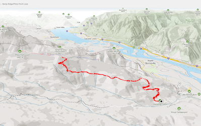
Hike: Phlox Point via East Hardy Ridge Trail, N Bonneville, WA

AllTrails map

AllTrails map


Getting There

The trailhead is accessible from the Equestrian Camp Parking Lot, a bit west of Beacon Rock & Hamilton Mountain.

Take WA-14 from Vancouver, WA east toward N Bonneville. Just after Doetsch Ranch you'll see the Ranger Station on the north side of the road just before the Beacon Rock parking lot. The road winds up the hill for a bit. Keep a lookout for the the Equestrian Camp turn off.


The Hike

Length: 8.56 mi
Elevation gain: 2,234 ft
Moving time: 3:12:43
Avg. pace: 22:31
Total time: 3:38:46
Calories: 1,698 (AllTrails), 3,192
(Fitbit)
Steps: 20,397
(Fitbit)
Floors: 245 (Fitbit)

I've hiked in warm weather before so I brought plenty of water but I knew most of the trails in this park are well-covered by the trees. One year minus a day I hiked Angel's Rest during last year's heat wave (90-100+℉). Today was nothing like that. It was in the 80s and cooler in the shade. Even the 1/2 mile section on the ridge to the point was pleasant but pretty windy.

I was wearing my big straw hat and had to really hold on to it during gust that were strong enough to knock me off balance.

The out-n-back section was a little overgrown but not bad.

Hardy Ridge (foreground), Mt Hood (background)

Table Mountain (left), Dog Mountain (distant middle)

Phlox Point cairn, Table Mountain


Saturday, June 18, 2022

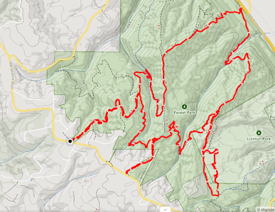
Hike: North End of Forest Park 18, Portland, OR

AllTrails map


Getting There

Take NW Skyline Blvd north from NW Germantown Road. The Skyline Blvd Trailhead is 1.6 mi and a parking are available on right (east) side of the road.  

I've been slightly wary of parking at popular hiking trailheads since hearing about the rash of break-ins at the Newberry Road Trailhead (N end of Wildwood Trail) and my own debacle at work. Sucks. Nevertheless, I figured I've done all I can do like locking the console and glove-box and not leaving any of valuable visible or stuff in the back like before the break-in. I parked in a highly visible area and (knock on wood) no issues.

The Hike

Length: 10.31 mi
Elevation gain: 2,133 ft
Moving time: 3:21:58
Total time: 3:24:12
Avg. pace: 19:36
Calories: 1,780

Steps: 22,436
Zone Mins: 37
Floors: 240
Calories: 1,606

This was my first full loop hike since Feburary. It felt good to be out there despite the rain. It was muddy but warm so it was fine. There was definitely spring overgrowth in the creek/ravine but it was pretty well beaten back, only a few ferns and blackberry vines to get out of the way.

The 800 ft climb up BPA Road took about 24 mins. Pretty great considering I hadn't been able to exercise for a while. No major issues with IT band in right knee but it was complaining a little bit.

Saturday, June 11, 2022

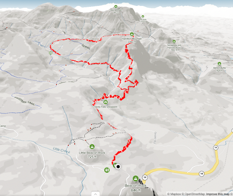
Hike: Hamilton Mountain/Hardy Creek Loop, N. Bonneville, WA

AllTrail map (Mapbox/OpenStreetMap)

Getting There

This was my first strenuous hike since April. The RA has been rough. The week I started my new job, the symptoms were getting to be too much so I started back on the meds several weeks ago. The relief is not happening very quickly. I started a course of a second med a couple of days ago and finally felt well enough to visit this old favorite hike spot. 

Take WA-14 from Vancouver, WA east toward N Bonneville. 

The rain was drizzling during my whole drive out. I knew it was going to be muddy in spots but I had rain gear and didn't care; the route is deep in the canopy.

Just after Doetsch Ranch you'll see the Ranger Station on the north side of the road just before the Beacon Rock parking lot, then another road across from the bathrooms. The road winds up the hill for a bit.

There was a Parking Lot Full sign up but several open spots. A car in front of me paused at the sign, then drove on to the 2nd parking lot. I knew the lot wasn't full and found a spot right away.

The Hike

Length: 7.39 mi
Elevation gain: 2,234 ft
Moving time: 2:56:03
Total time: 3:13:45
Avg. pace: 23:50
Calories: 1,551

The trail was in pretty good shape. Not a lot of mud except in the usual spots. No new downed trees to contend with nor excessive overgrowth since April. I cut one small branch that was right in the path.

The made good time on the ascent and didn't really pause anywhere until I reached the top where I had a swig of water and had a snack.

Looking at the Moving & Total Time, my pace is comparable to previous hikes. That's good news given my joint issues lately and lack of calorie burning-level exercise. I hadn't fallen too far behind. Another MSH hike might be possible if I can get conditioned for a sometime in Sept again.  

Sidenote: I'm not sure how AllTrails calculates the Moving & Total Time because 17m42s of non-Moving time seems like too much.

The only issue I had on the descent (1/2 a lemon) was some IT-band tightness in the right knee, as per usual. I need to stretch better before the descent and in general.

There were some spots on the trail where I could feel moisture in my socks. My boots are no longer waterproof. I may attempt some more repair if I can find the likely holes. Seems like the glue continues to fail slowly.

Young ferns at the top 1

Young ferns at the top 2

The Saddle panorama

The Saddle (IG post)

SW view of the River (Dog Mtn, Cascade Locks, Bonneville Dam)

Same view with low clouds