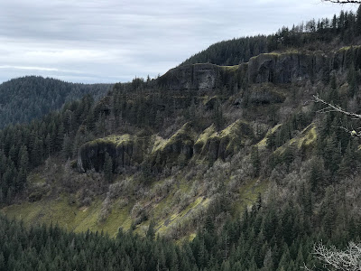
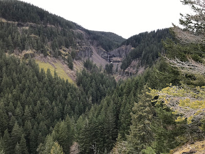
Featured Post

2024: My Year in Review

Another trip around the sun! I kept my same hiking goals from previous years: 52 hikes , 365 miles , 84,000 feet . However, I came up short ...

Showing posts with label Archer Mountain. Show all posts

Saturday, April 8, 2023

Hike: Archer Mountain, Washougal, WA


Getting There

Take WA Hwy 14 out from Washougal. Take a left (north) at Smith-Cripe Road, about half way between Prindle and Franz Lake. The High Valley trailhead parking lot is about 0.5mi up the road. There's room for 10-15 cars if everyone parks responsibly (i.e. perpendicular or angled).

This time there were 6 cars when I got there so I parked parallel. I geared up and set out.

Note: I thought the day was going to be a bust. My original plan was to hike Eagle Creek or Nesmith Point but I knew it was going to be bad when I saw 1/4 mile traffic jam at Multnomah Falls. I changed plans then to hike on the other side of the river. Indeed, cars lined every nook and cranny at Eagle Creek. Table Mountain Trailhead looked okay but Hamilton Mountain was packed. Archer was the clear choice. I hardly saw anyone on the trail. Peaceful. 


The Hike

Length: 5.83 mi
Elev. gain: 2,274 ft
Moving time: 3:27:57
Total time: 4:05:00
Avg pace: 35:39
Calories: 2,093


Cool hike around Archer Mountain. After quite a climb (1000':1 mi) to Scott Point, my first stop was Quiver Point. I didn't quite go to the end but close enough. The next stop was gonna be Arrow Point but when I got to the cutoff, the route looked muddy, steep, and sketchy. Oh well, I'll try again when it's dry. I continued up to the top of Archer Mountain. The foliage was flattened from the winter snow so you could see through the trees to BRSP.

When I got back to the meadow near the trailhead, I still had some energy and it was only ~3:30p. I headed up the other side of the canyon towards the basalt ridge. It was grueling but I made it past the scramble section. I felt a twinge in my L ankle and R knee. I knew the descent was going to be tough so I turned around.

Half way up the trail

View from Quiver Point

View of ridge from Scott Point

More from Scott Point

More from Scott Point

Archer Falls

Trillium

View from ridge

View from Scott Point


Saturday, July 3, 2021

Hike: Archer Mountain, Arrow Point, & more, Washougal, WA


AllTrails map

Getting There

Take WA Hwy 14 out from Washougal. Take a left (north) at Smith-Cripe Road, about half way between Prindle and Franz Lake. The trailhead parking lot is about 0.5mi up the road. There's room for 10-15 cars if everyone parks responsibly (i.e. perpendicular or angled).

This time there were 4 cars when I got there so I parked parallel. I geared up and set out.


The Hike

Length: 5.88 miles
Elevation Gain: 2,490 feet
Type: Dual out-and-back treks


My intention was to hike to the lookout by Archer Creek and then hit Arrow Point on the way back.

When I got to the meadow, I could see the lookouts above. It's still amazing to be able to climb up there.

The first section down to the creek crossing is getting better with overgrowth. Many people have whacked the bushes out of the way. Lots of black berry but also ferns and broad-leafed maple. I saw some poison oak but tried to steer clear.

I really enjoy the switchbacks, they're difficult but you gain a lot of elevation quickly and views. I encountered a couple and their two dogs when the trail sort of levels off a bit. One doggo was protective. LOL. Maybe it was my big hat.

I stopped at Scott Point for a bit. It was windy on the outcrop so I went back into the trees to cool off. My stomach started to bother me. I thought "no, I don't want to have to take #2 out here" I had baby wipes but ugh.. The feeling went away. Thank goodness.

Scott Point

I continued up to Archer Mountain. I had plenty of phone battery so keep looking at the map. When I got to the turn for the Archer Creek lookout, it was totally overgrown. Someone had put a lot across the opening. I pushed through a few feet to see if it cleared up. Nope. I wasn't up for bush whacking for a mile or more.

I changed my goal to Arrow Point. I needed the map to find the turn for the point. You could see light from the Gorge through the trees as I got closer to the edge.

Holy cow. The trail to Arrow Point is literally on a knife's edge of rock. I reached a point where it was too sketchy to continue but looks like someone had made a trail to go right to the tip of the rocky point. Nope.

Arrow Point

I took in the view for a few minutes then continued on my journey. I had hopes that the cutoff to the Creek was only blocked on the lower section. I saw on the map that there is another leg from Archer Mountain.

The hike up to Archer Mountain was crazy steep. You really have to look at the elevation changes on the map. I looks like a nice little jaunt out the the view spot.. LOL.

My trail coming up were so overgrown. Unless you're using GPS and/or map, you'd never see it. The place needs a bunch of work with a machete. I could see the Archer Creek trail on the map but not on the ground. Oh well.

I started back down the the TH.

***

I got to the Y in the meadow. I wasn't sure I was up for this 2nd section. I decided to go as far as I could and loosely to start back at a certain time.

I took a wrong turn which bypasses the easier switchbacks. holy cow. I figured if I were to turn back, I wasn't going to take the other route, I'd go back to the car so I kept going. I pulled out my phone to see where I was. I was close to rejoining the trail.

When I got there I was pretty gassed. I put a tree branch across the trail so I didn't take it on the way down. I could see daylight and the start of the scramble. "Alright, I got this." I took a couple of swigs of water and forged on.

When I reached the top, I knew I was within striking distance. I knew I had plenty of sunlight for the descent. It was high in the sky but I had to check the height of the neighboring mountain.

I got to the tree where you start going up. I packed my hiking poles. I recalled the last time I was there.

At the top I was hot and tired. The shade where I'd gone before looked appealing. My first priority was to get into the shade and take off my pack. My shirt was dripping with sweat.

Secret spot :)

It's amazing how much I perspire. The rag I had tucked in my waistband was saturated as was the shirt. At least my pants weren't as wet as they were during and after the Phlox climb. I put on my dry shirt after walking around shirtless for a bit. The breeze felt good.


I thought about the challenge ahead of me. A safe descent down the scrambles. I made it down both intact.

[ I have had a couple of times where I slipped pretty good. My confidence is also making me a little complacent. However, things would have been worse if I'd been hiking without poles. Because I had more that two points (my feet) on the ground I avoided a harder fall. ]

Sunny spot in the trees on my descent

I'm not sure if micro-spikes would really help me. It's loose gravel/rocks that I'm slipping on. It's really about the angle of force. It should be directly down or a little prone (forward) and not at a backward angle.

I had put a stick across another wrong turn. I found it and soon I was emerging into the meadow by the TH.

I was last car in the parking lot. I felt good to put on my sandals.


Saturday, June 19, 2021

Hike: Archer Mountain + Private trail, Washougal, WA


AllTrails map


Getting There

Take WA Hwy 14 out from Washougal. Take a left (north) at Smith-Cripe Road, about half way between Prindle and Franz Lake. The trailhead parking lot is about 0.5mi up the road. There's room for 10-15 cars if everyone parks responsibly (i.e. perpendicular or angled). There was only one car when I got there so I parked parallel (oops). (I did the same thing at Vista Ridge last year).


The Hike

Length: 6.53 miles
Elevation Gain: 2,444 feet
Type: Dual out-and-back treks

I was looking for a new place to hike since I'd done Cape Horn and Hamilton Mountain several times already. I got an early start, around 9am so I had plenty of time.

The parking lot is darkened by the trees but you emerge into a wide meadow with views of the both sides of the canyon.

The Archer Mountain Trail starts heading downhill (to the right) where the dirt road splits. The foliage is overgrown. I'm sure I scraped by poison oak but I didn't experience any symptoms. I was a little anxious because it felt like a less used trail. I'd hoped I'd wasn't heading on the wrong trail. (I wasn't).

I could hear the stream/creek somewhere below and finally found the little bridge. 

The route seemed a little clearer, cross the water, zigzag up the side of the forest until you reach the base of rocks, then tight/steep switchbacks.


Meadow near the trailhead


First lookout on Archer Mountain Trail

Columbia Lily

Top of Archer Mountain


I forgot my extra battery for the phone and I didn't give it a full charge so I only checked the map occasionally. I saw the spur trail for Scott Point on the way up but kept going.

I reached the top of the mountain, a small clearing in the trees.

Note: I completely overlooked the trail to Arrow Point. schucks.. I'll have to go back!

On the way back down, I stopped at Scott Point. Initially I stopped at this first spot and took in the view. I realized there was a little trail going out further, passed the trees.


Columbia River Gorge from Scott Point


Scott Point

There is a little point that extends out over the valley below. It's not as shear a drop as it appears here.
I could see some exposed rock on the other side of the valley. I wanted to go there!

I descended all the way back to the meadow near the trailhead. I took the other side of the fork. I was a forest road for about 1/8th of a mile until it dead-ends at a stone wall. Perhaps, an old foundation, now a campsite.

Stone wall

I continued up the steep trail and encountered a group of three (well, four): a 30-something couple, their dog, and an older guy (guy's dad). They were taking their time and I scooted passed. I made it up a really steep section (scrambling on all fours).

It's quite a view, but wait there's more...

from private trail

I keep going but I was questioning if I was getting in too deep. I saw another steep scramble route but followed the lower trail (see next photo).

It hugs the mountain like a wave/tube. I couldn't help worrying about being buried under fallen rock.

The trail surface was well covered with moss/ground cover and didn't look like anyone had taken this route for some time.

I turned around. I found the scramble route again and went up a bit but bailed.


The "other" trail.


I found that group of four (3 plus dog). I asked if I had given up too soon. They confirmed that awesome views were just around the corner. I decided to follow them back to where I'd just come from. They said they rarely see other people on this side.

I told them that I'd already been up to Archer Mountain.

I stood there for a second to take in the views. I thanked them for the advice and motivation to come back.

I thought I'd continue on the ridge trail but when I got under the canopy of the trees, the trail went up sharply, nearly a 40 deg grade. I didn't have the energy to climb and didn't want to have to come back down this section.

I emerged back out and found a cool spot to chill.


Across from Scott Point/Archer Mountain (private)

My new friends (lol) left and I hung back for awhile (mostly to give them a head start because I knew I'd catch up if I left right away).

Just after the steep scramble section, I did catch up. The dad was sitting down resting and asked if I'd seen his lost sunglasses. I apologized that I hadn't but said I'd keep an eye out. I pardoned myself for leapfrogging them one last time.

Not long after I heard a kid screaming like a bird of prey. I passed them and fist bumped the air that I didn't have to hear that nonsense.

I made it back to the parking lot and realized I was the only car not perpendicular or angled parked.