Showing posts with label Ape Cave. Show all posts

Tuesday, June 17, 2025

Hike: Ape Cave Return Path and Lower Passage, Cougar, WA

Getting There

It's 28 miles from Woodland to the Cougar. There are a couple of gas stations here. Continue east on SR-503 which becomes Rd 90 for 9.5 miles to Ape Cave. Looks for the sign to Ape Caves, June Lake, Climber's Bivouac, Ape Canyon & Lava Canyon which is Rd 83. It's 0.3 miles to Trail of Two Forests and 0.7 miles to Ape Cave.

However, there was road construction on Rd 83 so the only way to get there, and other places north like Marble Mountain, June Lake, Ape and Lava Canyon was to get Road 81 past Merrill Lake and Kalama Horse Camp. This deterred a lot of would-be visitors but there were still folks that persevered and made it.

I was here for an MSHI mentor shift but no one had signed up. Normally I would just spend the day at the cave entrance, but I kinda wanted to take a break and explore the cave when fewer people were coming up. 

The Hike

Distance: 3.92 miles
Elevation Gain: 495 feet
Highest Elevation: 2,443 feet


I started the day in the parking lot, collecting trash and cleaning up the bathrooms a bit. The Ape Headquarters Store was closed (Mon, Tue). I was the only "official" presence up there. 

I wandered up the info kiosk by the entrance and set up shop. I hung my array of visual aids and greeted the slow but steady trickle of novice cave explorers. Several groups had young kids and a few opted for the upper, more challenging, passage. 

One couple I met had parked near the FR-90/83 junction and hopped on their bikes to get to the site. Another couple parked below the road construction project and walked the road to get here.

After an hour or so, I realized I didn't have my radio, it was still in the car. I walked back down to the parking lot and retrieved it, and my lunch. I heard some noise coming from behind the still-closed store. I peaked around the corner and found Camille, a full-time USFS staff member. I'd never met her personally but knew her name. She was our POC for the trailwork on the S/SW side of the monument. She asked if it was I that cleaned the bathrooms. I said "yes" and tried to downplay it. She was so appreciative and repeated her "thanks" a few times. 

A pair of visitors found us and began asking questions about the site. I told them I'd be glad to escort them to the cave entrance and said goodbye to Camille. When we got there, I get them the run-down and they made their way to the lower passage. 

After noon, I figured I'd hike up to the upper cave's exit on the surface trail, to pick up trash, trim a few branches, and just get away from the stationary spot where I normally hang. Sometimes, the mosquitos and other insects can get annoying but there were few to none on this day. I was ready with a bug repellent gizmo I got from Sportsman's Warehouse. I encountered many visitors whom I'd seen earlier.

I returned to the kiosk but figured I do some roving in the lower cave. I took the opportunity to chat with a few folks down there, making sure to identify myself as an MSHI Volunteer. The last time I was in the lower cave was for the youth trip back in mid-Feb. We'd only gone as far as the "Meatball". I wanted to go to the "end", where the passage tapers down to a dead end. It was further past the "Meatball" than I remembered. 

When I got back, it was about time to leave. I packed up my visual aids and headed for the car.

I wanted to take a look at the washout between Marble Mountain and June Lake, as well as the road construction near the cave. I was a bit surprised to see the blockade had been removed and a car passed. I headed up to Marble Mountain first. I was happy to see all but one whoop-de-whoop was gone, back to pavement.

I did a u-turn and headed out. I was glad I didn't have to take the "long" way via Rd 81. The construction project was not done, still asphalt to be applied but it was easily passable, a huge improvement from the gnarly pothole that have been there for years. 

It was a great first shift of the season.


Sunday, September 22, 2024

Hike: Ape Cave Upper Passage, Cougar, WA


Getting There

It's 28 miles from Woodland to the Cougar. There are a couple of gas stations here. Continue east on SR-503 which becomes Rd 90 for 9.5 miles to Ape Cave. Looks for the sign to Ape Caves, June Lake, Climber's Bivouac, Ape Canyon & Lava Canyon which is Rd 83. It's 0.3 miles to Trail of Two Forests and 0.7 miles to Ape Cave.

I was here for an MSHI shift and normally I would just spend the day at the cave entrance, but I kinda wanted to explore the cave when fewer people were coming up. Last time I went through the upper passage was back in June. The more times I have first hand knowledge of the cave, the better I feel about giving info & advice.

Additionally, when I was driving past the Cougar RV Park & Campground, I saw a banner for a Spelunking meeting and noticed some people climbing & lowering on ropes from a tree visible from SR-503. It was the 2024 NSS Western Regional of the National Speleological Society, from Sept. 19th to 22nd!

The Hike

Distance: 2.64 miles
Elevation Gain: 377 feet
Maximum Elevation: 2,444 feet


In the afternoon when the crowds began to wane, I decided to take a spin through the upper passage. I left my visual aids tacked up to the kiosk.

I stowed my grocery bag behind the kiosk and donned my headlamp. I met some folks that weren't prepared: of the four people, only one had a flashlight and it was a cellphone light. They asked if I'd been in the cave before and I told them yes and that I was an MSHI volunteer. I recommended renting some lanterns from the Ape Cave store.

I didn't want to follow any one, so hung back while another group started their trek. When I couldn't see any lights ahead of me, I started cruising along. I could still hear some voice but at least they were getting the "full experience". I stopped a few times to take photos and the first rock pile after the "Big Room" took a while to get up and over.

I have a bunch of photos of the cave itself so I wanted to snap a few of the cave features including this "blowout". I heard another group approaching so I figured I'd wait and introduce myself. I explained how the "blowout" is formed. After chatting, they continued on and I said something sort of cringy. "I'll wait a minute but I'll be back here in the dark." Ugh.. why did I phrase it that way!! "I didn't mean it in creepy way". They laughed but maybe ironically. Durr!

I wanted to be out of the cave before 4:30p so I could still make my "out of service" call to Columbia on time. I took my time to be careful but didn't lollygag for too long at any one spot.

Eventually, I reached the first skylight. I thought about the story I heard from EMT Joe about having to rescue a woman that was stuck 1/2 way out of the hole. She couldn't get out and couldn't climb back down safely. Joe said they'd parked at the Cougar Sno-Park and accessed the skylight by traipsing through the forest.

I inspected the "route" and it looked sketchy. A slip from the first ledge would certainly result in at least an small injury.


I've been telling folks that neither the Lower or Upper caves have spots where you have to crawl around but I was wrong. Beside the Lava Falls wall and the squeeze point, there ARE a couple low spots in the Upper passage. I'll have to incorporate this info into my pre-hike spiel going forward.

The exit

The exit


Saturday, March 30, 2024

Hike: Trail of Two Forests & Ape Cave Lower Passage, Cougar, WA


Getting There

It's 28 miles from Woodland to the Cougar. There are a couple of gas stations here. Continue east on SR-503 which becomes Rd 90 for 9.5 miles to Ape Cave. Looks for the sign to Ape Caves, June Lake, Climber's Bivouac, Ape Canyon & Lava Canyon which is Rd 83. It's 0.3 miles to Trail of Two Forests and 0.7 miles to Ape Cave.

This was our second field trip with the 2024 Volcano Naturalist Program with Mt St Helens Institute. We had a carpool signup since there was going to limited parking in the Trail of Two Forests parking lot. I added my car to the list and a fellow volunteer signed up. It was nice to have someone to talk with on the drive up and back.

I didn't expect anyone to signup, so I had booked a motel in Woodland for Saturday night. I still wanted to have the company so I took my rider back to their house in Portland after the field trip and drove back to Woodland for my stay.

The Hike

Distance: 3.57 miles
Elevation Gain: 358 feet
Maximum Elevation: 2,110 feet


We met the rest of group at the Trail of Two Forests parking lot. Ape Cave is closed right now until May 18th but we had special permission from the USFS to explore the cave.

After introductions and a preview of what we were going to see and do, we took a walk around the TTF boardwalk, stopping at a few spots along the way. I got some more details that I will be adding to my talks with visitors.

Since I am a volunteer, I was selected to carry a radio and assist with the field trip.

There was no need for snow shoes since the road to the cave was mostly clear of snow. When we reached Ape's Headquarters, another volunteer and I was asked to talk a little about our experiences volunteering at the cave.

We had lunch in the sun and got ready for the adventure.

It was great to have a guide explore the cave with. She had a bunch of details that I didn't know from my own research or from my mentor. I will be adding it to my own storytelling when I volunteer at the cave later this year.

Some highlights:

  • The ledges inside the cave that look like bathtub rings are Cave Levies. The lava flow slowed down and there was cooling & hardening of the lava.
  • Air currents are mostly due to temperature differences between the surface air and cave air. Cold air flows down to lowest points. If air on surface is warmer than the cave air, cold air moves downhill. If air in the cave is warm than the surface air, cold air moves uphill.
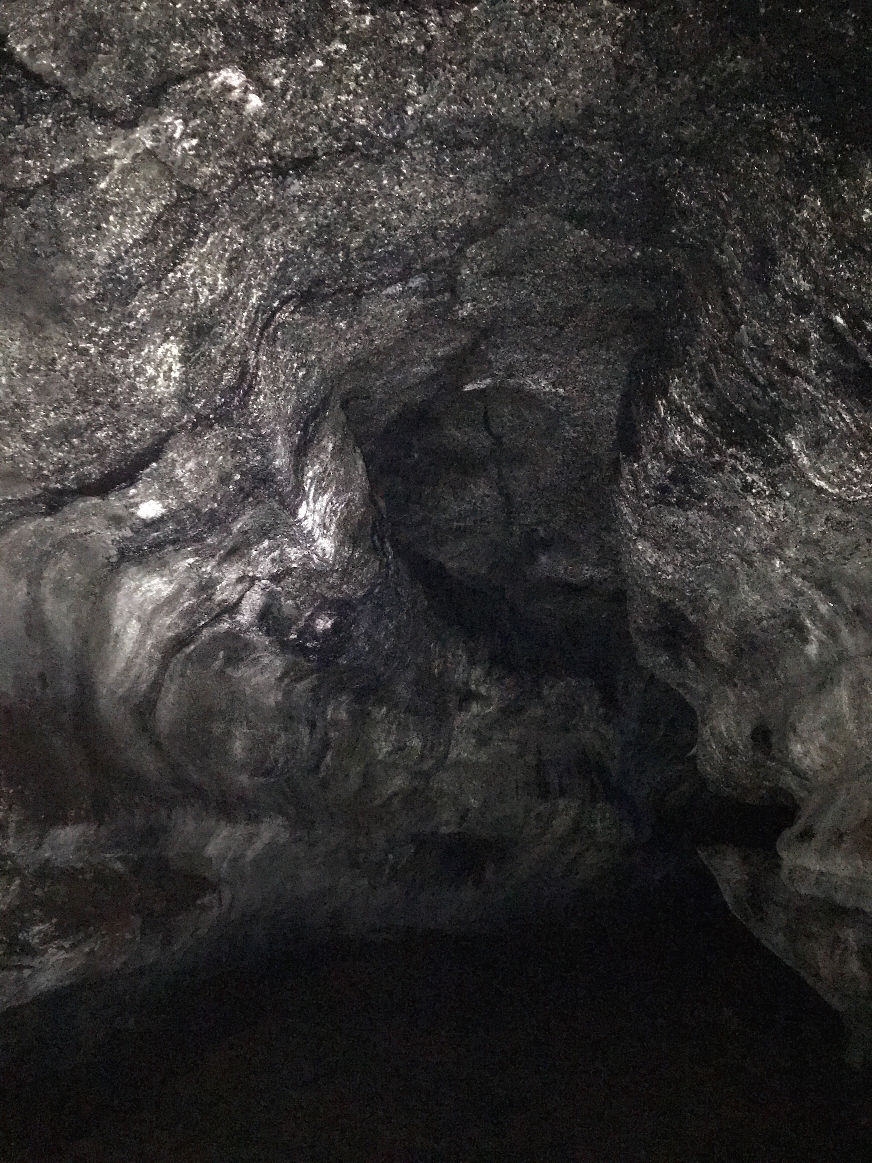
  • The holes on the side of the cave are from blowouts. Moisture in the surrounding soil/earth was heated and turned to steam and exploded the rock into the cave. You can see how thick the cave wall is because the rock from the riverbed is brownish.
  • Rock fall inside the cave happened when the cave was cooling. Geologists have checked the debris after recent earthquakes and have not discovered any new rocks. Seems to be stable.
  • The railroad tracks were formed when the volume of lava was diminishing and slowing down, allowing it to cool and harden.
  • Ripples on the walls are rock that was remelted and began sagging due to gravity.
  • 450 years ago, a lahar flowed down over the cave entrance and mud & rock flowed through the cave and was deposited on the floor.
  • The white stuff on the walls is cave slime, a combination of fungus + bacteria that work together in symbiosis.

It was great to take our time and discuss what we found. Several folks were able to find small insects on the cave wall.

At one point, we all turned off our lights and just listened to the sounds and experience the cave in total darkness. The instructor light a single wooden match. We became "Cave Apes", pledging to protect with amazing, natural place.

At the end of the lower passage was a pile of something, fabric, basically trash. We were picking up trash along the way. Even though the cave is "closed to the public", there's not gate to prevent people from going in.

There were several folks in there with us. The instructor just told them they the cave was closed and there are lots of signs saying as much but we weren't there to enforce anything.

Two classmates from Seattle were interested to visit the viewpoint above the cave parking lot. I'd mentioned it in my talk. I couldn't find a good map due to poor cell service but someone else was able to pull up a map. I was glad to have sparked some interest.


Looking for resident insects on the walls

The Meatball


Saturday, August 5, 2023

Hike: Ape Cave Upper Passage, MSH, Cougar, WA

Selfie at the skylight

Getting There

It's 28 miles from Woodland to the Cougar. There are a couple of gas stations here. Continue east on SR-503 which becomes Rd 90 for 9.5 miles to Ape Cave. Looks for the sign to Ape Caves, June Lake, Climber's Bivouac, Ape Canyon & Lava Canyon which is Rd 83. It's 0.3 miles to Trail of Two Forests and 0.7 miles to Ape Cave.

The Hike

Distance: 2.55 miles roundtrip
Elevation Gain: 364 ft


I'd been to Ape Cave on June 19 for my mentor session to be a Hiking Steward for MSHI, another volunteer/mentee had only gone in a few hundred feet to the bottom of the 2nd set of stairs. However, this was my first time actually inside the lava tube.

Like many locals and nearby resident from Vancouver and Portland, I'd lived in the PNW for over 20 years but had never ventured up there. I just assumed it was always super busy with people and I'd always gone out to the forest for some solitude and scenic views.

At the last minute and per my MSHI mentor's suggestion, I arranged for a mentor session at Ape Cave with a seasoned volunteer. I confirmed with the volunteer coordinator and confirmed with the person I'd be spending the day with on arrival time and other details. While I'd been trained for the NF-83 road and sites like June Lake, Ape Canyon, Lava Canyon, Ape Cave is unique

I expected to spend most of my day at the cave entrance greeting, educating, and orienting visitors who were there to explore the lava tube. I knew about the history of the area and some facts about what to expect but none of it was first-hand. To my delight, part of my orientation was to include my own venture underground.

I was tempted to do the Lower Passage with is shorter and easier to get my feet wet but when I descended the stairs inside, I decided to go for the challenge, the Upper Passage. And it was!

The day before when i'd confirmed I was coming, I stopped by a hardware store to get two new, powerful flashlights and a brick of AA batteries. On my previous visit, I'd used my camping headlamp which is fine for puttering around a campsite at night and digging through the snack box but was totally inadequate for cave exploration or spelunking. I was hardly do anything that adventurous since thousand of visitors do the same tube every week but it was still my first foray into this kind of environment.

I knew there was "27 rock piles" but that didn't quite describe what I actually found. To add to the challenge, I only had one free hand to negotiate the giant rocks that you had to climb over since I was holding the flashlight on the other hand.

As a volunteer and representative of the site, I greeting folks along the way and tried to answer questions. One that kept coming up is "how much further". I told them honestly that it was my first time in the lava tube as well. I encouraged the people that were a bit tepid about their abilities.

The rock piles were not difficult to get over but as you got further along, some of the passages were narrow. Fortunately, my pack did not prove to be an encumbrance. Actually, I think the only place were I felt the squeeze was when climbing the ladder at the end to get back to the surface.

One obstacle that presented an bigger challenge was a 6-7 foot rope ladder with no foot hold. I was behind two other groups that were helping each other out. Bravely, I didn't accept the help I should have take but I managed to clumsily get up the ladder, like a beached whale. LOL. I did put my knee down on a jagged rock but didn't suffer any lasting discomfort.

I thought about one visitor I'd talked to at one of the early rock piles that seemed particularly nervous about the adventure. They weren't gonna like this section. I stopped and waited for another large group I'd passed to see how they managed. The kids made it up with little effort and in fact, several adults who protested seemed to make it fine. I certainly wasn't there to provide climbing assistance or be a guide. As they waited for the whole group to get up and over this obstacle I took off.


The cave

The cave

Near the skylight

Fascinating textures

What an experience. I continued to marvel at the high ceiling and contrast of course rock with smooth, glasslike patterns. Near the end, there is a skylight. I did my best to photograph the tunnel but my camera didn't have anything to focus on so many pictures were blurry. This skylight was perfect for some underground photography.

Near the exit

If there hadn't been so many people down there, I would probably have been nervous as there was no way to gauge distance or progress with technology. Eventually, I made it to the exit. There was a gathering of people there waiting their turn for the ladder. The climate got a bit humid and there was a bit of a fog as the outside, warm air mixed with the cave air.

Lots of folks were resting outside the cave, enjoying snack and the daylight. One teenager that was having a little difficulty was sitting quietly, relieved.

It had been raining earlier but that had stopped but it was still warm from the summer heat. I took off my jacket, took a bit swig of water, and ate half a sandwich. I picked up some bits of trash and milled about. I'd seen many of these people at entrance so there wasn't much need to engage. Most people just seemed a bit tired and glad to completed the "more difficult" section of Ape Cave. I said something about taking a well-earned rest and headed back to the trailhead through the forest.

The exit (hole in bottom left)
Just outside the exit

Trail back to the cave entrance

Trail back to the cave entrance

I finally reached the entrance and again and shared the highlights of my subterranean journey with my mentor. He was an older gentleman who admitted he wasn't fit to do the cave. I was glad to share my own experience.

Throughout the day, visitors arrived in waves due to the timed 2-hour passes: 9am, 11am, 1pm, 3pm, 5pm. Around 4pm another MSHI volunteer arrived. She was going to work this site but did some roving on the Loowit Trail near June Lake and ended up helping participants of 5K stay on track.

At 4:15p, we took down the signs we'd put up, mostly pictures of the 1980 eruption and other educational aid, even though this side of the mountain was mostly unaffected. It's still the reason the monument exists.

Walking through Ape Cave is high on the list of exceptional things I've done, right there with Preikestolen in Norway. I said goodbye to my mentor and the other volunteer. A great day!

Monday, June 19, 2023

Hike: Ape Cave & June Lake, MSH, WA


Selfie from June Lake

Getting There

From I-5/Woodland, take the Lewis River Road (WA-503) eastbound to Cougar. Continue past on NF-90 to NF-83 (Ape Caves, Ape Canyon, Lava Canyon, etc).

I was out there for my mentor session with an experience MSHI volunteer and two other mentees. We met at a road pullout, then, because of the rain, we stopped at Ape Caves. While one mentee, Evan, was getting instructions on using the radio and other stuff we covered last weekend at SLC, Katie and I introduced ourselves to the Ape Caves staff. 

We went to the lava tube opening and chatted with a few visitors and got some orientation on the area. Katie and I ventured into the tube for a little bit but just to where the trail splits.


When the rain stopped, the four of us drove up to the Marble Mountain Trailhead in order to head up to June Lake.

The Hike

Distance: 4.83 miles
Elevation Gain: 545 ft


From Instagram:

Today I had my mentor session on the south side of Mt St Helens. I met a seasoned MSHI volunteer and two other mentees near Cougar, WA. It was raining this morning so we stopped at Ape Caves to interact with some visitors and take at peek at the lava tube.

When the rain stopped, we drove up NF-83 to the Marble Mountain Sno-Park, where road is still closed. We took the Pine Marten Trail for a while then out on the road. We stopped to chat with two people visiting from Chicago, then continued to the June Lake Trailhead and up to the lake for lunch. We talked with two more people that were from the East coast.

On our way back we met a guy who had a wealth of knowledge and a lifetime experience in the area. You never know who you'll encounter. We chatted for 15 minutes. We passed a couple with a dog and just said hello. Some interactions are brief while others develop into an interesting dialogue.

It was good practice engaging visitors and using the radio. I'm feeling ready to go out there on my own or co-rove with another volunteer.

From the Trailhead parking lot, we followed the Pine Marten trail, while parallels NF-83. We popped out onto the road when we saw a couple of visitors from Chicago. We chatted with them for a bit about their plans and where they could see MSH.

We continued along the road to the June Lake Trailhead. We meandered up the trail, chatting with each other, discussing flowers and the ancient lahar flow next to the trail.

We stopped at the lake to eat lunch but the rain came back. We hiked into the trees for shelter and examined the foliage. When the rain stopped again, we went back to the lake and met two more visitors. We chatted for a bit and they took a group photo for us. Before we left the lake, we popped over to the lahar flow to look at the boulders.

We walked back to Marble Mountain Sno-Park. A car and an RV past us on the road that was supposed to be closed. The car came back pretty soon because the road was blocked by snow.

When we got back to the gate, we called Columbia Dispatch to report the open gate. While waiting two more cars full of people looked like they wanted to go through. We closed the gate but didn't lock it. The RV came back through.

We drove back to where we met in the morning to check out on the radio. We caravaned back to Amboy to the MSHI HQ to return the radio.