Showing posts with label Ape Canyon. Show all posts

Saturday, August 10, 2024

Hike: Ape Canyon, Mt St Helens, Cougar, WA


Getting There

It's 28 miles from Woodland to the Cougar. There are a couple of gas stations here. Continue east on SR-503 which becomes Rd 90 for 9.5 miles to Ape Cave. Looks for the sign to Ape Caves, June Lake, Climber's Bivouac, Ape Canyon & Lava Canyon which is Rd 83. It's 0.3 miles to Trail of Two Forests and 0.7 miles to Ape Cave.

Ape Canyon and Lave Canyon are 10 miles north at the 83/90 junction. The trailhead is at the end of Rd 8300 on the southeast side of Mt St Helens.

The Hike

Length: 10.77 mi
Elev. gain: 2,123 ft
Moving time: 4:20:35
Avg pace: 24:12
Calories: 2,636
Total time: 5:06:26


Talked to a lot of mountain bikers, all were friendly, esp when passing by (letting me know if others were behind them), many thanks for being out there as a MSHI volunteer. 

One person was asking where Plains of Abraham was located. Met more mtn bikers at the Loowit/Ape Cyn junction that knew my name (from the other mtn biker), they were happy for the MSHI presence in the monument. 

On my way back down, I met two backpackers in their 20s that recognized the MSHI logo and asked for stickers. 

Lastly, I met two trail runners near the switchbacks; one had done the Bigfoot 40M trail race the day before and was heading back up to the Pumice Butte to take photos with their race apparel.


Tuesday, August 15, 2023

Hike: Ape Canyon to Pumice Butte, MSH, Cougar, WA

View from Pumice Butte near Ape Canyon/Loowit Trail junction

Getting There

It's 28 miles from Woodland to the Cougar. There are a couple of gas stations here. Continue east on SR-503 which becomes Rd 90 for 9.5 miles to Ape Cave. Looks for the sign to Ape Caves, June Lake, Climber's Bivouac, Ape Canyon & Lava Canyon which is Rd 83. It's 0.3 miles to Trail of Two Forests and 0.7 miles to Ape Cave. 

Ape Canyon and Lave Canyon are 10 miles north at the 83/90 junction. The trailhead is at the end of Rd 8300 on the southeast side of Mt St Helens.

---

This hike was one of my stops for my 2nd solo outing as Hiking Steward for Mt St Helens Institute. The forecast of triple digit temperatures had me nervous. I wasn't sure if I was even going to hike and planned on just visiting the trailheads and other points of interest to interact with visitors.

After a short stop at Trail of Two Forests at 9:30a, I noticed the thermometer was still in the 80s and the peak temps weren't supposed to hit until 2p. I figured I had time to rove the Ape Canyon Trail and be headed back down in time. Then, I could stop at Ape Cave and cool down underground.

When I arrived at the trailhead, there were only two cars in the lot. The forecast had kept people away.

As I was getting ready, 6 mtn bikers who'd parked at Lava Canyon rode by and up the trail. I packed plenty of water (over 6L) to give to visitors, plus two bottles of Gatorade and another two bottles of water I had from the cabin. This was in addition to my own water supply and electrolytes. It was heavy but I was glad to be prepared to intervene if need be. The last time I was out on this trail I encountered a few people that seemed to not have enough water.

I put on my pack and grabbed my radio and started up the trail.

The Hike

Distance: 8.67 miles
Elevation Gain: 1,868 ft


As soon as I left the asphalt parking lot and was in the trees, I could feel the temperature drop. There was a slight breeze. It took a bit got get used to the extra weight and made sure my hip belt was tight to minimize the strain on my shoulders.

About a mile up the trail, I passed the first pair of hikers that were finishing their outing. One person hardly made eye contact when I introduced myself so I shifted my attention to the other person. I asked if they wanted some extra water but they declined and hurried by.

A short while later, a second pair of hikers came down the trail. I introduced myself and we made comments about the heat. I asked if they wanted some water but they also declined.

That was it for the two cars in the parking lot. I marched onward and upward.

I kept drinking electrolyte powered water and felt really good and energized.

Eventually, I caught up with three of the 6 mtn bikers, all teenagers. They all seemed well equipped with Gatorade and one had an emergency transponder like the InReach. They was off their bikes walking slowly. They stopped to let me pass.

A bit further up two more bikers were stopped to wait for their buddies to catch up and beyond that, a guy, the adult in the group, was stopped. 

We leap-frogged up the trail several times. When Mt Adams and Mt Rainier were in view, I pointed them out to the two lead bikers.

At one point, I had a nice longer conversation with adult. They were visiting from Seattle and was appreciative of my volunteer presence on the trail and within the monument.

At one point, when they was stopped to wait for the boys in the rear of the group, I zoomed past at a good pace. When I'd started, I wasn't sure if I'd reach the top of the trail but I could see the monitoring equipment and it motivated me to complete the route.

I walked up the Loowit Trail junction and took off my pack. I found a large tree which provide ample shade. It was great to take off the weight I was carrying. I ate an apple and refilled my water bottle.

The six bikers finally arrived and celebrated their arrival with a cheer. I saw them from 100 yards away as they sought some shade off the Loowit Trail. I waved and started my descent.


It was good to be out of direct sun and back in the trees. It must have been in the high-80s or lower 90s. A nice breeze was refreshing.

I stopped to check out my new favorite plants: Ghost Pipe and Pinesap, both do not contain chlorophyll; they get their food through parasitism upon fungi rather than photosynthesis. The Ghost Pipe looks a bit creepy and looks like zombie fingers poking out of the ground.

I also saw a plant that had leaves reminding me of duck's feet called Sweet After Death!

Ghost Pipe (Monotropa uniflora L.)

Ghost Pipe (Monotropa uniflora L.)

Pinesap (Monotropa hypopitys L.)

Sweet After Death (Achlys triphylla DC.)

I finished my hike and found an empty parking lot besides my own car. Thankfully, it was in the shade. I was kind of surprised that the bikers had not passed me on the way down. I hoped they hadn't had a mishap but thought if there was some kind of emergency, the chaperone would have sent two scouts to find me for assistance.

I got out my camp chair and sat in the shade nonchalantly. Soon after all 6 bikers emerged from the trail.

We chatted some more about the cooler-than-expected temperatures and a successful outing.

The rest of my rove

I stopped at the Lahar Viewpoint and talked to several visitors. I still wanted to stop at Ape Cave to explore the lower passage. I'd read in the previous day's report that the gift shop had closed early so I hoped I could still make it.

The parking lot was about 1/2 full and the store was indeed closed. There weren't any USFS people either. I was the only "official" presence. I said hello to people but didn't do my usual interpretation. Most everyone was focused on the lava tube and not paying much attention to me despite my obvious red Volunteer shirt and red MSHI hat.

I descended into the cave and hike to the end of the lower passed. It was difficult to interact and identify myself but I didnt' chat with a few people. One person complained about other hikers yelling in the cave. I just said some folks just like the reverb.

Another person asked when the gate was closed but I assured them that they wouldn't close it if cars were still in the lot. Actually, I didn't know if the gate is even closed during the summer.

I gave my "out of service" call to radio dispatch and disassembled the radio (removed the battery and antenna).

Funny Story

As I was getting ready to drive back home, I realized I could find my phone. I remember noticing I'd cracked the screen on my hike and set it down somewhere. I couldn't imagine how I could have lost it between the trailhead and the Ape Cave parking lot.

I searched everywhere; under the seats, in the seat pockets, through all my gear in the back seat and cargo area. Nothing. I was dismayed and confused. "How????". Besides losing my phone, I'd lose all my photos from the last two days. <sad face>. I drove the 9 miles feeling like it was sour end to a spectacular two days.

My only option was to retrace my steps and hope for a miracle. Maybe I'd set it on the bumper at the trailhead and it had fallen off. It was highly unlikely anyone had driven in the parking lot after me so there was a glimmer of hope.

To cover my tracks, I first stopped at the Lahar Viewpoint but there were no cars and no phone on the ground.

I drove the rest of the way to the Ape Canyon parking lot. I hit a bump and heard a noise between the steering wheel and the gauges.

My phone!!!! 

Holy cow. I laughed quietly in relief. I didn't remember if falling there earlier but all was well. I had my phone and photos. Whew!!!!!

I put on some music and drank a mate drink. So thankful and happy. Good things do happen.
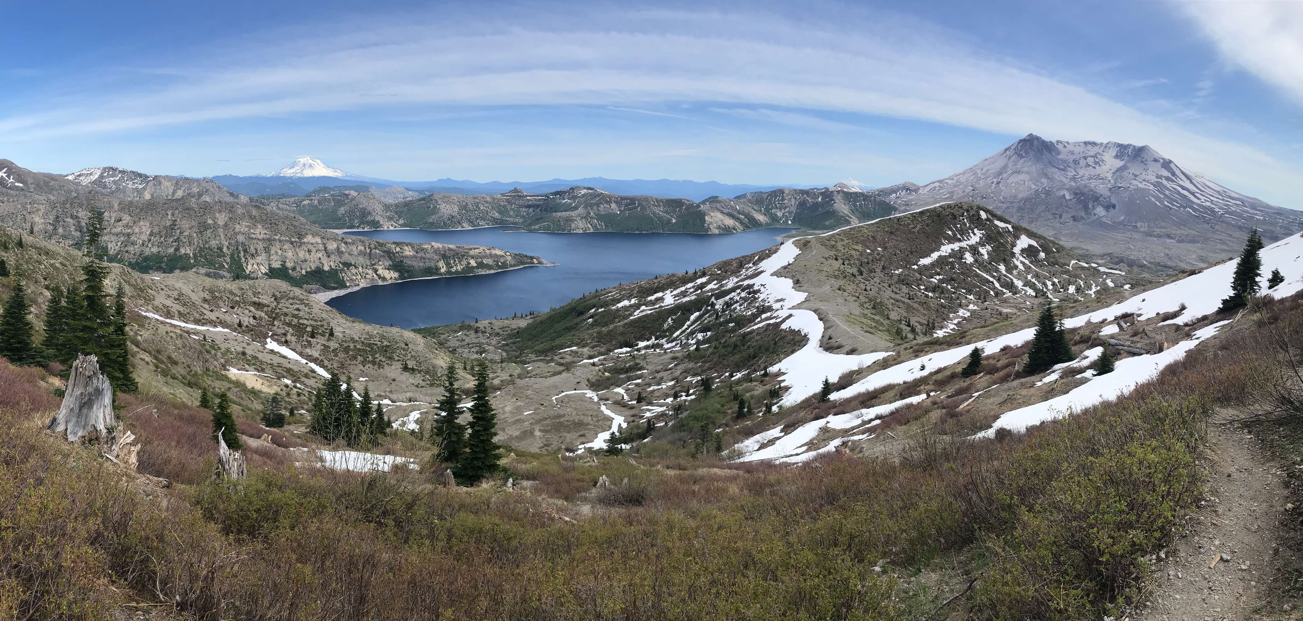
Monday, July 31, 2023

Hike: Ape Canyon Trail to Pumice Butte, MSH, Cougar, WA


Getting There

Take I-5 from Portland to Woodland. It's 23mi from N Portland to the exit 21.

Note: Because I had to pick up my radio from the Mount St. Helens National Volcanic Monument Headquarters in Amboy, WA, I took a slightly different route through Battleground and across the Yale Bridge before connecting with the Lewis River Road (SR 503).

It's 28 miles from Woodland to the Cougar. There are a couple of gas stations here. Continue east on SR-503 which becomes Rd 90 for 9.5 miles to Ape Cave. Looks for the sign to Ape Caves, June Lake, Climber's Bivouac, Ape Canyon & Lava Canyon which is Rd 83. It's 0.3 miles to Trail of Two Forests and 0.7 miles to Ape Cave.

It's 9.7 miles from the Trail of Two Forests to Ape Canyon on Rd 83.

Background

This hike was part of my first official day as a Hiking Steward with the Mt St Helens Institute. I started my day at 9:20am just after the Hwy 90/83 intersection where I checked in via radio to the dispatch. Another volunteer was working at Ape Cape so I wanted to spend most of my time at Ape Canyon and Lava Canyon.

I heard about a viewpoint above Ape Cave that you can either walk to or drive up to. I figured I'd start there. I drove right past and continued on this narrow road for almost two miles, 1/2 on gravel before I realized I'd missed it. Sure enough, it was just a 1/4 mile from the Ape Cave Parking lot. I parked at the sign and found the clearing in the trees to see the mountain.


I doubted anyone else would be up here at a quarter to 10am so I drove back down the hill and stopped at the Trail of Two Forests parking lot.

The only car there was leaving as I arrived but it wasn't long before another one showed up. They were traveling from Northern California. They'd stopped because they thought they could get a parking pass for the area there, not just the $5 pass. I chatted a bit about the TTF and they were happy to take a spin. I also recommended June Lake for a shorter hike since they were heading to Seattle in the afternoon. One of them was intrepid enough to crawl through the tunnel. (I just climbed down the ladder and looked.)

Hole left where a tree once stood


As I completed the boardwalk loop, I talked to a mother and daughter. The daughter had gone on a guided climb to the summit the day before. It was recommended to stop at the TTF on their way out. When I got back to the parking lot another couple had just arrived and were looking at the signage. We talked for awhile about history of Ape Cave and TTF. I asked if they had plans to head up 83 further; they'd camped in their van the night before somewhere between June Lake and Ape Canyon. They'd wanted to check out Ape Cave and the husband displeased about the timed ticket requirement. The wife tried to get him off the subject and accepted that it's just how things are at popular spots. They said Subway Cave in Lassen NF is another excellent lava tube. I said it was nice chatting and they headed to the boardwalk.

The Hike

Length: 10.00 mi
Elev. gain: 2,021 ft
Moving time: 3:27:32
Avg pace: 20:45
Calories: 2,091
Total time: 4:09:49

My third stop was Ape Canyon. I was ready for a bit of hiking and seeing the place through the lens of being a hiking steward. I carried some materials, the radio, and a notepad to record observations and visitor interactions. There were only a few parking spaces left so I knew I'd get to talk to some folks. As I was getting my pack and gear ready, two cars arrived nearby (a pair of hikers and a solo hiker). I took the opportunity to introduce myself. They didn't have any questions but thanked me for volunteering. The solo hiker said he'd heard about MSHI.

On the trail about 2 miles from trailhead, I encountered a large group; 13 members of a multigenerational family (4 under 10, 3 teens, 5 adults, 1 senior). They were spread out a bit and I said hello and introduced myself as I moved through them. One person asked about length of the trail and I showed the map on my phone with marker where we were at the moment. There were in good spirits, happy that there were making progress up the trail. They teens seemed annoyed by the flies that pestered them when they stopped. One person at the front of the group was carrying a medium sized cube-shaped cooler.

Mt Rainier

Mt Adams

Note: I never felt the need for bug spray. The flies were a bit annoying but never seemed to bite. No mosquitoes. I think I saw some hover flies (look like bees but aren't). The most unusual plants that I saw were the Indian Pipe and Pinesap.

About 45 mins later, a couple of mountain bikers came down the trail. I alerted them that a large group was below somewhere; they thanked me and continued their descent.


When I reached Pumice Butte, I encountered a woman and two 6 year olds just after the monitoring equipment. They didn't feel comfortable negotiating the narrow part of the trail and were turning back to find a place for a snack. I gave the kids stickers that they were happy to get. They showed me their camera watches. I talked to the mom for a bit and she asked me to tell two guys that might be waiting for them around the corner that they'd retreated. When I rounded the corner, I didn't see them and headed up the Loowit trail toward the Plains of Abraham to look for them but didn't. Two more mountain bikers were heading back down and greeted them. 


I double-backed and headed south on the Loowit trail into the trees to find some shade. I noted in my report that a couple of trees were fallen across the trail but easy to get around. I didn't see anyone on this part of the trail so I returned to the junction.


I walked back down past the monitor station and had lunch and admired the view of Mt Adams. The person with the cooler and two youngster from that group of 13 showed up. The little ones asked where the car was. LOL. I gave them both stickers which they seemed happy to get. They headed back down, apparently to regroup with the other 10 people.


The two guys the woman with two kids was looking for came by. I told them where they'd gone: looking for a place to rest and have a snack. The solo hiker that had parked next to me came by. He'd gone to the (dry) creek a bit north on the Loowit Trail for lunch.

At 2pm, I started my descent. I encountered the group of 13 about a 1/4 mile from Pumice Butte. One of the teens asked if there was a lake and looked slightly disappointed when I said there wasn't one up here.

I passed the woman with the two kids a third time while they were on their way down. The kids seemed tired but the mom had snacks and water to keep them motivated. I didn't see anyone else until close to the trailhead; a mountain biker starting the ascent. In general, I didn't have much time to introduce myself to the bikers except where I noted earlier. I made sure my MSHI shirt was well visible and they just cruised by.

One last look at the mountain and lahar

I reached the parking lot at 3:30p.

After The Hike

My next stop was Lava Canyon. There were a couple cars in the parking lot but I didn't see anyone. I only made it to upper bridge. I stayed there for about 30 mins. I did pass a solo visitor on my way back to the parking lot who wasn't too chatty. I just introduced myself and said I was just saying hello and could answer any questions but none came. I wished him a nice afternoon. I did the same with another pair of visitors.


My last stop for the day was the Lahar Viewpoint. I interacted with one person that was enjoying the views from a shaded rock. I talked with her for awhile about the 1980 eruption and Shoestring Glacier that melted during the eruption and become the lahar that scoured the east side of the mountain and Lava Canyon. She asked about the climbing routes as well. She and her family (in the car) were planning to visit the northside via 503. I detailed a few sites along the way: Silver Lake Visitor Center, Castle Lake Viewpoint, SLC, Coldwater Lake and the Hummocks.

Another couple just wanted to know where they could get a better view of the lahar. I recommended going a little further on 83 to Ape Canyon and maybe stop at Lava Canyon. In between interactions, I took the opportunity to collect some trash. My last interaction of my first rove was a mother and daughter. I talked about what changed in 1980 on this side of the mountain, the '80-84 and '04-08 domes, "In the Blast Zone" collections of essays, and Le Guin's, Pander's, & Cronin's visit to the blast zone in Oct 81.

I drove back to place I'd make my morning radio call near 83/90. and did my "out of service for the day" call to Columbia at 5pm.


Monday, July 4, 2022

Hike: Ape Canyon Trail to Pumice Butte, MSH, Cougar, WA

AllTrails map

AllTrails map

Getting There

Take I-5 from Portland to Woodland. It's 23mi from Kenton to the exit 21.

There are a few gas stations to fill up here. 

It's 46.2 miles to the Ape Canyon trailhead and it takes about 1.1 hrs (if you're going the speed limit ;). From WA-503 (out of Woodland) take this passed Merwin, Yale Lakes to the turn off for the following: Ape Caves, June Lake, Climber's Bivouac, Ape & Lava Canyons.

The parking lot was and side road were full. I found a spot off Lava Canyon Road.

The Hike 

Length: 10.99 mi
Elevation gain: 2,277 ft
Moving time: 3:43:32
Avg. pace: 20:20
Calories: 1,970
Total time: 4:14:27 

Fitbit
Steps: 25,048
Zone Mins: 40 (36 Fat Burn, 4 Cardio & Peak)
Floors: 271
Calories: 3,594

The weather perfect for a hike, a bit overcast, in the 60s and good trail conditions. I love this hike because it flanks the 40+ yrs old lahar flow but you get to experience the old forest. It's similar to June Lake hike in that regard. 

I've said it before but this hike is not difficult from the elevation gain but it's a decent length.

I didn't see very many people going up, just one couple, but several on their way down, including several mountain bikers. I didn't start my hike until around 1pm. There weren't many bugs out either but I was ready with spray and itch ointment. I forgot my rain fly and a few times the skies were pretty dark but I did have a compact rain jacket.

When I reached Pumice Butte and trail junction to June Lake I stopped briefly to chat with a woman on her way down. Then, continued north on the Loowit Trail to the creek.

Originally, I'd hoped to make it all the way out to Plains of Abraham and Windy Pass but by the time I reached the creek, it was getting a bit too late. I found a spot to sit, have a snack, and just chill. I have a tendency to go for distance and don't pause enough.

On the way back through Pumice Butte, I found my spot overlooking the lahar field and the trees covering the trail back. I was so peaceful and quit. Not much of a breeze and no bugs.

The hike back to the car was chill and uneventful. I meditated a bit but also made a point to listen to the birds and other sounds. My body felt fine, no knee issues.


MSH from near the top of the trail

Looking SE from the creek

From Pumice Butte

From lower on the trail, lahar flow

Winding trail

Selfie from Pumice Butte

Old tree stump

Another SE view

Rest stop view

Pink mountainheath

Lovely Loowit (MSH)