Showing posts with label Beaverton. Show all posts

Sunday, May 28, 2023

Hike: Cooper Mountain Nature Park, Beaverton, OR


Getting There

This place is just minutes from Beaverton, off SW Farmington Road. Take SW Grabhorn Road to SW Gassner Road. Then turn onto SW 190th and take it until it turns into SW Kemmer. It's not a bad as it sounds. (There's another route from SW 175th.)

The parking lot is pretty limited but they have a dirt lot for overflow.

The Hike

Length: 2.83 mi
Elev. gain: 436 ft
Moving time: 53:09
Total time: 1:02:07
Avg pace: 18:49
Calories: 535


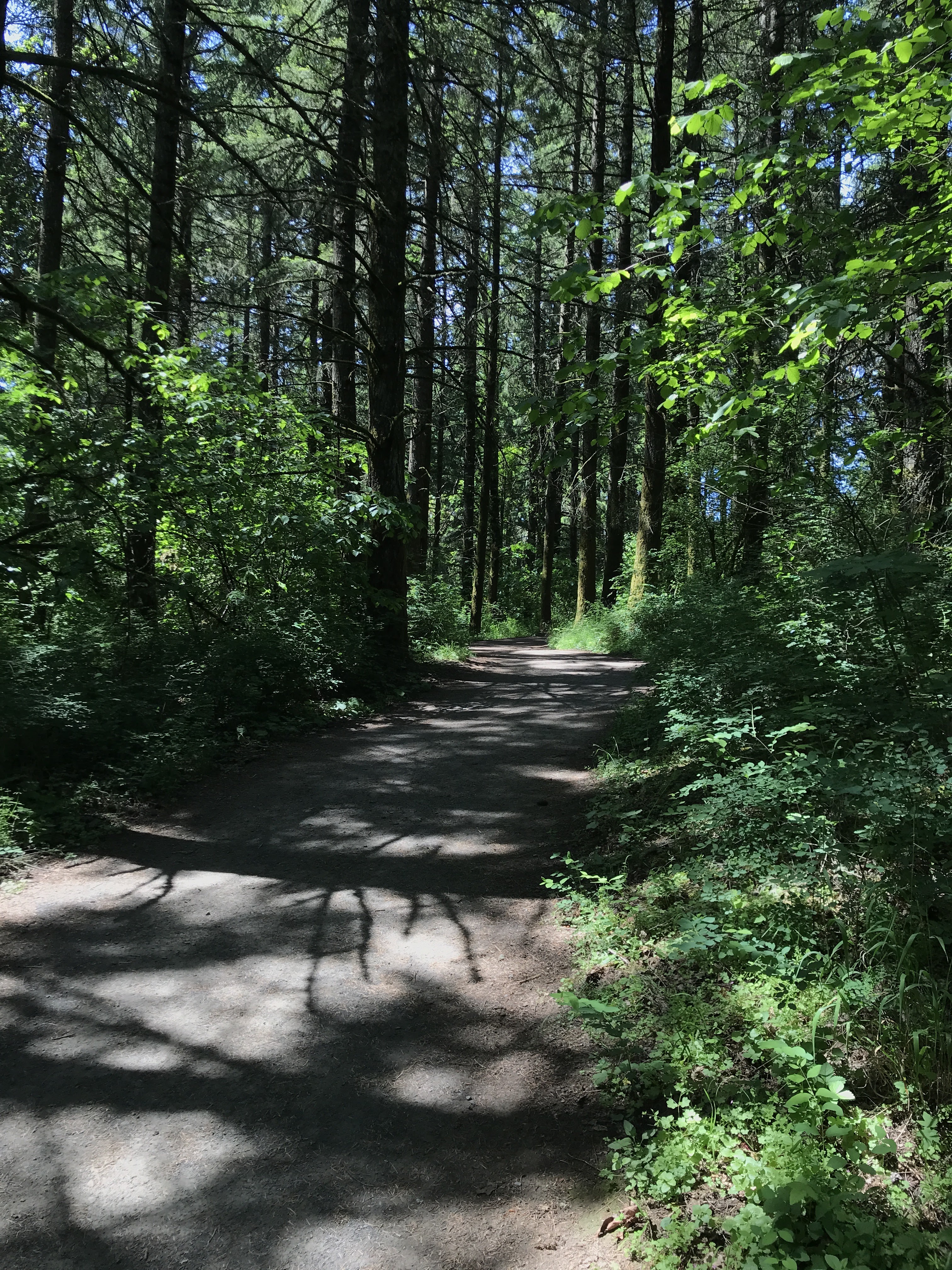
Even though I've been here several times before, I'm amazed by the variety of plants and trees. At times, you get wide views of the adjacent rolling hills and others, surrounded by trees like oaks and other foliage. It's even got a little bit of elevation loss/gain, ~450ft. 

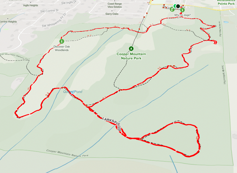
Like previous times, I take the longest loop around the perimeter. During the pandemic, the rangers had setup a counterclockwise loop to maximize social distancing and I've continued this route.

After leaving the parking lot, I followed the Cooper Mountain Loop. I'm not sure I've taken the Overlook Trail but maybe next time. You walk down the lowest elevation in the park. After the Quarry Pond, I took the Larkspur Loop for a bit more distance and elevation, then back on the main trail. The Cooper Mountain Loop cuts through the middle but I continued on the perimeter on Blacktail Way. 

This path includes a short spur trail to a prairie which has some benches. I found one bench partially in the shade and sat down to reflect on my life at this moment and listen to the wind and birds.

The last leg of the hike was up the east side of the Little Prairie Loop back to the parking lot.

I haven't been able to go for hikes further away from town but glad this place is an option for a short getaway. While I love the Sandy River Delta, I realize I'm not a fan of other people's dogs. This place is dog free.


Sunday, December 18, 2022

Hike: Cooper Mountain Nature Park, Beaverton, OR

AllTrails map

Getting There

This place is just minutes from Beaverton, off SW Farmington Road. Take SW Grabhorn Road to SW Gassner Road. Then turn onto SW 190th and take it until it turns into SW Kemmer. It's not a bad as it sounds. (There's another route from SW 175th.)

The parking lot is pretty limited but they have a dirt lot for overflow.

The Hike

Length: 2.90 mi
Elev. gain: 430 ft
Moving time: 52:12
Total time: 52:54
Avg pace: 18:00
Calories: 525

I'm behind on my hiking goals for 2022 so this hike was mostly for the stats but it was good to get out and get some exercise. While it was relatively short hike, there was a little elevation gain and I, somehow, avoided rain. (It was raining the entire drive over there from N Portland, including on Farmington Road.)

When I was here last time in summer of 2021, the trails were on "covid" routes, meaning most trails were one-way to maximize social distancing.

This time I followed basically the same route, counterclockwise:

Cooper Mountain Loop > Larkspur Loop > Blacktail Way > Little Prairie Loop.


Friday, May 14, 2021

Hike: Cooper Mountain Nature Park, Beaverton, OR


AllTrails map

Length: 6.28 miles
Elevation Gain: 426 feet
Type: Loop
Steps: 13,771


Getting There

This place is just minutes from Beaverton off SW Farmington Road. Take SW Grabhorn Road to SW Gassner Road. Then turn onto SW 190th and take it until it turns into SW Kemmer. It's not a bad as it sounds. (There's another route from SW 175th.)

The parking lot is pretty limited but they have a dirt lot for overflow. I was the second car in this lot. I stopped here before but only explored the trail a few feet.


The Hike

I started down Little Prairie Loop and took it to the end. The trail system is mostly one-way for social distancing but a bit confusing and I found myself back at the junction near the trailhead.

This time, instead of Prairie Loop, I took the Cooper Mountain loop. There another intersection both marked Cooper Mtn Trail. I took the one that was went downhill. Again I hit a one-way sign that was directing me toward Little Prairie Loop again.

I did a 180 and marched back up to the intersection. I found the loop I wanted and followed it all the way down the hill. Beautiful views of farms in the distance and wildflowers and meadows in the foreground.

Not wanting to miss any parts, I took the Larkspur Loop trail. It's a one-way trail and I passed an older guy going the 'wrong' way. I waved and kept going. The backside of the loop is a steep hill so guessing the gentleman wasn't up for that park.

From there the trail turns into Blacktail Way. I passed the intersection where I had to do the 180.

I did that little section of Little Prairie again and returned to my car.


Toughleaf Iris


AllTrails says the loop is 2.6 miles but my FitBit recorded 6.28. I know I backtracked quite a bit but wondering if I forgot another stop where I got some steps in. I'm going with recorded data for now.