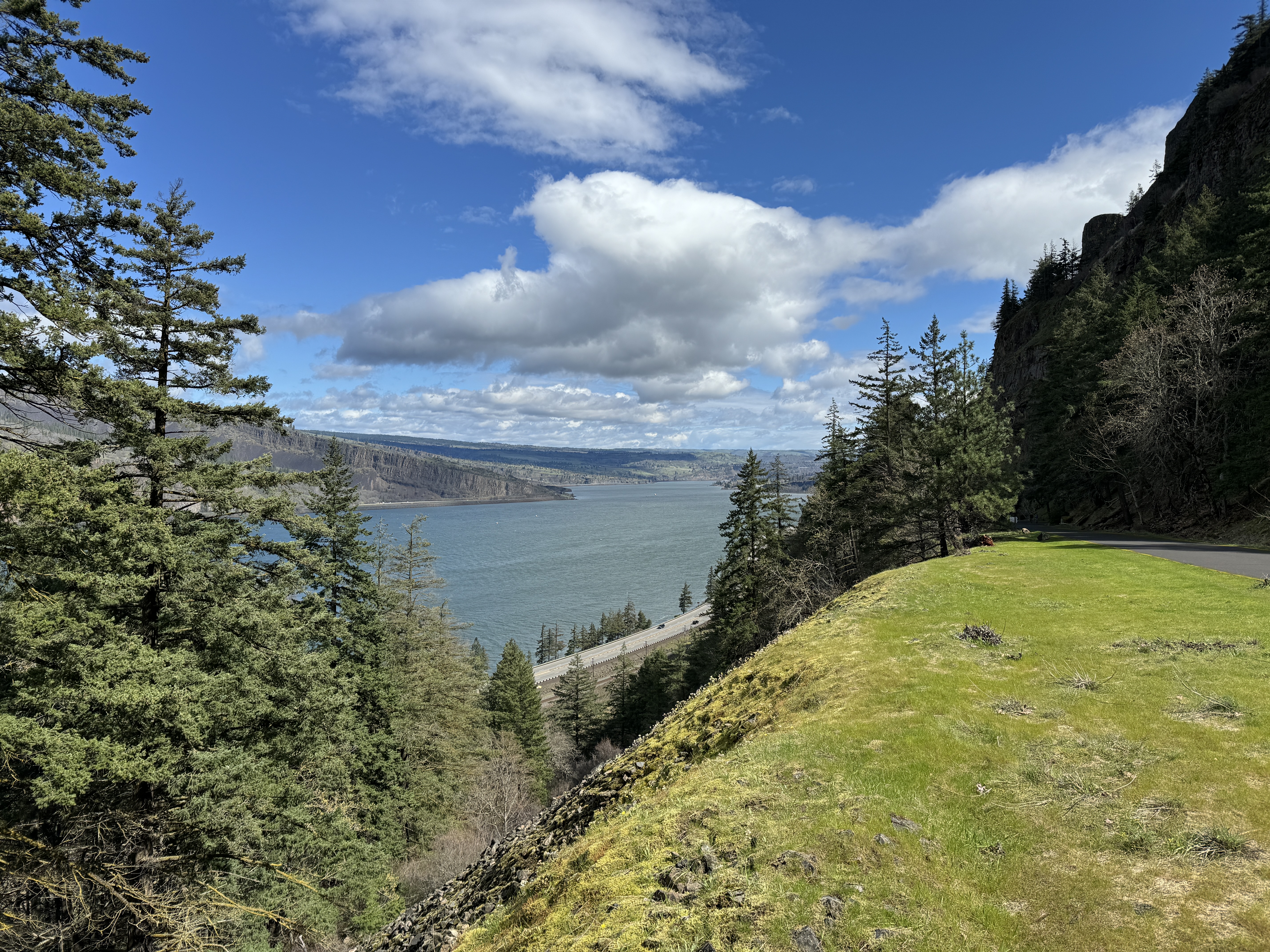
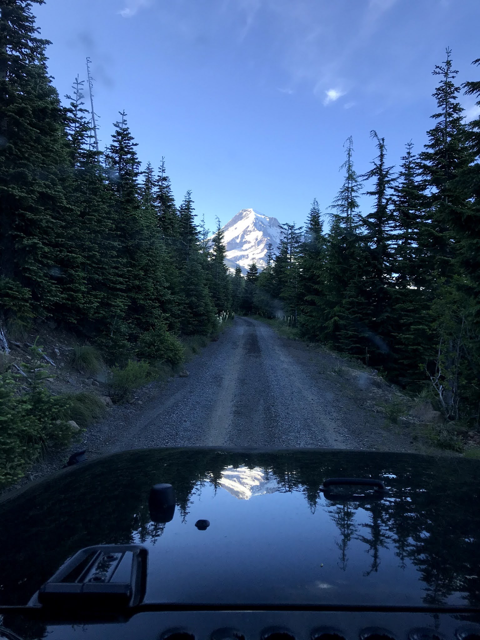
Showing posts with label Hood River. Show all posts

Friday, February 6, 2026

Hike: Mitchell Point, Hood River, OR

Getting There

From Portland, it's about 57 miles (92km) east on I-84, about 5 miles (8 km) from Hood River. You have to take exit 58 from the eastbound lanes: there is no exit from the westbound lanes. 

The trailhead/tunnel parking lot is just up the hill. Parking is limited. When I went there on a weekend (or holiday), cars were parked illegally on the shoulder - please don't do that. Come back during the week or when early or late in the day. 

I waited until mid-afternoon to decide to go somewhere. I knew I didn't have time for any of my usual hikes. The weather was great in town and I hoped it would be like that all the way to Hood River. When I was getting close (I was parallel with Wind Mountain across the river), the cloud cover was pretty thick. The sunset was going to be nice but it was a bit chilly.

Fortunately, the parking lot was only about 1/2 full (5-6 cars). I didn't have any gear, just a jacket, fanny pack, hiking poles. No water, or snacks. Raw dogging. 

The Hike

Distance: 1.85 mi
Ascent: 892 ft
Total Time: 1h 27m 


This was my first hike of 2026 but not my first outdoor excursion. I've done a bunch of work parties with WTA and TKO but was finding motivation was still a bit elusive, a feeling that has lingered for several months.

Last time I stopped here, I didn't even have proper hiking boots and found my footwear was not appropriate for the steep terrain. This time I had a singular goal in mind: make it to the top!

Given the lack of cars in the parking lot, I figured I'd have the place to myself. I had just an hour or 1.5 hrs left before sunset.

The trail climbs about 900 feet (275m) in just under a mile (1.4km). I grinded up the switchback, crossed a couple of scree fields which lead me to the saddle. The trail climbs up to the service road for the power lines, before turning sharply back towards the river (north). The climb up the spine is kinda steep but not bad.

As I was ascending the last stretch I saw two people near the top. They disappeared out of view. I guessed they were enjoying the views. I continued upwards but wanted to give those folks some space. I peeked around the corner and saw them sitting. I backed up a bit and took some pictures.

After a few minutes I saw them coming back down. I pretended I was a bit surprised. I said hello and made a cringy (dad joke) comment: "What goes up must come down".. (ewwww, why?). LOL

I climbed up to where they were sitting and took a look. Not much further to go on the point before getting too sketchy. I was ready to start my descent but wanted those people to get a little further along so I wasn't crowding them.

I saw them stop to put on jackets so I hurried so I could pass. Unfortunately, they saw me coming down the hill and quickly started hiking again.. argh!

I stalled and walked really slowly but they kept stopping so I eventually caught up again.

As I crossed the last scree field, a bunch of softball to bowling ball sized rocks started to slide down right above were I was. Only my legs & ankles stopped them but they kind of piled up against me. Yikes. More rocks might have made me lose my footing and swept me down the scree field, or if they'd had started sliding higher up and picked up speed, it could have been more dangerous. Oof.

I made a noise in surprise then relief when nothing more happened. I looked up and noticed the couple had stopped. In fact, they'd stopped to make sure I was okay. I brushed off the danger and said "well, that was a bit spicy!" but thanked them.

Again, I adopted a slow pace so I wasn't right behind them on the trail. Back at the parking lot, one of them headed to the loo and the other putting their gear away. I should have thanked them again for waiting after the rock slide. 


Sunday, March 24, 2024

Hike: Historic Columbia River Highway State Trail, Hood River, OR


Getting There

After the WTA trail work party the day before, I stayed in Hood River overnight. I didn't know what I was doing when I woke up. The weekend before I'd done a hike at Wind Mountain on the way home so I wanted to do something else. 

I drove up to the Historic Columbia River Highway State Trailhead just east of Hood River.

From downtown Hood River, I took State Street east toward Hwy 35. The road changes to Old Columbia River Drive. It's another 1.3 miles up a winding road. I instantly recognized that I'd been here before.

I wondered if my Northwest Forest Pass would work for this trailhead/parking lot. I went inside the visitor center to ask the volunteer. We chatted for a long time about her history with the park service and volunteering. I shared that I'd been out in the area with WTA at Lyle Cherry Orchard.

My parking pass wasn't good here since it was a forest pass and not a parks pass. I bought the $5 day fee and got ready to go.

The Hike

Distance: 9.79 miles
Elevation Gain: 842 feet
Highest Elevation: 526 feet


I really didn't know how far I was going to follow this trail. It was paved the entire way but the volunteer I'd talked with gave me the mile markers where stuff was. It was about 4 miles to the east trailhead in Mosier. I'd been there a couple of years ago and checked out the tunnels.

I had my pack with rain gear and snacks. Unfortunately, I'd forgotten to refill my water bottle. Oops. It was hardly a remote area but still a bit of a bummer.

I thought I'd go to the view point at mile 71 and turn back. I took my sweet time enjoying the views and explore every side trail. I found an open gate to a small meadow. There was a scramble route to the rocky outcrop but I wasn't sure if it was off-limit and didn't want to get too far off the official trail.


Just beyond the meadow was a small trail through some oak trees but there was also a gate and No Trespassing sign forbidding access for safety and preservation reasons. From there I could see the small pond I'd seen from the meadow. I'd scared a crane when I got there.


From the cliff above, I saw the crane had returned to its pond.

I found the viewpoint at Mile 71. I could see I-84 below and Lyle Cherry Orchard in the far distance. The weather was amazing and slightly chilly. I just had my base layer with was moisture-wicking. I had my soft-shell jacket just in case.


Since the volunteer had told me the tunnel was at Mile 72, I figured I'd just keep going. I didn't see anyone for the most part except a couple of bikers that zipped through.


On the other side of the tunnels was another lookout. It was cool to see the sloped terrain on the WA side of the river. Sedimentary rock that had been tipped at a 30° angle. The clouds were fluffy and gorgeous.


I ended up going all the way to the trailhead parking lot in Mosier. I'd hoped to find a drinking fountain but alas there was none. I used the lew and started the walk back to Hood River.

Near the west side trailhead, the trail splits for bikes and pedestrians.


Nice outing. Not exactly a "hike" because it was 100% paved but I'm marking it as such. I had my hiking boots on (which were pretty comfy TBH) and my backpack. And whew, 9.79 miles! Surprisingly, I had a decent amount of elevation gain (842 ft), comparable to EG at the Lyle Loop Trail (942 ft) even though it was spread over 9.8 miles here vs 1.7 miles one-way to the top of arc.

Wednesday, July 15, 2020

Road Trip: Mosier Twin Tunnels, Hood River, Mt Hood, OR

Day 1: Mosier Twin Tunnels, Hood River, OR

I got to Hood River to my hotel at the Westcliff Lodge. Sweet room overlooking a grassy area used for events like weddings. 

With plenty of daylight left, I headed east to check out the Mosier Twin Tunnels, just 9 miles away.

Here are some shots from the Historic Columbia River Highway State Trail. "The trail comprises three disconnected paved paths along stretches of historic Highway 30 — which predated I-84 as the only road connecting Portland and The Dalles. Together the segments provide a combined 12-plus miles of thrilling scenery and spectacular geologic formations."1


 I also to a spin down to check out "The Hook" and Waucoma Basin on the Columbia River.


I got sushi from Sushi Okalani and curbside pickup. I had to time to visit Gorge Greenery All Things Cannabis- Marijuana Dispensary Hood River while for order was prepared.


Day 2: Hike at Vista Ridge Trail #626


I drove pretty far up Lolo Pass Road underneath the power lines before turning back around. The easier route is NF-1810.


Sources

1 https://stateparks.oregon.gov/index.cfm?do=park.profile&parkId=113