|
St Helen's Lake from Coldwater Peak
|
 |
Wide pano from Coldwater Peak summit
|
 |
Mt Adams (Pah-to) from the Stagman Ridge Trail
|
Why 52 hikes?
There are lot of hiking challenges "out there", one being the 52 hike challenge. I thought this aligned well with my new targets and I liked the symmetry with the calendar.
Since
I was working, my hiking was limited to weekends and the occasional
holiday for the most part. I wasn't able to take my annual road trip but
was able to catch up on hikes in the fall. I visited my favorite spots (Hamilton/Beacon Rock, Dog Mountain, Forest Park).
I participated in the WTA's annual Hike-A-Thon in August and did one hike per week. While the contest was open to trails all over the world, I limited my hikes to ones on WA trails. My first one was Butte Camp on the south side of Mt St Helens, and my second time there. My second one was Silver Star Mountain, north of Washougal. I crushed this hike and got some great photos. My third one was Coldwater Peak, another epic hike. I got some more great photos. I'd been there the month before but didn't quit reach the top due to snow/ice and some mountain goats on the trail. My fourth and final HAT hike was a new one for me: Stagman Ridge on the west side of Mt Adams. This was my first visit to trail.
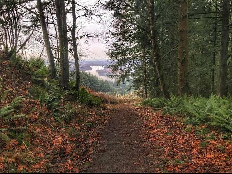
Like last year ('21), I did a lot of conditioning hikes in Forest Park & Beacon Rock State Park. I did 7 hikes at Forest Park, my longest being 10.4 miles and 2,133 ft just a couple of weeks ago. I also spent a lot of time hiking around Beacon Rock including Phlox Point and Hamilton Mountain, totaling 14 hikes combined.
Why 365 miles?
I adjusted my distance goal from 500 miles to 365. I liked the symmetry with the calendar and of course, it works out to 1 mile per day. My average distance this year is about 7 miles per hike so that complements the 52 hikes goal.
My hikes usually are a bit longer so I knew I could budget for some shorter hikes without falling too far behind on the goal.
What destinations are 365 miles from Portland?
The Canadian Border is 365 miles from Portland, and so is Medford, OR. It's about the same as a round trip to Eugene, OR (at least by highway).
Elsewhere in the US, for example, it's exactly 365 miles from New Orleans to Houston.
And in Europe, according to TripSavvy, "London to Cologne: 365miles/587km".
Why 84,000 feet?
This goal was somewhat arbitrary. This works out to 7000 ft per month. 52 hikes at 1600' per hike calculates to 83,200 ft. I preferred the symmetry with the number of months in a year. I also knew many of my hikes would be a bit more in the 2000' range so I could take some hikes without much elevation gain and still not fall behind on the goals.
What is it like at 84,000 feet high (15.9 mi/25.6 km)?
"At 84,000 feet, MSU’s balloon was above 98 percent of the Earth’s atmosphere." (source)
 |
| Montana State University students |
Fitbit uses some interesting comparisons/achievements.
These
stats are incomplete because I didn't always hike with my Fitbit and
the mileage is calculated from Steps times Average Stride Length rather
than the Actual Distance moved via GPS. When hiking up inclines and
technical section you tend to take smaller steps so the mileage is often
inflated.
Also, the way the Floors is calculated makes it an inaccurate analog to elevation gain. According to SteveH on the Fitbit blog,
Floor are based on 10 ft (3m) of continuous rise. "So, if you rise 9
feet, level off for a few steps, then rise another 9 feet then you rise
18 feet but get zero floors."
Yearly Totals:
1,869,380 steps ● 11,045 floors ● 855.7 miles ● 756,124 calories
This
includes more than just hikes, like pushing my shopping cart back to
the corral or going up the stairs in my house for the 7th time because I
forgot why I went up there last time. While
my hiking goals are reduced this year, my FitBit stats are pretty much
inline with last years'. I was walking regularly at work over the
summer.
And,
one caveat about the following information is that all lesser levels
are incremented when a Trail Badge is earned, e.g. when you hike 16k
daily steps, you earn the Urban Boot, Sneakers, Boat Shoe badges.
The counts are cumulative from last year when I started keep track on FitBit so I only included the milestones that were added or updated this year.
Daily Steps
- Trail Shoe: 30,000 steps in a day (1x)
- Classics: 25,000
(4x)
- High Tops: 20,000
(17x)
- Urban Boot: 15,000
(33x)
- Sneakers: 10,000
(45x)
- Boat Shoe: 5,000
(127x)
|
Daily Climbs- Stadium: 150
floors in a day (33x)
- Roller coaster: 125
(35x)
- Skyscraper: 100
(36x)
- Ferris Wheel: 75
(38x)
- Lighthouse: 50 (41x)
- Redwood Forest: 25
(54x)
- Happy Hill: 10
(102x)
|
Lifetime Distance
- India: 1,997 lifetime miles (1x)
- Japan: 1,869 (1x)
- Great Barrier Reef: 1,600 (1x)
|
Lifetime Climb
- Astronaut: 28,000 lifetime floors (1x)
- Shooting Star: 20,000 (1x)
|
Reflections
Even though I hiked some familiar trails, I hiked some new ones like the newly opened Steigerwald Lake National Wildlife Refuge in Washougal, WA. I returned to Wahtum Lake, north of Mt Hood to summit the small peak of Chinidere Mountain.
Moulton Falls
 |
East Fork Lewis River
|
One place that I'd driven by but never stopped to look was Moulton
Falls, WA. The day before
Halloween, I'd ventured up to the trail parking lot for Silver Star
Mountain on L-1200. It was pretty overcast and dark when I got there and
it just didn't look like a lot of fun. I didn't even stop. After I got
back to pavement on the north side of L-1200, I stopped at Moulton
Falls. I just intended to take some photos and get some steps. I did
bring my whole pack but just because. As I continued further on the
path, I passed joggers and dogs+owners. I found the turn for Bells Mountain. I was stoked to get some elevation gain and distance. Bonus: When I got back to the car, a fellow Jeep owner had "ducked" me with a small blue rubber ducky.
 |
Selfie from Bells Mountain, above Moulton Falls
|
To the south, I also explored some trails around Mt Hood that I hadn't done, at least in awhile. Specifically, the routes accessible from Lolo Pass Road.
McNeil Point
 |
| Selfie from Ho Rock/Cathedral Ridge |
One was McNeil Point. A friend had done this one the previous summer. Until then, it really wasn't on my radar. I started from the Top Spur trailhead. I'd seen the sign for this trailhead when checking out Lola Pass and Ramona Falls. When I reached the hut, I still had a few hours of daylight. I saw a trail going up, up, up so I figured I'd go as far as I can before I needed to start the descent.
 |
Mt Hood (Wy'east), Ho Rocky, Cathedral Ridge (McNeil Point Trail)
|
On the front side, I passed a couple coming down. When I reached the top of the first section, I met another guy starting his descent. The approach to Cathedral Ridge & Ho Rock is not very steep. I could see the end of the trail. I stopped at the rock to shed my pack and have a snack. I walked a little further to the 'real' end. A couple was sitting, enjoying the view so I backed up quietly to give them space.
Barret Spur
While I'd hiked the Vista Ridge trail a couple of times, I'd had mixed results. The first time was in 2020 and I only made it to the intersection for the loop to the Cairn Basin. There was snow above and I wasn't ready to go further that time. My second visit was 2021 where I only got about 0.4 mile from the trailhead before getting to dozens of downed trees blocking the trail. I ended up bailing and wound up at Wahtum Lake and Ant Hill.
 |
Mt Hood (Wy'east) - Selfie from base of Barrett Spur
|
This most recent hike I was well-prepared and was on a mission to get as much elevation as I could. At the Cairn Basin junction, I ran into quite a bit of snow covering the trail but had my eye on Barrett Spur to put on my microspikes and crawled along on the snow bank. I was going up steep embankments and around trees to try to stay on course.
 |
Snowy trail
|
I reached the Timberline Trail and met two guys hiking the mountain perimeter. I missed the actual turn to Barrett Spur but found an alternate route. I kept going up and up, skirting the snow where I could.
I reached the base of Barrett Spur. I was tired and wary of the clock. The final mile was scrambling up a rocky incline. I decided to call it there instead of going the last bit. Still amazing up there but I wanted to get back to the car with plenty of daylight.
On my descent, I didn't follow the snowy covered trail the same way and got off course. I didn't realize it until I looked at the map. I was closer to the Timberline section of the Cairn Basin loop. Phew! I was back on a trail instead of bushwhacking however I quickly encountered lots of snow covering the trail. I saw some post holes from other hikers so I just needed to follow them back to the trail junction.
 |
My favorite alpine flower (Western pasqueflower, Old Man of the Mountain)
|
The rest was smooth sailing back to the car. (Props to the trail crews that had cleared the massive number of trees from the previous year.).
Mt St Helens Summit
On
the one-year anniversary my previous MSH hike, I took another run at
the summit. This time I didn't quite make it; I made it through the
boulders, all the way to the pumice section but just ran out of energy. I
was struggling all morning with low energy and I got to the point where
I was resting a lot more than I was progressing upwards.
In
hindsight, I knew I hadn't nourished my body correctly for the
endeavor. I didn't have my food the night before and just a banana in
the early morning. The decision to turn back was a bit of a relief. I
watched people get further ahead of me and I was getting a bit down
emotionally. I knew sometimes you just have to play it safe and try
again another day. While it takes a bit of planning with getting the
permit to getting to the trailhead to camp, setting out in the dark on
an 8 hr journey up a steep mountain.
I also knew I needed to save my reserve energy for a safe descent back to the car and the Climber's Bivouac.
 |
| Ptarmigan Trail |
 |
| Selfie from my turnaround point about 1/2 mile from summit |
In the end, it was a beautiful hike and great outing. I will try again.
This experience had motivated my to pay a lot closer attention to how and when I fuel my body on these hikes. I started getting Gatorade and drinking it during my ascent but saving enough for my descents. There has been a noticeable improvement in my energy levels during and after the hikes, fewer leg (IT band, hammies), ankle, or foot issues.
What's Next
I
like to continue exploring the west and northwest side of Mt Hood,
particularly the Tilly Jane and Cooper Spur side. There's also a route
to Barrett Spur from over there. I saw there are guided climbs but not
sure if that's in the cards this next year.
I saw an Instagram post for 29029 Everesting:
a hiking challenge based on the height of Mt Everest. There are several
sites that host the event. The challenge is to hike for 24 hrs to equal
the distance but only the ascents, you get to take a chairlift back to
the bottom. Some sites have short trails so you have to do a lot more
repetitions. The most difficult is Whistler with the longest route so
fewest hikes.
The
section of BPA Road in Forest Park is about 1 mile and 900 ft.
Therefore, it'd be like do that over and over about 30 times in the 24
hr period. That sounds exhausting. Ha! As much of a physical as mental
challenge. It cost a few thousand dollars and not sure I'm up for it but
I'm still intrigued. Perhaps I can craft my own challenge.
Overall Stats for the Year
- Number of Hikes: 49
- Total Distance: 341.9 miles
- Total Elevation Gain: 85,561 feet
- Average Distance per Hike: 7 miles
- Average Elevation Gain per Hike: 1,746 feet
- Longest Hike: 13.98 miles (Coldwater Peak, 8/21/2022)
- Highest Elevation in a Hike: 7,289 feet (Mt St Helens, 9/16/2022)
- Most Elevation in a Hike: 3,330 feet (Cathedral Ridge, 7/10/2022)
Check out these platforms for updates and photos