|
| AllTrails map |
Getting There
From Hood River, follow directions to Lost Lake and take the turn off on Lolo Pass Road. Go for 3.1mi. Look out for the sign for the Vista Ridge Trailhead via Forest Road NF-16.
From Hwy 26, take Lolo Pass Road at the Zig Zag Ranger Station. It's about 26 miles (1h 9m) from here. The road is closed at Lolo Pass (NF-18), so take NF-1810 for 10.5mi to a sharp right on to NF-16.
---
Follow NF-16 uphill for 5.5mi and look out for a sharp left and NF-1650. From here is dirt/gravel. There are a few sections of washboard but otherwise the road is in great shape, no potholes.
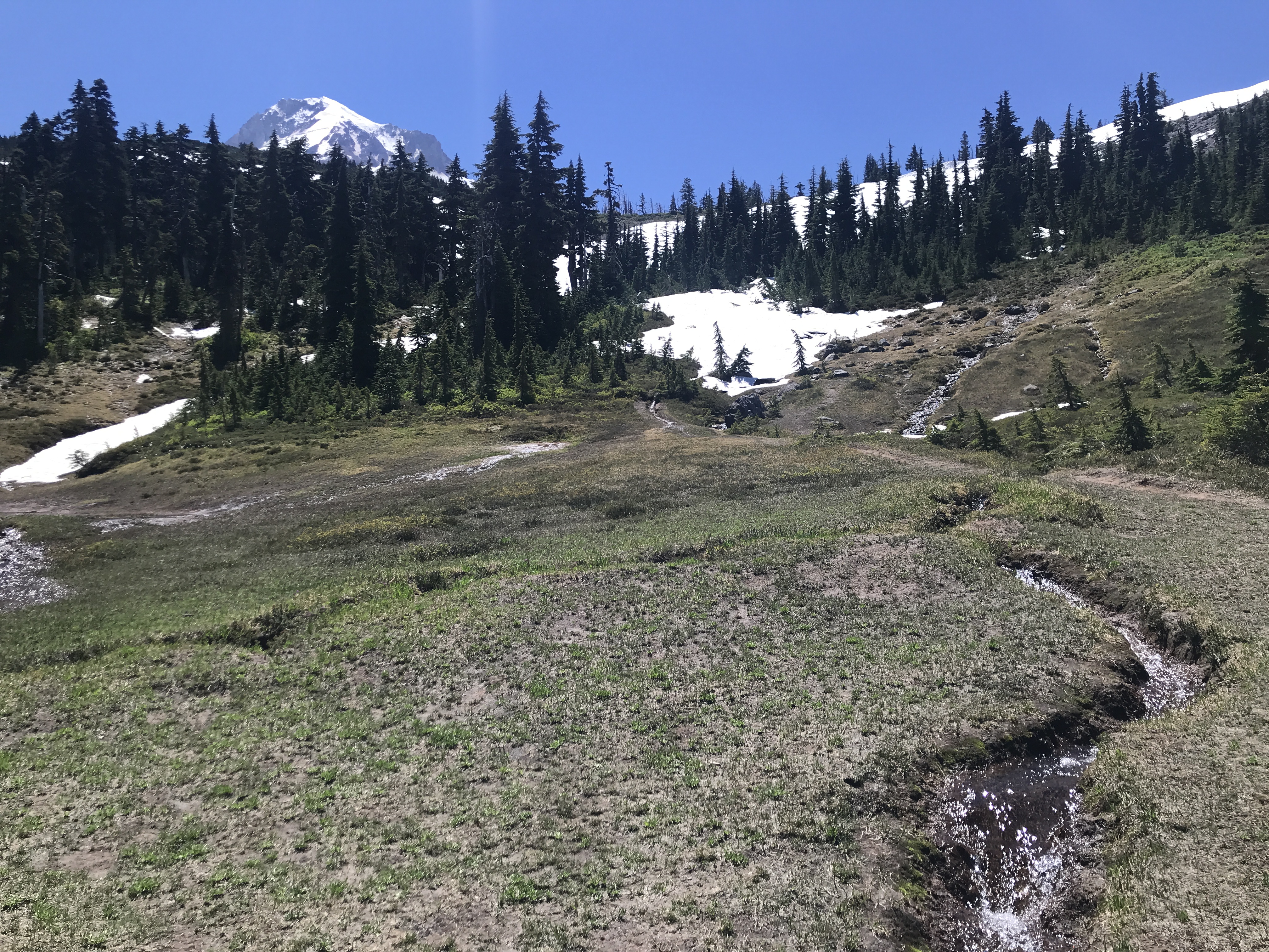
The Hike
Avg. pace: 30:29
This is my 3rd visit to this trailhead. The first time was July 16, 2020. I made it to the Eden Park Trail but turned around because I didn't have microspikes to negotiate the snow. The second time was June 12, 2021 and the trail was in rough shape due to dozens of downed trees, esp. at the point where the old Vista Ridge Trail intersects. I bailed and hiked Wahtum Lake/Ant Hill later that day.
This time was had my eye on Barrett Spur esp after my recent hike above McNeil Point at Cathedral Ridge/Ho Rock. At the Eden Park junction, there was a huge bank of snow on the direct route. I put on my microspikes and did my best. Eventually, I dropped into the trees and bobbed and weaved up the hill. The trail was buried somewhere below. I finally made it to the Timberline Trail.
I crossed path with two hikers/campers. They said the snow wasn't bad further along. That was good news. Except, I quickly started heading up towards Barrett Spur and up a huge patch of snow. It was like this for most of the rest of the way. The trailblazing was okay, lots of animal paths or other hikers to follow.
As I got close to my destination, the mountain ahead was daunting. The last bit of the hike was up a steep hill. There wasn't an obvious trail to follow, even when I was close. I found a bit of a trail and started going up but I knew it was going to be tough. According to AllTrails, it's a 0.4mi and 200-300 yds-45deg scramble.
I was thinking about my descent and making it back safely and before sundown. I had plenty of daylight but considered the risk too much for a solo attempt. I'd spent a lot of energy trailblazing. I vowed to come back with another hiker/friend and/or solo when there's no snow to contend with.