Sunday, May 28, 2023

Hike: Cooper Mountain Nature Park, Beaverton, OR


Getting There

This place is just minutes from Beaverton, off SW Farmington Road. Take SW Grabhorn Road to SW Gassner Road. Then turn onto SW 190th and take it until it turns into SW Kemmer. It's not a bad as it sounds. (There's another route from SW 175th.)

The parking lot is pretty limited but they have a dirt lot for overflow.

The Hike

Length: 2.83 mi
Elev. gain: 436 ft
Moving time: 53:09
Total time: 1:02:07
Avg pace: 18:49
Calories: 535


Even 
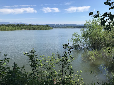
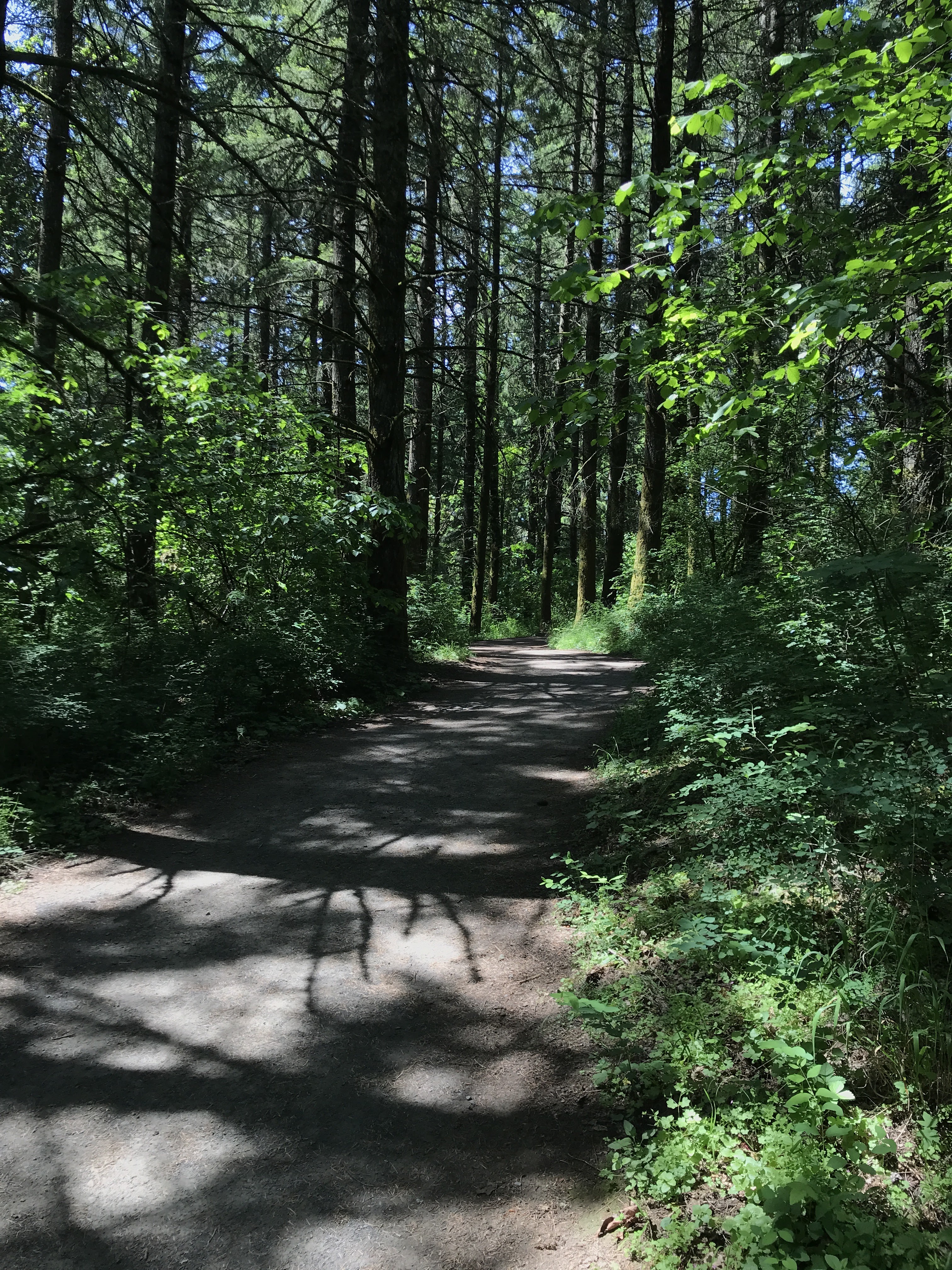
though I've been here several times before, I'm amazed by the variety of plants and trees. At times, you get wide views of the adjacent rolling hills and others, surrounded by trees like oaks and other foliage. It's even got a little bit of elevation loss/gain, ~450ft. 

Like previous times, I take the longest loop around the perimeter. During the pandemic, the rangers had setup a counterclockwise loop to maximize social distancing and I've continued this route.

After leaving the parking lot, I followed the Cooper Mountain Loop. I'm not sure I've taken the Overlook Trail but maybe next time. You walk down the lowest elevation in the park. After the Quarry Pond, I took the Larkspur Loop for a bit more distance and elevation, then back on the main trail. The Cooper Mountain Loop cuts through the middle but I continued on the perimeter on Blacktail Way. 

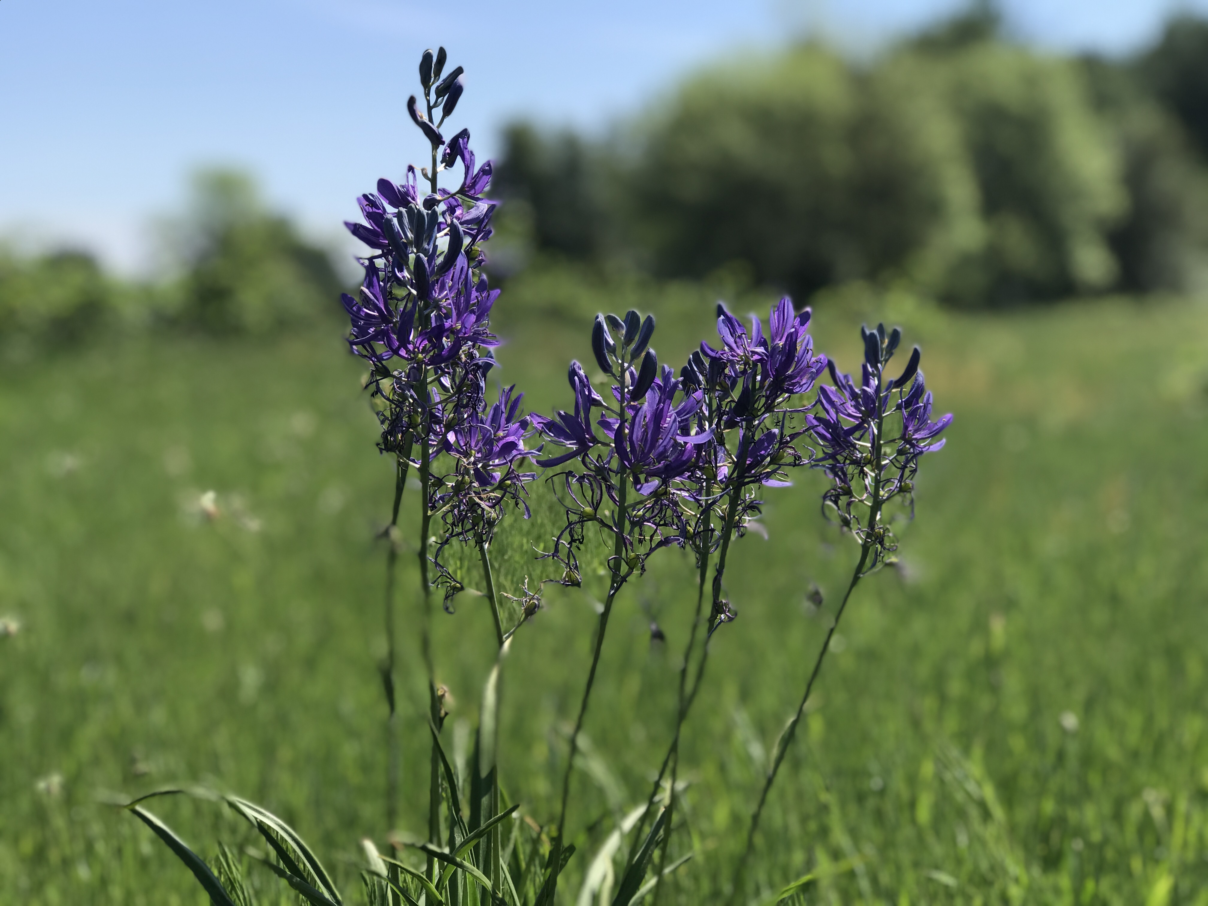
This path includes a short spur trail to a prairie which has some benches. I found one bench partially in the shade and sat down to reflect on my life at this moment and listen to the wind and birds.

The last leg of the hike was up the east side of the Little Prairie Loop back to the parking lot.

I haven't been able to go for hikes further away from town but glad this place is an option for a short getaway. While I love the Sandy River Delta, I realize I'm not a fan of other people's dogs. This place is dog free.


Thursday, May 18, 2023

Hike: Sandy River Delta, Troutdale, OR

Bird Blind by Maya Lin (Confluence Project)

Getting There

The parking lot is accessible from Hwy 84 just east of Troutdale. It was warm day. The lot was about 3/4 full. Made sure to pay the $5 day fee. 

"The Sandy River Delta is just north of I-84 off Exit 18. Driving east, exit the freeway and turn right at the T, go under the overpass and enter the park at the sign. If you’re driving west on I-84, take Exit 18 and take an immediate right. At the parking lot, look for the gravel path marked “Confluence.” Follow the path for 1.2 miles to reach the Bird Blind."
https://www.confluenceproject.org/river-site/sandy-river-delta/

The Hike

Length: 3.96 mi
Elev. gain: 75 ft
Moving time: 1:11:31
Avg pace: 18:04
Calories: 720
Total time: 1:12:14


I was wearing my sandals and just out of a light spin. I had my favorite straw hat as well. There were lots of dogs and their people. I basically did a figure-8, taking the most direct route to the bird blind.

The Sandy River Delta is one of six River Sites as part of the Confluence Project.

I remember doing trail maintenance three times when I was with TechTracker. They were weekend, work sponsored outings. I feel a certain affinity to place because of my involvement.

I was a bit surprised to find the river level was so high. Last time I was there on Dec 3, 2022, you could walk out beyond the bird blind. Now, it was well submerged.

East Channel
Bird Blind

Columbia River
 
Boundary Trail

Sandy River

Meadow Road


Confluence Trail

This is one my go-to spot when I don't have a lot of time and just want some low key exercise and fresh air. Unfortunately, it also a reputation for encounters with off-leash dogs and careless dog owners. 

I hate to focus on the negatives but it must be said. I passed several dog+owners and mostly had no issue. However, when I was on the Boundary Trail, I passed a guy and a dog who took interest in me but trotted by. When the man also passed, the dog turned and nipped at my heels. I didn't look back but he seemed surprised and reprimanded the dog. I wasn't bitten but put my on edge a little. I love dogs!

Then, on the Ranch Dike Trail, two walkers with three off-leash dogs approached. I was apprehensive and even said to myself "please don't maul me". As we got closer to each other, one dog ran ahead, barking aggressively. Immediately, one of the owners called to the dog and started to apologize. I stopped in my tracks and raised my hands to protect them. That person had the other put on a leash. While they were distracted, the other two dogs began barking but quickly retreated when the owners reprimanded them. I tried to be cheerful but was annoyed. Talking to the 1st dog: "What's the matter? why did you do that?". The classic "my dog never does that. He's fine and won't bite." I was prepared to defend myself. Sigh.

---

In hindsight I've had many odd dog encounters out there over the years. A Rottweiler ran up to me and go uncomfortably close. I didn't see the owner was out of sight for several seconds, then said nothing to me as the dog returned to their side. Another time, a dog with muddy paws actually jumped up on me. I was were rain gear so not a huge deal but still annoying.

Sunday, May 14, 2023

Hike: North End of Forest Park 24, Portland, OR


Getting There

Take NW Skyline Blvd north from NW Germantown Road. The Skyline Blvd Trailhead is 1.6 mi and a parking are available on right (east) side of the road.

The Hike

AllTrails map
Length: 6.90 mi
Elev. gain: 1,407 ft
Moving time: 2:21:22
Avg pace: 20:29
Calories: 1,423
Total time: 2:28:46


I haven't been to my favorite conditioning hike in city limits since Feb which was when my plantar fasciitis started to rear its ugly head.

The PNW is in the middle of some crazy hot weather but I knew most of the hike is in the shade. I was trying out some new electrolyte powder (LMNT) that I saw on Kyle Hates Hiking.

Well... things were pretty rough. I wasn't feeling particularly strong on my hike down to Hwy 30 via the Wildwood Trail. The first sign things weren't right was when I decided to skip my side quests up to the BPA Road and Newton Road Trailheads. 

I reached the bottom of 1mi/900ft climb up BPA Road and checked my watch. All the way to this point I was drinking my LMNT and snacking but on the ascent I kept getting chills.

"Usually, this is a product of dehydration, especially if you are training in a hotter and humid climate like you might be. First off, chills occur when you are running in high temperatures and humid weather."1

I guess I wasn't as hydrated as I thought. It took my 35 mins to get the top vs the usual time of 25 mins.

I was wiped out but glad to be on the return segment. I considered heading on my usual route down Firelane 12 but opted to keep going to Wildwood. The chills continued even though the elevation gain was minor. I decided to hike up to the BPA road trailhead and walk the road back to the car.

Sad face. Something was definitely off. I've hiked in warm weather but this was different. I drink almost the entire 32 oz of the LMNT and had another 32 oz bottle of water which is mostly full.

Guess I need to start drinking more water daily. I had recent blood work and my creatine was in good shape. IDK.