 |
Broken Top, Green Lakes
|
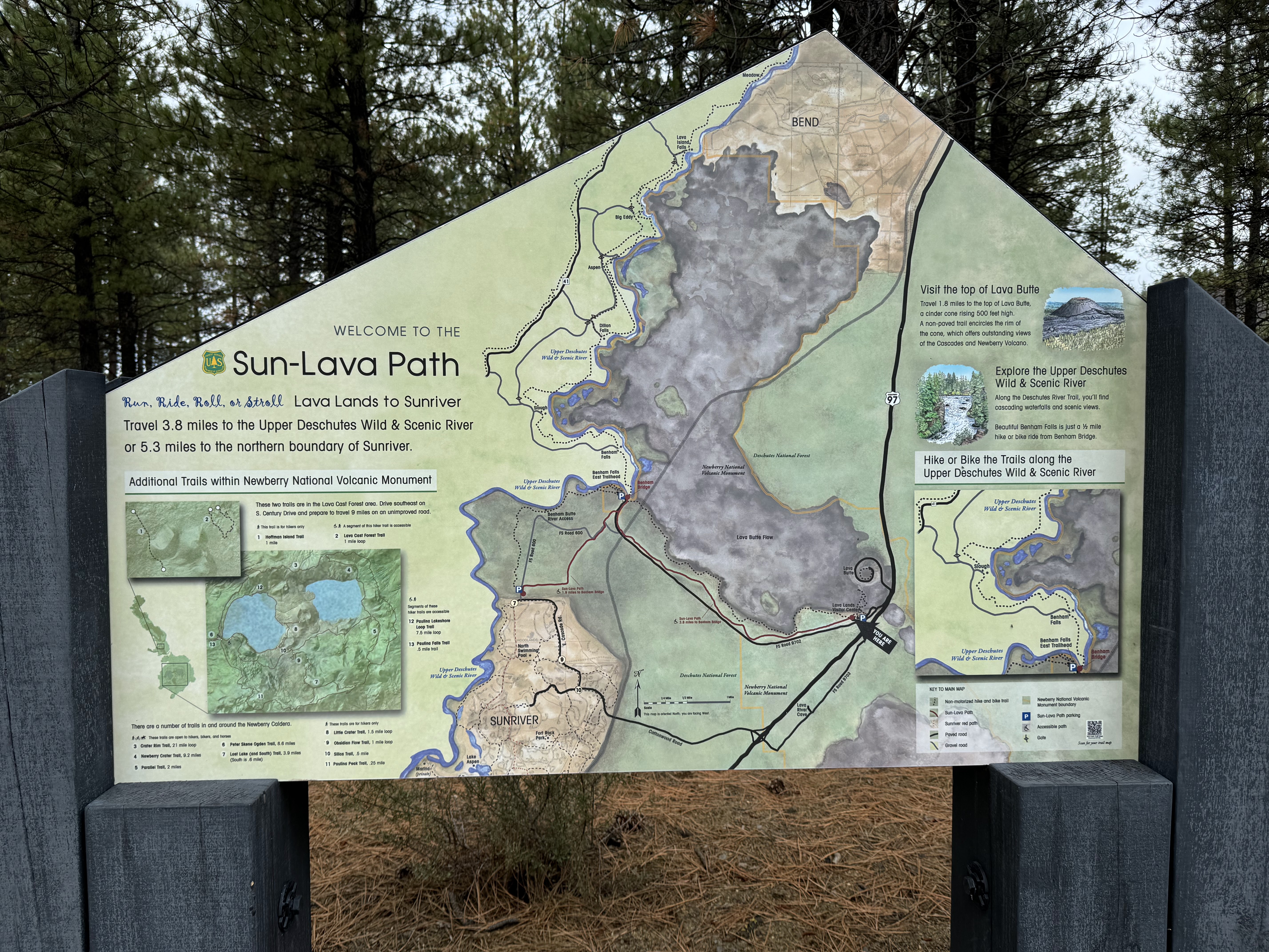
Getting There
From Bend, take SW Century Drive to Mt Bachelor until it changes to and continue on Cascade Lakes National Scenic Byway: it's about 25 miles out of town. Pull into the Green Lakes/Soda Creek Trailhead parking lot.
The Hike
Distance: 9.84 miles
Elevation Gain: 1,221 feet
Highest Elevation: 6,576 feet
For this hike, a Central Cascades Wilderness Permit is required for
both day use and overnight stays from this trailhead between June 15 and
October 15.
https://www.fs.usda.gov/detail/willamette/passes-permits/recreation/?cid=fseprd688355
---
After my relatively short hike with little elevation gain along the Deschutes River the day before, I was craving something a little more challenging. Plus, I was eager to get a closer look at South Sister and Broken Top since I saw them upon arriving to Bend and they are visible from all over.
Just after leaving the parking lot, you cross a primitive log bridge. The Fall Creek Trail follows the creek and climbs steadily, with many opportunities to see the many waterfalls. Only in hindsight did I realize I'd seen Fall Creek Falls.
 |
| Fall Creek Falls |
|
You cross a couple more bridges before getting to the west edge of the moraine. The trail sort of level off and you see the foliage along the river changes to deciduous trees and bushes in full fall colors.
I decided to take the side trail to Broken Top and veers away from and above Fall Creek.
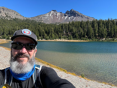
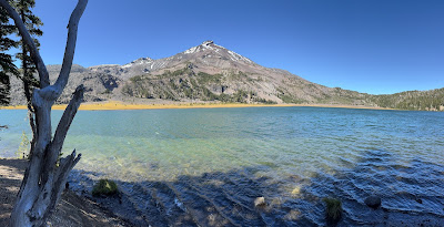
Suddenly, Broken Top and the small lake beneath it come into view. Spectacular!
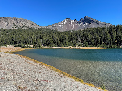 |
Broken Top
|
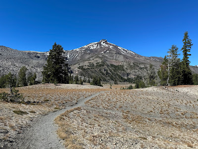 |
South Sister
|
 |
Broken Top
|
There are several options of trails to get to the large Green Lake. South Sister towers above the valley. It's awe-inspiring to be saddled between these two mountains.
I continued on toward a spit of land with trees to get a look at the large lake. Another wow moment! There were several people already there enjoying the views and result of their hike. The water was all around with South Sister revealing more of her eastern flank.
While it certainly wasn't crowded, when more people arrived, I decided to find somewhere else to have lunch and frankly, it was a bit chilly in the shade with a moderate breeze. As I left, I found another place to photograph Broken Top.
 |
South Sister
|
|
Broken Top
|
I retraced some of my steps and made my way back to the smaller lake and a trail marked Broken Top. There were a few marked campsites (#7, #8). I found a place to have my sandwich and soak in the views.
I wasn't going to make a summit attempt but I thought I could go for a little bit. I hesitated since I didn't have my Keen hiking boots. There was a trail going down the water on the south side. I found a tiny plastic duck. I returned to the detour. (It's a good thing it didn't go any further because that wasn't the summit trail, it just passes the mountain and continues south of Ball Butte.
I wanted down the shoreline on a narrow trail and noticed more horse hoof prints than footprints. I found a tiny plastic duck. I had to take a picture of the little guy before putting it in my pocket. Leave no trace!
I had a great descent back to the trailhead on the Fall Creek Trail. The light had changed from earlier so I didn't bother with any photos.