Getting There
I was already at the Lava Lands Visitor Center off US-97. Take NF-9702 northwest for 4.0 miles to the Benham Falls East Trailhead. There are enough parking spaces for about 10 cars. Pay $5 for a day pass or use your America The Beautiful or Northwest Forest Pass or other qualifying pass.The Hike
Distance: 4.73 milesElevation Gain: 280 feet
Highest Elevation: 4,188 feet
I had no idea what I was in for. I just enjoyed the beautiful landscape along the Deschutes River: trees on one side and rugged lava on the other. I studied the large area map-sign for a bit and looked at possible destinations.
 |
| Across from the trailhead parking lot |
 |
| From Benham Bridge, near the parking lot |
Beyond Benham Falls, there were several spots along the route. I was prepared for a longer hike but also wasn't sure about elevation and time. It looked like I could reach Dillon Falls.
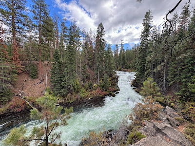
The trail between where I was parked and Benham Falls was pretty flat and straight but you could see through the trees at the rugged lava field across a slow-moving river. As I got closer the the falls, the noise of the rushing water got louder and louder.
As I got closer the the falls, the noise of the rushing water got louder and louder.
I found a side trail that lead down closer the water and suddenly the river took a turn and was rushing downhill through a narrow gully. The falls weren't so much a long drop as a series of cascading drops. To my surprise I came to the West Trailhead and a small parking lot accessed by a dirt road. I wondered where this road started from.
I found the lookout and snapped a few more pictures, then continue on the trail.
After a short distance and a few more turns, the water was much more calm and there wasn't any whitewater. It was still pine trees on one side and lava rock on the other.
I reached a section of deciduous trees and other foliage. I was a blast of fall colors: oranges, yellows, reds, browns and quite a contrast to the coniferous trees I'd been walking through.
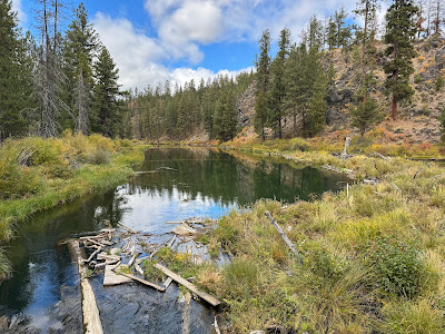
I reached another parking lot with a pit toilet and picnic tables. The water was glassy. I thought it made a good spot to eat lunch.
 |
| Slough Day Use Area |
 |
| From Slough Day Use Area |
I met a couple that were also checking out the view and we chatted for a bit about Newberry and I shared comparisons to MSH. When they continued their hike, I picked a table and took off my pack.
It was peaceful besides a few people nearby yelling at their dog that it was time to go. LOL. The pupper didn't want to get out of the water.
As it turns out, I was at the Slough Day Use Area. I still didn't know where this dirt road originated but it didn't matter. I decided this was my turnaround spot. I wasn't planning to do a long hike. I still had time to visit the High Desert Museum before it closed at 5pm.
I put 1/2 my sandwich away and started back to the trailhead. If I understood the signage, the side of the monument was on closed at 5pm. I didn't want to get stuck behind the gate. I guessed the dirt road gave 24/7 access to the area.
Back at the car, I finished my sandwich and drove back to US-97.


