Featured Post

2024: My Year in Review

Another trip around the sun! I kept my same hiking goals from previous years: 52 hikes , 365 miles , 84,000 feet . However, I came up short ...

Showing posts with label Forest Park. Show all posts

Tuesday, December 26, 2023

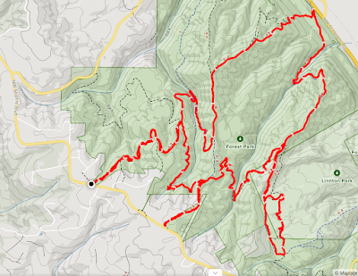
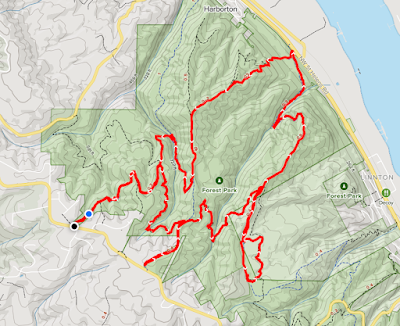
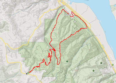
Hike: North End of Forest Park 26, Portland, OR


Getting There

Take NW Skyline Blvd north from NW Germantown Road. The Skyline Blvd Trailhead is 1.6 mi and a parking are available on right (east) side of the road.

The Hike

Length: 7.76 mi
Elev. gain: 1,729 ft
Moving time: 2:45:02
Avg pace: 21:15
Calories: 1,665
Total time: 2:54:52


It's been awhile since I last hike this trail. This time I thought I'd switch things up and do the clockwise route which takes you down the BPA Road and up Newton Road.

With my R foot hurting, I wasn't sure I was going to hike all the way down to Hwy 30 and waited to decide when I got to the power lines about 1/2 down.

When I got there, I stopped and considered the effort to get back up the other side. If worse got to worse, I could call a Lyft to take me back to the car, a luxury I don't have when hiking in other places.

It was good choice. My foot hurt but never too bad that I couldn't keep going. I passed a few people doing  the counter-clockwise route to wherever.

When I reached the car, I was glad to done the whole loop. It was proof that I was 'on the mend'.

I also had the camera I got for Xmas. Unfortunately, I wasn't happy with the limited features, slippery plastic finish, especially compared to the power of an iPhone with all the options and settings. I feel bad and don't want to tell my mom, lest she feels bad about the gift. I'll find a use for it somehow, even if I don't use it while hiking.


Monday, October 30, 2023

Hike: North End of Forest Park 25, Portland, OR

Wrong view, different hike

Getting There

Take NW Skyline Blvd north from NW Germantown Road. The Skyline Blvd Trailhead is 1.6 mi and a parking are available on right (east) side of the road.

The Hike

Length: 4.53 miles
Elevation Gain: 1,020 feet


Ha. The picture at the top is from Dec 26, 2023 and it from a viewpoint lower than where I turned around on this hike. 

I just wanted to record this hike in the blog for continuity. It was my first hike after my trip to Bend. My foot was unhappy so I didn't do the full loop. I was only able to north end of the BPA Road just before it descends steeply to Hwy 30.

It was good to make an effort and get outside but I knew I was hobbled to some extent.

Saturday, July 22, 2023

Hike: Forest Park, Linnton, Portland, OR


Selfie from NW Leif Erikson Road

Getting There

This was a first, taking the bus to get to Forest Park to hike. My car needs to go to the shop so I don't want to risk making the problem worse by driving it.

From Kenton, I took the #4 bus from the park to St Johns. The Trip Planner showed a short waiting time for my connecting bus but when I got there it was updated to almost 50 mins. I went to Safeway and got a sandwich.

I hopped on the #16 bus to Sauvie Island and got off at NW Marina Drive on Hwy 30 (NW St Helens Road).

It was short walk to the bottom of the BPA Road.

The Hike


Length: 11.56 mi
Elev. gain: 1,998 ft
Moving time: 4:08:34
Avg pace: 21:30
Calories: 2,504
Total time: 4:26:08


This was a variation on my usual conditioning loop from the Skyline Trailhead. Instead, I was starting with the steep climb up BPA Road, approx. 850 ft of climb in less than a mile. I continued onward on my route to just past the Kielhorn Meadow.

I turned around and retraced my route to the Wildwood Trail junction and gave my regards to Benjamin George Collins' bench.

When I got the the Newton Road junction, I continued to the trailhead parking lot as I usually do but decided to keep heading south to Germantown Road instead of going down Newton Road to the trailhead where I started. I wasn't ready to end my hike just yet.

This was unknown territory but a welcome change to my usual loop.

I crossed Germantown Road and took the Cannon Trail connector to NW Leif Erikson Road. There was no way I was walking on the road and it was pretty nice.

When I got to Leif Erikson, I found it was flat gravel road that wound through the trees. I wasn't sure how long with its twists and turns but I forged ahead. I stopped to check the map several times to make sure I hadn't missed my turn.

I noted a side trail (Hardesty Trail) for future exploration.

Eventually, I made it to the Ridge Trail that ran east to west and took it down to the St Johns Bridge.

I was stoked to not have to find a stop for the #16 bus and wait for an unknown period of time. My feet were sore and the vehicle noise was pretty loud but I knew I just had to get across to St Johns and I could get the #4 bus back home.

View of the Willamette, Mt Rainier, Mt St Helens, and Mt Adams

View from the bridge


Sunday, May 14, 2023

Hike: North End of Forest Park 24, Portland, OR


Getting There

Take NW Skyline Blvd north from NW Germantown Road. The Skyline Blvd Trailhead is 1.6 mi and a parking are available on right (east) side of the road.

The Hike

AllTrails map
Length: 6.90 mi
Elev. gain: 1,407 ft
Moving time: 2:21:22
Avg pace: 20:29
Calories: 1,423
Total time: 2:28:46


I haven't been to my favorite conditioning hike in city limits since Feb which was when my plantar fasciitis started to rear its ugly head.

The PNW is in the middle of some crazy hot weather but I knew most of the hike is in the shade. I was trying out some new electrolyte powder (LMNT) that I saw on Kyle Hates Hiking.

Well... things were pretty rough. I wasn't feeling particularly strong on my hike down to Hwy 30 via the Wildwood Trail. The first sign things weren't right was when I decided to skip my side quests up to the BPA Road and Newton Road Trailheads. 

I reached the bottom of 1mi/900ft climb up BPA Road and checked my watch. All the way to this point I was drinking my LMNT and snacking but on the ascent I kept getting chills.

"Usually, this is a product of dehydration, especially if you are training in a hotter and humid climate like you might be. First off, chills occur when you are running in high temperatures and humid weather."1

I guess I wasn't as hydrated as I thought. It took my 35 mins to get the top vs the usual time of 25 mins.

I was wiped out but glad to be on the return segment. I considered heading on my usual route down Firelane 12 but opted to keep going to Wildwood. The chills continued even though the elevation gain was minor. I decided to hike up to the BPA road trailhead and walk the road back to the car.

Sad face. Something was definitely off. I've hiked in warm weather but this was different. I drink almost the entire 32 oz of the LMNT and had another 32 oz bottle of water which is mostly full.

Guess I need to start drinking more water daily. I had recent blood work and my creatine was in good shape. IDK.


Saturday, February 11, 2023

Hike: North End of Forest Park 23, Portland, OR

View from BPA Road

Getting There

Take NW Skyline Blvd north from NW Germantown Road. The Skyline Blvd Trailhead is 1.6 mi and a parking are available on right (east) side of the road.

Today, I was actually headed to Sauvie Island and Wapato Greenway for a short, flat hike. It was too late to get all the way out to Warrior Rock. As I approached Newberry Road, I make the quick decision to head up to Skyline.

 At the Wildwood Trail parking lot, there were 7-8 cars. I probably could have found a spot but continued to my usual trailhead. I was going to do an abbreviated version of my usual hike.

AllTrails map

The Hike

Length: 4.72 mi
Elev. gain:
1,017 ft
Moving time:
1:25:24
Total time:
1:27:08
Avg pace:
18:07
Calories:
859

FitBit
Steps: 11,458
Floors: 131
Cals: 2,568

Sidelined (sorta) due to anterior impingement and plantar fasciitis in my left foot + ankle. Argh! It happened after my last hike here. I've had range-of-motion issues since a football injury in high school in my left ankle but it's never posed this kind of problem. It could be exacerbated by the arthritis. Seems doubtful but the hike before at Nesmith Point Trail in the Gorge was where I got absolutely soaked. I wondered if this affected my boots; I tried some different sole inserts. Or, maybe I need to do more stretching before strenuous hikes. I may tried 200-400 mg of ibuprofen before the next hike to see if that alleviates the pain. All speculation.

The heel pain and ankle tightness comes and goes and are probably related to each other. I'm still waiting to get a referral to a podiatrist. I wanted to take a short hike to test myself and the weather was just too nice not to head out.

---

I stayed on the fire lanes in Forest Park. When I got to the Wildwood intersection, I continued on Firelane 15 to Firelane 12. Before the drop a couple were looking at their phone, probably deciding their route. I waved and zoomed by. 

When I reached BPA Road, I considered make a loop with Wildwood but kept going to the end of the road where you can see the mountains.

The Cascades were out today. The sun was reflecting off the snow on Loowit (MSH) and Klickitat (Mt Adams), and I could just make out Tahoma (Mt Rainier). Worth a little discomfort.

I could hear a puppy barking really loudly. I saw the dog before I saw the owner carrying a big stick. I made the dumb joke "is that the branch manager?". (eye roll, sigh).

On the return, I still was going to do the Wildwood section but dropped down Firelane 12 again, making this hike a true "out-n-back".


Friday, January 20, 2023

Hike: North End of Forest Park 22, Portland, OR

Getting There

Take NW Skyline Blvd north from NW Germantown Road. The Skyline Blvd Trailhead is 1.6 mi and a parking are available on right (east) side of the road.

AllTrails map

The Hike

Length: 10.49 mi
Elev. gain: 2,178 ft
Moving time: 3:14:58
Avg pace: 18:36
Calories: 1,961
Total time: 3:21:10

FitBit
Steps: 22,433
Floors: 259
Cals: 3,336

The forecast showed clearing skies into the afternoon. It was pretty foggy above 500' and on Skyline Blvd. The out-n-back section of the hike was pretty cool (temp) but was a good warmup.

As I was going along Wildwood, I encountered another hiker with a dog. He stopped at Benjamin G. Collins bench and I mentioned it was my favorite bench when I walked by, which prompted to ask if I wanted to sit there. I backpedaled inadequately "no, no.. I just acknowledge it when I come by here." I said have a good day.

It was pretty muddy in spots and I noted several downed trees since I was here a month ago. In fact, a few must have been recent because you had to crawl over them. One was on Newton Road and another major detour on the Wildwood near the Newton Road parking lot. At the bottom of the ravine along Newton Creek/Road. (Keeping the trail crews busy.)

As I was heading south towards Germantown Road, it looked like the sun was finally breaking through the clouds.

I made it to the top of the BPA climb in about 23 mins, my usual ascent time. I stopped briefly at the picnic benches at the end of BPA Road.

It was really socked in about 2/3rd of the way up to the top. No sun today. The powerlines disappeared into the mist.

There was a toy horse attached to a telephone pole. Just some random Portland shit, like the horses "hitched" to the metal rings in town.


Monday, December 19, 2022

Hike: North End of Forest Park 21, Portland, OR


AllTrails map

Getting There

Take NW Skyline Blvd north from NW Germantown Road. The Skyline Blvd Trailhead is 1.6 mi and a parking are available on right (east) side of the road.

The Hike

Length: 10.40 mi
Elev. gain: 2,133 ft
Moving time: 3:12:31
Total time: 3:19:05
Avg pace: 18:31
Calories: 1,935

BPA Road in Forest Park. This is the top of a 1.0 mi / 800 ft climb. It's part of a 10 mi / 2000 ft loop that I've been doing for awhile; my favorite nearby hike for conditioning. I'm close to meeting some goals I set for the year, so I'm trying to squeeze in as many outings as I can before NYE. I took every side quest/detour: (1) to the BPA Road Trailhead (+0.9 mi) (2) to the Newton Road Trailhead (+1.7 mi), (3) the Kielhorn Meadow (+0.3 mi).  

** Shoutout to the trail maintenance people. The Wildwood Trail was in great shape. Looks like a lot of recent work.

--
On my way down toward Hwy 30 on Newton Road, I heard a strange noise, like from an animal. It didn't sound like a dog or bird. When I was in the area in Nov I saw some bear poop on BPA Road near Firelane 12. I heard two vocalizations -
2 sec each. It didn't sound like was close to the trail but certainly nearby, down the hillside.

Wednesday, November 9, 2022

Hike: North End of Forest Park 20, Portland, OR

Sunset from Firelane 15

AllTrails map


Getting There

Take NW Skyline Blvd north from NW Germantown Road. The Skyline Blvd Trailhead is 1.6 mi and a parking are available on right (east) side of the road. 

The "prowler" sign is still there. There were three other cars and no room to park where there is full visibility. I had to park behind a car next to the blackberry. Again, I figured I've done all I can do like locking the console and glove-box and not leaving any of valuable visible or stuff in the back like before the break-in. I parked in a highly visible area and (knock on wood) no issues.

The Hike

Length: 6.14 mi
Elevation gain: 1,089 ft
Moving time: 1:49:35
Total time: 1:54:45
Avg. pace: 17:51
Calories: 1,101

Fitbit
Steps
: 13,385
Zone Mins: 33
Floors: 136
Calories: 2,633

This was my first Forest Park hike since August 13. I got a late start so I did a abbreviated version of my usual hike.

The part from the trailhead and Firelane 15 to BPA Road via Wildwood was the same. I headed towards Newton Road but stopped about 1/2 way. I didn't think I had enough daylight to make it all the way down to Linnton and back up in time.

I hike back up to BPA Road and walked to the end. Then, on my way back to the car, took the usual section of Firelane 12 back to Firelane 15.

Note: I did say hello to Benjamin George Collins - or at least the park bench dedicated to him.

This hike is #38 for 2022. I getting closer to my goals for this year. The Elevation Gain is looking good but I'm behind on Hikes and Distance Hiked. I wouldn't mind doing some 'flat' hikes to pump up my stats.

https://rtah.xyz/2022-stats/


Saturday, August 13, 2022

Hike: North End of Forest Park 19, Portland, OR

AllTrails map


Getting There

Take NW Skyline Blvd north from NW Germantown Road. The Skyline Blvd Trailhead is 1.6 mi and a parking are available on right (east) side of the road.  

I've been slightly wary of parking at popular hiking trailheads since hearing about the rash of break-ins at the Newberry Road Trailhead (N end of Wildwood Trail) and my own debacle at work. Sucks. Nevertheless, I figured I've done all I can do like locking the console and glove-box and not leaving any of valuable visible or stuff in the back like before the break-in. I parked in a highly visible area and (knock on wood) no issues.

Since the last time I was here, a plastic lawn sign was added warning about "prowlers".

The Hike

Length: 7.30 mi
Elevation gain: 1,699 ft
Moving time: 2:33:34
Total time: 2:38:39
Avg. pace: 21:03
Calories: 1,353

Steps: 22,436
Zone Mins: 37
Floors: 240
Calories: 1,606

This was my first full loop hike since June. I was happy to finally not have to deal with mud. There was a little bit of overgrowth but manageable. I skipped the detours this time which cut the hike down 500 ft of climb and 3 miles.

The 800 ft climb up BPA Road took 25 mins, on par with my previous times. I'm feeling good physically about my 2nd MSH climb next month. The new boots are giving me some troubles but I'm going keep trying to get them broken in. Just in case I'll take both pairs to the trailhead and decide on hike day.

I should have hiked in WA for the the August Hike-A-Thon but I made the decision late. As I write this on Sunday morning, I'm wondering if I have a second hike in me this weekend. I'll have to get going soon.

Saturday, June 18, 2022

Hike: North End of Forest Park 18, Portland, OR

AllTrails map


Getting There

Take NW Skyline Blvd north from NW Germantown Road. The Skyline Blvd Trailhead is 1.6 mi and a parking are available on right (east) side of the road.  

I've been slightly wary of parking at popular hiking trailheads since hearing about the rash of break-ins at the Newberry Road Trailhead (N end of Wildwood Trail) and my own debacle at work. Sucks. Nevertheless, I figured I've done all I can do like locking the console and glove-box and not leaving any of valuable visible or stuff in the back like before the break-in. I parked in a highly visible area and (knock on wood) no issues.

The Hike

Length: 10.31 mi
Elevation gain: 2,133 ft
Moving time: 3:21:58
Total time: 3:24:12
Avg. pace: 19:36
Calories: 1,780

Steps: 22,436
Zone Mins: 37
Floors: 240
Calories: 1,606

This was my first full loop hike since Feburary. It felt good to be out there despite the rain. It was muddy but warm so it was fine. There was definitely spring overgrowth in the creek/ravine but it was pretty well beaten back, only a few ferns and blackberry vines to get out of the way.

The 800 ft climb up BPA Road took about 24 mins. Pretty great considering I hadn't been able to exercise for a while. No major issues with IT band in right knee but it was complaining a little bit.

Tuesday, March 22, 2022

Hike: North End of Forest Park 17, Portland, OR


AllTrails map

Getting There

Take NW Skyline Blvd north from NW Germantown Road. The Skyline Blvd Trailhead is 1.6 mi and a parking are available on right (east) side of the road.  

It was such a nice day in March, it seemed like people were out and about in St Johns as I was approaching the bridge. It was already ~4p when I got going. The trailheads on Germantown Road had lots of cards but weren't full. The Skyline trailhead only had two cars.

The Hike

Length: 5.31 mi
Elevation gain:
951 ft
Moving time:
1:45:01
Total time: 1:48:19
Avg. pace:
19:47
Calories:
925
Calories: 2,581 (Fitbit)
Steps: 11,518 (Fitbit)
Floors
: 127 (Fitbit) 

Unexpected Spring-like day in the PNW. I was able to go to Forest Park for a spin. It was really muddy even on BPA Road and Firelanes 12 & 15.

I did a shortened version of my usual workout because my knees are still buggin’ from arthritis. Still glad to get my boots dirty and say “hello” to Benjamin George Collins. (There’s a bench in his honor on the Wildwood Trail.)

Also, I got to see Mt Rainier (“Tahoma", "Takhoma", "Ta-co-bet"), Mt St Helens ("Loowit"), Mt Adams ("Pahto" and "Klickitat").

Wildwood Trail

Wildwood Trail

Mt Rainier (“Tahoma"), Mt St Helens ("Loowit"), Mt Adams ("Klickitat").


Thursday, February 17, 2022

Hike: North End of Forest Park 16, Portland, OR

Footpath App Map

Getting There

Take NW Skyline Blvd north from NW Germantown Road. The Skyline Blvd Trailhead is 1.6 mi and a parking are available on right (east) side of the road.  

It was earlier than most of my other hikes here: ~12:30p. There were no cars at the trailhead.

The Hike

Distance: 9.96 miles
Elevation Gain: 2,060 feet
Calories: 1,318 (Fitbit)
Steps: 21,686 (Fitbit)
Floors
: 243 (Fitbit) 

Again, the AllTrails app failed to record my hike. Getting lame. And the Fitbit wouldn't track my heartbeat thus didn't capture any zone minutes. Argh!

It was a good hike. I made my usual stop at Benjamin George Collins bench on Wildwood. It notes his passing on Feb 14, 2002 so just a couple of days after the 20 year anniversary.

a moment of silence.
.
.
.
.
.

RIP, BGC!

The people were friendlier than usual. In fact, an older guy stopped to chat about different routes by combining the Wildwood Trail with various Firelanes and the BPA Road. I mentioned I was 1/2 through my loop and that I was heading toward Hwy 30.

The only bizarre thing was I got stuck behind three woman and 5 dogs on the Firelane 12 from the BPA Road. Usually, people hiking with dogs (if they're not jogging) tend to go a bit slower, for the dog to pp or #2. Often a group will stop and let you go by but that never happened, but these three hikers and the dogs was cruising fast and I could barely keep pace. I finally slowed down to put some distance but somehow I kept catching up with the slowest of three.

The bummer part was one of the ladies had a dog that was off-leash and she kept yelling at it every 10 secs when it wandered too far ahead of the group. The peaceful tranquility was repeatedly broken by this hollering. Ugh.

At the Firelane 12 + 15 intersection, I just stopped and let them really gain some distance. It was steep hill and I keep closing the distance. I didn't know what else to do. I didn't want to seem like I was tailing them.

I caught up on the section just before crossing Wildwood. They were all stopped, looking at the trail sign. Two of the dogs came up, wagging their tails. I smiled and held my hand down where they could sniff me out.

As I ascended the steep section of Firelane 15, I could still hear the one woman yelling at her GSD.

--

While I was back at my car, changing shoes, a guy stopped and gushed about the Jeep. I can't remember exactly, but he said something like "that's a dream rig" "so badass". I was speechless and smiling widely. I mustered a "Thanks" and waved as he drove off.

Saturday, January 15, 2022

Hike: North End of Forest Park 15, Portland, OR

Footpath maps

Getting There

Take NW Skyline Blvd north from NW Germantown Road. The Skyline Blvd Trailhead is 1.6 mi and a parking are available on right (east) side of the road.  

Granted it was a Saturday, I was still a bit surprised to find all the usual trailheads on Germantown Road and NW Skyline. There were more cars/people in Dec and Jan than I saw in the fall. Perhaps, folks are staying a little closer to home for their outings. It could be that I was often hiking midweek.

The Hike

Distance: 7.64 miles
Elevation Gain: 1,761 feet
Moving time: 2:38:17
Total time: 2:38:17
Avg. pace: 23:51
Calories: 1,395 (AllTrails), 3,196 (Fitbit)
Steps: 17,1881 (Fitbit)
Zone Minutes: 100 (78 fat burn, 22 cardio/peak) (Fitbit)
Floors
: 210 (Fitbit) 

This was my first "dirt" hike of 2022. The first outing was a snowshoeing "hike" at White River Sno Park.

Given all the cars I saw at the trailheads, I didn't see that many hikers out on the trails. I maybe passed a dozen hikers. It's one of the reasons I love this end of Forest Park.

Every time I go out for a hike, my mood is almost always better for it. I've been pretty sedentary since after Christmas. Basically, I got very little exercise between Dec 22nd (last Hamilton hike in 2021) and Jan 9th (1st outing of 2022). I know I'm in pretty good shape and have dropped enough weight to put me in the "Healthy" BMI category, though probably more from low appetite thus lower caloric intake, than proper diet & exercise.

I still have doubts about my physical abilities, regardless of how long it's been since my previous hike. I've been trying to maintain some flexibility of lower limbs (mostly knees) and working on upper body strength with weights.

As far as the hike and trail conditions: It's still pretty muddy out here on the Wildwood and some parts of the trail are eroded or damaged from fallen trees. There will be some work in Spring to restore the trail.

This year is off to a tough start, emotionally, spiritually, and physically. I'm starting to see negative effects of my rheumatoid arthritis treatment (methotrexate) and seeing issue with liver and blood. Despite my radical change to diet, quitting booze & cigarettes, and exercise like a mountain goat, I'm wearing down. This hiking is one of the few things that takes my mind off of things yet I'm feeling more and more guilty about my job situation. Fucked if I do, fucked if I don't.

But it doesn't have to be this way. I just am finding it hard to make a difficult choice to turn my world upside down. My recent selection of books has revealed some interesting synchronizations.

Lila - ideas of Quality and being at the leading edge of Dynamic Quality vs static quality, intellectually, socially, biologically.

In the Blast Zone - ideas of destruction or disruption and renewal and hope, rethinking scientific study. Also, how "we" (collective We) can get lost in too much detail, fact, which can lead to "losing the storyline".

Moonbreaker - doing what needs to be done while facing individual struggles, hope despite odds

Thinking in Systems - rethinking how we understand the world and find collaboration between a wide variety of specialties. Also, the quote from Zen and the Art of Motorcycle Maintenance in the preface.

Jr Devs meeting - Zettelkasten and random access/shuffling of ideas, mind mapping used for writing of Lila.

Friday, December 17, 2021

Hike: North End of Forest Park 14, Portland, OR


AllTrails map

Getting There

Take NW Skyline Blvd north from NW Germantown Road. The Skyline Blvd Trailhead is 1.6 mi and a parking are available on right (east) side of the road.

The Hike

Length: 9.53 mi
Elevation gain: 2,083 ft
Moving time: 3:11:54
Total time: 3:15:48
Avg. pace: 20:08
Calories: 1,691

Well, this was not exactly the hike I expected would be my 75th, where I crossed the 500th mile and 600ft shy of 120,000 ft!

I made a late decision to hike because the December weather has be dodgy. While it was overcast, it seemed like the rain was holding off. I started on the trail at around 2pm. Even then it seemed darker than usual because of the fog.

I made good time to the various waypoints and even took the extra segments up to the BPA Road and Newton Road trailheads. I reached the bottom of the BPA road @ Hwy 30. It was 4:17pm. My previous times to get up the 900 ft over 0.8mi has been around 25mins. I reached the top at 4:43pm. I was getting pretty dark and I still have to go down in the gully at Firelane 12/15. I could no longer see the trail.

In places where I would have been cruising on a normal hikes, I was speed-walking, using my poles to probe into the darkness, hoping I didn't slip on a rock or muddy spot. I was on high alert. My dumb flashlight was completely useless.

I listened intently for any noises, like in the bushes, and strained my eyes to adjust to the dark. I know this trail so well so I wasn't the least bit worried about get lost but this was crazy.

My Fitbit was not tracking my heart rate for some reason but I'm sure I would have recorded some great numbers!

I reached the car at about 5:15pm. It was satisfying to reach my hiking goals but damn....

Friday, December 10, 2021

Hike: North End of Forest Park XIII, Portland, OR


AllTrails map

Getting There

Take NW Skyline Blvd north from NW Germantown Road. The Skyline Blvd Trailhead is 1.6 mi and a parking are available on right (east) side of the road.

The Hike

Distance: 7.46 mi
Elevation Gain: 1,739 ft
Moving Time: 2:31:00
Avg Pace: 20:15
Calories: 1,330
Total Time: 2:33:57

View of NoPo and the Willamette River from BPA Road


This is the thirteenth time I've hiked this loop. This time I took the clockwise route to change things up. It's amazing that simply changing directions makes a familiar trail seem new.

To my surprise, the Descent took 22 minutes matching my best Ascent time and just 5 mins faster than my average.

This marks Hike #72 for 2021. I'm getting close to meeting my hiking goals and it feels good as I approach my 50th birthday.

It's great to see so many birds on the trail and hearing & seeing the creeks swollen with water. The trails are pretty muddy though but whatever.... waterproof boots FTW!

Thursday, December 2, 2021

Hike: Forest Park (Firelane 12, 15, Wildwood, Newton Road, BPA) XII, Portland, OR


AllTrails map

Getting There

Take NW Skyline Blvd north from NW Germantown Road. The Skyline Blvd Trailhead is 1.6 mi and a parking are available on right (east) side of the road.

I parked, geared up and set out.


The Hike

Length: 10.04 miles
Elevation Gain: 2,086 feet
Type: Loop (except section to trailhead)

This is the 12th time I've done this general route and 5th time I've added a leg to Newton Rd Trailhead which adds about 1.6 miles but not much elevation change. I also hiked up to the high point near the BPA Trailhead.

My ascent time from Hwy 30 to the top: 0.8mi was 22min. My Best Time so far.

I'm just trying to get a few more reps (hikes) before the end of the year but also to stay fit for other adventures (snow shoeing, skiing, more hikes).

Tuesday, November 23, 2021

Hike: Forest Park (Firelane 12, 15, BPA Road) XI, Portland, OR

AllTrails map

Getting There

Take NW Skyline Blvd north from NW Germantown Road. The Skyline Blvd Trailhead is 1.6 mi and a parking are available on right (east) side of the road.

I parked, geared up and set out.


The Hike

Distance: 6.96 mi
Elevation Gain: 1,650 ft
Moving Time: 2:16:41
Total Time: 2:21:01
Avg Pace: 19:39
Calories: 1,204
Type: Loop (except section to trailhead)

This is the 11th time I've hiked this section of the park but I tried a new route this time.

I did the first segment to the Firelane 12-15-Wildwood and I took Firelane 12 all the way down to Hwy 30. Actually, the trail ends in the neighborhood of Harborton (NW Creston Road & NW Harborton Drive.)

Then, I traversed along Hwy 30 (noisy) but I saw some interesting trash like love notes on heart-shaped sheets, like torn for a teenager's notebook.

I considered going up Newton Road but opted to just take the BPA Road up. Using my hiking poles seemed to help, I didn't feel as winded as without. The tiny push I got from each arm helped enough to make a difference.

I stopped for a couple of minutes to talk to a woman with a dog. My time was slower than usual. 3:17-3:46 = 29 min vs the usual 25. Maybe those couple of minutes chatting but I really feel like the poles helped me go faster. Guess not.

I wanted to check out Wildwood to Newberry but it was pretty muddy/mucky out there and I bailed after 0.2mi (0.4mi rt).

I didn't start my hike until about 2:10p so I had limited daylight. It was dark when I reach the St John's Bridge.


Wednesday, November 17, 2021

Hike: Forest Park (Firelane 12, 15, Wildwood, Newton Road, BPA) X, Portland, OR

AllTrails map

Getting There

Take NW Skyline Blvd north from NW Germantown Road. The Skyline Blvd Trailhead is 1.6 mi and a parking are available on right (east) side of the road.

I parked, geared up and set out.


The Hike

Length: 8.69 miles
Elevation Gain: 2,014 feet
Type: Loop (except section to trailhead)

This is the 10th time I've done this general route and 4th time I've added a leg to Newton Rd Trailhead which adds about 1.6 miles but not much elevation change. 

I also added a few extra legs for extra elevation gain and distance. (I was <2200' to reach my 100K' goal). I hiked up to the high spot near the BPA Road Trailhead and another on Newton Road. (Net gain: +283' & +1.2mi).

It's still pretty muddy in spots but peaceful to hear the water flowing in the creeks. Just a smattering but always great to hear the little birds flitting about.

I even saw a small garter snake.

Ben's Bench on Wildwood Trail

View from the high point on the BPA Road.

Late afternoon in the Forest Park