Showing posts with label Canada. Show all posts

Monday, June 18, 2018

Road Trip: Mt Baker, WA + Vancouver Island, BC

Day 1 - Portland, OR to Bellingham, WA: 

For the first leg of the trip, I drove from Portland to Bellingham and stayed at this cool hotel, Heliotrope Hotel, that reminds me of Norwegian accommodations, modern, minimal but smart furnishings.
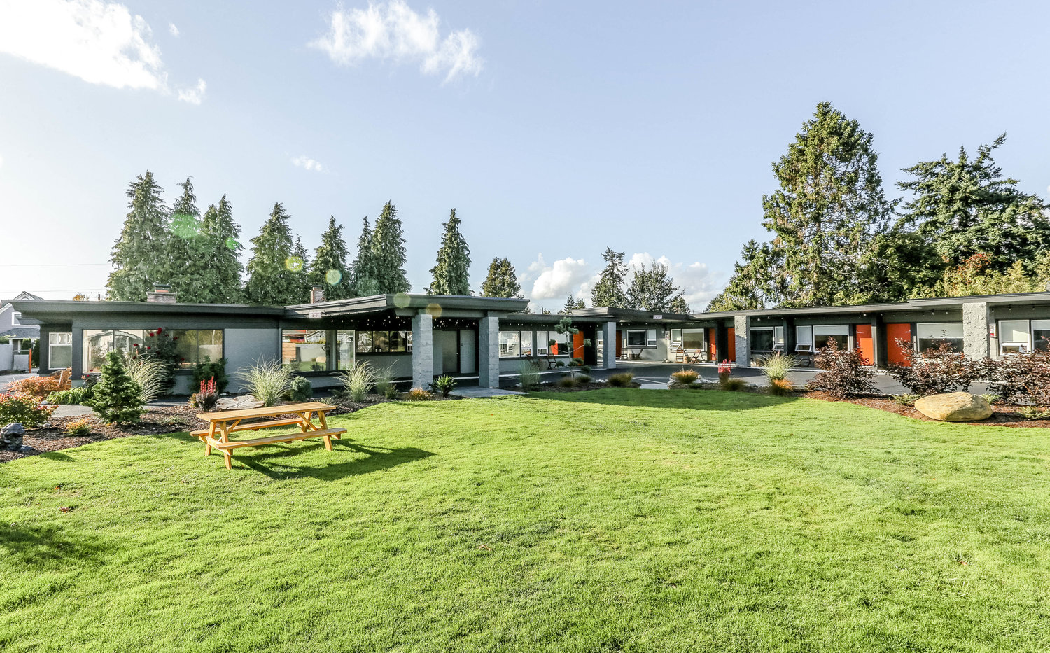
 Bellingham Hotels | Hotels in Bellingham | Airbnb Bellingham

Day 2 - Bellingham, WA to Boulder Creek Campground near Mt Baker, WA

The next day I hugged the coastline south along Hwy 11 (Chuckanut Drive) through Samish. It's kind of like Hwy 1 around Big Sur or Bodega Bay. I followed this road until it opened up into farmland after Blanchard.


Out of curiosity and the need to get some ice and a few other last minute supplies, I headed out on Hwy 20 to Anacortes for a quick look around at the coastal community before heading in the mountains. I took my time to pack all my food in the cooler and stow the other non-refrigerated stuff.

Vowing to return to Anacortes, I started on my journey to the mountains via Hwy 20. It's exhilarating to head into the wilderness; the freeway in the rear-view mirror and trees and rugged peaks ahead.

The turnoff for the campground and Baker Lake is Concrete, WA. From there it's another 15 miles up a paved road to the campground.


Day 3 - Boulder Creek Campground (Hike day)

Hike from end of the lake on Bake Lake Trail

Campfire started forest ablaze at Panorama Point Campground

Ventured all the way back to Concrete for beers and ice and other stuff (1+ hr round trip)

Day 4 - Boulder Creek Campground to Vancouver, BC Canada

I think I had one more night at the campground but the fires kind of messed things up a bit. I wanted to leave but didn't want to drive back to Portland. I figured I was so close to Vancouver, BC, why not head up there for a couple of days.

I tried to be as convincing as possible when telling the border official what my plans were. I made up my itinerary on the spot with some vague reservations at a hotel and camp spot.

Wandering around waterfront: Tap & Barrel, Digital Orca, The Drop, Ferry Terminal

Deluxe suite at the Delta Hotels by Marriott, 2 rooms plus bath 

Drinks at Pourhouse, and a killer dinner on Water St (Momo Sushi)

Day 5 - Vancouver, BC Canada to Rathtrevor Beach

Walk to Dr. Sun Yat-Sen Classical Chinese Garden

Trip up to the Vancouver Lookout

Trip up the lift at Grouse Mountain; saw the two orphaned Grizzly Bears - Grinder and Coola

Impromptu (and lucky) ferry boat ride from Horseshoe Bay to Nanaimo, then up Hwy 19/19A to Parksville and Rathtrevor Beach Provincial Park.

Day 6 - Rathtrevor Beach to Port Angeles, WA

Long side trip to Ucluelet and the Amphitrite Point Lighthouse

Impromptu (and lucky) ferry boat ride from Victoria, BC to Port Angeles, WA

Day 7 - Port Angeles, WA back home to Portland, OR

I left the mediocre motel early in the morning and saw tons of dense fog on Hwy 101. I imagined being chilly in a tent somewhere nearby, maybe having to urinate but not wanting to get out of the warm sleeping bag and putting on pants and shoes. Yet, I was speeding by in the Jeep with my heater and tunes, both blasting in my face.

I remember stopping at restaurant in Hoodsport. I glanced at it when I drove by. It was in 2006 after I'd graduated from PSU and was returning after a few days on the Olympic Peninsula.

It always makes me a bit melancholic at the end of a road trip, that last day. You realize it'll be over soon. You're heading from camping locales and nature to freeways and lots of people and cars, all going which way.

The routes up to now have be new and exciting but now I'm on a familiar road, and a big one, I-5. I've driven it at least a few dozen times on my way to Seattle and such over the years in the PNW.

I sort of get excited when I start to get close to home. I see signs from the Interstate Bridge. I cross the bridge into Oregon and pass Jantzen Beach and the Expo Center. Soon I'm in my driveway, engine off and  it's crackling. Home.


Trip Map


Wednesday, August 3, 1988

Hike: North Boundary Trail, Alberta-British Columbia, Canada


Length: 86.6 miles
Type: Point to Point
Highest Elevation: 7,150 feet
Elevation Gain: 3,440 feet
Duration: 10 days


Getting There

I flew up from San Diego, California to Vancouver, BC and met my fellow hikers & our two guides. We stayed at a hostel somewhere and left the next morning for Jasper, Alberta on the Trans-Canadian Railway. 

https://commons.wikimedia.org/wiki/File:Pacific_Central_Station_Vancouver.jpg
Train Station in Vancouver, BC
 

Observation car

 "The stretch from Vancouver to Jasper is around 19 hours, and you gain an hour along the way as the clocks go forward when you cross into Alberta. The train normally leaves Vancouver's Pacific Central Station at 3pm and arrives into Jasper at 11am the next day, though the timetable can change depending on the season." 1

Train Station in Jasper, Alberta
 

Train route from Vancouver, BC to Jasper, AB via Banff


Trans-Canadian Railway

From the itinerary:

"August 1: Fly to Vancouver, arrive at 3:30 in the afternoon. Travel by taxi to the Jericho Park Youth Hostel where we'll spend the fist night eating burgers, getting acquainted, and sorting through piles of expeditionary equipment. Extra gear and clean clothes for the trip home can be left at the hostel.

August 2: Morning free in Vancouver. We might swim or head out to Granville Island for lunch. In the afternoon, we collect our packs and head over to the train station to catch the 4:30 train to Jasper. We'll spend that night on the train, in seats that lean way back for sleeping.

August 3: We awaken to great views of the Canadian Rockies outside the train window. After the train arrives, well head into Jasper for lunch, fuel, fishing licenses, and last minute supplies for the trip. In the late afternoon we'll catch a van-taxi to our trailhead near Rock Lake. The trip out to Rock Lake takes a couple of hours, so we'll camp at the trailhead that night."

Screenshot of map from @myownfrontier video

The Hike

"August 4: Hike through forest and open meadow to Willow Creek on the Snake Indian River. Camp near Willow Creek.

August 5: Follow the Middle Snake Indian westward to Blue Creek. This is pleasant open country with good views of the peaks, and forests of aspen and lodgepole pine. The valley narrows as we approach Blue Creek, and we'll pass some small mountain lakes.

August 6: Layover day to swim, fish, and explore the country around Blue Creek Valley.

August 7: Hiking up into the high country, we catch great views of the big glaciers on the north face of Upright Mountain.

August 8: Cross Snake Indian Pass (6700') after a long gentle uphill over alpine tundra. Descend to a campsite along upper Twintree Creek.

August 9: Descent past Twintree Lake and then drop steeply into the valley of the Smokey River. Continue on to a campsite at the mouth of Chown Creek at the edge of a broad valley near some glaciers and high peaks.

August 10: Layover at Chown Creek. Great place for a day hike up to the surrounding glaciers.

August 11: Hike up the Smokey River to campsite just below Robson Pass. Adolphus Lake is nearby, and if the weather is clear, we'll have good views of Mt. Robson.

August 12: Cross Robson Pass (5550') and descend past Berg Lake -- full of icebergs -- and pass through the "Valley of a Thousand Falls" to Kinny Lake where we'll make our last camp just a couple of miles from the trailhead. Here the forest is especially lush, because of the surplus rain that condenses around Robson's icy bulk."


Last Night

Our last night on the trail was at Kinney Lake in a cabin. It felt weird to be back to civilization and some modern conveniences. It seems that this area is often used as base camp for climbers.

Last Day

Kinney Lake: On our exit day, we made record time. It was a wide, well-maintained trail to the trailhead on Hwy 16. Someone said there was a walk-up cart in the in the parking lot (a food truck) that had burgers and fries, a welcome change to freeze-dried camp food we'd been eating all week.

From the itinerary:

"August 13: Descend to the Robson River Trailhead, and catch a bus or van-taxi back to Jasper. In Jasper we'll have time for lunch, showers, and a brief re-adjustment to the "civilized" world before catching the evening train back to Vancouver.

August 14: Arrive in Vancouver in the early afternoon. Spend the night at the Jericho Beach Youth Hostel.

August 15: Morning free in Vancouver. After a farewell lunch we'll head over to the airport for afternoon flight home, via San Jose."

--

I have a memory of having to hang our food from a tree at least 200 feet away downwind from our tents. I hadn't really thought of wildlife until then.

Illustration from momsgocamping.com
 

The food and cooking gear was distributed among the hikers but the guides did all the cooking. 

I do recall having a Eureka! moment with my backpack. It was an external frame backpack I borrowed from a neighbor back home. For at least the first day, my shoulders were bearing the full weight of the pack and I was only using the waist belt to keep it from moving around. 

By accident while sitting down on a log, I over-tightened the belt then stood up. Now the weight of the pack was carried on my hips and the shoulder straps were now just for stability.

"A properly fitting backpack should comfortably transfer approximately 80 percent of its weight to your hips and lower body, 20 percent to the front of your shoulders, and exactly zero to the top of your shoulders."

 
Start: Rock Lake (upper right); End: Kinney Lake (lower left)


...