Showing posts with label Washougal. Show all posts

Thursday, July 27, 2023

Hike: Cape Horn Loop Trail, Washougal, WA


Getting There

The Trailhead parking lot is 18min (14.1mi) from the Camas Chevron off Hwy 14. It's about 1.5mi to the Salmon Falls Park & Ride from the Cape Horn Lookout.

I noticed a woman and her two young kids and a small dog were excited to head out on the trail.

The Hike

Length
: 7.31 mi
Elev. gain: 1,463 ft
Moving time: 2:48:26
Avg pace: 23:03
Calories: 1,697
Total time: 3:17:27


When I left the parking lot, I hadn't thought if I could the full loop. Part of the trail is closed for peregrine nesting but I couldn't remember the exact dates. I thought about doing the clockwise loop and get the road walk out of the way at the beginning but decided it was a good workout at the end of the hike, a steady incline but easy walking surface.

I took the counterclockwise direction. The trail was pretty well manicured but there were a few spots where the bushes were encroaching a bit. No worries, I pushed them out of the way. I really need to learn to identify the poison oak and ivy. 

I passed a trio, parents and teenage kid. Not long after met another older couple and we chatted briefly about the dry weather and shade.

From Pioneer Point looking south

Near the top of the first ascent, I stopped to take a requisite look at the view from Pioneer Point. Just as I was leaving a pair of hikers and a dog showed up. They asked me to take a couple photos for them which I happily obliged. It took a little bit to get the dog to comply as it was busy sniffing around and staying in the shade. It was black German Shepherd so with the contrast it was hard to see in the shade but I could see its smiling face. I took a few shots and showed them the results. Then, they requested a shot or two of them on the gnarled tree root. I got on my knees so I wouldn't back off the ledge and took a few more pictures. I was using one of the hikers iPhone 14. Man, that takes some nice photos! As I was leaving, I asked if they knew when the nesting period was. The one hiker wasn't sure but guessed it was until the end of July. Oh well, I thought. I would go as far as I could, then double back.

From Pioneer Point looking east

I continued on my way. Another couple were ahead of me on the trail. I slowed my pace so they could get way ahead. It was nice to meander and enjoy the sights and smells. By the time I reached Strunk Road, they were way ahead of me.

Good news. I saw a sign that said the nesting period is Feb 15 to July 15! I could do the loop!

Meadows near Strunk Road

Meadows near Strunk Road

Gravel road just before rejoining the trail

At the first lookout, I discovered that couple were sitting on the wall, facing out towards the river. I only stopped for a few seconds and quietly retreated back to the trail to continue down.

It was a nice hike down the tunnel under Hwy 14. I remember being here in Dec 2022, it was really muddy and slippery. Today, it was dry and a tad dusty. Somewhere before the tunnel I ran across a guy that was pruning the bushes. It was pretty overgrown in the part of the route. After I was well past, I thought I should have asked what species he was targeting, if any, and maybe get some education on spotting the poisonous plants.

The lower section of the trail gets steeper as you descend closer to the water, sort of. There's a long section that heads west. I know there are road pullouts and access trails to this part of the loop.

Looking east from Windblown Fir Viewpoint

I stopped at the Windblown Fir Viewpoint for a min. When I rejoined the trail, I noticed that couple again. I decided to stay ahead of them and adopted a brisk pace. Along the way, I passed the woman and her two young kids. They'd taken the clockwise loop. I was quietly impressed by the young ones. I thought about the experiences and memories they were forming from outings like this. For a second, I wished I'd started hiking much sooner in life.

Cigar Rock Viewpoint

At the Cigar Rock Viewpoint, I stopped, took off my pack and ate some apple slices. It was good take break and really see where I was. That couple passed me, I waved and we exchanged hellos.

This was the lowest elevation on the loop. From here the trail zigzags through a talus field. It was a little rougher than I remember and took my time. It's times like this I wished I had the rubber feet for my hiking poles. 


At the top of this section is the Cape Horn Falls. Last time I poked around up there, I nearly slipped on some wet rocks. I did not want that to happen so I was very slow and cautious. It paid off, every step was deliberate and stable. I went behind the waterfall and snapped some photos and took a couple videos.


I was nearly at the end of the trail. I passed a guy and his tired look dog on my final descent through the trees.

End of the trail on Cape Horn Road


Back on Cape Horn Road, I adopted a slow steady pace. My feet and legs felt good and I enjoyed the farmland views on either side of the road. A couple residents passed in their cars. I noticed the asphalt was bubbled quite a bit. I mistook the shiny blobs for glass or rocks but when I poked one, it popped. In fact, I could hear a few pop under my feet.

I finally reached the trail again just below the Hwy 14 tunnel back to the parking lot.

The truck that I'd seen the woman and her kids was still there. I was casually hoping to see them again just to comment on our opposing loop directions and pace. 

---

To get home, I decided to take the back route via Canyon Creek Road. I deliberately passed the turn to get to Belle Center Road and continued all the way to Washougal River Road. As I passed it, I noted where I'd met the tow truck to put on my spare that day I got a flat.

Saturday, April 8, 2023

Hike: Archer Mountain, Washougal, WA


Getting There

Take WA Hwy 14 out from Washougal. Take a left (north) at Smith-Cripe Road, about half way between Prindle and Franz Lake. The High Valley trailhead parking lot is about 0.5mi up the road. There's room for 10-15 cars if everyone parks responsibly (i.e. perpendicular or angled).

This time there were 6 cars when I got there so I parked parallel. I geared up and set out.

Note: I thought the day was going to be a bust. My original plan was to hike Eagle Creek or Nesmith Point but I knew it was going to be bad when I saw 1/4 mile traffic jam at Multnomah Falls. I changed plans then to hike on the other side of the river. Indeed, cars lined every nook and cranny at Eagle Creek. Table Mountain Trailhead looked okay but Hamilton Mountain was packed. Archer was the clear choice. I hardly saw anyone on the trail. Peaceful. 


The Hike

Length: 5.83 mi
Elev. gain: 2,274 ft
Moving time: 3:27:57
Total time: 4:05:00
Avg pace: 35:39
Calories: 2,093


Cool hike around Archer Mountain. After quite a climb (1000':1 mi) to Scott Point, my first stop was Quiver Point. I didn't quite go to the end but close enough. The next stop was gonna be Arrow Point but when I got to the cutoff, the route looked muddy, steep, and sketchy. Oh well, I'll try again when it's dry. I continued up to the top of Archer Mountain. The foliage was flattened from the winter snow so you could see through the trees to BRSP.

When I got back to the meadow near the trailhead, I still had some energy and it was only ~3:30p. I headed up the other side of the canyon towards the basalt ridge. It was grueling but I made it past the scramble section. I felt a twinge in my L ankle and R knee. I knew the descent was going to be tough so I turned around.

Half way up the trail

View from Quiver Point

View of ridge from Scott Point

More from Scott Point

More from Scott Point

Archer Falls

Trillium

View from ridge

View from Scott Point


Saturday, December 17, 2022

Hike: Cape Horn Loop Trail, Washougal, WA


Getting There

The Trailhead parking lot is 18min (14.1mi) from the Camas Chevron off Hwy 14. It's about 1.5mi to the Salmon Falls Park & Ride from the Cape Horn Lookout.

My original plan was to hike in Oregon in the Gorge somewhere. I considered Angel's Rest and Multnomah Falls but when I got in the area it was all in the winter shade even though the sky was clear.

It just didn't seem that appealing, so I kept heading east. I considered Eagle Creek but the same issue applied. I looked across the river at a sunny Archer and Hamilton Mountains.

My next plan was to at least scout the Whistle Punk and Bunker Hill Trails north of Carson.

I stopped in Stevenson to get coffee and take a look at the riverfront park.

Stevenson, WA

I bailed on going further east and settled on Cape Horn.

The Hike

Length: 6.97 mi
Elev. gain: 1,398 ft
Moving time: 2:28:51
Total time: 2:42:49
Avg pace: 21:22
Calories: 1,496

I took the counterclockwise route. There was snow in the bush everywhere but the trail was clear albeit muddy, a foreshadowing of the conditions.

As I made my way up the switchbacks, I hiked through good patches and sticky mud patches.

By the top of the first hill, thick mud was unavoidable.

I kept an eye out for strange hair ice where I'd seen it before but I didn't find any. There was a lot of nccdle ice though.

Both lookouts were occupied so I kept moving, plenty of views ahead. At this point, my plan was to go to the first lookout past Strunk Road. 

There were people at that lookout too so I kept going. I made the call there to go for the full loop. I was making good progress and still had plenty of daylight. I only needed to make it to Cape Horn Road; I didn't mind it being darker on that part.

I saw a guy with an overweight & friendly black lab. I met another hiker that was leaving a viewpoint and was going the counterclockwise loop as well. I stopped for a bit to enjoy the views and sit for a minute.

My last time here was Oct 21, 2021. My memory was hazy on the route but it seemed familiar.

When I reached Cape Horn Falls, I noticed a pair of hikers. I kept going and figured I'd pass them eventually but the trail reached the road before I could.

There were a couple more hikers finishing the hike and starting the road part. I zoomed between them on the road and pulled far ahead.

I felt strong the entire hike, making sure to eat part of the Clif bar and drinking Gatorade.

Columbia River Gorge

Cigar Rock viewpoint

Cape Horn Falls bridge

Sunday, May 1, 2022

Hike: Lewis & Clark Discovery Greenway Trail, Steigerwald Lake National Wildlife Refuge, Washougal, WA


AllTrails map
 

Getting There

Take Hwy 14 E from Vancouver, WA (Downtown) for about 20 miles. The newly opened parking lot is located 1.5mi from the 32nd St roundabout, on the right (south). There's room about 15 cars and one bus. (There's a pit toilet as well.)

The Hike

Length: 6.60 mi
Elevation gain: 118 ft
Moving time: 1:59:13
Avg. pace: 18:04
Calories: 1,050
Total time: 2:08:46 

The area is called Steigerwald Lake National Wildlife Refuge and has two main trails. The newest section is titled Gibbons Creek Wildlife Art Trail which takes you from the trailhead & parking lot to the Columbia River. On Google Maps, the trail, which originates at Steamboat Landing Park, is titled Captain William Clark Park Trail. However, on AllTrails, it's called the Lewis & Clark Discovery Greenway Trail.

The place opened today, May 1st. There are fresh tractor markings everywhere, freshly planted trees, and newly sawn trees carefully placed in the creek bed. It's going to take some time for nature to thrive.

I remember how barren the Sandy River Delta looked back in the early 2000s after a lot of work had been done to reclaim the area for the public. The bird blind could be seen several hundred feet away. Now, the place is lush with life and you don't see the bird blind until you're almost on the ramp.

The Trailhead
 

Some of my favorite shots

Mt Hood and Crown Point, OR
Late afternoon clouds over the Columbia River
Late afternoon clouds over the Wildlife Refuge
Redtail Lake, Steigerwald Lake National Wildlife Refuge


The Lewis & Clark Discovery Greenway Trail dead-ends at the property line of M bar J Ranch.


On the way back I took a different route through a section of Gibbons Creek Wildlife Art Trail that will be closed seasonally from Oct 1 - April 30 for Wintering Waterfowl. 


There are several art pieces along the way.

 
I even saw a group (family) of 4 deer.


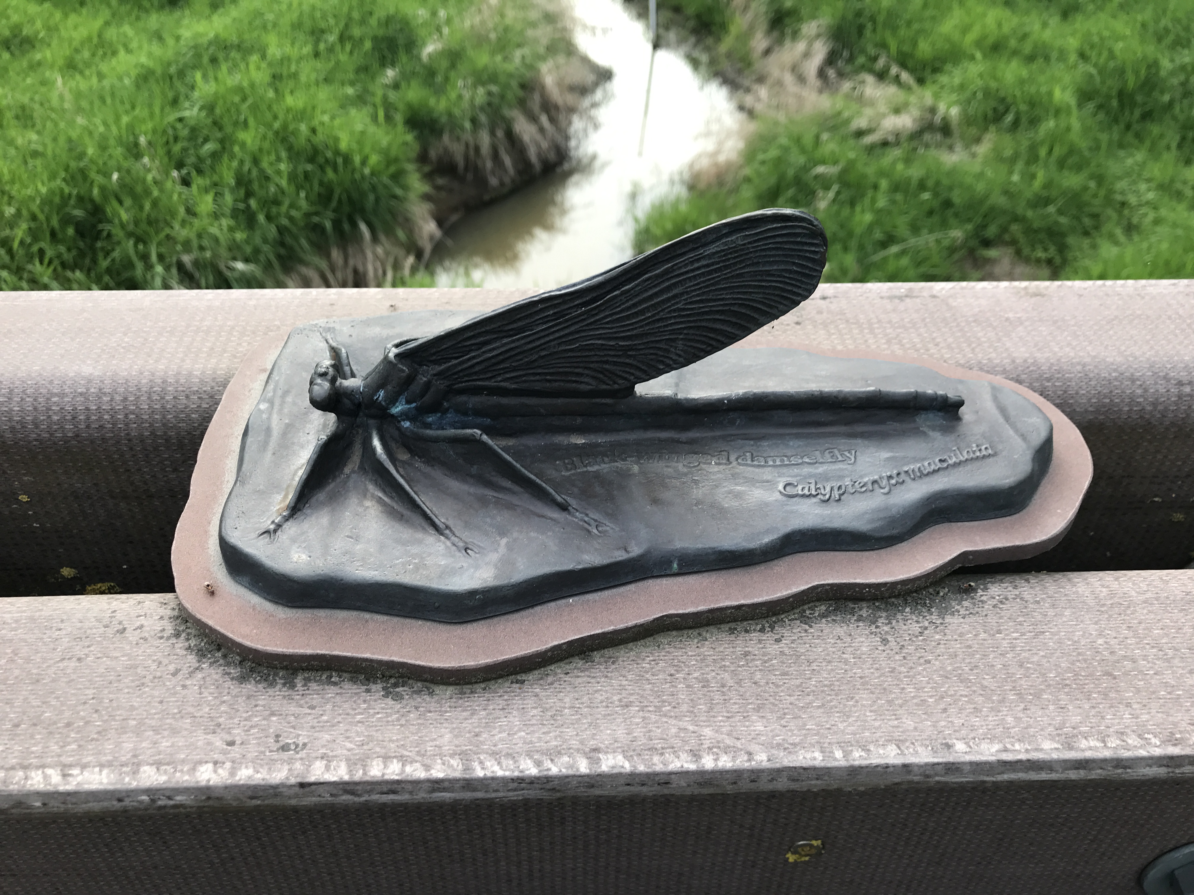
There's a bridge of the western tip of Redtail Lake. The railing has several oversized bug in bronze.


Redtail Lake, Steigerwald Lake National Wildlife Refuge

Redtail Lake