Showing posts with label Newberry National Volcanic Monument. Show all posts

Tuesday, October 1, 2024

Hike: Trail of the Molten Land, Sunriver, OR


Getting There

From Bend, OR, take Hwy US-97 south for about 10.9 miles to the Newberry Nat'l Volcanic Monument. Take the exit for the Lava Lands Visitor Center (NF-9702). 

On this occasion, I was coming from a very smoky Newberry Caldera/Paulina Peak. I actually drove past but had no where to turn around until South Bend. I pulled over to check the drive time and estimate how much daylight I had left. It was still early enough in the afternoon.

I made good time back to the visitor center. Since it was a Tuesday I knew there was a slim chance that the cinder cone road was open but I checked anyway. It was closed. Since the visitor center was closed, I took a chance parking in a employee/staff parking spot, closest to the trailhead.

Just as I was walking away, I saw a pickup drive through the lot toward the gate. I thought I was busted but they took off. Just a tourist. I took off before a ranger showed up. Forgiveness vs permission.

The Hike

Distance: 1.12 miles
Elevation Gain: 132 feet
Highest Elevation: 4,620 feet


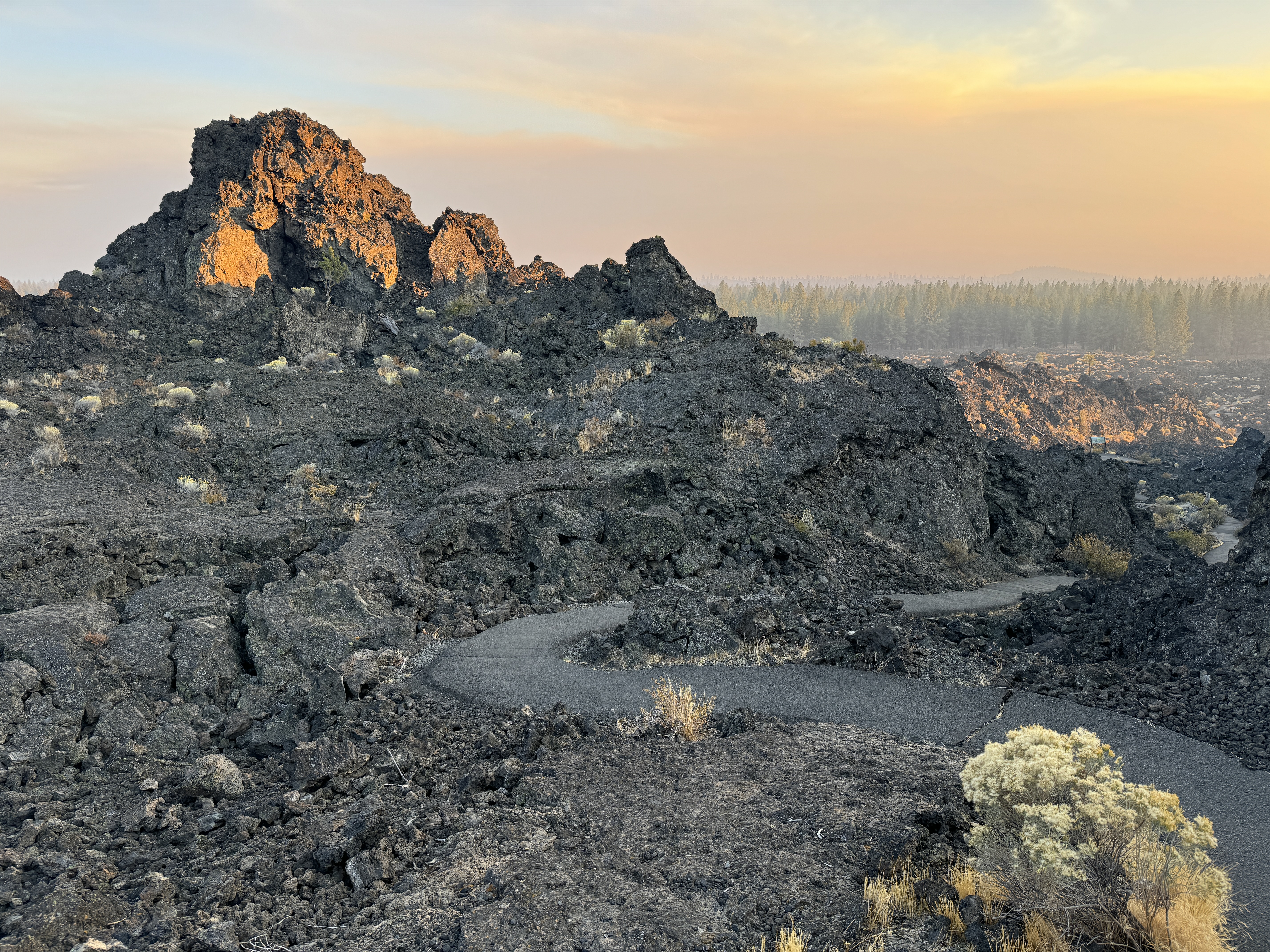
The smoke from La Pine (south) had not quite reached this area but it was very close. Consequently, it made for an incredible sunset. I could smell smoke in the air but I knew it was short loop, 20-30 mins. I did the counterclockwise loop up to the Phil Brogen Viewpoint. I had the place to myself.  

What a landscape! I knew I'd be taking photos similar to what I had from last year but the smoke added a new element. Terrible for the environment but adds some drama to the photos. Sigh.

As I walking back to the car, I saw a guy with a decent looking DSLR. I waved and tried to sound hopeful: "Still a bit of light left!". I knew he wasn't making to the viewpoint before the sun dropped below the horizon.


Exercising some creative license


Field Trip: Paulina Peak, Newberry National Volcanic Monument, Oregon


Getting There

Earlier in the day, I was at the Lava Cast Forest, so I was already part of the way to the caldera from my base camp in Bend.

I drove south on Hwy 97 from Lava Cast Forest Road (NF-9720) for about 16.7 miles to Paulina Lake Road. Continued on NF-2120 for 12.5 miles. Just past the Paulina Lake Campground, I took NF-500. It's just shy of 4 miles to the top, mostly washboard dirt road. 

On the Lava Cast Forest Road, I'd tried going about 25 miles per hour on the washboard which seemed to work. Better than going 5-10 mph and feeling every bump, you seem to skim on the top of the perpendicular crest/troughs. I feel comfortable doing that down there because if I got a little sideways, shoulder of the road was mostly flat. Here on the Paulina Peak Road, there are drop-offs that would not be good. I had to slog up (and down) at 5-10 mph.

When I reached the parking lot, there was a guy with a big tanker truck that was servicing the bathroom but no other visitors, a contrast to the last time I was up there. Guess folks had a better sense to stay away from the smoke.

The Hike

There is a interpretive trail that part of the Crater Rim trail. I didn't count this as I "hike" as it was more of a viewpoint. I did the same jaunt last year as well. I could smell the wildfire smoke and see it creeping north across the landscape. I took advantage of the short respite from the dirty air to hike down to the viewpoint looking back at Paulina Peak, a little bit of it off-trail though well traveled.

I did less exploring this time since the air quality was declining rapidly. I was still glad to have made it out here to the caldera. I remember seeing pictures of the lakes and cinder cone in the middle and making my mind up to visit. All of my pictures are basically the same as last year.


After descending down the road (NF-500), the air quality had gotten a lot worse. I continued north on Forest Service Road 21 to the Hot Springs Boat Launch. (The previous year, I'd gone all the way to the end of the road and toured the Cinder Hill Campground.) 

I only stopped briefly as the sun was setting and smoke in the caldera was getting unbreathable. (I would later find out that the AQI was nearly off the chart in La Pine, OR, dangerous/unhealthy.)

I was a little bummed I didn't have time to explore more of the lakes, Big Obsidian Flow, other stuff I wasn't aware of. I remember driving by Paulina Falls and had hoped to stop on my way out but by the time I was leaving, the air was awful.


I left the caldera around 5pm but I still had an hour or so of daylight. Although I passed the Lava Butte cinder cone & visitor center (closed during the week), I did a u-turn in south Bend and made a last stop at Trail of the Molten Land.

Hike: Lava Cast Forest, Sunriver, OR


Getting There

Google Maps shows several ways to get to the Lava Cast Forest but you want to get directions for Lava Cast Forest Day Use Interpretive Site, Lava Cast Forest Rd, La Pine, OR 97739.

From Bend head south on Hwy 97 to Sunriver. Take Exit 153 and head east on Lava Cast Forest Road. It's a grinding 8-9 mile washboard dirt road. There really is an art form to driving on this kind of surface. (Last time I was here I bailed after Google routed me onto NF-440 which is a narrow, rutted rural road.) Stay on NF-9723 to NF-9720. Look for a right turn near the Day Use site (NF-950). I was surprised to find bus parking here after the rough ride.

I did the paved loop and on my way out, saw a USFS truck going in the other direction going pretty fast. I'd been creeping over the washboard, maximizing the bumps. It didn't make sense but maybe going faster would smooth out the ride. I accelerated to about 30-35 mph and it worked! I was still really worried about drifting or fishtailing but as long as I kept it straight, it was riding on top of the washboard ruts. Hmm.

The Hike

Length: 1.09 mi
Elev. gain: 69 ft
Moving time: 36:34
Avg pace: 33:40
Calories: 322
Total time: 41:34


I was so impressed with this place, considering how off the beaten path it is. (There is signage on the Hwy so maybe my washboard hesitation was an overreaction.) I had expectations from my knowledge and visits to the Trail of Two Forests near Ape Cave (GPNF), another lava cast forest interpretive site.

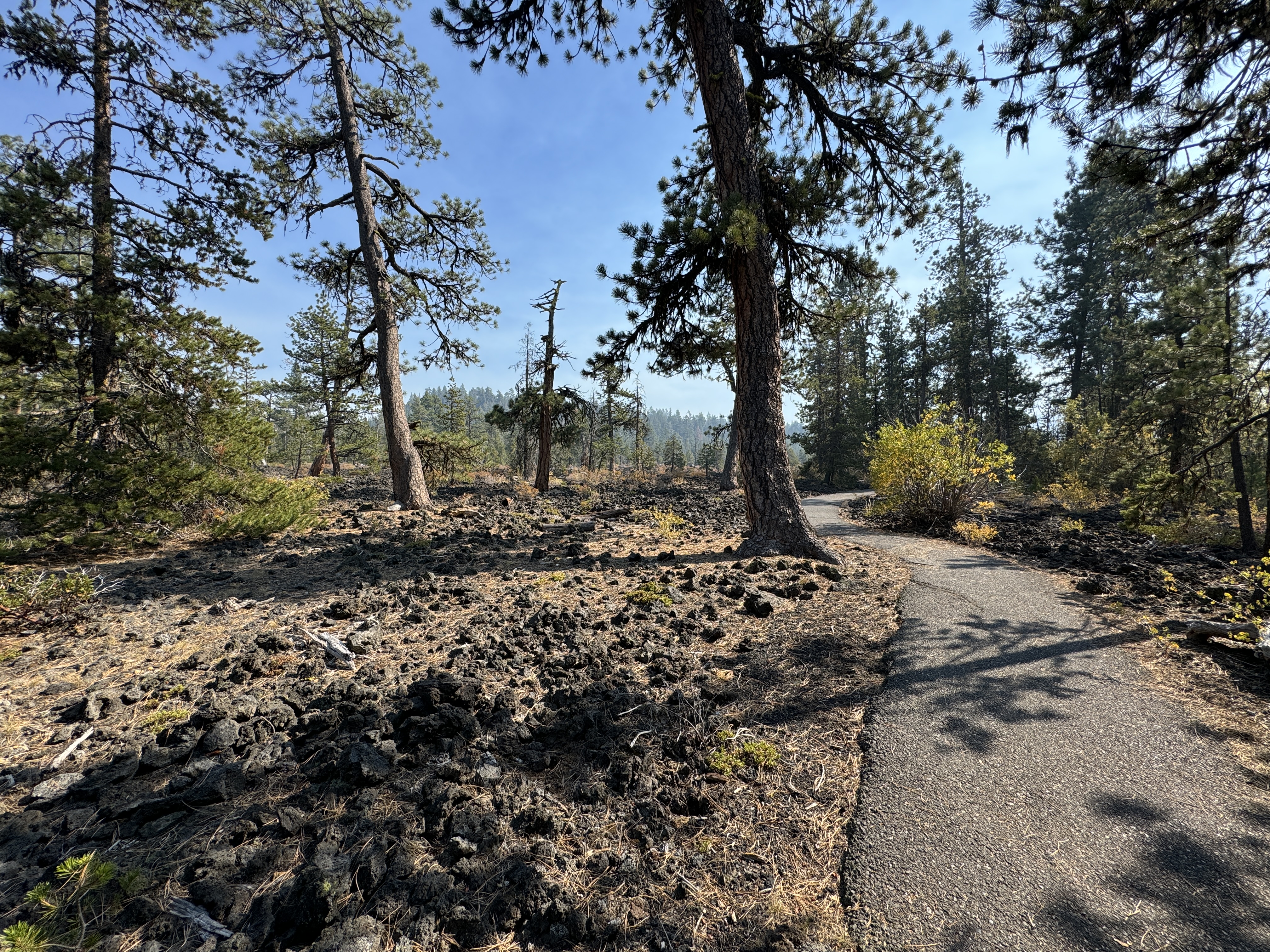
However, I did not expect to find such an expansive site with a meandering, paved trail. There seemed to be a lot of standing (living?) trees that were enclosed by lava in addition to the holes like we have at ToTF.

From the furthest southern point of the loop trail, you can see the northern rim of the Newberry Crater. 

"The former Lava Cast Forest Geological Area (now part of the Newberry National Volcanic Monument) was established by the Forest Service in 1942. The geological area was established to protect the many lava trees and tree molds which occur in this area. The various flows of the Lava Cast Forest were all erupted from the Northwest Rift Zone of Newberry Volcano. This site offers a one mile paved self guided interpretive trail with barrier free access. The trail loops through an area where hot molten lava erupted from the northwest flank of Newberry Volcano and engulfed the forest 7,000 years ago. The landscape now includes the "casts" or molds of these ancient trees. Colonizing plants such as delicate penstemon flowers and Indian paintbrush, have now taken root in the rocky soil. Ponderosa pine trees have re-established themselves and flourished as well.  The landscape now includes a blend of the past and the present. "

https://www.fs.usda.gov/recarea/deschutes/recarea/?recid=38388


Tuesday, October 3, 2023

Hike: Benham Falls & Lower Deschutes River Trail, Bend, OR

Getting There

I was already at the Lava Lands Visitor Center off US-97. Take NF-9702 northwest for 4.0 miles to the Benham Falls East Trailhead. There are enough parking spaces for about 10 cars. Pay $5 for a day pass or use your America The Beautiful or Northwest Forest Pass or other qualifying pass.

The Hike

Distance: 4.73 miles
Elevation Gain: 280 feet
Highest Elevation: 4,188 feet


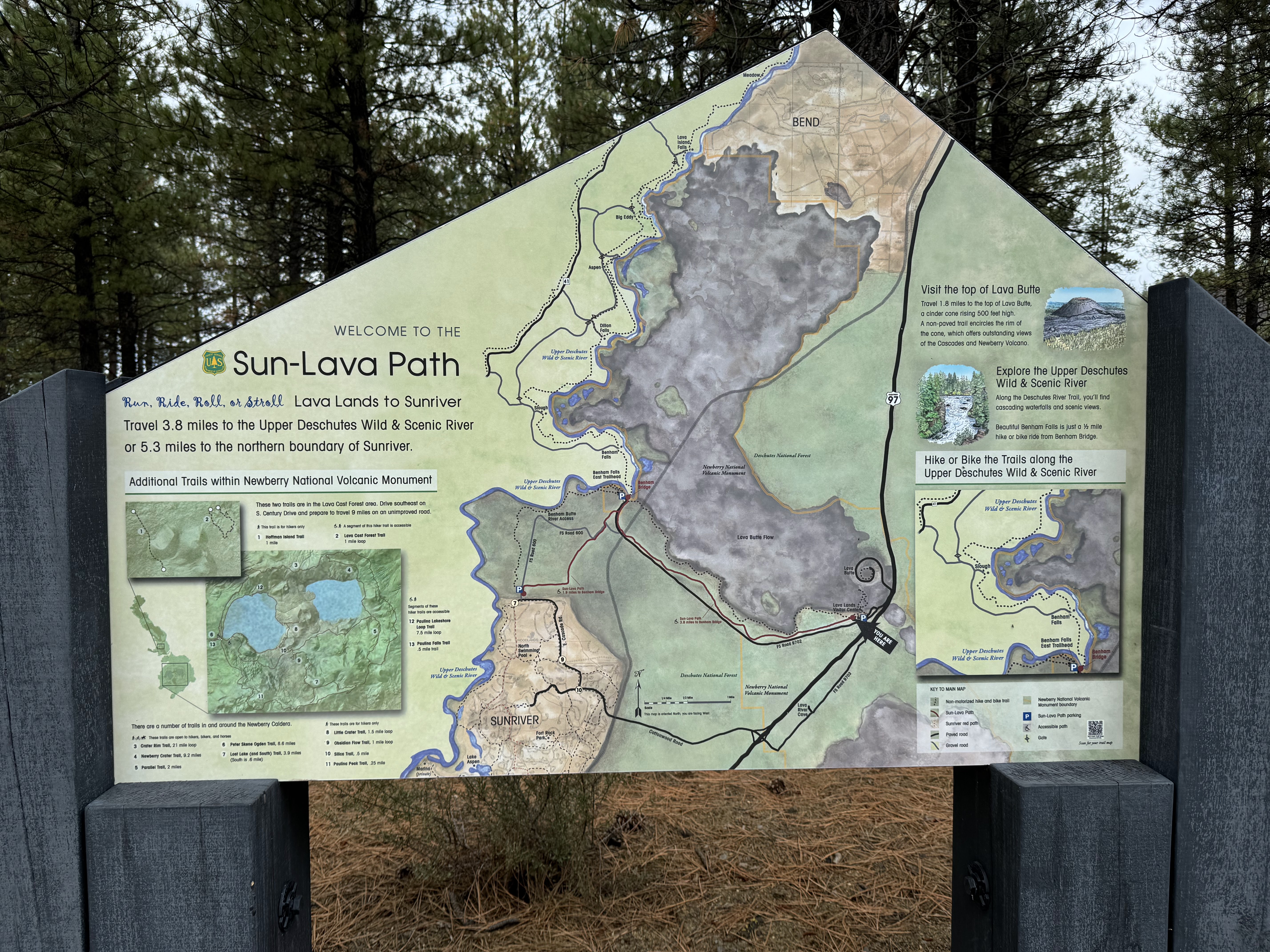
I had no idea what I was in for. I just enjoyed the beautiful landscape along the Deschutes River: trees on one side and rugged lava on the other. I studied the large area map-sign for a bit and looked at possible destinations. 

Across from the trailhead parking lot

From Benham Bridge, near the parking lot

Beyond Benham Falls, there were several spots along the route. I was prepared for a longer hike but also wasn't sure about elevation and time. It looked like I could reach Dillon Falls.

The trail between where I was parked and Benham Falls was pretty flat and straight but you could see through the trees at the rugged lava field across a slow-moving river. As I got closer the the falls, the noise of the rushing water got louder and louder.


As I got closer the the falls, the noise of the rushing water got louder and louder.

I found a side trail that lead down closer the water and suddenly the river took a turn and was rushing downhill through a narrow gully. The falls weren't so much a long drop as a series of cascading drops. To my surprise I came to the West Trailhead and a small parking lot accessed by a dirt road. I wondered where this road started from.

I found the lookout and snapped a few more pictures, then continue on the trail.

After a short distance and a few more turns, the water was much more calm and there wasn't any whitewater. It was still pine trees on one side and lava rock on the other.


I reached a section of deciduous trees and other foliage. I was a blast of fall colors: oranges, yellows, reds, browns and quite a contrast to the coniferous trees I'd been walking through.


I reached another parking lot with a pit toilet and picnic tables. The water was glassy. I thought it made a good spot to eat lunch.

Slough Day Use Area

From Slough Day Use Area

I met a couple that were also checking out the view and we chatted for a bit about Newberry and I shared comparisons to MSH. When they continued their hike, I picked a table and took off my pack.

It was peaceful besides a few people nearby yelling at their dog that it was time to go. LOL. The pupper didn't want to get out of the water.

As it turns out, I was at the Slough Day Use Area. I still didn't know where this dirt road originated but it didn't matter. I decided this was my turnaround spot. I wasn't planning to do a long hike. I still had time to visit the High Desert Museum before it closed at 5pm.


I put 1/2 my sandwich away and started back to the trailhead. If I understood the signage, the side of the monument was on closed at 5pm. I didn't want to get stuck behind the gate. I guessed the dirt road gave 24/7 access to the area.

Back at the car, I finished my sandwich and drove back to US-97.

Hike: Trail of the Molten Land, Bend, OR


Getting There

From Bend, OR, take Hwy US-97 south for about 10.9 miles to the Newberry Nat'l Volcanic Monument. Take the exit for the Lava Lands Visitor Center (NF-9702).

The Hike

Distance: 1.12 miles
Elevation Gain: 132 feet
Highest Elevation: 4,620 feet


This was my first stop at Newberry Nat'l Volcanic Monument. It didn't occur to me until later in the week that this wasn't the place that I'd seen from the pictures when I was researching my trip.

Nevertheless, the lava field was an incredible sight to see. The lava field and Lava Butte (cinder cone) are visible from the road. I quickly found that the visitor center was closed until Friday. I was looking forward to introducing myself and an unofficial ambassador from the Mt St Helens Institute.

I quickly found the Trail of the Molten Lands, a paved trail, partially wheelchair accessible. The signage was really helpful to get oriented and I marveled at the unique landscape.

The viewpoint was incredible and gave a bird's eye view of the lava field and the adjacent treeline.

It was a short trail so I was done in less than an hour.


The viewpoint was incredible and gave a bird's eye view of the lava field and the adjacent treeline.


It was a short trail so I was done in less than an hour.

---

In the 1960s, NASA sent astronauts to the area to test equipment for the upcoming moon landings. 

I was stoked to explore this part of the monument. On my way back to the car, I noticed an area map and bike trail: The Sun-Lava Path. I would have loved to bike this path but luckily Crawford Road (NF-9702) lead to a trailhead.

To be continued... (in the next post).