Saturday, September 30, 2023

Hike: Kings Mountain, Tillamook, OR


Getting There

Take Hwy 26 from Downtown Portland and drive about 20 miles west to Hwy 6 past Banks, OR. From there it's another 26.4 miles to the trailhead. It's about 3.2 miles east of the Tillamook Forest Center. There's room for about 8 cars to angle park and some room for another 3-4 cars to parallel park.

When I arrived, the lot was full but there were a few cars parked on the side of the road. Cars and trucks were whizzing by but at least there was room to pull off completely. I geared up and set out on the hike. Just as I reached the parking lot, a car was pulling out. I quickly ran back to my car and hoped that another hiker wouldn't arrive and snag it in the short time it took to U-turn and drive the 100 yds. I lucked out. In fact, the car next to me was also leaving as I got there so there was soon another empty spot. I was happy not to be on the side of the highway.

The Hike

Length: 5.67 mi
Elev. gain: 2,575 ft
Moving time: 2:55:03
Avg pace: 30:51
Calories: 1,765
Total time: 3:05:31


Today is the last day of the The Nature Conservancy September 2023 Fundraiser. The goal was to hike 40 miles. While I surpassed that in August during WTA's Hike-a-Thon, I came up short in September.

It's a tough hike at 2,575 ft of elevation gain in around 2.8 miles. The total mileage for the day was 5.67 miles. This brings me to 33.6 miles for September. Not a bad effort! Glad to support this organization.

This signage says this is a difficult hike and they aren't kidding. Fortunately, I'm in good shape for the elevation gain. My feet are still a bit sore from plantar fasciitis but it didn't stop me. Just before I'd started, I'd downed a 16 oz can of coconut water, a great source of electrolytes.

There were only a few people on their descent as I made my way up the trail, including a few dogs and their owners.

In a particularly steep section, I saw a couple with two dogs coming down so I stepped off the trail and behind two trees. My intention was to make room while still be visible. Unfortunately, it backfired a little because the woman saw me looking up the trail and was startled. Oops. I said hello and apologized for her causing her reaction. She laughed and her partner did also. He wished me a good hike.

As I was getting close to the top, a trail runner came up behind me quickly. Not his first "rodeo". He just had a small bottle of water and was shirtless. He quickly pulled away but said encouragingly, "almost to the top".

When I got to the clearing near the summit, I saw him again and wished him a good descent.

I had the top to myself. So peaceful and quiet. Just the right temperature.

I'd stopped at the viewpoint on the way up, so I decided to stop there again to eat half of my sandwich.

Some mushroom foragers arrived and we chatted for a bit before I left so they too could enjoy the viewpoint.

I made sure to be careful on my descent. It was a great hike. I'd love to go back and do the longer loop which includes Elk Mountain portion. It's a 10.6 miles loop with 3,697 ft of elevation gain: totally doable. The AllTrails route is counter-clockwise so you traverse to the Elk Mountain Trail and descend from Kings Mountain.


Saturday, September 23, 2023

Hike: Silver Falls Canyon Trail Loop, Sublimity, OR


Getting There

When travel south from Portland or anywhere north of Wilsonville, Google Maps recommends taking OR-551, just south of Charbonneau. I think it's a more enjoyable route that taking I-5 to Woodburn but I did take that route home. I preferred the freeway in the rain to a narrow two-lane highway.

I found gas (a 76 station) in Hubbard, OR. I think the per gallon cost was around $4.50.

Both routes go through Woodburn and you take a left on OR-214. This takes you through Mt Angel, where the big Oktoberfest is held. (Funny that the event is Sept 14-17, not even in October - WTF?) 

Point of Interest

There is a covered bridge called the Gallon House Bridge on the right (south) about 1/2 way between Mt Angel and Silverton. This one you drive over the Abiqua Creek and through the countryside. Take Downs Road NE, the left on Gallon House Road NE/Oak Lane. You can get back to OR-214 at Hobart Road NE.


 Continued

After about 13.5 miles from Silverton on OR-214, you'll come to the North Falls Trailhead parking lot and a hard right gooseneck turn. Continue another 2 miles to the South Falls Day Use Area. It's $5 a day for parking.

The Hike

Distance: 5.09 miles
Elevation Gain: 1,060 feet


I hadn't been out here in years. It's a bit touristy for my hiking tastes but I knew the waterfalls would make for some good pictures and I wanted to do something a little less strenuous. It was National Public Lands Day! The North Falls parking lot was nearly full and I knew the South Falls area had ample parking. It's where I'd started from on previous visits, including my last and that time I went with Brian and Andy and Jodie's dog, Miles, but had to leave him in the truck (sad face).

I found a trail ambassador with a big sign but while I was looking at where to go, a group came and rudely crowded me out. Dicks! I just started going on the first trail I saw, the Rim Trail which connects the South Falls Day area with Winter Falls and North Falls parking lots. I dropped into the canyon at Winter Falls and continued on the Canyon Trail.

The water levels were really low and two of the 10 falls were dry. No matter, most were flowing enough and were spectacular just the same. Silver Falls is known for it's trails that are carved into the rocks and go behind the waterfalls.

I kept going and although it seemed liked I was going away from my car at South Falls, the trail slowly curves around and back.

Somewhere I remembered hiking there and vaguely remember going in the opposite direction. I specifically remember going down the switchbacks at Lower South Falls and looping back in the Maple Ridge Trail, clockwise. This time I was going counterclockwise and enjoying the views just the same. 

Close the South Falls, I saw a man that was sitting on the ground oddly. When some people ahead of me stopped to help him get up, I realized he wasn't just resting. This partner looked a bit concerned. When I got closer, I heard him say that he was experiencing a bit of vertigo. My volunteer/trail steward/first aid instincts kicked in. To my disappointment, he pointed at two guys behind me and asked for the "big strong guy" to help him negotiate a bumpy section of trail. I guess I didn't look sturdy enough. I followed and chatted with the man's partner. 

When he told the other guys he was fine to carry on without them, they took off. I offered my hiking poles and said the 3-points-of-contact would add stability. He took them and started down the trail confidently. I continued to walk a bit behind him with his partner. When we got to another rock/bumpy section, she asked me to help by offering my hand and/or shoulder to lean on. I sped up and offered to take one of the poles in exchange for my hand. He put both poles in his right and I grabbed his hand. We introduced ourselves and I tried to lighten the mood by talking about the beautiful surroundings and being a volunteer at MSH.

We go to the bridge below South Falls. They said they were good to continue from there. I wasn't sure but a man's got his pride and there were lots of other people. Some other hikers had sent for some park rangers so they were going to wait for them. I wished them well and took the waterfall loop.

As I made my way to the other side, I saw the couple again. They had climbed a steeper incline and were making good progress. I offered my poles again but the partner said he was doing well with the railing for support. Shortly thereafter, two park rangers appeared. I knew they would take it from there. I wished the partner well again as the rangers were asking the man how he felt, etc. As I walked by I waved and he told them, I'd given my poles to use. I was glad to help someone out that was in-need on the trail and get (most of the way) back to the parking lot.

It was good 5 miles hike and I'd come back when the waterfalls were flowing again in the Fall after we get some rain!


South Falls


Friday, September 15, 2023

Hike: Hamilton Mountain + Hardy Creek Loop, N Bonneville, WA

Selfie from Little Hamilton Mtn

Getting There

Just after Doetsch Ranch you'll see the Ranger Station on the north side of the road just before the Beacon Rock parking lot, then another road across from the bathrooms. The road winds up the hill for a bit.

It must be past the summer tourist season because there were a bunch of open spots on the parking lot.

Apparently, I didn't clean my water bottles out well enough and my 32 oz green one had spots of mold inside. Fuck. I'd brought my Sea-to-Summit 6L pouch that was about 1/2 full and ended up strapping it to my pack. Good thing I had it because it was a hot one in the Gorge.

The Hike

Length: 7.69 mi
Elev. gain: 2,270 ft
Moving time: 3:10:06
Avg pace: 24:43
Calories: 1,916
Total time: 3:45:40


After a doozy of a week, moving out of my house and enduring the long process including the closing, I needed a hike. This was the first hike since my MSH summit last Wednesday. My feet were still hurting a bit.

I hadn't had any food in the morning so I was wondering how I would do. I gulped a can of coconut water at the car and munched a handful of nuts 'n' dried fruit.

At Baby Hamilton, a trail runner past me and didn't have any gear, i.e. water. Wow!

I knew I was doing the Saddle-Hardy Creek Loop but I wanted to stop at Little Hamilton for the views. To my dismay, I saw that some asshat had chiseled out the USGS Survery Marker and stolen it. What a P.O.S! I took a photo of it back in May 2021, but I know it was still there when I was there in July.


Photo from May 29, 2021

I looked towards the switchbacks above and could see the trail runner disappear into the trees. I continued onward. I was a bit tired, energy-wise, but my legs felt good. I drank a lot of water+electrolytes. I was finishing my Nuun tablets. I took a lot short breaks to snack and drink fluids.

Just before the last turn and straightaway to the top, I finished my drinky drink. I gave me the fuel I needed to finish strong. I knew I had more water and electrolytes - Liquid I.V. At the top, I stopped for a few minutes, then continued to the Saddle.

A little way along, I stopped at a place where I could prop my back up and refill my bottle from the pouch.

At the MSHI happy hour last week, I'd talked with the trail work manager about gathering intel about the BRSP since I'd mentioned I hike there a lot. I was making mental notes about downed trees and other things that seemed noteworthy. The big item in my mind was the stolen USGS marker.

I carefully avoided touching any bushes lest they be poison oak or ivy. I was in shorts and short-sleeved shirt.


It was empty out there on the Saddle. So peaceful and rewarding to bask in the sun and enjoy the views.

As usual recently, I took Don's Cutoff Trail down to Upper Hardy Creek. About 2/3rd of the way down, I stopped and closed my eyes. It was so quiet. I thought about the noise from my former house from the trucks, train, PIR, crazy lady across the street. No more. But also, that I don't stop and listen enough when I'm hiking.

I didn't see anyone until I was back to Rodney Falls.

One person stopped me to ask about a pool of water. I said they could climb down to the water but that everything was really dry this time of year, just a trickle. I wonder what they were expecting.. maybe a pool they could swim in?? 

I skipped Little Beacon this time around. All in all, a good hike.

Thursday, September 7, 2023

Hike: Mt St Helens Summit, Cougar, WA


Getting There

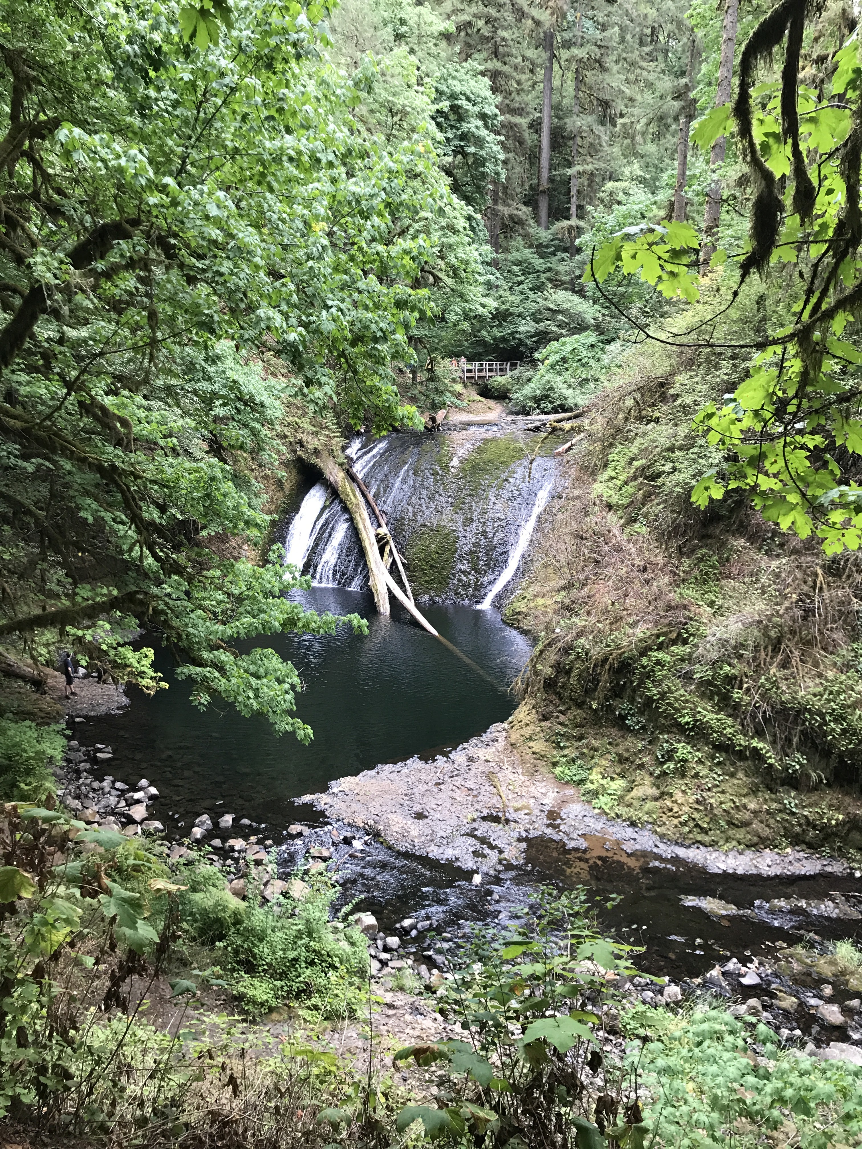
From Portland: Take I-5 N for 28 miles to Woodland. Take Exit 21 for WA-503 E to Cougar. Follow Lewis River Road (WA-503) for 30 miles. Continue east for another 3.4 miles past Cougar on Road 90 and take NF-83 for Ape Cave/Climber's Bivouac. Take this road for 3 mile then turn left on FS-81 for 0.4 miles. Turn right onto Road 830 (dirt/gravel) and take that to Climber's Bivouac (2.2 miles).

I realized about half way between Woodland and Cougar that I'd left my hiking poles in my garage in Portland. It's weird how the mind works: I was listening to music and enjoying a leisure drive and it hit me. Fuck! I pulled over and did a search for the nearest store that would have some. I didn't want to drive all the way back to Portland. I thought it'd either be Woodland or Battle Ground. 

I found a Walmart in Woodland and double-backed. I wandered the section of the store where they were sure to be but I didn't see any trekking poles. I approached a store employee and asked. Yes. Aisle whatever. I panicked for a second, thinking they were out of stock but hooray!, a pair of aluminum poles. I grabbed 'em and a small cooler. (I'd also left my cooler at home and had guacamole and hummus from my stop at the Woodland Safeway a hour earlier). At this point I wanted to top up the gas tank and stopped at a AM/PM near the Walmart. I grabbed a small bag of ice and headed back out Lewis River Road. Whew!

When I got to Climber's Bivouac, I spent an hour or so organizing my stuff and putting snacks in plastic bags for the hike. There were people on the other side of the parking lot but I had my side to myself. It was pretty quiet since I didn't have my little Bluetooth speaker. Eventually, it got a bit cool and dark and I got in my cocoon in the back of my Jeep. Even with the yoga mat and blanket, I didn't have enough padding. Argh! Lying on top my sleeping bag helped.


I was awake every few hours as cars pulled into camp, their headlights illuminating the place briefly. Once I was in the sleeping bag, I really felt the lack of padding. 🤣. Luckily, there was just enough cell phone signal to stream some tunes from Spotify.

Around 4am I saw a few hikers with their headlamps walk by. I wasn't ready. Around 5:30a I put on my hiking clothes to warm them up in the sleeping bag. I waited until about 6am to get out of truck and take a wazz. I ate a banana and drank 1/2 can of maté: breakfast. I got on my boots and pack and walked to the sign-in board. There was just enough morning light to see my permit to enter the number into the register. I realized I might not have locked the car. I tried to see the taillights flash but couldn't. When I got back to the car, a big group was getting a pep talk. They were recruits or army reserves, about 10 guys. I pretended to get something out of the truck and consciously locked the car. Here we go!

The Hike

Distance: 8.18 miles
Elevation Gain: 4,570 ft
Highest Elevation: 8,258 ft
Total Time: 8h7m
Ascent: 6:15a - 10:45a (4h30m)
Time at Top: 10:45a - 11:35a (50m)
Descent: 11:35a - 2:22p (2h47m)


I started the hike through the forest. No other climbers were around. It was nice and quiet and I got adjusted to my pack.

At 6:56am, I was close to the Loowit Trail and sun was coming up.

At 7:09, I reached the treeline at about 4,800 ft. This is the end of the Ptarmigan Trail. I remember reaching this point back in 2020 when the idea of doing this climb was planted. I was just out exploring the lakes/reservoirs and drove up to Climber's Bivouac on a whim and did the hike. I had no idea what was involved.

I made my way up the Monitor trail and stopped to enjoy the views to the south and above me. A couple of pair of climbers past me and I passed a father and daughter that were doing this hike for the first time. I talked about my volunteer role on the trails below.


I didn't take any photos between 9:13a and 10:53a, after I'd reached the top. About 1/2 way up in the boulders, I synchronized with that group of military guys and chatted with a few of them. It felt good to have them as motivation and trail companionship, at least in my mind. I wondered how my fitness and age stacked up with the older guys and younger ones. The leader was a SAR guy and I overheard him talking about the gear he'd bring on these rescues.

There was one kid in the group that was struggling. Per the trailhead pep talk, the group took breaks every so often and wait for everyone to catch up. He was getting advice from the older guys. While I didn't revel in his discomfort, it reassured me that I was doing pretty damn good. All the worry about my recent arthritis symptoms and general anxiety about not reaching the top, thinking about my 2022 attempt was in my head.

I kept striving to reach the next lodge pole or rock or whatever: the counting method from Bear Grylls, thinking about Joe Simpson in Touching The Void. Breaking the big "thing" into smaller bits, like I have with Hamilton Mountain.

At the GPS station, I could see little dots of the people on the rim. The goal was within sight but it was still a 0.5 mile away. I was a bit nervous here. This is where I'd turned around last year. I continued hiking with the military guys and passed a couple of hikers. I just kept aiming for my next goal/milestone.

Eventually, the people at the rim looked a lot bigger. I was really going to make it! Fuck yea! I did my best to find other hikers' footprints and used them as steps. 

When the rim was close, I estimated I had 30 steps to go! I counted each one and it was actually just 32 steps. I made it!

I walked up to the high spot to the right of the end of the trail and took this photo! I turned and snapped the photo of that group of 10. They were hanging out on the other side. A pair of hikers I'd seen way below were sitting near them, eating sandwiches.


I walked towards the "true summit" but opted not to go. I was glad to be up there and regret not going a little but decided I'd head over there next year. I just enjoyed the views and the silence from up there. I'd purchased safety goggles because I'd anticipated wind and dust but it was perfect up there. It was so quiet you could here little rock falls in the crater but they were so small, I wasn't able to place them as there wasn't any dust.

True Summit from my spot on the rim

Shoestring Notch and Mt Adams

South view w/ Mt Hood, Mt Washington, Mt Jefferson

Crater view with Mt Rainier in far background

Panoramas