Showing posts with label Carson. Show all posts

Saturday, April 18, 2026

Dog Mountain, Carson, WA

Getting There

I took Hwy 84 to Cascade Locks, then crossed the river. I suppose it's a little quicker than going all the way to Hood River and taking Hwy 14 back to Cook. 

This was a WTA trail work party in conjunction with the Mazamas. James and several others were already there when I arrived to the parking lot.

I mentioned to James that I was having "performance anxiety", referring to be unsure how fit I was to hike to the top and then doing trail work. He was surprised and said he was feeling the same thing. It was a relief that I wasn't the only one. We joked about letting the Mazamas cruise to the top with a CL or ACLs. 

The Hike

Length: 6.48 mi
Elev. gain: 2,840 ft
Highest Elevation: 2,948 ft


Before we set out up the trail, we stopped to take a group photo with the park rangers. 

Surprisingly, I was one of the first to reach Puppy Dog Viewpoint with a couple of the Mazamas. I guess I didn't need to be anxious about my fitness.

We planned to work from the top back down to the viewpoint on eastern side of the loop trail which winds through the trees, instead of the wildflower route to the west. Since it took about 2 hours to complete the hike, we decided to have lunch before starting work. We dropped out tools and headed for the summit.

After lunch, we hiked back to the top of the work site.

The trail was in pretty good condition but there were several areas that needed re-benching and widening.

There was one small diameter tree (maple vine?) that was a bit close to the trail, at about eye level. Before this volunteer actually made the cut, I suggested that we cut a big chunk off the top to lighten the branch. I also showed them how to undercut so there wasn't a slab when the weight finally brought the branch down.

A little re-benching project.


We made it back to Puppy Dog Viewpoint. The weather was great and the work wasn't too difficult.

While this wasn't a leisure hike, it was some descent distance and elevation gain. Some work parties are only 1-2 miles and minimal EG so I don't count those. 

Wednesday, June 19, 2024

Hike: Falls Creek Falls, Carson, WA


Getting There

From Portland/Vancouver, take I-84 to Cascade Locks, then cross the Bridge of the Gods and head east on WA-14 through Stevenson to the Carson. Take the Wind River Hwy and go for 14.4 miles. Just after the Carson National Fish Hatchery, take the right (north) on NF-30 (Meadow Creek Road). Go for about 2 miles and take a right on NF-3062. The road is pretty bumpy with dips and potholes but I saw lots of low-clearance cars that made it to the trailhead parking lot. It's about 2.5 miles from the turnoff.

I really wanted to hike something new. I think I'd had my sights on a Gorge hike but nothing seemed feasible (Multnomah Falls requires a parking pass and there were cars everywhere at Eagle Creek.) I remember seeing some pictures from this waterfall on IG.

I really didn't know what to expect. I was wondering if it was going to be a deserted trail like Bunker Hill but to my surprise the parking lot was huge and it was mostly filled with cars.

I immediately thought, "I'm gonna knock this out, then split to somewhere a bit quieter."

The Hike

Distance: 3.63 miles
Elevation Gain: 755 feet
Maximum Elevation: 2,081 feet


The trail is pretty rad, to be honest. There's not much elevation gain and your always within earshot of the creek.

The route reminds me a bit of Forest Park but with water! Near the end of the trail, you start to catch glimpses of the water as the noise level rises. It was sunny out but the shade and breeze made it so nice.


There were a bunch of people hanging out: taking pictures, sitting and chatting, a teenager exploring around the boulders. 

I was in awe of the double waterfall. Spectacular. I can see why so many people love to come here.

I only stayed for a little while before starting back for the trailhead.

This would be a good place to bring someone who doesn't hike much, or with dogs, or to have a picnic.


Sunday, March 3, 2024

Hike: Dog Mountain, Carson, WA


Getting There

I took Hwy 84 to Cascade Locks, then crossed the river. I suppose it's a little quicker than going all the way to Hood River and taking Hwy 14 back to Cook. I stopped in Stevenson to get fuel and some water and Gatorade.

There were only 4 other cars. I pulled up nearest the trailhead and signage. I hemmed and hawed a bit if I was really gonna do this. Heading to Hood River and having brunch or lunch seemed pretty good.

I still wanted to do the hike and try out the new Vasque boots. I put on my big boy pants, geared up, and started up the trail.

The Hike

Length: 6.49 mi
Elev. gain: 2,808 ft
Moving time: 3:13:59
Total time: 3:45:48
Avg pace: 29:54
Calories: 1,959


Kind of a gnarly hike. I was trying the new boots and I knew right away that my movement, hiking dynamics were different with over-the-ankle boots vs mids like my Keens. I'd read some complaints with this boot, Vasque Torre AT GTX, that there's not enough padding in the ankle area and tongue.

This forced me to hike with the soles on the ground as opposed to bending the foot and hiking up the incline on my toes. I feel this may have lead to the pain in my metatarsal. I also saw a video that recommended not hiking on your toes. I can see both methods as valid but maybe switching it up is the key to avoid aggravating certain muscles, tendons, ligaments... IDK.

I'm getting use to trail and the breaking it up into sections like I have with Hamilton. Before I knew it, I was at the first view point and then where the Difficult and More Difficult trails reconnect below the final push to Puppy Dog Viewpoint.

I passed a hiker earlier that had microspikes hanging from their pack, meaning the conditions were different up above.

This is where the snow fully covered the trail and was icy. I stopped there to put on my gaiters, jacket, raincover for my pack, and microspikes. I was ready for the weather.

I passed another hiker on they way up but sensed that I was the only one up there at the moment. I sometimes try to count cars and hikers to gauge if I'm by myself or if I might encounter others. Seeing others gives me added confidence but I know I have extra gear and the InReach if I need.

I only paused briefly at Puppy Dog Point but it was completely socked in so I figured I'd push for the top.

The snow was much deeper from this point on and I could barely see the other boot prints and postholes. As I marched upward, I still wasn't sure if I was going all the way. I was a bit nervous about the conditions and looming steep section.

As with previous hikes, it's pretty narrow but there's still room to walk along the edge without feeling too vulnerable. Fortunately, it wasn't too windy and I felt stable up there. Still pushing the boundaries of my comfort zone. The little fall I had on Hamilton last week was playing in my mind as I continued.

I finally made it to the Augspurger Trail and I knew I only had a little more distance to go.

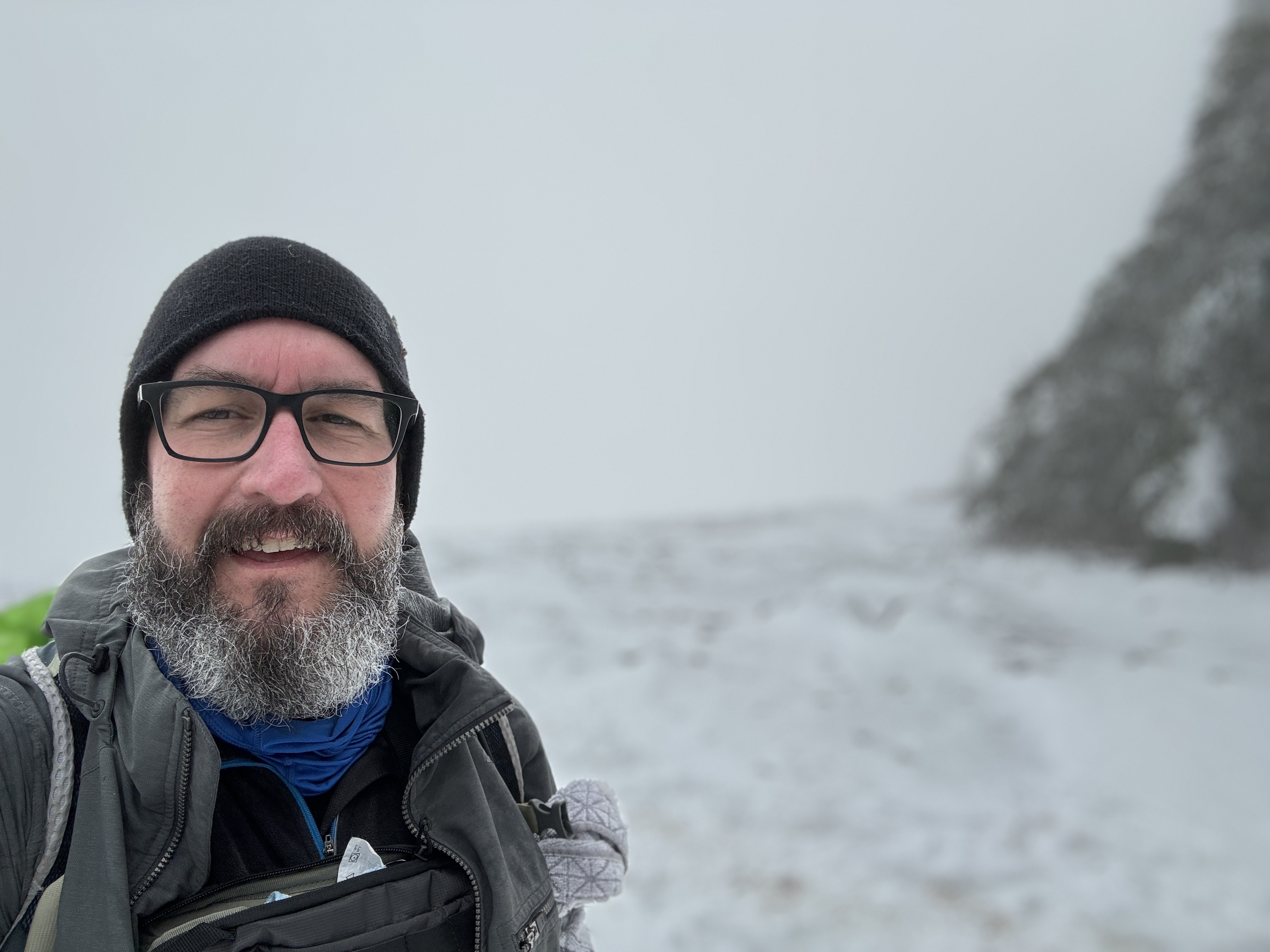
The trees were overladen with snow. I looked like those pictures from the Mt Hood Summit. It was snowing and visibility was still low.

Eventually, I made the last turn/switchback to the top. I opted to head into the trees and skipped my usual tree "fort".

Knowing I had a tricky descent, I only stayed there for a few minutes to snap some pictures and enjoy the "views". I couldn't let my guard down until I was below the scary part of the upper trail.

I relaxed quite a bit when I got near Puppy Dog Point. I encountered another hiker who was on their way up. They asked how much further the top was. I noticed they only had Yaktrax and no gaiters. I mentioned it was deep and visibility was poor. The hiker said they'd come up the More Difficult trail and wanted to see the river. I offered info that there were some great view on the way down the Difficult trail.

I'd conquered the mountain again and was feeling elated. My feet were hurting on the way down. Again, the over-the-ankle boots were limiting how much I could flex my ankles and it was causing some pain. Also, the snow was really sticky and I was getting a lot of accumulation on bottoms of my microspikes and had to stop several times to clear the build-up.

I made it back down to the trail junction where I'd put everything on, and removed the microspikes. I could travel faster on the intermittent snow and bare ground.

Every once in awhile, my left ankle really hurt. It wasn't due to a pressure point or lack of padding. It was like it was going to pop like a knuckle. I stopped and rotated my foot in a clockwise and counterclockwise direction. Nothing out of the ordinary and couldn't reproduce the pain.

I continued down and it happened a few more times. Hmm.. I liked the boots and maybe I just need to break them in a bit. The downside of having two pairs of fairly new boots means neither one will get the regular use to wear them in. (First world problems). The Keen Targhee IIs are starting to mold much better to my feet. I got the over-the-ankle boots to minimize an ankle roll but seems to come with some other issues.

I passed a couple going up that asked about the need for microspikes. I told them were the snow started but knew they didn't have time in the day to make it that far up without hiking down in the dark. Not my problem.

I was so happy to reach the parking lot and take off my wet gear and get on a dry shirt and comfy boots.

Another epic hike and confidence boost.

Enjoy some pics!

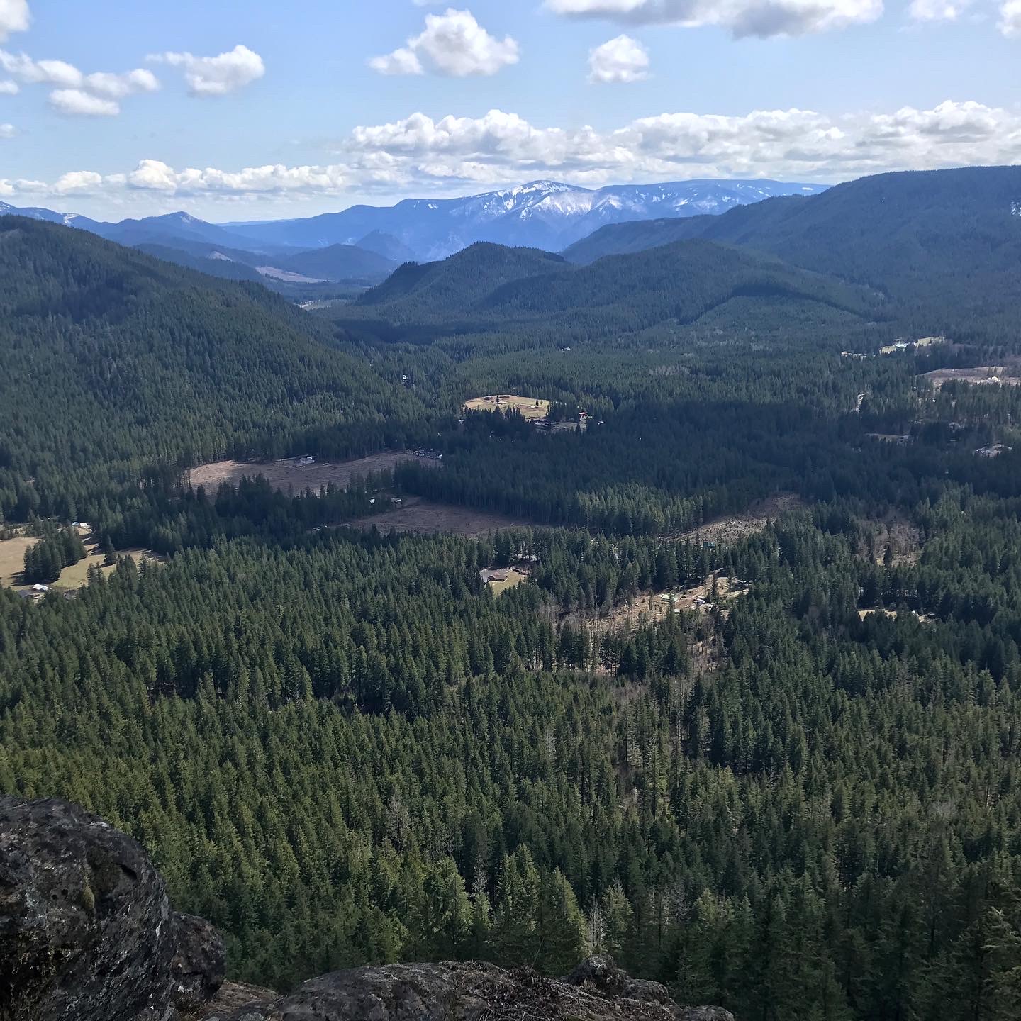
No snow on the lower part of the trail

View from the top


Another view from the top

Below the scary section, above Puppy Dog Point

Looking back up. The trail is somewhere in the fog.

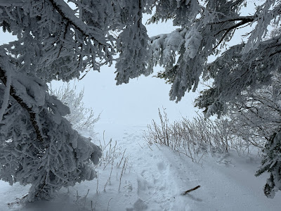
Trail disappears into the trees

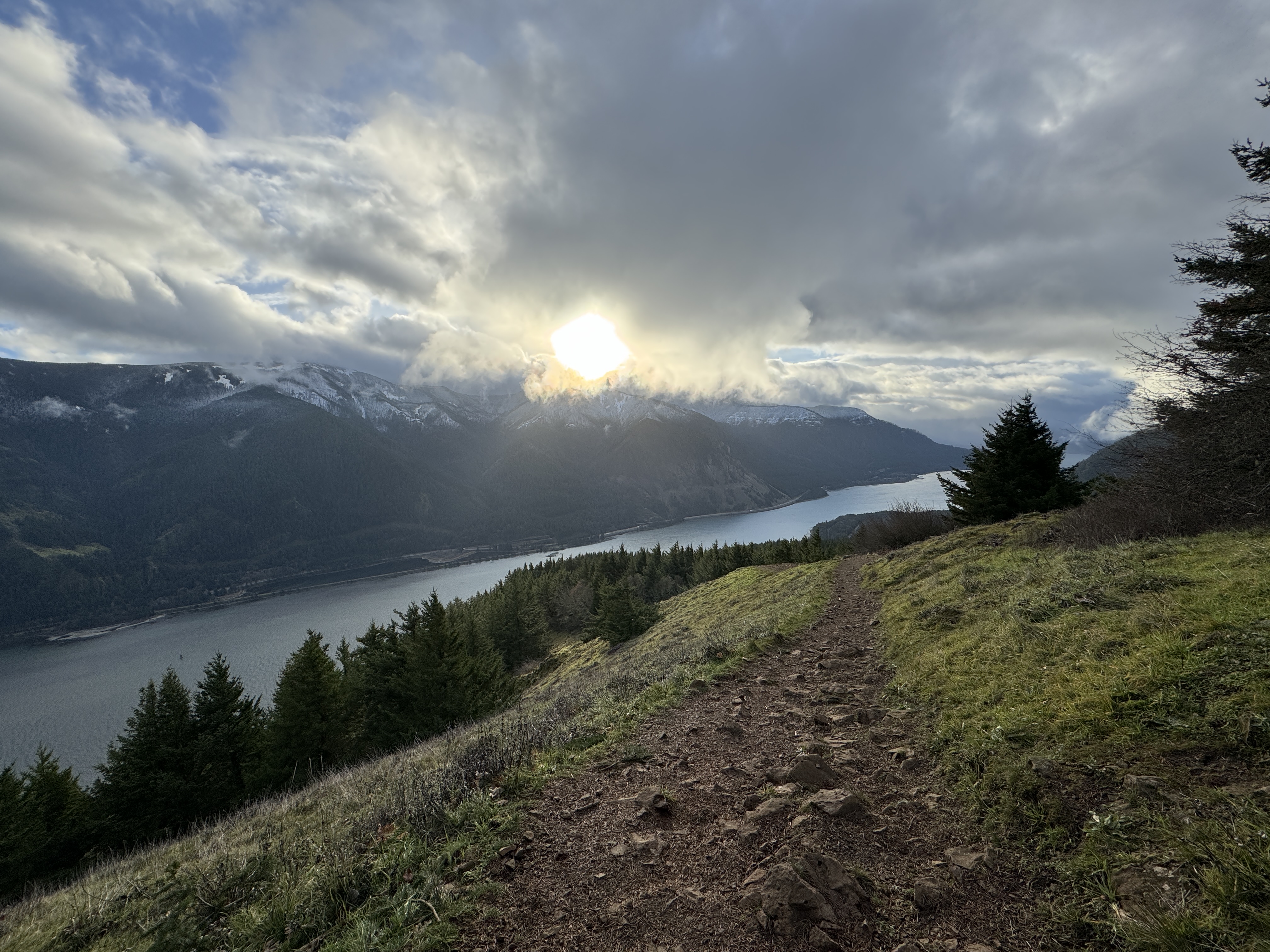
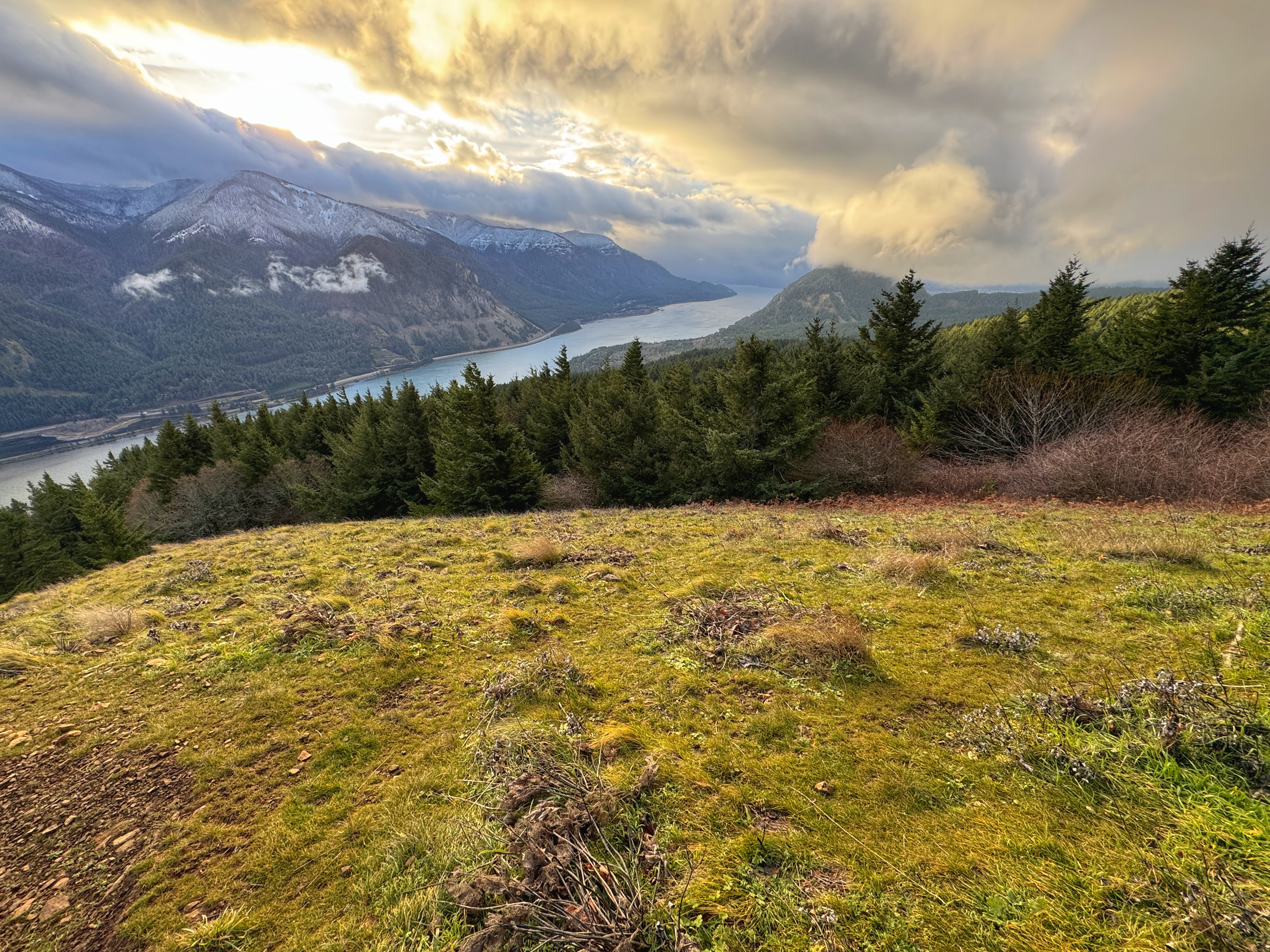
Lower viewpoint, a bit of the river and Wind Mtn


Sunday, January 7, 2024

Hike: Dog Mountain, Cook, WA


Getting There

I took Hwy 84 to Cascade Locks, then crossed the river. I suppose it's a little quicker than going all the way to Hood River and taking Hwy 14 back to Cook.

There were a lot of cars but it wasn't at capacity. I found a spot near the trailhead. I made sure there was nothing visible. I'm not sure if car break-ins is as bad as it was but I wasn't taking any chances.

The last time I hiked Dog Mountain was Nov 22, 2022. I was parked next to another Jeep that was broken into while the owner was on the trail. The fact that the parking lot is right on Hwy 14 gives a false sense of security. The difference between vehicles was that mine was empty and other Jeep had stuff in plain sight since they were on a road trip. 

Frustrating. I remember bailing on a hike at Herman Creek because of how much glass there was on the ground in the small parking area. That was during the pandemic. It feels like happens a lot less but still important to take precautions.

The Hike

Length: 6.92 mi
Elev. gain: 2,828 ft
Moving time: 3:27:23
Avg pace: 29:57
Calories: 2,093
Total time: 3:54:55


My streak of not getting an early start is unbroken. Well, that's not entirely true: I got there earlier than for the previous couple of hikes but it was still in the afternoon when I set out on the trail.

I made good progress up the first switchback to the trail split where you have Difficult and More Difficult.

There wasn't any snow until above the trail split at the top. I was able to climb the steep section of trail with just my new Keen boots and new tread, however, when I got to slushy snow I got out the microspikes for some extra traction, esp. for the mud. A pair of hikers I'd passed went by. They were wearing trail runners and not particularly outfitted for colder, snowy conditions. I knew I would have the advantage higher up.

Yep, on the straightaway to Puppy Dog Viewpoint, they were stopped to catch their breath and I cruised by.

At Puppy Dog VP, there was a person taking photos so I didn't stop. The trail to the top had about 8 inches of snow but it was well packed, so I wasn't worried about postholing.

I passed a couple of hikers on their way down and I had the top to myself. 

I ducked into "my" tree. I wanted to get out my mittens and gaiters, then ran over to the other clearing for a pitstop. I lingered for a little while before starting my descent. I passed a big group (about 6 people) on their way up.

A little ways down I stopped to wait for a hiker to finish taking photos. I got my camera out as well as it seemed like a perfect "Kodak" moment. It was momentary break in the clouds, revealing Wind Mountain and the Gorge.

When I got down into the forest again, it warmed up and I took off my microspikes and ate an orange.

The views at lower elevations just got better and better.

I reached the car and was happy to not have any vandalism. Excellent hike, decent mileage and elevation gain. And my foot wasn't too unhappy.

---

There were so many good photos, although similar in composition, I wanted to include several. Enjoy!


Friday, April 14, 2023

Hike: Bunker Hill + Whistle Punk Loop, Carson, WA


Top of Bunker Hill

Getting There

In Washington, take Hwy 14 to the Wind River Hwy through Carson. Take the highway north for 10.7 miles to Stabler. Take Hemlock Road west and go about 1.2 miles to the Wind River Work Center. The Google Maps directions are wrong and try to route you through private property! Go a little further past the Work Center to NF-417. Keep a lookout for the a right turn for Old Bunker Hill Road. It's just a little more to the Trailhead parking lot.

The Hike

AllTrails map

Length: 5.62 mi (Bunker Hill: 3.91; Whistle Punk: 1.71)
Elev. gain: 1,322 ft (BH: 1266; WP: 56)
Moving time: 2:11:39
Total time: 2:31:49
Avg pace: 23:26
Calories: 1,325 

Bunker Hill

Note: The Bunker Hill trail crosses a large field before you get to the tree line. The trailhead signage marks the Whistle Punk Loop trail.

The first part of the trail is a bit swampy but there are some logs to help you get through. Eventually, you reach a wider trail which is most of the route.

It's a beautiful hike with very little undergrowth. It climbs at a moderate rate via switchbacks. While it's airy in the trees you can't really see the surrounding hills in the valley. It's not until you reach the ridge that you can see daylight and hints at views.

The trail makes the final climb to the top on the backside of the actual ridge. The photos below start from the top. 

"A fire lookout once perched on the 2,383-foot-elevation summit, offering views of the Wind River Valley and the former Wind River Nursery. Bunker Hill is an igneous volcanic plug that was pushed up through layers of lava flows and volcanic debris 25 to 20 million years ago. The igneous plug is less resistant to erosion than the surrounding rock. Several places along the trail furnish superb views of the Wind River Valley, and the Ranger District/Nursery complex."
(https://www.fs.usda.gov/recarea/giffordpinchot/recarea/?recid=31724)

Footings from old fire lookout before the canopy grew up

A tribute to an old friend

View looking southeast of the Wind River Valley

Ridge trail

Another view of the Wind River Valley


Glimpse at the PCT

Swampy crossing

Pano of approach to trail (Bunker Hill is on the left)


Whistle Punk Loop

After my Bunker Hill hike, I took a spin around the Whistle Punk Loop. Just a few relics of the lumber industry is left, i.e. several rusted spark arresters.

"This trail is a barrier-free interpretive trail that tells the story of forest management from a historical perspective. Signs and a brochure guide visitors along the trail, which runs along an old railroad grade (dating back to 1913) and past features associated with railroad logging by the Wind River Logging Company."
(https://skamania.org/experience-skamania/whistle-punk-trail/)

"In logging's heyday, whistle punks were men tasked with operating the signal that let other loggers know a log had been hooked up and was ready to be moved. Using interpretive signage, this trail illustrates what was like to be on a logging show, from the crew, to the cook, to camp. There are even some relics from the past, including a "sled", which is now quite hard to see, as well as some other metal artifacts."
(https://www.wta.org/go-hiking/hikes/whistle-punk)

Wind River Research Natural Area

"This old-growth Douglas fir and hemlock forest is
designated for scientific and educational use. Research
is conducted on all aspects of this import forest type,
including plants, animals, soil and climate; this research
is used to improve our understanding and management of
similar forests.

If you enter this area, please leave plants, animals and
research installations undisturbed because continuing
ecological studies depend on unaltered natural conditions."


The Smoke Stack's Connected to the Spark Arrester

"The smoke from the fire makes hot sparks.
The hot sparks rise up the smokestack.
The smokestack is connected to the spark arrester.
The spark arrester is layered with wire mesh.
And the wire mesh stops the sparks."

As the Donkey Puncher pulls on the controls, smoke pours out of
the stack. He thinks about how steam generates power needed
for moving the cables that move logs. He hums.
"Dem Bones, dem bones, dem dry bones..."

"That steam, that steam, that powerful steam,
so hear the sound of the steam donkey..."

The water tank pipes to the boiler.
The wood tender throws in the wood chunks.
The fire box heats up the water.
And the steam goes into the steam box.

The steam box is connected to the pistons.
The pistons push the rods that turn the gears.
The gears are connected to the cabin drum.
And the donkey puncher feeds out the cable.

The cable goes out to the big woods.
The choker setter connects the cable to a big log.
The log is yarded to the landing.
And the steam donkey powers the cables.

That steam, that steam, that powerful steam,
so hear the sounds of the steam engine.

A continual menace to logging operations -- FIRE!
Despite protection from the spark arrester, firey sparks
flew from cables rubbing cables, cables rubbing logs, and
from screeching brakes on railroad cars."


"... and cables swing the 6,000-pound log overhead. As it
swings over the railroad car, he signals to the Donkey Engineer
to drop it quick. He scurries to remove the tongs, ignoring the
Head Loader's mouth over on the log pile.

He dreams of becoming a High Climber, He knows he has
enough nerve to climb and rig 200-foot spars with 2,000-pound
blocks. He'd be his own boss and earn $5 more a day - a big
jump from the $2-day wage he received when starting out as
as Whistle Punk."


A Portable Workshop of Ingenuity
 
"Ha! You call dis ah verkshop?" mocks the Swede. "It's just a railroad
car with sides and a roof. Da crew just rolled it off da railroad on
'dare way to pick up another trainful of logs. Ha! A verkshop! Ha!"

"by Tunder, Svede!" shouts back the Irishman. "If we didn't have
dis workshop, the logging show wouldn't operate. If it weren't for
our smarts, the railroad wouldn't run, the blocks wouldn't move smoothly,
and we wouldn't have handles on our saws."

"Oh yah, Red. Yah. So where's da Marlin spike to splice da cable?
Da boss vants me to work on dis one. Fast! It's holdin' up one side
of da show! Da main line cable broke, and dat boss!... Dat boss, he
don't want 'dose 50 men hangin' round in da woods."