

Getting There
Take WA-14 from Vancouver, WA east toward N Bonneville.
Just after Doetsch Ranch you'll see the Ranger Station on the north side of the road just before the Beacon Rock parking lot, then another road across from the bathrooms. The road winds up the hill for a bit.
The Hike
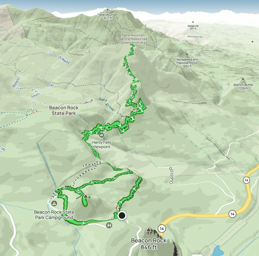 |
| AllTrails map |
Length: 6.84 mi
Elev. gain: 2,231 ft
Moving time: 3:16:04
Avg pace: 28:40
Calories: 1,972
Total time: 3:41:16
FitBit Stats:
Steps: 20,463
Calories: 3,388
Distance: 9.4 miles (incorrectly estimated by steps x tread length)
Zone Activity: 78 minutes (64 fat burn, 14 cardio & peak)
I was glad to take another spin up my favorite mountain. I'm still dealing with pain in my left foot, specifically anterior ankle impingement and plantar fasciitis. Not sure if one is causing the other.
It seems the best remedy is to stay off that foot and not aggravate the injury. However, being an avid hiker, this is difficult. I really want to get out there and take some photos and it's so beneficial for my mental well-being.
I made moderate progress on my ascent. I noticed part of the trail that were damaged due to people going around the snow. I read an article that implores hikers to just power through the mud and whatnot and avoid going off trail.
On the last section of the hike (with the 14 switchbacks), I noticed my ankle was hurting quite a bit. I made it to the top but didn't want to linger for too long because I was worried about my descent.
While this pain is not even as bad as I've felt with IT band tightness, it still worried more more. I'm 99% sure there are not fractures or damage.
Actually, as I descended the pain seemed to fade enough that I didn't notice it anymore. I made sure to stretch my calves and rotate my ankle in both directions periodically. Whew.. I wasn't as worried anymore.
I popped up to Little Hamilton for the obligatory views. It was grand as usual.
A lightly dressed hiker (or trail runner) appeared. He oohed and aahed and continued down the face of Little Hamilton. (I've done a few times in warmer weather. It's just narrow but one should exercise lots of caution.)
I proceeded back to the main trail and the switchbacks. I expected to see that hiker still on the hill or making it through the switchbacks. I didn't see him. I thought it was peculiar.
There was one guy resting about 1/2 way down. I'd intended to ask if he'd seen that hiker go by but he disappeared behind a tree at a lookout spot. I kept an eye out but never saw anyone.
I made a point to look up at the cliff (Little Hamilton), hoping I didn't see a stranded hiker or worse. Nothing.
I assumed this person was a trail runner and had already made it down much faster than I expected.
When I reached the power lines, I still had plenty of daylight so figured the views from Little Beacon were going to be excellent.
I encountered another hiker/photographer there. I said hello and climbed up to the lookout. A few mins later the photographer showed up, apparently her first time up there. I mentioned the slab of petrified wood holding the Hadley plaque.
She snapped a bunch of photos and left. I lingered for awhile, mostly to give her time to get down so it didn't seem like I was following or crowding her.
I saw her one more time in the campground. I waved and walked briskly by & back to the parking lot.
I err on the side of caution when encountering solo hikers, esp woman. I don't know their comfort level, if they've had creepers in the past, generally just wanting a wide berth to maximize the feeling of being outdoors & enjoying the solitude.
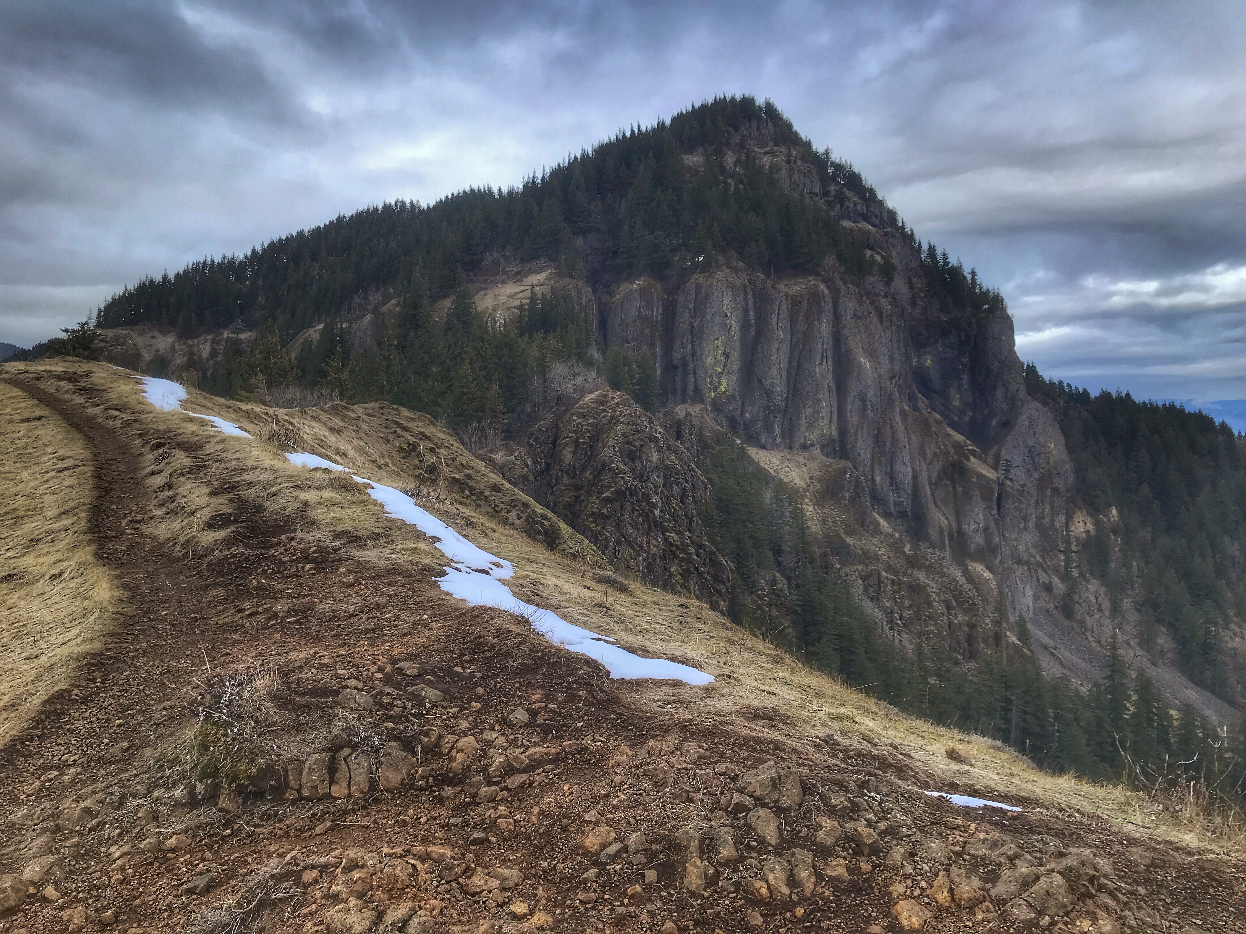 |
| (Big) Hamilton Mountain from Little Hamilton Mtn |
 |
| Hardy Creek near Rodney Falls |
 |
| Viewing platform at Hardy Falls |
 |
| View from Hardy Falls. Yeon Mountain on Oregon side of the Columbia River Gorge The faint outline of Hardy Creek at the bottom. |


