Featured Post

2024: My Year in Review

Another trip around the sun! I kept my same hiking goals from previous years: 52 hikes , 365 miles , 84,000 feet . However, I came up short ...

Showing posts with label Mt Rainier. Show all posts

Sunday, August 25, 2024

Hike: High Rock Lookout, Towhead Gap, WA


Getting There

In the morning I had hiked up to Packwood Lake, so to get to High Rock Lookout trailhead, I dropped back down to Packwood and crossed US-12 onto Skate Creek Road. It's also labeled NF-52. Follow this westbound for about 18 miles. Keep an eye out for signs to High Rock Lookout. Turn left (south) onto NF-52, a dirt road with some potholes and dips.

Keep going for about 4.5 miles and look for a slight right onto NF-8440. The trailhead is another 2.6 miles. It tends to get busy up there since it's a popular hike and there are likely more folks that can't get into Mt Rainier due to the timed permit system.

I was fortunate to find an open parking spot right next to the trail but there were cars parked on the shoulder around the bend as well as some person's Toyota FJ Cruiser that was parked high up on a rock like some car manufacturer's promo. LOL.

The Hike

Length: 3.53 mi
Elev. gain: 1,339 ft
Moving time: 1:39:08
Avg pace: 28:07
Calories: 1,003
Total time: 1:53:19


This was only my second time hiking this trail. I'd tried to get up here way back in April but, of course, the roads were long from being opened. 

My feet were tired from the Packwood Lake hike but I was determined to get to the top. I'd just driven for an hour and I still had to drive back to Portland afterwards. I knew it was well traveled and no way to get lost since it's a ridge out-n-back trail.

I passed two couples on the way up which gave me some motivation to keep going even when I was winded. I had to pause a few times to let my heart rate drop back down.

I remember some of the places on the trail from my previous hike back in Sept 2020. Whoosh! That was a long time ago!

Near the top, there are a couple places where you can see the lookout from below. I noticed some people standing up there, looking over a railing. I didn't remember that you could stand on the roof, maybe that was new.

I rounded the last switchback and saw the last traverse. I paused to rest for a minute. A hiker on their way down gave me some encourage that I was almost there. Indeed. 

I finally reached the edge of the trees and the scramble up the slab of granite. The structure was indeed gone. The people I saw earlier weren't on the roof but rather, standing on the floor.

Several people were on the platform enjoying the views. Several more people were scattered below on the rocks getting some other vantage points. Mt Rainier was hidden somewhere in the clouds. You could barely make out its shape, or at least the lower flank.

I was happy to have made it up and gotten a bit of elevation since the Packwood Lake hike wasn't very challenging.

I changed my shirt at the top and put on my puffy jacket. It was both cool and humid. I was glad to be in a dry top. I started my descent and kept a steady pace to the bottom. My foot and toe pain came and went. Nothing major.

I passed a bunch of folks going up and wondered if they had flashlights and/or warm layers. The clouds were dark nearby and it seemed like rain was possible. Not my problem!


Looking south from the trail


Looking north

Cora Lake

Looking south

Monday, July 26, 2021

Hikes: Summary of my week of hikes on my Washington road trip


Summary of my week of hikes, July 2021

Wow, what an adventure! I left Portland on Sunday afternoon. One night near MSH, two nights near Mt Rainier, two nights in Snoqualmie Pass, and one more night near Mt Rainier.

Ever since I started hiking in earnest, I’ve been keeping stats.

This trip included 7 different hikes:
- Total distance: 52.17 miles
- Total elevation gain: 11,770 feet
- Highest elevation: 7,441 feet (Mt Rainer)
- Most elevation gained in a hike: 2,943 feet (Kendall Katwalk)
- Longest distance: 13.1 miles (Kendall Katwalk)
- Avg. distance: 7.45 miles
- Avg. elevation gain: 1,681 feet

F.U. arthritis! Ha!

Saturday, July 24, 2021

Hike: Panorama Point, Pebble Creek Trail, Paradise Glacier, Skyline Trail, Mt Rainier, WA


AllTrails maps


Getting There

This was Day 7 of my Road Trip. I stayed on NF-52 along the Nisqually River the night before because I hadn't made accommodations after leaving Snoqualmie Pass.

I was up early and since I didn't have any gear to pack, I just hopped in the front and drove to the Park.

There was already a long queue of cars waiting to get in but something to be expected for a summer Saturday morning.

Once I got in, the cars were well spaced so it was soon cruising mostly alone. Cars peeled off at various viewpoints and trailheads. I was heading straight for Paradise. By around 8-8:30am the main parking lot was already full but I found a spot in the first overflow lot.

I took my time gearing up, then headed out.

The Hike

Distance: 9.73 mi
Elevation Gain: 2,654 ft
Moving Time: 4:18:36
Avg Pace: 26:34
Calories: 2,279
Total Time: 5:13:51

The Ascent

Since I was on the left side of the trail system, I hoped on Skyline Trail, then Dead Horse Creek Trail. At 6135', I hopped on the Skyline Trail briefly, then onto the Glacier Vista Trail. Then, back to Skyline to Panorama Point, so many trails crisscrossing. 


I really hadn't planned my hike but the weather was perfect and I wanted to gain as much elevation as I could. The spots I'd hiked the previous Tues were swarming with people so I was also seeking fewer casual hikers. I headed up the Pebble Creek Trail which eventually is used by mountaineers heading to the Muir Camp and the summit. I climbed to the snowfield and stopped. I had crampons in the car (dammit!). Most people had microspikes but a few continued without. I figured going down without spikes was going to be the challenge.


Another hiker who appeared to be contemplating the same thing: go on without spikes? I said "Let's go for it". I just went up the first 'hill'. I saw the dirt trail on the left so made my way over the rocks. I crawled up the ridge. I went as far as I could: 7444'.

Distance: 3.2mi - Elevation Gain: 2080'.

I descended from the ice field safely and found a spot to stare at the quiet giant looming above. There was a perfect rock to lie down on.

The view (though stretched)


The Traverse

I followed my route from Tuesday, continuing on the Skyline trail, below McClure Rock and winding downhill. Instead of taking the Golden Gate Trail back to the lodge, I kept going on the Skyline Trail.

The benefit of getting an early start is having time to explore side trails. The Paradise Glacier Trail is a 2.0mi up-and-back trail. The upper part cross a huge patch of snow. I followed the footsteps of previous hikers.

When I got toward the end, a couple was resting at a small cairn. The actual end of the AllTrails trail is buried in the snow but I think I got with 800' of the end.


End of the Paradise Glacier Trail 800' ahead

The Descent

On the way back, instead of crossing the snowfield again, I followed a rocky ridge for a bit, while keeping the trail in sight. (I'd planned to knock down pile of rocks someone had left. Only trail makers are okay). I saw another one a few ridges over. I was really off-trail at this point. I was going to cross a patch of snow and looked down. Mountain Lion tracks in the snow. Not big, maybe a adolescent or female. They looked somewhat fresh, i.e. given the sun/heat, I'd expect older tracks to melt & lose shape. IDK.

I stopped, took the photo, and turned around. In hindsight I should have backed up first and scan the area. Anyway I walked briskly toward the ridge and eventually to the trail. Once I had some distance I turned around and scanned the horizon. Once I was on trail again, I felt safer for no good reason. Why should the snow make me more vulnerable than dirt? False sense of security. (Maybe like finding a forest or logging road when you're lost and feeling like you've made it but in reality you still might be in a pickle.)

Mountain Lion tracks


I made it back to the Skyline Trail. The hike was sort of over for me. So many people. The views were gorgeous but I just was ready to get back to the car. I'd taken about 100 oz of water and had finished all of it. I wasn't sure about drinking stream water, esp. at the lower elevations.

When I got to Myrtle Falls the place was so packed, it was uncomfortable. I donned my mask and weaved through the oblivious throngs.

Post Hike

When I got back to the parking lot, dozens of cars were prowling by looking for a parking space, and when they saw me, it was like sharks circling prey. I'd barely put down my pack and hiking poles and people were asking when I was leaving.

I was tired and this annoyed me. I flatly responded "not for awhile". In hindsight, I could have deflected by saying I was waiting for someone else instead of coming off as "I'll go when I'm good and ready". I looked across the lot and saw a guy snoozing in a camp chair. He knows.

One of the pleasure of hiking (or skiing, snowshoeing) is taking off your boots. When I had accomplished this, my mood improved. I changed into a dry shirt and was feeling much better. Another car came by and asked when I was going. Even though I was close I gave my "not for 10-15mins". The driver said "cool, I'll pull over." I liked that. I immediately chose them to take "my" spot. I quickly finished stowing my gear and told them I'd leave right then. I hoped in, backed out, and waved to them.

Leaving the park, I passed by such a long line of cars waiting to get in. It must have been 2 miles of cars. Ugh. It was time to go home (or at least get out of here.) I was stoked about the day of hikes and thought about it as I drove west.

Tuesday, July 20, 2021

Hike: Panorama Point Loop, Paradise, Mount Rainier, WA


AllTrails maps


Getting There

I made the short drive to the Day Lodge parking lot from Reflections Lakes. I found a spot near the edge of the lot. I recalled stopping here in 2020 to just take a look around. I marveled at the views of the Mt Rainier as well as the peaks I'd just hiked, Pinnacle, Plummer, etc. It's how I image the Alps. I remember coming up here in 2019 when there was snow everywhere and I'd stopped at Carter Falls, my first time inside the park.

Memories. Connections. ... anyway, I geared back up and headed out.


The Hike

Distance: 4.95 mi
Elevation Gain: 1,640 ft
Moving Time: 2:22:41
Avg Pace: 28:48
Calories: 1,257
Total Time: 2:31:01

There are so many trail starting from the parking lot. I quickly ended up on the Skyline Trail. I had no expectations about what elevation I was going to reached. I'd looked at the Panorama Point trail on the map but it's so different when you're out there IRL. The trail was full of people so I had no concerns about being the only one, far from it. 

I could see tiny dots far above me. Hikers. It gave me the drive I needed to keep pushing up.

The weather wasn't great. The clouds around the mountain were low. That band I'd seen earlier had grown. I knew this giant was looming over us all, we just couldn't see it.

When I reached Panorama Point, the views of the surrounding peaks was amazing. The trails are so amazing up there. A pair of hikers were coming down from the Upper Skyline Trail. I asked about the views and was encouraged to keep going.

I reached the Pebble Creek junction and more views of the glaciers and peaks. A group of about 10 hikers emerged from the fog. (I learned later in the Paradise Inn gift shop that they'd stayed at Camp Muir.)

From there I had the option to go back the the same way or continue on the loop. It was about the same distance so why not see new terrain.

The trail snakes down the slopes of the mountain. You can see people as little dots below, well above the tree line. It's a really nice trail so it's easy to make quick progress. The drank in the views.

I reached the Golden Gate Trail junction and happily cruised to the Inn. What a day I'd had. It was getting darkish. I'd put in some great hiking on this day.

When I reached Myrtle Falls there were lots of people that were just sightseeing, not hiking. A group was attending to a woman in a beautiful dress and photographer in the middle of a session. I continued back to the parking lot.

After the hike

Before heading to the car, I popped inside the lobby of the inn. I wanted a mocha which I got and a salad. I set me food and drink down and stepped into the store. Most people were wearing masks but it was sorta crowded. Turns out several were the hikers I'd seen at the Pebble Creek Trail who'd stayed at Camp Muir.  It had to do some research.

I drove back to Packwood.


Hike: Plummer Peak via Pinnacle Peak Trail, Reflections Lakes, Mt Rainier, WA


AllTrails maps

Getting There

Day Three of my July 2021 road trip. The weather on Monday was warm & clear skies. On this Tuesday, I wanted to get an early start so woke up and got ready.

When I got outside the skies were overcast. Oh well, the forecast said clear & sunny so I thought I'd just need to kill some time for it to burn off. I drove up the White Pass. I feel like I bring up the factoid that Phil & Steve Mahre skied here before their Olympic successes.

https://www.wenatcheeworld.com/news/local/olympians-coming-to-mission-ridge/article_feebb382-083d-5d73-ac36-276e3f55b897.html

There wasn't much going on this morning. I noticed a group of mountaineers gathering at the lodge. I remember driving through there in Aug 2018 when there were 100s of firefighters camped out here.

On my way back toward Mt Rainier, the skies were already starting to clear. I caught some glimpses of Mt Rainier and some other alpine ridges.

I cruised through the Stevens Entrance and drove passed the very first viewpoint, parking lot. It was overflowing with cars. Ugh. why? It's almost as if every 4th car sees the crowds and figures they have to stop cuz it must be awesome.

I whizzed by and was soon carving up the mountains alone (or the closest car was 100s of yds behind). Whew. The farther I went, the fewer cars I noticed on the road.

Given my connection to Reflections, this was my first stop. Coming up Stevens Canyon, my hiking curiosity was piqued. I had to get "up there". I didn't know where that was but now I do: Unicorn Peak.

I found a space to park across from the Lakes. I geared up and set out on the Pinnacle Peak Saddle Trail.


The Hike

Distance: 4.18 mi
Elevation Gain: 1,739 ft
Moving Time: 2:34:11
Avg Pace: 36:53
Calories: 1,359
Total Time: 3:28:04

The trail is well-maintained. I passed a lot of hikers but it didn't feel crowded per se. I made good time up and out of the trees. The trail changes from dirt and pine to rocks and scree fields. The upper section has a wall that is beautifully built.

The payoff of passing through the Saddle to backside is well worth the effort. It opens up to Mt Adams and the surrounding peaks: Plummer, Denman, Lane, Pinnacle, The Castle, Foss, Unicorn, Boundary.

There's a sign that says the trails are unmaintained from Saddle. I looked left and right. I saw some people exploring around but when I heard a 'woohoo' from a tall peak nearby I knew I had to get there.

It was Plummer Peak. It wasn't a difficult climb but there were a couple tricky spots. The pair of hiker I'd heard (likely) left a selfie stick which is mine now. Ha.

The views were just incredible. I could have stayed up there all afternoon but I wanted to see more! I saw the trail on the other side of the Saddle. It looked doable.

I hiked down to the Saddle and took the other trail. It's was pretty steep. When I got between Pinnacle & The Castle, I climbed up to see the views of Mt Rainier. In-fucking-credible!

I took some amazing photos and superwide panos. (According to AllTrails, I could have continued all the way to Unicorn as well as complete a loop back to the trailhead. Next time!

I found a spot just below Pinnacle Peak to sit for a minute. I was grinning ear to ear.

The day was young and I had more energy to hike. I made the descent back to the car. 

After changing out of my hiking boots and putting on a dry shirt, I grabbed my Nikon and headed to the Lakes. There was a band of clouds hiding Mt Rainier. I thought about Mr Haines and imagined him standing on the shore somewhere nearby taking a similar photo.

I snapped a couple mediocre shots and headed back to the car. I headed up the Paradise Lodge!

Wednesday, July 29, 2020

Road Trip: Mt Rainier, Snoqualmie Pass, Lake Chelan, North Cascades, WA

"On the road again"


I needed this road trip. I needed to get away, to see something new. I know I'm incredibly fortunate to be able to travel overnight. I knew there were risks traveling to Washington State given the coronavirus numbers, specifically in Wenatchee (65% of the states new cases at the end of July)... and I was planning to travel within 20 miles. Nevertheless, I decided to go anyway.

Until a day or two before the trip I'd only booked the two nights in Chelan and the Lady of the Lake day trip.

My goal was to avoid any major highways and cities. I knew I wanted to travel past Mt St Helens and Mt Rainier.


DAY ONE: Travel - Portland, OR to Packwood, WA

I got a late start from Portland. I kept procrastinating on packing my stuff but I knew I had a place to stay so I really didn't matter if I got there in the evening. It was important to ensure I had all I needed for the trip.

I5 to Woodland, passed three lakes/reservoirs (Merwin, Yale Swift). Then, NFD-25 to Randle, then NE to Packwood on Hwy 12.

NIGHT ONE: Mountain View Lodge


 Mountain View Lodge


The Mountain View Lodge was a cool spot, nice grounds, and decent room. I was glad to be on the road again. I ate my mediocre food and watched TV.


DAY TWO: Travel - Packwood, WA to Snoqualmie Pass, WA

In the morning I found a route off Hwy 12 to poke around the forest and meander my way north.

It starts with Skate Creek Road S to NF-52. My original route took me to a locked gate into Mt Rainier Nat'l Forest.


I took the long way around and found a short 9 mi drive up a Forest Road #84 to the High Rock Lookout. I didn't actually know it was Fire Lookout facility so I drove a ways past the 8.5 miles to a view of Mt Rainier, before the actual short trail to Lookout. (I'll have to go back again).


I continued into the park and up to the Paradise Lodge. There were some amazing vantage points to view the mountain up close. When I got up to the lodge it was pretty busy with people so I didn't even get out. I just looked at the maps & found the route to Hwy 410.

It took me passed Reflection Lake which hold special meaning. Here's what I wrote on IG:

"I’m fairly certain this is one of the spots my neighbor when I was a kid & venerable photographer, Irving Haines, frequented. He and his wife Martha would travel up from San Diego and stay at the Paradise Lodge. I’m not sure how much I’ve embellished the story over the years but he was an old school photographer. They’d spend a week at the lodge and he’d only shoot 1-2 rolls of film. (I’m guessing this was 1970s or earlier as he was an octogenarian by the time I knew him.)
They’d wait at Reflection Lake for the perfect conditions: light, shadows, stillness of the water. But it wasn’t until he was back home and developed the film that he got to see the photos. Talk about delayed gratification but also the patience of a consummate professional.
"


I made my way to Hwy 410 and beyond. I continued up to I-90 and ultimately to Snoqualmie Pass.

NIGHT TWO: Summit Inn


I looked at the food options for dinner when I got to my room and decided to drive 25min back to North Bend for teriyaki plate. When I got to the area I topped off my gas tank and found the strip mall with the teriyaki joint. I was not impressed and bailed and drove 25min back Snoqu
almie Pass.

I ended up having a great salmon burger & salad from The Commonwealth.

The Summit Inn is pretty dated. It must have been cool back in the day but in July 2020, it feels run down. I questioned the linens, the TV remote and other surfaces. I rearranged the furniture so I could eat. I didn't sanitize but I made sure to avoid touching anything then my face or other parts of my body.


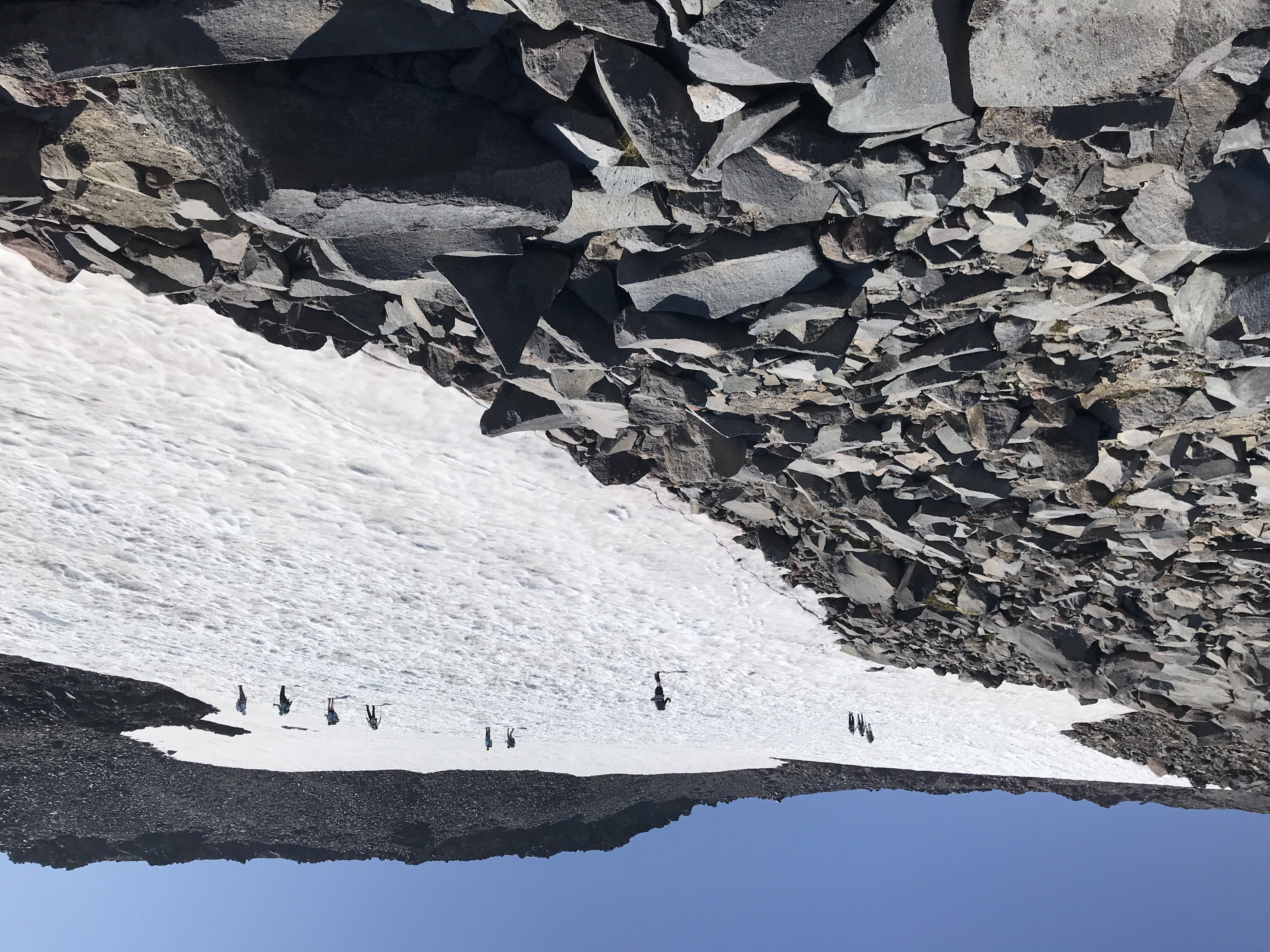
DAY THREE: Layover & Hike - Snoqualmie Pass, WA

I purposefully planned this as a layover day so I could hike. I checked out the trails on my phone and settled for the closest trailhead. I decided on Kendall Katwalk. What a spectacular hike! holy shit! A couple heading back down told me that I'd reach a point on the trail when the freeway noise from I-90 was miraculously disappear... and they were right! I found myself in a gorgeous trail in the forest and across some rock/boulder fields, going up, up, up. More jagged peaks formed a semi-circle. I was driven to keep going up to see more amazing views. I passed many hikers and virtually all of them practiced social distancing and covered their mouths and noses. Just before I reached the Katwalk I chatted with a forest ranger who was carrying a shovel to ensure no one at the lake campground ahead didn't have campfires. She thanked me for filling out my hiker card at the bottom. I saw here again as I started my journey back down and she wished me well and to have a great rest of my hike. It made me smile.


NIGHT THREE: Summit Inn

I was so exhausted when I reached my car. It felt so good to take off my boots and put on my sandals. My knees held out on the descent and kept my toe pain at bay.

I took a quick drive to Lost Lake just behind Keechelus Lake. I knew the restaurants closed at 8pm so I kept it short. I let a Toyota prod me to drive through the potholes faster than was comfortable but was still appropriately cautious.

I decided on pizza & salad for dinner at Pie for the People NW. The pizza was really good but the greek salad was amazing! I finished a salad-for-two. Mmmm.


DAY FOUR: Travel - Snoqualmie Pass, WA to Chelan Lake, WA

Shit show in Leavenworth, incident with tailgater, :( crowds at the lake
I get sandwich supplies at Safeway and drove up to Echo Ridge Recreation Area Trailheads.

Despite the crowded beaches, the area around the Riverwalk Inn was perfect and quiet. I walked around and noticed few people wearing masks. No wonder nearby Wenatchee is a Covid-19 hotspot.

NIGHT FOUR: Riverwalk Inn

wandered around until dusk. reminded me of lake isabella.


DAY FIVE: Layover & Hike - Chelan Lake, WA & Methow, WA

I knew when I arrived at Lake Chelan yesterday that there was no way I was going on that tour boat. Unfortunately I'd already missed the deadline to cancel the reservation and get a refund the previous day. I'd been hiking then.

The weather was gorgeous and not very hot when I got my start. It was a beautiful drive along Hwy 97 and the Columbia River. I stopped at the Wells Dam Rest Area And Information Center and snapped a couple photos.

I drove passed the turn off for Hwy 153 to top off the gas tank in Pateros. This short drive to the Gold Creek Road turnoff was a preview of my drive along the Scenic Byway the following day. At the beginning of Gold Creek Road I passed some local residents who waves and smiled. Definitely a good sign. As I wound my way up the road it turned to gravel/dirt. I was grinning ear to ear. This is what I got the Jeep for. It took about an hour to make it up to the top.

I passed a couple of cars coming down but I was not prepared for the parking lot to be nearly full. I found a spot and parked. I geared up and started the day's journey. The parking lot serves mountain bikers, horse riders and hikers. The trail to Crater Lake, WA is for hikers and horses.

The trail to the lake was 4 miles shorter than my hike to Kendall Katwalk but nearly the same elevation gain. As badass as I was feeling, seeing kids with their parents on the trail put things in perspective but also gave me some motivation (if they can do it, so can I).

It's funny. I wanted the solitude but also some reassurance that I wasn't really alone (if something were to happen). Virtually everyone I passed did not have a face mask but respected the social distancing, a contrast to my interactions with people on the Katwalk trail.

When I got the horse camp at the lake, I still didn't realize I'd reached the lake. There forest went right up the shore and the water was very still. There was a small trail around the lake but it wasn't super obvious. I found a path to the water and snapped some photos.


The mosquitoes and biting flies were out in force. I had a mosquito net for my head but I was getting stung. I saw an outcropping of rocks on the shore across the lake and started to make my way over there. It was already 3 pm and I had another 2+ hours back down to the trailhead.

I decided to have my lunch at an overlook about 20min back down the trail. I expected to hear or see other hikers at the lake but it seemed like I was alone.

At the outcrop I took off my top layers to dry them on a big rock. I was still get harassed by the insects so I quickly ate my sandwich and geared back up.

About a hour from the lake I passed a mom and her two young daughters. It was at the bottom of all the steep switchbacks and rapid elevation gain. They asked how much further. I said an hour and went on my way.

I remembered crossing a bridge and kept thinking "when I get to the bridge, I'll stretch and drink some water". I'd find it much further down the trail. "Where is the confounding bridge?" (line from Led Zeppelin's song "The Crunge" from Houses of the Holy. I keep reciting the lyrics.

I finally reached the trail junction and let a guy on a mountain bike go ahead. 20 mins later I'd reached the parking lot. Most of the cars were gone so I'm guessing most of them took the Eagle Lakes trail. (Next time :) I felt accomplished and tired.

I got in the Jeep and put it on 4wd. I was euphoric on the way down, playing Beth Orton's Central Reservation. I passed a couple of vehicles. Luckily one of the times, I had room to completely pull off to let a big truck and horse trailer by. Right behind them was a middle aged woman and older man in a town car. I'm thinking I'm badass in my 4WD Jeep with 2" lift and fancy 33" tires and here are these people in town car. LOL. Reality check.

NIGHT FIVE: Riverwalk Inn

I ordered dinner from a nearby bar (takeout) and got overpriced tacos and a big salad. The pizza joint across from the Riverwalk Inn was closed according to Google. I guess I should have looked out the window or called. Oops. 6 and one half dozen of the other.


DAY SIX: Travel - Chelan Lake, WA to Concrete, WA

Contrast: transition from Pateros (hot, desert) to rugged mountains @ Washington Pass and Ross and Diablo Lakes.

Hike at Diablo Lake

NIGHT SIX: Cascade Mountain Suites - Mt. Baker Hotel

weird check in and car/parking incident in Concrete

meal at nearby restaurant.


DAY SEVEN: Travel - Concrete, WA to Portland, OR

Trip down Mountain Loop Highway. Scouting for future trip.

Couldn't get a ferry reservation from Whidbey Island to "mainland" on the day or time I wanted, nor was there any available camping on the island or a reasonable room rate so I opted to skip the ocean/island route home. The Mountain Loop Hwy was serendipitous discovery and I was able to stay away from major highways, zigzag my way through the state, and continue the "rugged mountain" theme of the trip.


-----------------------------
no touchy (branches)
fellas (ants), holmes/homie (insects),