
 |
 |
| AllTrails maps |
Getting There
This was Day 7 of my Road Trip. I stayed on NF-52 along the Nisqually River the night before because I hadn't made accommodations after leaving Snoqualmie Pass.
I was up early and since I didn't have any gear to pack, I just hopped in the front and drove to the Park.
There was already a long queue of cars waiting to get in but something to be expected for a summer Saturday morning.
Once I got in, the cars were well spaced so it was soon cruising mostly alone. Cars peeled off at various viewpoints and trailheads. I was heading straight for Paradise. By around 8-8:30am the main parking lot was already full but I found a spot in the first overflow lot.
I took my time gearing up, then headed out.
The Hike
Distance: 9.73 mi
Elevation Gain: 2,654 ft
Moving Time: 4:18:36
Avg Pace: 26:34
Calories: 2,279
Total Time: 5:13:51
The Ascent
Since I was on the left side of the trail system, I hoped on Skyline Trail, then Dead Horse Creek Trail. At 6135', I hopped on the Skyline Trail briefly, then onto the Glacier Vista Trail. Then, back to Skyline to Panorama Point, so many trails crisscrossing.


I really hadn't planned my hike but the weather was perfect and I wanted to gain as much elevation as I could. The spots I'd hiked the previous Tues were swarming with people so I was also seeking fewer casual hikers. I headed up the Pebble Creek Trail which eventually is used by mountaineers heading to the Muir Camp and the summit. I climbed to the snowfield and stopped. I had crampons in the car (dammit!). Most people had microspikes but a few continued without. I figured going down without spikes was going to be the challenge.
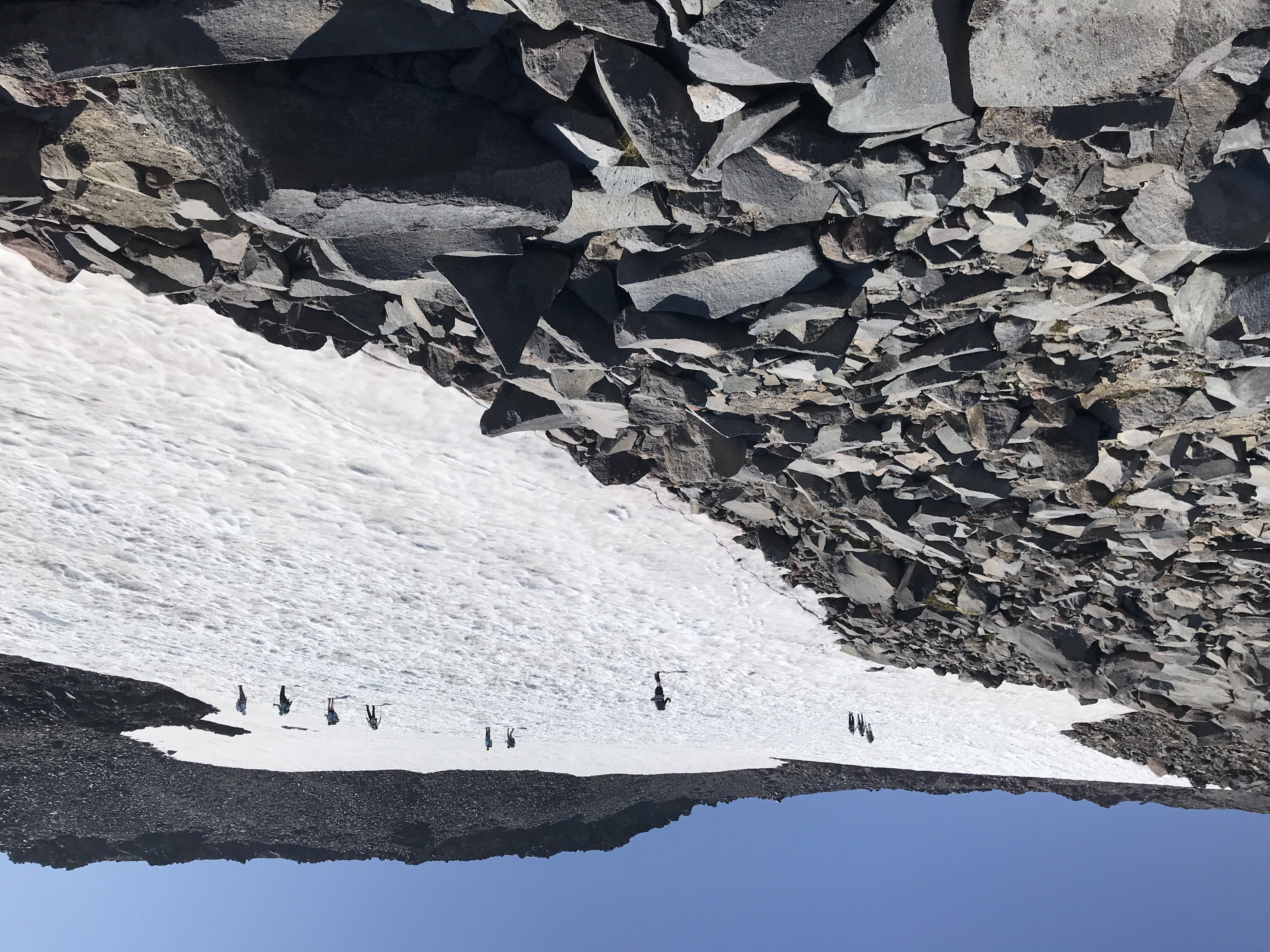
Another hiker who appeared to be contemplating the same thing: go on without spikes? I said "Let's go for it". I just went up the first 'hill'. I saw the dirt trail on the left so made my way over the rocks. I crawled up the ridge. I went as far as I could: 7444'.

Distance: 3.2mi - Elevation Gain: 2080'.
I descended from the ice field safely and found a spot to stare at the quiet giant looming above. There was a perfect rock to lie down on.
 |
| The view (though stretched) |
The Traverse
I followed my route from Tuesday, continuing on the Skyline trail, below McClure Rock and winding downhill. Instead of taking the Golden Gate Trail back to the lodge, I kept going on the Skyline Trail.

When I got toward the end, a couple was resting at a small cairn. The actual end of the AllTrails trail is buried in the snow but I think I got with 800' of the end.

 |
| End of the Paradise Glacier Trail 800' ahead |
The Descent
On the way back, instead of crossing the snowfield again, I followed a rocky ridge for a bit, while keeping the trail in sight. (I'd planned to knock down pile of rocks someone had left. Only trail makers are okay). I saw another one a few ridges over. I was really off-trail at this point. I was going to cross a patch of snow and looked down. Mountain Lion tracks in the snow. Not big, maybe a adolescent or female. They looked somewhat fresh, i.e. given the sun/heat, I'd expect older tracks to melt & lose shape. IDK.
I stopped, took the photo, and turned around. In hindsight I should have backed up first and scan the area. Anyway I walked briskly toward the ridge and eventually to the trail. Once I had some distance I turned around and scanned the horizon. Once I was on trail again, I felt safer for no good reason. Why should the snow make me more vulnerable than dirt? False sense of security. (Maybe like finding a forest or logging road when you're lost and feeling like you've made it but in reality you still might be in a pickle.)
 |
| Mountain Lion tracks |
I made it back to the Skyline Trail. The hike was sort of over for me. So many people. The views were gorgeous but I just was ready to get back to the car. I'd taken about 100 oz of water and had finished all of it. I wasn't sure about drinking stream water, esp. at the lower elevations.
When I got to Myrtle Falls the place was so packed, it was uncomfortable. I donned my mask and weaved through the oblivious throngs.
Post Hike
When I got back to the parking lot, dozens of cars were prowling by looking for a parking space, and when they saw me, it was like sharks circling prey. I'd barely put down my pack and hiking poles and people were asking when I was leaving.
I was tired and this annoyed me. I flatly responded "not for awhile". In hindsight, I could have deflected by saying I was waiting for someone else instead of coming off as "I'll go when I'm good and ready". I looked across the lot and saw a guy snoozing in a camp chair. He knows.
One of the pleasure of hiking (or skiing, snowshoeing) is taking off your boots. When I had accomplished this, my mood improved. I changed into a dry shirt and was feeling much better. Another car came by and asked when I was going. Even though I was close I gave my "not for 10-15mins". The driver said "cool, I'll pull over." I liked that. I immediately chose them to take "my" spot. I quickly finished stowing my gear and told them I'd leave right then. I hoped in, backed out, and waved to them.
Leaving the park, I passed by such a long line of cars waiting to get in. It must have been 2 miles of cars. Ugh. It was time to go home (or at least get out of here.) I was stoked about the day of hikes and thought about it as I drove west.