 |
AllTrails map
|
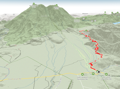 |
AllTrails map
|
Getting There
Take I-5 from Portland to Woodland. It's 23mi from Kenton to the exit 21.
There are a few gas stations to fill up here.
It's
46.2 miles to the Ape Canyon trailhead and it takes about 1.1 hrs (if
you're going the speed limit ;). From WA-503 (out of Woodland) take this
passed Merwin, Yale Lakes to the turn off for the following: Ape Caves,
June Lake, Climber's Bivouac, Ape & Lava Canyons.
The parking lot was and side road were full. I found a spot off Lava Canyon Road.
The Hike
Length: 10.99 mi
Elevation gain: 2,277 ft
Moving time: 3:43:32
Avg. pace: 20:20
Calories: 1,970
Total time: 4:14:27
Fitbit
Steps: 25,048
Zone Mins: 40 (36 Fat Burn, 4 Cardio & Peak)
Floors: 271
Calories: 3,594
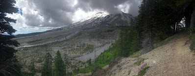
The weather perfect for a hike, a bit overcast, in the 60s and good trail conditions. I love this hike because it flanks the 40+ yrs old lahar flow but you get to experience the old forest. It's similar to June Lake hike in that regard.
I've said it before but this hike is not difficult from the elevation gain but it's a decent length.
I didn't see very many people going up, just one couple, but several on their way down, including several mountain bikers. I didn't start my hike until around 1pm. There weren't many bugs out either but I was ready with spray and itch ointment. I forgot my rain fly and a few times the skies were pretty dark but I did have a compact rain jacket.
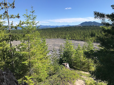
When I reached Pumice Butte and trail junction to June Lake I stopped briefly to chat with a woman on her way down. Then, continued north on the Loowit Trail to the creek.
Originally, I'd hoped to make it all the way out to Plains of Abraham and Windy Pass but by the time I reached the creek, it was getting a bit too late. I found a spot to sit, have a snack, and just chill. I have a tendency to go for distance and don't pause enough.
On the way back through Pumice Butte, I found my spot overlooking the lahar field and the trees covering the trail back. I was so peaceful and quit. Not much of a breeze and no bugs.
The hike back to the car was chill and uneventful. I meditated a bit but also made a point to listen to the birds and other sounds. My body felt fine, no knee issues.
 |
MSH from near the top of the trail
|
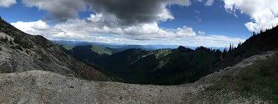 |
Looking SE from the creek
|
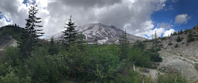 |
From Pumice Butte
|
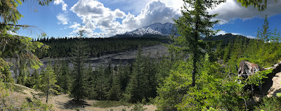 |
From lower on the trail, lahar flow
|
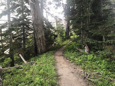 |
Winding trail
|
 |
Selfie from Pumice Butte
|
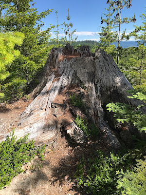 |
Old tree stump
|
 |
Another SE view
|
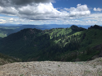 |
Rest stop view
|
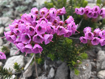 |
| Pink mountainheath |
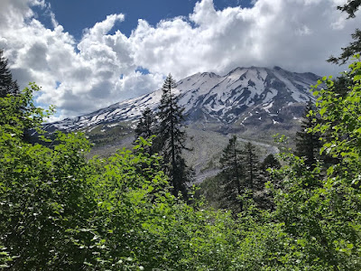 |
Lovely Loowit (MSH)
|