 |
| AllTrails map |
 |
| AllTrails map |
Getting There
Take I-5 from Portland to Castle Rock. It's 55mi from Kenton to the exit 49.
There are a few gas stations to fill up here.
It's 62 miles to the Johnston Ridge parking lot/trailhead and it takes about 1 hr (if you're going the speed limit ;).
There's was dense fog in spots, so heavy that I put on my hazard lights to be more visible to cars coming up behind me.
This lot had quite a few cars compared to the last few visits. It was 4th of July weekend.
 |
| AllTrails map |
The Hike
Length: 10.82 mi
Elevation gain: 2,365 ft
Moving time: 4:10:29
Total time: 4:43:00
Avg. pace: 23:09
Calories: 2,207
Fitbit
25,998 steps
42 zone mins
330 floors
3,758 calories
I really didn't plan on going up to Coldwater Peak. When I got junction for Harry's Ridge the fog was pretty thick.
I figured I'd see how far I could get. There are recent trail reports saying the snow was still making it difficult to follow the trail. I had microspikes and poles so I made a go of it.
I passed a couple coming down the trail. Every time I see other hikes, it gives me confidence to keep going. The snow was minimal where I expected it. There were some patches but with good foot holes it wasn't any problem.
The only place I was nervous was near the Hole in the Rock. The foot holes weren't great and the slope was 40 degs and about a 50 foot slide into trees. I envisioned busted ankles or worse, esp. since there was a group of about 8 people on the lookout above.
I made it across safely and continued on my way. More hikers coming in the other direction.
I noticed virtually no one was were decent footwear. Mostly trail shoes. I kept my microspikes even on the dirt.
I keep an eye on the clock. I wanted to be heading back by 3pm. I was also weighing the fact that there were some challenges on the return trip, and my fitness level.
I reached the Coldwater Peak junction about like 3:10p. I rationalized that I could go until 3:30p. I started the final ascent. I passed a couple there were not prepared. No poles, or appropriate footwear. I made good progress until about a 1/3rd of the way up.
I saw a mountain goat in the bushes so stopped to look and assess my route. I was jumping switchbacks by climbing up the steep, muddy hillside. I noticed lots of poop and deep holes with vaguely recognizable hoof marks.
Suddenly I caught a glimpse of a large buck in the direction I was heading. I instantly got a little spooked. I was definitely outmatched on this terrain, even with poles and microspikes. The buck looked imposing and glared in my direction.
As I retreated down the hill a bit, I realized the other goat I'd seen was trying to catch up with the buck. When I was far enough away, it ran to join the buck. There might have been others in the herd. The big buck keep an eye on me.
It was now like 3:30p and I just didn't think it was worth reaching the summit. I started my descent. There was another solo hiker. I stopped to mention the buck. I reached the couple from earlier and told them as well and that it was long hike back.
My legs and knees were feeling good but I wanted the have plenty of sunlight. The fog was darkening up things quite a bit. I'm glad I had some extra layers.
By the time I reached the Harry's Ridge junction, it was pretty dark from the fog. To my surprise, there were still hikers heading out. It was about 4:45p.
The hills weren't bad, I made quick work of the first climb out and then the long series of hills back to the trailhead.
I made I back to the car at 6pm. I thought about the solo hiker and couple at Coldwater Peak. I hope their hikes back were okay.
 |
| Heavy fog to the south west |
 |
| Saint Helens Lake |
 |
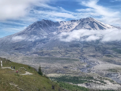
| Mt St Helens |
 |
| Saint Helens Lake |
 |
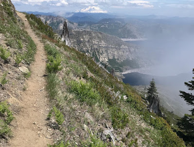
| Mt Adams and corner of Spirit Lake |
 |
| Mt St Helens |
 |
| Hole in the Rock |
 |
| Spirit Lake and Mt St Helens |
 |
| Coldwater Peak and Saint Helens Lake |
 |
| Saint Helens Lake |
 |
| Mt St Helens, fog in the valley |
