Featured Post

2024: My Year in Review

Another trip around the sun! I kept my same hiking goals from previous years: 52 hikes , 365 miles , 84,000 feet . However, I came up short ...

Showing posts with label Warrior Rock Lighthouse. Show all posts

Saturday, January 27, 2024

Hike: Warrior Rock Lighthouse Trail IV, St Helens, OR

Getting There

From Hwy 30, cross the bridge to Sauvie Island and head north passed the store. Turn right onto NW Reeder Rd and take it all the way to the end. Just before the beaches, the road turns to dirt.

A parking permit is required on the island: https://sauvieisland.org/visitor-information/park-permits/

The Hike

Distance: 6.41 miles
Elevation Gain: 84 feet


After the Jan 2024 snow storm and ice storm that came after it, I was itching to get out on the trail again. I knew the Gorge was still in rough shape with trees down, ice, road closures, etc. I figured I would be able to get to the lighthouse without too much trouble.

I also wanted to try out my Osprey 65L pack that had the horrible squeak whenever I got moving. During the sequestration, I applied silicone spray but it made it smell horrible so I washed it, intending to sell it back to Next Adventure. To my relief, the squeaks were gone for the most part. I don't recommend the route I took to get it fixed but in the end it worked!

As soon as I left the parking lot, I encountered really muddy conditions and big puddles. I'd planned accordingly, bringing my older boots but I was still weary about getting all the way to the lighthouse. It was just mucky and slippery.

Muddy trail

I got some confidence when I passed a couple on their way back to the trailhead and noticed another couple with a dog. They ended up stopping at clearing next to the water. I didn't talk to them, but it seemed liked they had gone as far as they wanted in these conditions; the dog looked pretty dirty - LOL.

After a short distance, the muddy mess was buried under a thick layer of leaves and I was able to keep a decent pace without slipping and sliding. This renewed my resolve to get all the way to the end of the trail.


Eventually, those people started back to the parking lot so I had the area to myself. I poked around for a bit, marveling at the quietness, fog, and occasional boat.

It was getting later in the day and since the sky was overcast, I wanted to make it back to the car with daylight to spare.

Somewhere along the way, I noticed some bird was squawking a lot, as if I was getting too close to a nest or something; they were warning other birds about danger, me! I looked up and saw two bald eagles. There was another one on a pylon in the river. After awhile, one of the birds on branches above me flew off. It had darker feathers and the other birds took off after it. It would land on a different tree and just as the other eagle landed next to it, it took off again. Maybe the male was trying to mate with a female and she didn't want any part of it. They continued this behavior in a semi-circle around me. I also saw a large nest in the tree tops.


About half way back, I passed three guys. When I reached the parking lot, there was only one other car remaining besides mine. It began to sprinkle just as I was driving out.

Friday, November 11, 2022

Hike: Warrior Rock Lighthouse Trail III, St Helens, OR

Warrior Rock Light

AllTrails map


Getting There

From Hwy 30, cross the bridge to Sauvie Island and head north passed the store. Turn right onto NW Reeder Rd and take it all the way to the end. Just before the beaches, the road turns to dirt. There is some washboarding but it's not as bad as on previous visits.

A parking permit is required on the island: https://sauvieisland.org/visitor-information/park-permits/

The Hike

Length: 6.95 mi
Elevation gain: 92 ft
Moving time: 1:55:12
Total time: 2:03:47
Avg. pace: 16:34
Calories: 1,158

Last time I hiked here was April 14, 2021. There were two school buses full of small kids at the beach. I saw several groups of people along the way but had the lighthouse to myself.

The lighting was amazing. I got some nice photos. No wind so the water was glassy. I tried to walk up the beach to the end of the island to see St Helens but there were a bunch of trees blocking the way. I could vaguely see the St Helens Courthouse and the 1/2 scale version of the lighthouse at the harbor.

The route is not that exciting to be honest. You skirt the beach in the trees for the whole time. There are a few spots where you can see the river and even some access trails. It's got a bit of the Blair Witch Project vibe at times. The occasional passerby helps to return the mind to "reality".


I glad to bump my hiking stats. This one makes #39.

https://api.roadtripsandhikes.org/hiking-stats/for/larry-moiola/?2022&full

AllTrails:

https://www.alltrails.com/explore/recording/warrior-rock-light-sauvie-island-06ee4c5


Wednesday, April 14, 2021

Hike: Warrior Rock Lighthouse Trail II, St Helens, OR


Getting There:


From Hwy 30, cross the bridge to Sauvie Island and head north passed the store. Turn right onto NW Reeder Rd and take it all the way to the end. Just before the beaches, the road turns to dirt. There are big sections of washboarding.

A parking permit is required on the island: https://sauvieisland.org/visitor-information/park-permits/

The Hike:

Length: 6.5 miles round trip
Elevation Gain: 42 feet
Type: Out & Back
Duration: 2 hours

This time I didn't stop at the lighthouse because there were some people over there already and I figured I'd give them space since I'd seen it before last Sept 2020.

When I reached the cove where the lighthouse is, I continued north on beach. I was going to see if I could get around the other side to see St Helens and the courthouse where the bell and 1/2 scale light is located but gave up when the shore sort of ran out.

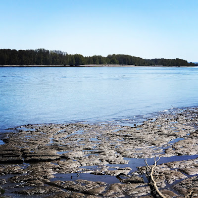
The tide was really low on the Willamette so there you could see well beyond the shoreline. I stopped briefly at this concrete structure that seemed like a bunker/lookout but there was just sand underneath.

Low tide

Concrete structure

View of lighthouse from down the beach

Lighthouse in relation to St Helens


Monday, September 28, 2020

Hike: Warrior Rock Lighthouse Trail, St Helens, OR

Getting There:

From Hwy 30, cross the bridge to Sauvie Island and head north passed the store. Turn right onto NW Reeder Rd and take it all the way to the end. Just before the beaches, the road turns to dirt. There are big sections of washboarding.

A parking permit is required on the island: https://sauvieisland.org/visitor-information/park-permits/

The Hike:

Length: 6.5 miles round trip
Elevation Gain: 42 feet
Type: Out & Back
Duration: 2 hours  

This is an easy hike. I'm surprised that AllTrails shows any elevation change. There is one fallen tree that you have to go around and a couple others that you can walk through single file. Otherwise, the trail is wide and was apparently used as an access road to the lighthouse in the past. 

You cannot climb on or inside the lighthouse. It's not the kind with a Fresnel lens, but cool landmark to see.


"Warrior Rock Light is a lighthouse on Sauvie Island in the U.S. state of Oregon, which helps guide river traffic on the Columbia River around the Portland, Oregon area. It once contained the Pacific Northwest's oldest fog bell. It is Oregon's smallest lighthouse, and the only lighthouse, or one of only two lighthouses, still operating in Oregon which are not on the Pacific Ocean, depending on whether the Umpqua River Lighthouse is considered to be on the coast or on the Umpqua River."

Source: https://en.wikipedia.org/wiki/Warrior_Rock_Light

Some more views from the point: 


Difficult to see, Mt St Helens is peeking over the horizon, right of center (photo below). She is pretty barren of snow at the moment.