Showing posts with label Sandy River Delta. Show all posts

Thursday, July 6, 2023

Hike: Sandy River Delta, Troutdale, OR


Getting There

The parking lot is accessible from Hwy 84 just east of Troutdale. From I-84 eastbound, take Exit 18 and follow the Crown Point Highway north under the freeway. It changes to Thousand Acres Road. Follow that into the parking just past the off-on ramps.

You can use a Northwest Forest Pass or buy a day pass at the vending machine.

The Hike

Length: 4.58 mi
Elev. gain: 62 ft
Moving time: 1:24:18
Avg pace: 18:25
Calories: 849
Total time: 1:26:08


I was planning to pick up some items from Costco near the airport but got there too early, before they opened. I took the opportunity to go for a quick hike around SRD.

I knew it would be warm but since it was still before 10am, it wasn't too bad. I had my favorite straw hat but I didn't anticipate the mosquitoes. 20 ft from my car, I paused to start the hike tracking on AllTrails and got bit several times. Ack! 

Not a welcome start to the day but I continued on. I've been paranoid about ticks as well and decided to stay out in the open despite the direct sun.

I followed the Confluence Trail towards the Bird Blind. Then, took the Meadow Road to the end, Thousand Acre Road. I didn't want to venture into trees because of the lack of bug spray on-hand so I doubled back toward the Confluence Trail.

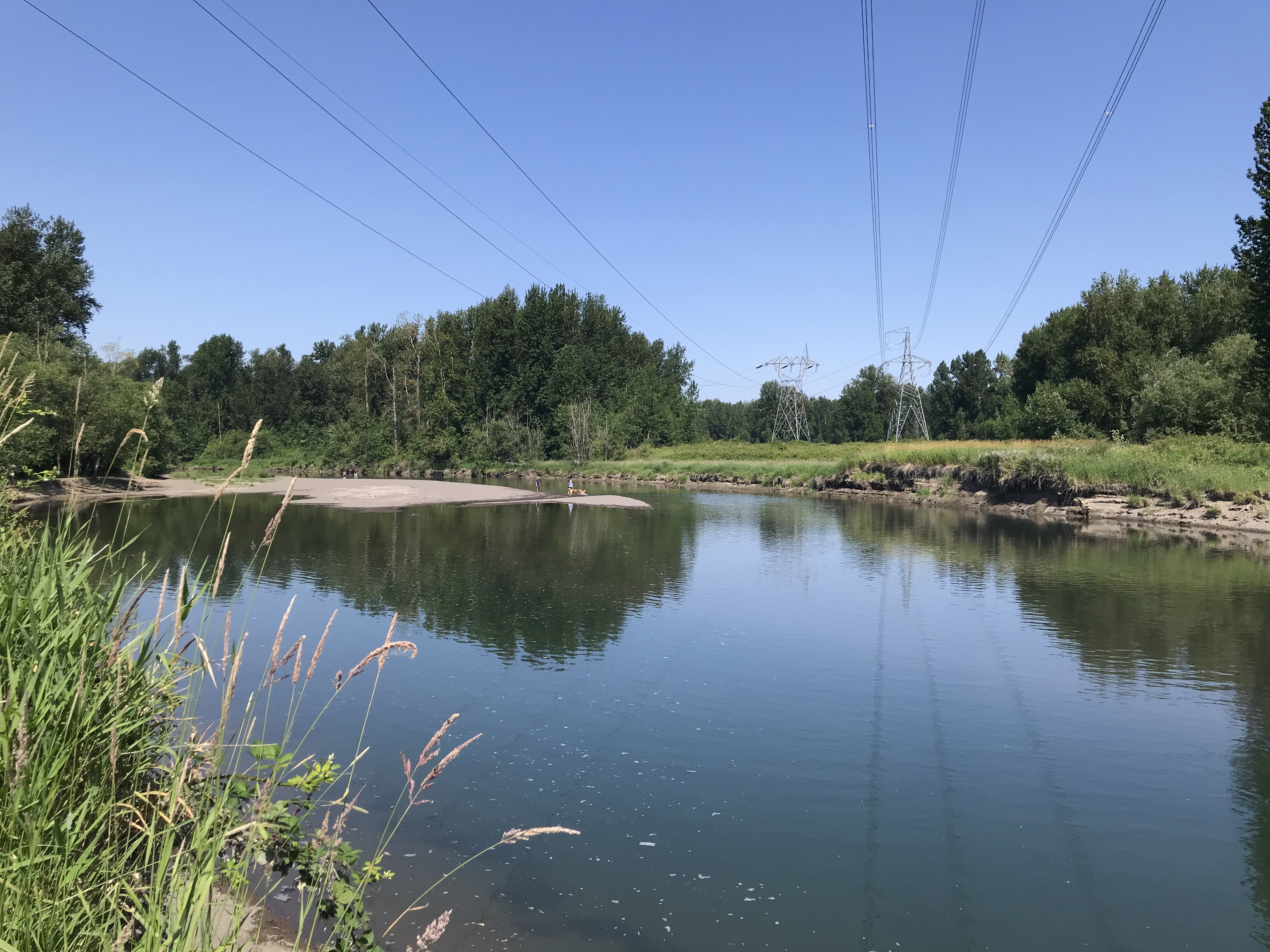
I wandered over to Channel and watched the dogs play in the water for a minute.

Old Channel Trail

The channel

I wasn't ready to go back to the car just yet so I took the Meadow Road to the end for a 2nd time. I knew the trail to the river was wide so I decided to go as far as I could. I passed a woman and her two dogs. I pulled out my phone to check the route and was immediately swarmed by a dozen mosquitoes. 

It wasn't my plan to double back to hastily but I had to get out of there. The woman must have been wary that I was following her but I didn't know what to do. If I could have said something about the bugs, I would have. 

At the first opportunity, I veered off down the Meadow Road and brushed my arms and legs to demonstrate (possibly) why I'd turned around so quickly. I never looked back but kept a brisk pace.

It was time to go back to the car. I took the Confluence Trail back to the parking. When I got to where I'd been bitten earlier, I paused and hoped to avoid more bites as I'd already racked up a dozen or more, including on my cheek and earlobe which was swollen.

I rushed through the trees to my car and hastily hopped in. Whew, I made it without any more bites.

I've been extremely stressed and depressed about selling my house. This little outing helped a tiny bit.


Thursday, May 18, 2023

Hike: Sandy River Delta, Troutdale, OR

Bird Blind by Maya Lin (Confluence Project)

Getting There

The parking lot is accessible from Hwy 84 just east of Troutdale. It was warm day. The lot was about 3/4 full. Made sure to pay the $5 day fee. 

"The Sandy River Delta is just north of I-84 off Exit 18. Driving east, exit the freeway and turn right at the T, go under the overpass and enter the park at the sign. If you’re driving west on I-84, take Exit 18 and take an immediate right. At the parking lot, look for the gravel path marked “Confluence.” Follow the path for 1.2 miles to reach the Bird Blind."
https://www.confluenceproject.org/river-site/sandy-river-delta/

The Hike

Length: 3.96 mi
Elev. gain: 75 ft
Moving time: 1:11:31
Avg pace: 18:04
Calories: 720
Total time: 1:12:14


I was wearing my sandals and just out of a light spin. I had my favorite straw hat as well. There were lots of dogs and their people. I basically did a figure-8, taking the most direct route to the bird blind.

The Sandy River Delta is one of six River Sites as part of the Confluence Project.

I remember doing trail maintenance three times when I was with TechTracker. They were weekend, work sponsored outings. I feel a certain affinity to place because of my involvement.

I was a bit surprised to find the river level was so high. Last time I was there on Dec 3, 2022, you could walk out beyond the bird blind. Now, it was well submerged.

East Channel
Bird Blind

Columbia River
 
Boundary Trail

Sandy River

Meadow Road


Confluence Trail

This is one my go-to spot when I don't have a lot of time and just want some low key exercise and fresh air. Unfortunately, it also a reputation for encounters with off-leash dogs and careless dog owners. 

I hate to focus on the negatives but it must be said. I passed several dog+owners and mostly had no issue. However, when I was on the Boundary Trail, I passed a guy and a dog who took interest in me but trotted by. When the man also passed, the dog turned and nipped at my heels. I didn't look back but he seemed surprised and reprimanded the dog. I wasn't bitten but put my on edge a little. I love dogs!

Then, on the Ranch Dike Trail, two walkers with three off-leash dogs approached. I was apprehensive and even said to myself "please don't maul me". As we got closer to each other, one dog ran ahead, barking aggressively. Immediately, one of the owners called to the dog and started to apologize. I stopped in my tracks and raised my hands to protect them. That person had the other put on a leash. While they were distracted, the other two dogs began barking but quickly retreated when the owners reprimanded them. I tried to be cheerful but was annoyed. Talking to the 1st dog: "What's the matter? why did you do that?". The classic "my dog never does that. He's fine and won't bite." I was prepared to defend myself. Sigh.

---

In hindsight I've had many odd dog encounters out there over the years. A Rottweiler ran up to me and go uncomfortably close. I didn't see the owner was out of sight for several seconds, then said nothing to me as the dog returned to their side. Another time, a dog with muddy paws actually jumped up on me. I was were rain gear so not a huge deal but still annoying.

Saturday, December 3, 2022

Hike: Sandy River Delta Loop, Troutdale, OR


AllTrails map

Getting There

The parking lot is accessible from Hwy 84 just east of Troutdale. It was rare clear, albeit cold and windy, day. The lot was nearly at capacity, save the pull-through spots for RVs. There were cars in these spots so I figured 'strength in numbers'. 

After my last hike at Dog Mtn and the car break-in, I'm a bit wary of opening this can-o-worms, esp. given my employment situation and past experience with a busted window and theft. 

I was originally going to hike at Hamilton/Beacon Rock but decided to bail on that idea when I got to the parking lot. I'd gotten a late start and only had a couple hours of day light. Plus it was really windy and in the 30s.

Normally, I would have minimal stuff in the car but since I wasn't taking my pack and other stuff, I was doing exactly what you shouldn't do, leave valuables in the car. Despite the constant flow of cars looking for an open spot, I still wasn't totally comfortable leaving my car.


The Hike

Length: 5.67 mi
Elevation gain: 108 ft
Moving time: 1:40:31
Total time: 1:44:28
Avg. pace: 17:43
Calories: 1,010

I've got less than a month to reach my 2022 hiking goals: 52 hikes, 365 miles, 84,000 ft of elevation, a tall order given the winter weather and occasional poor air quality. I wanted to at least get some fresh air and book a few miles/steps. My health has been slipping with the constant anxiety I've been experiencing this last month and change.

It was a good decision. Even though there were lots of people and dogs, I got some solitude. I took a direct route to the Maya Lin Bird Blind.

From there, I went down below to the mud flats since it was low tide. I took a few photos, then headed south on the Meadow Trail back towards the parking lot.

I hopped back on the Confluence Trail and walked back to the power lines to the water access point on the East Channel. That's where the Ranch Dike trail in the trees starts.

I followed that to the Thousand Acres Road. I walked out to the Sandy River and continued along the shoreline.

I cut back through the bushes on a spur trail and passed a homeless camp. Yikes. The trail suddenly got a bit overgrown with blackberry vines. I kept thinking, please don't be any people to rob me or take my car keys, phone or wallet, or worse, kill me. Honestly, I don't even know if was an active camp, could have been abandoned or residents were out getting supplies. 

I was happy to get back to the main trail and see other people. I continued my loop on Meadow Road to the Meadow Trail, then back to the car.

Yea! No vandalism! 

Such a shame that worrying about a car break-in while hiking is just normal these days. Fucking scumbags!


Tuesday, May 25, 2021

Hike: Boundary, Meadow, Confluence, and Sandy River Delta Loop, Troutdale, OR

AllTrails map


Length: 5.66 miles (Loop 3.3mi plus more)
Elevation Gain: 59 feet
Type: Loop
Steps: ~12,393


Getting There

I stopped at the Subway at Cascade Station. I was thinking about popping into Target to get some sundries but I didn't have a solid list so bailed and drove out to Sandy.

It was raining when pulled into the nearly empty lot. Even as I sat there, I wasn't sure if I was going to hike or take off.


The Hike

I had to get out to get my rain coat. I knew then that I was going in my Keens and leaving the hiking boots in the car. I zipped up and locked up. I noticed a parking pass was required so I grabbed my Oregon State Park pass out of the glove box and put it on the dash.

I went for the Boundary Trail. I was trying to find the junction I found last time I was out there but I never did. I keep going along the edge of the park toward the bird blind. There were tons of puddles but most of the ground was hard packed soil or clay. I found a few surprise spots of mud but didn't slip n fall.
I was able to take off my rain coat for awhile the another downpour happens. I was getting drenched on my legs. I expected it and welcomed the water. 

I made a quick spot at the bird blind but made my way back to the Boundary Trail instead of following the channel like usual.

When I got back to the power lines, I went for a look at the cove where people let their dogs play in the water. I followed the shore as long as I could. On the way back, a large dog (50+ lbs) came running toward me. I didn't see the owner. (Last time I was there, a dog jumped up on me with its tail wagging; the owners were mortified and apologetic). I wasn't sure if this dog was going to do the same or bite me or what.

He skimmed by and tried to lick my hand. The owner appeared and called to the dog who obeyed. She didn't say a word to me and took off down the trail. So weird. 

I was going to take the same trail and figured the woman and her dog was trotted off however I was only a few feet in when I saw here stopped. The trail was narrow and overgrown with foliage. I quickly surmised that I didn't want another encounter with that dog and not in a narrow area in the trees.

I turned on my heels and walked away as casually and quietly as possible. I headed back to the power lines where I had detoured. There was a couple with two dogs who made not effort to control the dogs nor assure me that they were "friendly". Weird. Fuck those people. (I encountered more dog n owner pairs, once with two on-leash dogs and one with off-leash who stopped, grabbed the dog's collar and left me pass; responsible owners!)

I got to the meadow near the parking lot and didn't want my walk to end so early. I keep going toward the Sandy River. I saw a sign somewhere that said "0.3 mile to Sandy River". It was easy walking but came across a burnt log that was deliberately placed across the trail. There were and probably still are homeless people living in the park somewhere on the west edge. 

The further I went, the more spur and side trails I found. It was getting difficult to know which one was the "0.3mi trail". I'd left my phone in the car cuz the battery was low. I had no GPS to help me get back. I decided it wasn't worth it and didn't want to stumble into someone's camp. (I suspect the rude lady with did was a "resident" and scouting for "stuff" and not a casual hiker with her dog.)

I finally headed toward the parking lot and didn't really see anymore people.
It was a refreshing "hike" even though I prefer some vertical on my treks. 
Not bad for some exercise: 5 1/2 miles + 12K steps.


AllTrails: