
Showing posts with label Vista Ridge. Show all posts

Sunday, July 24, 2022

Hike: Base of Barrett Spur, Vista Ridge Trail, Mt Hood, OR

AllTrails map


Getting There

From Hood River, follow directions to Lost Lake and take the turn off on Lolo Pass Road. Go for 3.1mi. Look out for the sign for the Vista Ridge Trailhead via Forest Road NF-16.

From Hwy 26, take Lolo Pass Road at the Zig Zag Ranger Station. It's about 26 miles (1h 9m) from here. The road is closed at Lolo Pass (NF-18), so take NF-1810 for 10.5mi to a sharp right on to NF-16. 

---

Follow NF-16 uphill for 5.5mi and look out for a sharp left and NF-1650. From here is dirt/gravel. There are a few sections of washboard but otherwise the road is in great shape, no potholes.

The Hike

Length: 8.57 mi
Elevation gain: 2,881 ft
Moving time: 4:21:21
Total time: 5:02:08
Avg. pace
: 30:29
Calories: 2,303

This is my 3rd visit to this trailhead. The first time was July 16, 2020. I made it to the Eden Park Trail but turned around because I didn't have microspikes to negotiate the snow. The second time was June 12, 2021 and the trail was in rough shape due to dozens of downed trees, esp. at the point where the old Vista Ridge Trail intersects. I bailed and hiked Wahtum Lake/Ant Hill later that day.

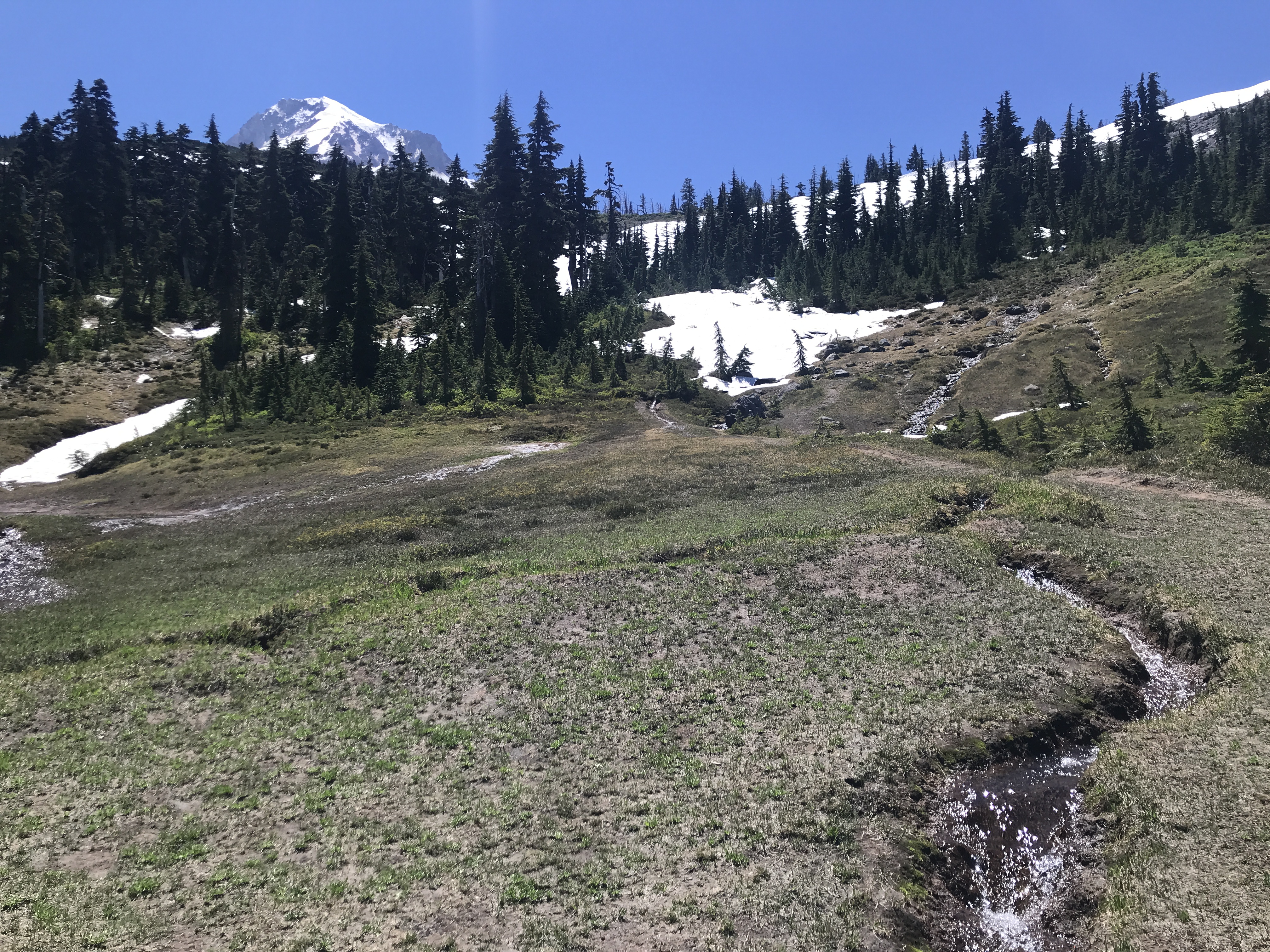
This time was had my eye on Barrett Spur esp after my recent hike above McNeil Point at Cathedral Ridge/Ho Rock. At the Eden Park junction, there was a huge bank of snow on the direct route. I put on my microspikes and did my best. Eventually, I dropped into the trees and bobbed and weaved up the hill. The trail was buried somewhere below. I finally made it to the Timberline Trail.

I crossed path with two hikers/campers. They said the snow wasn't bad further along. That was good news. Except, I quickly started heading up towards Barrett Spur and up a huge patch of snow. It was like this for most of the rest of the way. The trailblazing was okay, lots of animal paths or other hikers to follow.

As I got close to my destination, the mountain ahead was daunting. The last bit of the hike was up a steep hill. There wasn't an obvious trail to follow, even when I was close. I found a bit of a trail and started going up but I knew it was going to be tough. According to AllTrails, it's a 0.4mi and 200-300 yds-45deg scramble.

I was thinking about my descent and making it back safely and before sundown. I had plenty of daylight but considered the risk too much for a solo attempt. I'd spent a lot of energy trailblazing. I vowed to come back with another hiker/friend and/or solo when there's no snow to contend with.




Saturday, June 12, 2021

Hike: Vista Ridge Trail II, Mt Hood, OR

AllTrails map

Note: I was not able to complete this hike. I only made it #626/626A junction (0.4mi one way), blue arrow. The map above shows the whole route including Cairn Basin.

Getting There

This was the first time I'd been on Lolo Pass Road since last fall. I keep meaning to buy a small electric chainsaw in case I encounter a smaller downed tree blocking the road. Fortunately, there weren't any new falls. (I did stop to move one trunk further off the road.) Other than that, vertical clearance was good and surprisingly not as many pothole as I remember from last time. 

The Lolo Pass trailhead had about 25 cars but there was still room for a few more. (I've been through there when it was far more packed.)

I only half expected to get out on the trail. I just wanted to scout the road to the Vista Ridge Trailhead. It was it really good shape and I only saw two cars coming down (a Jeep Patriot, Chevy Pickup). I was surprised to find the trailhead empty. I like the solitude but sometimes it's nice to know there are other humans around.

I grabbed my "usual" parking spot. LOL and geared up. I packed my crampons in-case I need to cross a large snow patch.


The Hike

Length: 0.8 miles round trip
Elevation Gain: 95 feet
Type: Out & Back

As soon as I started the trail, I was hyperaware of the sounds around me. I nervously whistled and talked out loud to no one,.. well, hoping to alert any wildlife that I was there and hopefully never see anything. 

I've gotten better about embracing the sudden noises because 9/10 it's a little bird or small mammal right next to the trail and just off. I clacked my hiking poles but they don't resonate very well but better than nothing. Of course, I do my duty as a good steward to bushwhack the new growth crowding the trail to keep it open for the next hiker.

There were still a few small patches of snow that had many footprints through or around them, the size of a throw rug, no biggie.

As I continued, my nerves quieted down a bit, esp. when I could see more daylight as I approached the ridge where Vista Ridge Trail (#626) meets Old Vista Ridge (#626A). This is where the area map and sign-in board are located.

At the ridge & 626/626A junction, before the signs

The photo above is what you see as you approach. The trail turn right under all that downfall. It was at least two big trees with trunks 6 ft in circumference and tall (20ft). I was able to skirt around them on the left (too much on 'going on' on the right).

I found the trail map/sign (intact) and the sign-in board (partially damaged) but beyond it were more downed trees as big as the ones I'd just detoured around. I could see short sections of trail, then massive horizontal obstacle.


Trail map and sign-in station

Looks like cleanup has started, fresh cuts

I didn't even try to go any further. Secretly I was a bit relieved. I don't like to back down from a challenge but since I was the only hiker up here, any reason to abort was welcomed. I knew this trail continues to a burn area and more forest so I deduced that it was going to be difficult to stay on track for any distance.

I started back to the car, again, going way around the downed trees. I continued to talk out loud, specifically to bears and other critters. 

Ahead I glimpsed bright color and heard a dog bark. They'd heard me talking loudly to no one and moved off the trail. LOL. I told 'em that the trail ahead was in bad shape. (Actually, I was relieved to encounter other humans -- and dogs). I didn't mean to be a downer but the guy said "we didn't even expect to get this far." I tried to salvage my hyperbolic warning and tell them about the beautiful views at the ridge. I was exaggerating a bit but also trying to be positive.

When I got back to the trailhead, they had parallel parked.. I guess when I come back, I'll have to be a good citizen and park this was to maximize capacity. (I'd hate to drive all that way and find some a-hole had parked poorly).


Thursday, July 16, 2020

Hike: Vista Ridge Trail, Rhododendron, OR

Length: 4.2 miles (total loop is 7.6 miles)
Type: Loop
Elevation Gain: 1646 feet (full loop: 1781 feet)
Highest Elevation: 6600 feet (full loop: 5906 feet)
Duration: n/a


Getting There

I got an early morning start from Hood River and made it to the trailhead parking lot in about 90 mins. There were only two other vehicles there.


The Hike

I only went as far as the Eden Park/Cairn Basin/Timberline turnoff to the upper loop. I've been dealing with a foot issue. I cut my losses and started back to the trailhead, vowing to return to complete the loop.


The Map

https://www.alltrails.com/explore/trail/us/oregon/vista-ridge-trail-to-cairn-basin