Getting There
I took Hwy 26 from Portland to Zig Zag and turn left onto E Lolo Pass Rd. After 4.2 miles, turn right onto Muddy Fork Rd. After 0.7 miles it becomes 1828. Continue for another 5.6 miles until the paved road changes to dirt & gravel, veer right. The Top Spur trailhead 1.5 miles from the last junction.
The Hike
Length: 8.91 mi
Elev. gain: 3,068 ft
Moving time: 4:24:35
Avg pace: 29:42
Calories: 2,667
Total time: 5:04:41
Steps (Fitbit): 25,244
Floors (Fitbit): 347
I knew weather was changing quickly and rain was forecast in Portland on Thursday. I wanted to get one more good hike in before my MSH summit next week. When I checked the weather at Zigzag, it look like just a light drizzle and overcast but I was not expecting such a wet environment.
The drizzle made the forest and ground wet. Water was puddling and streaming down the middle of the trail. I had to be careful stepping on the roots and rocks.
When I reached the PCT/Timberline Trail junction, I filled out the form and slid it into the slot on the box. The dirt on the trail was only wet on the top and I could see fresh tracks from hikers doing the Timberline Loop. It also stuck to my boots but didn't compromise my traction. I made sure to follow the "three points of contact".
I crossed paths with several hikers who looked prepared but also a bit surprised by the sudden change in weather, considering we've had a hot, dry summer and there are dozens of wildfires, including nearby at Bull Run.
I noticed a burn smell but as far as I knew, the air quality was good. I wondered if it was burn, wet trees giving off the scent.
When I passed the McGee Creek Trail junction, I felt like I had the place to myself. With the fog or low clouds, it was a bit eerie but I tried to appreciate the solitude.
Even with over 1000 miles on the trail in the last couple of years, I still feel apprehensive when I start a new hike, esp. when it's a remote trailhead. When I was driving up, I almost considered bailing on the hike if the Top Spur TH was empty but it wasn't: there was one other car in the lot and another about 100 yds away, likely overnighters. As I greeted more people, my nerves calmed down. I knew I had bear spray but not sure how I'll react if I actually have to use it one day.
I laughed that Mt Hood was no where to be seen but I reveled in the typical PNW hiking weather, I'd been waiting for the season change all summer. Nevertheless, a part of my kind of wished from some warm, clear skies without the wildfire smoke. It's still likely until October. I'm hoping for good conditions at MSH next week.
I talked to the birds and named several boulders Dwayne.
Last time I was on this trail, there was quite a bit of snow in the last section of the McNeil Point Trail. In fact, I took the steep route up and down last year. This time around, I wanted to experience the roundabout route. It was gorgeous. There were dozens of awesome camp spots along the way and by the two, now dried, lakes.
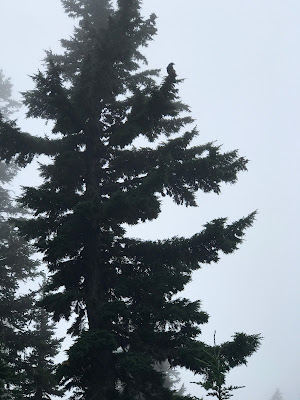
I saw some fly agaric mushrooms and Western Pasqueflowers and a crow that was squawking above me.
After I reached the Timberline-McNeil Point junction, I passed another pair of hikers going the other way.
I imagined the epic views of the mountain somewhere above in the clouds.
The trails climbs up a ridge and through some talus fields. In one of them, I critter (mammal or bird) was somewhere nearby upset by my presence. I guessed I was too close to it's burrow or nest. I talked to it calmly and moved on.
I finally reached the ridge and could see the McNeil Shelter. I'd made good time up here and still had some energy to spare. Cathedral Ridge and Ho Rock was somewhere above and I adopted the "let's see how far I can make it". It was longer than I remember but I continued on, an analog of next week's climb. It was windy and a bit rainy. In hindsight I was close to the end of the trail (600 ft and 0.3 miles) but I turned back.
On the descent back to the shelter, my knees were hurting which gave me pause. I still had the entire return trip back to the car. I stopped at the shelter to eat my sandwich and refill my easy access water bottle. My right knee was really barking and I rubbed it to try to feel better. I was going to take the steep trail down to save some distance but I knew I taking a small risk as well.
Less than 100 ft into the descent, I met a hiker coming up the trail. This alleviated my concerns and I felt energized to continue. Call it bravado or saving face, it just refreshed my self-confidence. Seeing others out there seems to do that for me. I love the solitude but not too much. It's probably while thru-hikers tend to buddy up with others. As a solo hiker, I worry about injuries and wildlife that would probably be less daunting with a partner. I'm not comparing myself to YouTubers like Joey Coconato who have tons of outdoor experience but it gives me a goal to shoot for. I've never done an overnighter since I started hiking again, and in fact since I was a kid in Canada with that group. I admire folks who set out alone to do the Loowit and Timberline Loops.
When I reached the Timberline Trail again, I was feeling good. My knee had calmed down and I was recharged to continue my hike back to the car. I was soaked but knew it'd be okay since I had dry clothes at the car and in a pinch had dry clothes in my pack.
I passed several more overnighters on the trail and said hello to all of them.
On the last segment of the trail back to Top Spur, a younger guy asked about water sources. I said I hadn't been on the lookout but offered some hope that were must be some streams, esp with the rain and damp conditions. The reality is I didn't know for sure. The puddles and trickles on the trail weren't viable options unless it was dire. I marveled at this guy confidence and maybe his naivete. There was certain water 4 miles away at Glisan Creek. He was just 1/4 mile from the car and hadn't thought about water? Bizarre but not my problem.
I was glad to reach the car and get out of my wet clothes. I only had my rain pants (which I had stupidly not put on) to wear on the way home, plus several dry shirts to choose from.
These images don't show the full picture. My jacket under the rain coat was drenched. My pants were wet all the way through from rubbing against bushes laden with water.


The drive back to Zigzag was uneventful and I was glad to be back on Hwy 26.
A gorgeous, successful outing.