|
 |
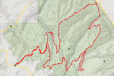
| AllTrails maps |
Getting There
Take I-5 North to Woodland. Then take WA-503 (Lewis River Road) to Yale Lake. One way to get to the Red Rocks Pass Trailhead, take the left turn for Merrill Lake - NF 81. If you reach Cougar, you've gone passed it. It's a peaceful drive along Merrill Lake (even though you can't really see from the road.) Watch out for a 90-deg right turn just after Goat Mountain because if you go straight, it becomes Forest Road 8123 (dirt) and if you turn right you continue on NF-81 (paved) (Merrill Lake Road).
Another way to get there is pass through Cougar and take the left turn for Ape Caves/Ape & Lava Canyons (NF-83). Then, take that for awhile. After passing through a huge clear cut area, take a left toward Climber's Bivouac (NF-81). Follow that road (partly paved until NF-830, then it's dirt/gravel) until you reach Red Rocks Pass Trailhead.
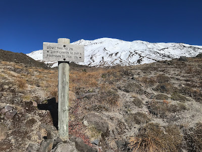
There is room for about 4-5 cars to perpendicular park near the sign and then, plenty of room for parallel parking on the shoulder. Be sure to show your WA Discover Pass (or equiv).
The Hike
Distance: 8.80 mi
Elevation Gain: 1,873 ft
Moving Time: 3:19:44
Total Time: 3:39:48
Avg Pace: 22:42
Calories: 1,760
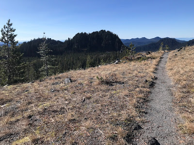
As soon as you leave the parking lot, you cross a huge rock field with MSH in the distance.
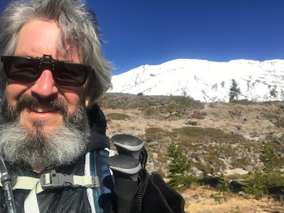
While the top of the mountain is white with snow, the coverage is still pretty minimal. It looks like most of the summit climb is snow-free, albeit with proper gear like spikes and picks and outerwear.

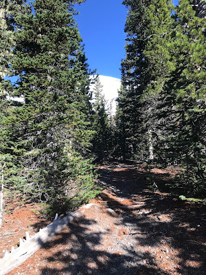
The rock field isn't too deep and you're soon in the forest. The trail surface is beautiful, not that muddy, soft but not mushy in places and the usual rocky/firm/pumice dust stuff similar to other trails around here (Ape Canyon, June Lake, Ptarmigan).
I passed a trio that were on there way down the trail.
I took a wrong turn pretty early on that added about 0.8mi by mistake. It's not marked in AllTrails but it's definitely more than an animal trail. Probably intersects with the Toutle or Blue Lake Horse Trails. I did see a marker (wooden post) on the way back and added some branches & and small log to "block" the wrong trail.
 | |
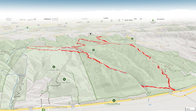
| AllTrails map |
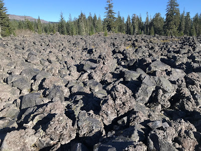
The 1800' elevation gain is pretty evenly spread on the 4+ mile ascent. There are some steeper switchbacks at Butte Camp Dome (~400ft elev. gain in 0.6mi) but not bad. There's a cool traverse across some ash (see below).
On my ascent, I saw a couple of hikers that had hopped on the trail just as I got there. On the switchbacks, I met a hiker that described the trail conditions and wind on a big loop they was on that links the Toutle, Sheep Canyon, and Loowit Trails with the Butte Camp Trail. Definitely coming back to hike this loop.
Just before the timberline, I met another hiker that confirmed the high winds ahead.
It was zippy. A few gusts stopped me in my tracks for stability. I should have deployed my hiking poles but didn't. I made it to the Loowit junction and took it west for 0.1mi just for a look.
I promptly started back down, mostly to get out of the wind. I saw the pair I'd seen early on just as they emerged from the timberline. I waved and continued my descent.
Eventually, I caught up with the 2nd hiker I'd seen earlier. When I catch up with hiker at a slower pace I try to make noise (step on branch, small cough). Usually that's enough to get their attention, turn around, and see me. This person didn't hear me though so I said "nice to get down the bottom out of the wind." Well, I really see but this exact moment, this person was adjusting their pants like no one was around. They laughed, I laughed and said "the sun was in my eyes and didn't see a thing. I promise." I really didn't. I kept going and waved over my shoulder, we're both still chuckling.
The sun was bright and warm. I took notice of all the beautiful things: a colorful mushroom, some interesting rocks, the birds foraging on the ground and giving them room & time to fly to a nearby branch. "Hi birdies!". I touched the tiny saplings and said "Hi little one!"
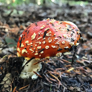 |
| Amanita muscaria (fly agaric) |
 |
| volcanic? |
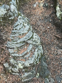 |
| volcanic? |
More Photos
 |
| MSH from the top of the Butte Camp Trail |
 |
| :) |
 |
| Last section of trees |
 |
| Butte Camp Dome from Loowit Trail |
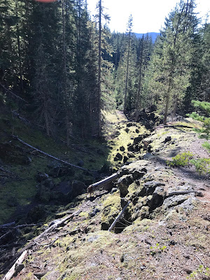 |
| Craggy topography in the forest |
 |
| Rock field near trailhead |
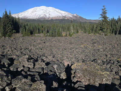 |
| Mt St Helens from the Butte Camp Trail |
I
was glad to reach the trailhead when I did. It was dark as the sun had
long dipped below the horizon, nearby hills, and still somewhat windy.
Going Home:
Instead of going towards Merrill Lake which takes a bit of time, I took NF-81 towards Climber's Bivouac and NF-83 to Lewis River Road (WA-503).