Showing posts with label Silver Star Mountain. Show all posts

Friday, June 7, 2024

Hike: Silver Star Mountain via Grouse Vista Trail, Yacolt, WA


Getting There

I took L-1200 out of Washougal to get there. It's 7 miles up a gravel road from the end of the pavement on Skamania Mines Road and it's 18 miles from Washougal. You can also reach the trailhead from the north via Yacolt.

The road was in great shape, very few potholes or washboards. Looks like it was recently re-graveled, probably for logging. I saw some new access roads and big pile of gravel along the way. No snow on the road at all, accessible to all vehicles.

Last time I tried to get to the trailhead from the north (Yacolt), the day after the Volcano Naturalist field trip to Ape Cave, I only made it part of the way. The road was closed due to active logging operations. 

There was several cars park down the hill but I found 2-3 open spots next to the pit toilet for parallel parking. Guess those cars belonged to morning hikers.

The Hike

Length: 6.80 mi
Elev. gain: 2,149 ft
Moving time: 3:09:26
Avg pace: 27:52
Calories: 1,915
Total time: 3:33:19


I still remember my first time up this trail in late August 2020, and how haggard I looked when I reached the top. I was still ramping up my hiking in the early stages of the Covid-19 pandemic. I had also purchased my first pair of Keen Targhee IIIs.

This most recent hike was number 6. It's challenging and very rewarding. Two days before Christmas 2023, I hiked up and encountered a lot of snow. I also shot a bunch of amazing pictures including this one

I was glad to be out there again. Another post-cracked-ribs hike. Things are getting easier and I'm able to hike without too much discomfort.

It was definitely a tough hike, esp. the first climb through the rocky tread and the second one past Pyramid Rock. I took my time, drank my electrolytes, and didn't pressure myself to be in any hurry.

I remember seeing a guy with a large pitbull that had labored breathing. I felt bad for the dog but didn't say anything. I encountered them not far up the trail; the owner was giving the dog some water.

When I reached the top of the first ascent, I was crisscrossing the trail, picking a path through the large rocks. A swelling of buzzing emanated from the bush on the southeast side of the trail. Yikes. They sounded agitated. Not something I wanted to deal with today (or ever!). I thought about telling folks coming down about it and to stay clear but as I got further away, I judged that I really didn't have a precise location and the intel wasn't valuable.

I passed a few people coming down. I noticed the places we'd stopped for a break and for lunch when I was hear last summer for my first WTA trail work party

Once I was past the long, rocky section, I knew I was in good shape and could finish strong. After the turn, past the campsite on the left, I met two hikers coming down that told me all 5 mountains were out. There was still a pad of snow on the trail but I followed the edge of the trail until I couldn't, then got onto the snow. I was slushy but I didn't punch through. At the top, there wasn't any snow.

I made the left turn and went up to the highest point, where the old fire lookout pad was located. There was a group of folks that looked like trail runners and another two hikers. I made my way to the edge and soaked in the view of the nearby Cascade Mountains: Mt St Helens, Mt Rainier, and Mt Adams. I also inspected Sturgeon Rock and remembered reading a trail report of a SAR helicopter dropping off and picking up crew (for practice).

I like to give folks some space and decided to take my lunch on the other side of the mountain. I had that side to myself and enjoyed the views of the southern Cascade peaks: Mt Hood, Mt Jefferson. I took off my pack and ate my sandwich. I need to try to slow down on these and really absorb the scenery.

Eventually, I started my descent. I noticed the group of trailrunners was packing up to go down. I was just ahead of them and hoped to give them space going back to the trailhead. I stopped a few times but never heard them.

Near Pyramid Rock, I encountered the guy and his wheezing pit bull :(. Poor doggo. I knew they still had a challenging hike ahead... and long descent. I don't know if the dog was miserable or what. I didn't say anything to the guy and he didn't meet my eyes when I was going to say hi. In hindsight, I wondered if this guy was pushing his dog unnecessarily. Or maybe, the dog had some kind of terminal issue and he was just trying to give it a few more outings. Maybe the group behind me would noticing something I didn't and talk to the guy.

I kept my pace and felt good. I remember hiking a few years ago and regularly having IT band issues on the descents. It's been awhile since I had issues; guess I'm in relatively good shape. Maybe a summit attempt of Mt Adams is doable.

I finally reached the parking lot and most of the cars were gone. A good day!

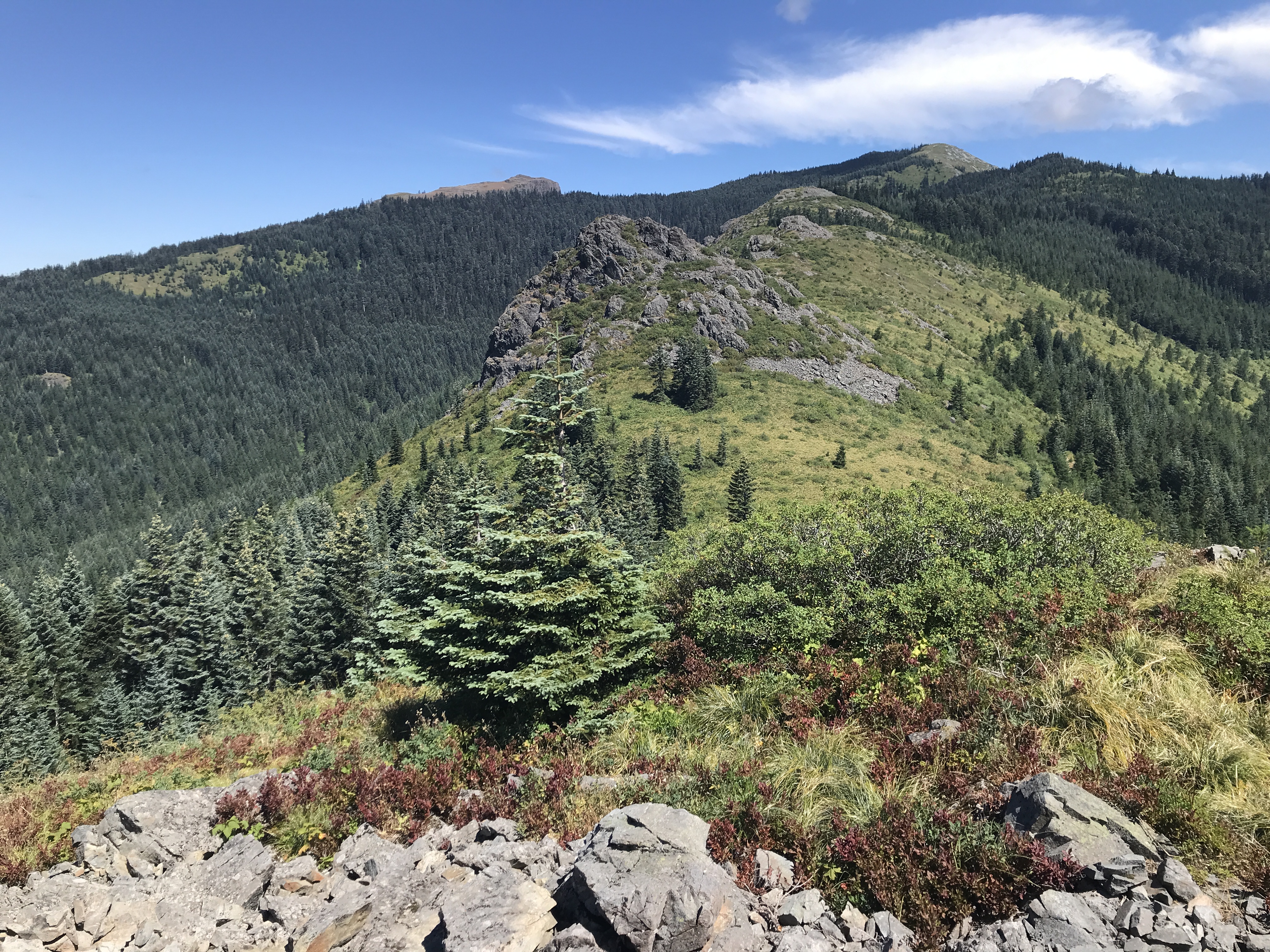
Heading up the trail, Pyramid Rock in the middle

Mt St Helens, Mt Rainier, Mt Adams


Mt Hood & Mt Jefferson (far distance)

Mt Jefferson

Mt Hood

Looking back at the highest point (trail to lookout slab)

Pyramid Rock


Saturday, December 23, 2023

Hike: Grouse Vista Trail to Silver Star Mountain V, Yacolt, WA


Getting There    

I took L-1200 out of Washougal to get there. It's 7 miles up a gravel road from the end of the pavement on Skamania Mines Road and it's 18 miles from Washougal. You can also reach the trailhead from the north via Yacolt.

The road was in great shape, very few potholes or washboards. Looks like it was recently re-graveled, probably for logging. I saw some new access roads and big pile of gravel along the way. No snow on the road at all, accessible to all vehicles.

The Hike

AllTrails map

Length: 6.97 mi
Elev. gain: 2,142 ft
Moving time: 3:05:53
Total time: 3:19:09
Avg pace: 26:40
Calories: 1,876


The trail was its usual rocky self for the first 1/2 mile or so then I started to see snow that had fallen from branches above. Where the canopy was most dense, the trail was bare rock. As the branches overhead began to thin out, more snow was making it to the ground.

Starting at the top of that initial steep section, the snow was thicker, maybe 3-6 inches. It was wet snow and fell in clumps. I was just hiking in my fleece layer but I got some snow down the back of my neck a couple of times. I stopped to put on my jacket and hoist the hood.

This was my first hike in my new Keen Targhee IIs. Overall, I'm happy with the boots but am wondering if I should have a bit more ankle support. I may still get the Salomons after all. Ssshh :) I could definitely tell that the outer soles were thicker and supportive. My right foot is still angry that I'm hiking but the pain was more than tolerable.

The sky was blue and just a few clouds that added to the scene and didn't block the gorgeous sunlight. I never felt the need for microspikes: the snow was well packed and not slippery. The trail was a bit easier to negotiate since the usual rocks were buried. The stiff heel in the Targhee IIs seemed to help during my descent.

I passed several groups on my ascent. Many doggos!

At the top, the views were endless in all directions. The major Cascade peaks were out: Rainier, Adams, St Helens, Hood. I didn't really check but I'd bet that Jefferson & Washington were visible to the south and someone on AllTrails mentioned being able to see Saddle Mountain in the Coastal Range.

It wasn't too cold but it was windy. I went to the old fire lookout first. There were several people up there already. I took a few requisite photos, tightened my boots, and took a big bite of a Clif Bar. I headed to the other high spot.

Wow, it was windy over there. Bits of ice carried by some sporadic gusts sandblasted my face. The wind was steady but wasn't quite as strong as the other day at Hamilton. Nevertheless, I only stayed for a min to take a couple photos.

My stay at the top only lasted 15 mins. A lot of effort for a brief stay. The hike is about the journey, not the destination. At least, that's what I tell myself in situations like this. I had a sandwich and could have lingered longer. Next time, like I always say.

I wanted plenty of time for my descent with nice afternoon light. It was worth it. 

The bottom section is brutal. My R knee was complaining a lot and so was my foot. Probably related since I was walking differently to compensate for the foot thing.


Saturday, August 19, 2023

Hike: Grouse Vista Trail to Silver Star Mountain, Yacolt, WA


Getting There

This was a momentous day. The last time I was on the L-1200/L-1201, I got a flat tire. I'd been on my way back from trying to visit the Noble Ridge Tree Deck up L-1201 and ran over a bullet shell. I was able to limp all the way back to the Washougal River Road and about 8 miles from town but ultimately, I had to get a new set of 5 tires. Ouch! That was back in May.

Most recently, I attempted to get to the trailhead from the north, Moulton Falls route but Google Maps did me dirt! It was trying to route me on forest roads that were gated closed. I was on L-1200 but 6 min from the trailhead the estimated time when from 15 mins to 1h45min! WTaF? I panicked and just turned around. I ended up going all the way up to MSH and hiking the Loowit Trail via June Lake.

To get there from the south take L-1200 out of Washougal to get there. It's 7 miles up a gravel road from the end of the pavement on Skamania Mines Road and it's 18 miles from Washougal.

"Head north on Washougal River Rd toward 6th Ave/F St (10 min (6.5 mi)). Continue on NE Hughes Rd. Take Skamania Mines Rd and 1200 Rd to L-1200 (32 min (11.5 mi))."

I was there for a WTA (Washington Trails Association) Trail Work Party that I'd seen a post for on the Mt St Helens Institute Facebook page. It was right up my alley so I signed up.

We met at the trailhead at 8:30am. Actually, I'd left around 7am and made it there by 8:15am. The crew leader talked to us 8 volunteers for about 30mins about tool usage, safety, and what to expect & what we were going to be doing. Five of the volunteers had their own hardhats and the other three of use had loaners with tape on the side to put our names in pen.

There were a couple of seasoned volunteers that were the assistant crew leaders. We'd be in 3 subgroups. One person was a MSHI volunteer as well and donned this year's shirt. She was celebrating her 600th work party with WTA! After the orientation talk, I got rid of my straw hat and stowed a pull saw. I grabbed the loppers that I was to carry to the work site.

The Hike

Distance: 3.77 miles
Elevation Gain: 1,200 ft


At around 9am, we started up the trail. It's a steep, rocky section but I was in good shape and adopted a slow steady pace.

We'd stop periodically to let everyone catch up. Eventually, we found some things on the trail that needed attention: small branches protruding over the trail. I made my first cuts.

Making the cut

Making the cut 2

A subgroup was going to saw a big log that was layed across the trail but I was in the group that continued on. At the unofficial trail junction to Pyramid Rock, we stopped for a water break and chocolate.

Along the way, we ate berries (blueberries, huckleberries, thimbleberries) along the way and chitchatted. 

We finally made it to the work site, a 1-mile section of the trail below Pyramid Rock. There were several squeeze points where we pruned bushes and trimmed protruding tree branches. We'd work for a bit, then continue up the trail.

Soon it was time for lunch. We found a place for everyone to site off the trail and eat. There wasn't shade but it was good to take off my hard hat and backpack.

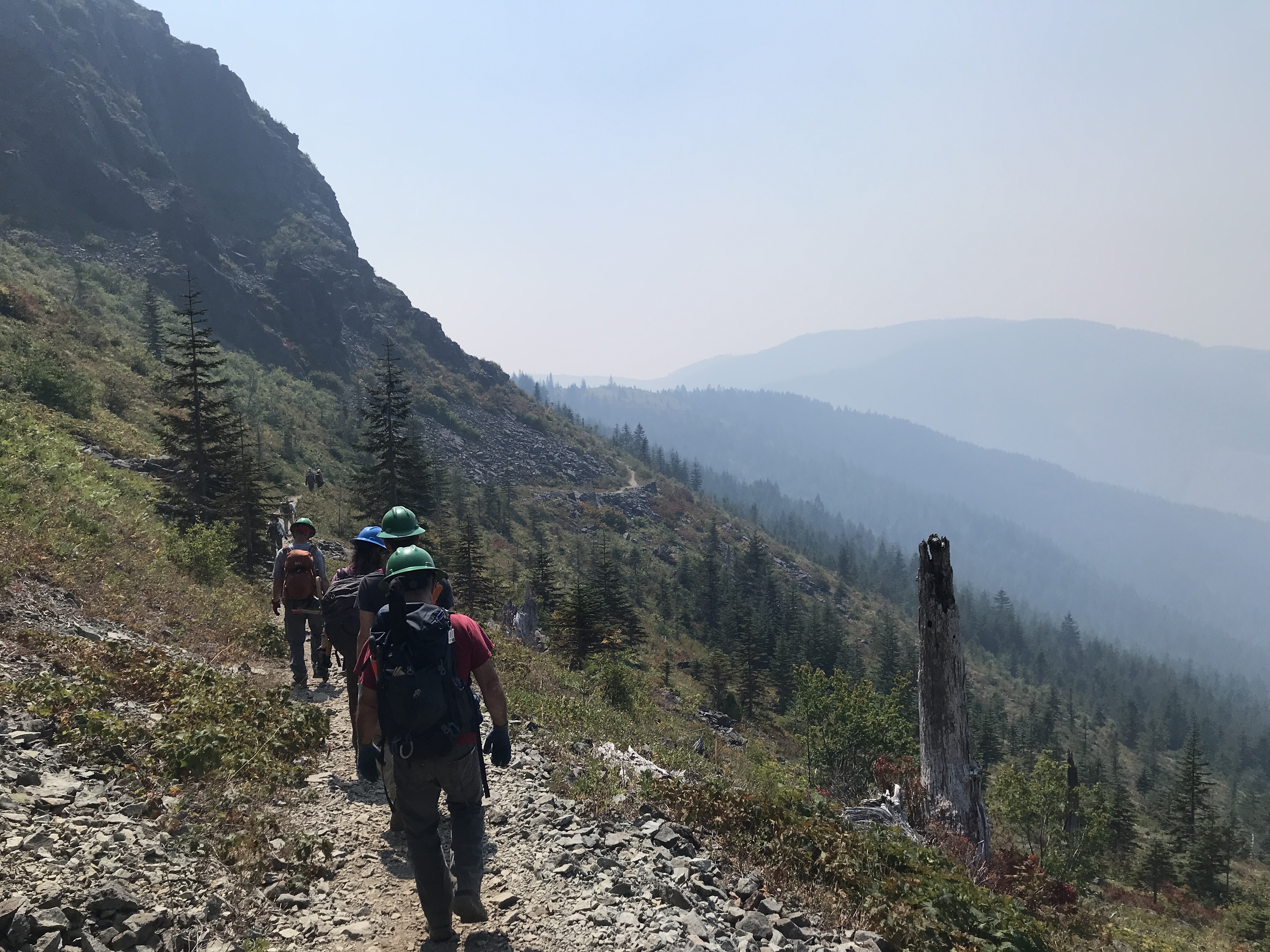
At that point, the wildfire smoke from Canada and Eastern WA was started to envelope the area. It was also getting warm and I only had my Hike-a-Thon cotton t-shirt. I changed into my long-sleeved, button-down shirt and filled up my water bottle from reserves.

Grouse Vista Trail

Pyramid Rock

Smoke beginning to roll in

Sturgeon Rock in the distance

After lunch was moved further towards the summit but were still 2-3 miles from the last junction. There was much to do in this section. Earlier I'd been asking what bushes and trees to trim and how much but by now, I felt confident to make wise pruning choices.

The crew leader finally gave the 10-min-more call. The smoke was getting dense and I was starting to feel it in my throat and eyes.

We called it a day and started back down.


Back at the place we'd taken our first break we stopped again to regather and take a group selfie.


Back at the trailhead, we gathered by the WTA truck and had soft drinks, chips, cookies, and popsicles!

Everyone worked together and was super friendly and welcoming. 10/10 will do it again!


Sunday, August 14, 2022

Hike: Silver Star Mountain via Grouse Trail, Yacolt, WA

AllTrails maps

Getting There

I took L-1200 out of Washougal to get there. It's 7 miles up a gravel road from the end of the pavement on Skamania Mines Road and it's 18 miles from Washougal. You can also reach the trailhead from the north via Yacolt.


The Hike

Length: 8.14 mi
Elevation gain: 2,539 ft
Moving time: 3:38:58
Total time: 3:54:39
Avg. pace
: 26:54
Calories: 1,929
 
This was my third time up this trail. The weather was amazing. Not too hot, very few bugs, trail was mostly free of obstructions like overgrowth and trees. The first hill is long and rocky and could be tedious but there are a lot of decisions to make, i.e. picking a route through the rocks.

I took a look at a side trail around Pyramid Rock and got some elevation. On my previous visits, the weather has been a little overcast so it was great to get above the trees and see outcrops above.

There are a lot of folks enjoying the views at the top. I did stop for a 10-15 mins to eat part of a sandwich and take some photos. I also had to change into a dry shirt.

I started down the trail to Sturgeon Rock. According to the map, there is another trail which I looked at but it was overgrown. I tried the more direct route but found it pretty steep and rocky, like a creek bed. I just didn't want to lose the elevation and decided to stick to the main trail.

On the map, you can make a cool loop by detouring to Sturgeon Rock then descending down to Tarbell Trail which reconnects with the Grouse Trail a few hundred feet from the trailhead and L-1200.

Grouse Trail

Looking west

Pyramid Rock (fg), Sturgeon Rock (bg/L), Silver Star Mtn (bg/R)

Mount Hood (Wy'est)(L), tip of Jefferson Mtn (R)

Sturgeon Rock
 
Silver Star and Mt St Helens (R)

Pano of Pyramid Rock

Pano from Silver Star Mtn


Sunday, June 6, 2021

Hike: Silver Star Mountain via Grouse Vista Trail II, Yacolt, WA


AllTrails map

Getting There

I was already at the trailhead after hiking the Larch Mountain via Tarbell Trail. When I finished I had some adrenaline and energy to do more hiking.

The Hike

Length: 6.3 miles round trip
Elevation Gain: 2,096 feet
Grade: 12.6%
Type: Out & Back

I crushed this hike today! Much different than last time. It took me less than 2 hrs to reach the top and 1.5 hrs down.

I actually didn't plan on making it to the top. I was just going to hike until I got tired or it got too late in the day to make a safe descent.

I powered up the first climb. I was huffing & puffing but not dying like last time. LOL.

I vaguely remember some of the waypoints from my last trek up here. It gave me incentive to keep pushing forward.

I knew there were several cars at the trailhead so I figured I'd keep going if I wasn't the last person at the top.

I passed a few solo hikers and one group of 4. Around Pyramid Rock I passed on guy that said he'd seen me before. I think I passed him on the Larch Mtn/Tarbell Trail earlier but when I told him, he still seemed baffled. Perhaps a doppelgänger?

Even further up, I passed a couple that looked a bit lost. She was looking at phone and told her SO that she thought they were still on track. My appearance confirmed they were still on the right trail. She was a plus-size girl was in fitness clothes but neither of them seemed to have gear (water, rain coat, hiking poles). I doubted I'd see them again.

I checked the time and the map and extended the time I had to stay at the summit. I was indeed the last hiker up there but was too close to not complete the hike.

I had the summit to myself but I could not see a thing, totally socked in.

On the way down, I passed the couple near the campsite just below the summit. I said "hello again". I was surprised to see them. A minute later a pair of guys walked by; they had backpacks and looked "prepared".

As I made my descent I thought about that girl. They rain and hail pounded me for a while then drizzled. I was soaked despite my rain gear, from head to toe. I thought of that couple coming back down. The ascent is mostly thighs and big muscles, the descent is ankles & knees.

My only solace was that those two other guys were up there and hopefully provided some kind of support. In reality, those fit guys left that couple in the dust(mud). If I hadn't seen them, I considered waiting for the couple to return to the parking lot. Would they have know? appreciate it?

View from the top

View from the top

View from the top

A short break in overcast sky

View of Pyramid Rock