Getting There
Just after Doetsch
Ranch you'll see the Ranger Station on the north side of the road just
before the Beacon Rock parking lot, then another road across from the
bathrooms. The road winds up the hill for a bit.
For a beautiful
day, I was happy to find a few open spots by the bathroom. It was late morning, around 11am. When I was getting ready, more cars arrived and filled up the lower lot. The gate to the upper parking lot was open but I don't know how full it was up there: there were a few occupied campground sites.
The Hike
Elev. gain: 2,264 ft
Moving time: 3:43:14
Avg pace: 26:08
Calories: 2,255
Total time: 4:16:15
The weather in Portland was sunny and springlike but as I drove out toward North Bonneville, clouds filled the Gorge. I knew the hike up Hamilton Mtn is mostly in the trees so I figured it'd be okay. Surprisingly, it was pretty nice. There were visible rain showers nearby but very localized.
The 2nd section between the powerlines and Rodney Falls, I got a nose bleed. It's been happening more lately, since January. Worst timing. I didn't even have any napkins or tissue with me. Fortunately, I was wearing a cloth neck gaiter. The blood was flowing pretty good. I didn't want to alarm other hikers so I turned my back on the downside of the trail. I blotted my nose and took my time opening a water bottle to hide the immediate issue.
The neck gaiter was black, which hide the blood. A white handkerchief would have been so noticeable. It was starting to slow down and clot but it kept going. Fuck! I thought my day was over. My allergies were fine but it was straining a lot on that first section. That probably was enough.
When I could, I hiked further up the trail to a stream where I knew I could rinse my gaiter out. Ew!!! I paused and consider if I could or should continue my hike. Fuck it. If it's gonna happen again, so be it.
I reached the trail to Little Hamilton. I considered whether I'd just summit and come back down or do the loop. If I was doing the loop, I would be back this way to see the 270/360 views. I did this "side quest". It meant the two hikers I'd just passed would pass me.
 |
Hamilton Mtn from Little Hamilton
|
 |
Cascade Locks, Columbia River
|
I did monitor how much I was straining and backed off when I needed. As I
continued I passed several pairs of hikers, including the two I just mentioned. I jokingly apologized for leap frogging (again).
I was making good progress
and feeling strong all the way to the top. A few hikers had been ahead of me but they were
nowhere to be seen at the top: they obviously did the Saddle Loop. I lingered for a min or two, and stalled when an older guy and dog came
up from the Saddle. Expecting conversation but none happened. I
continued the loop.
 |
| Table Mtn |
|
 |
| Rain on Carson and/or Home Valley |
|
|
The traverse was in great shape and I think I found the section where
I fell in the snow: a soft fall but a bit of a wake up call. Accidents
happen. In a way, I'm glad because it keeps me careful and vigilant and
also reminds me that stuff is gonna happen and how you respond is
important. Like that first 1st-Aid incident at Ape Cave: hopefully next
time, I'll be more calm and collected.
When I reached the Saddle I
kind of expected to see some of the hikers ahead of me but I had the
place to myself. The part of the hike is exhilarating and comforting. It
is the furthest from the car but it's virtually all downhill: the hard
was over.
The nose bleed made me choose the Equestrian Trail and
not take Don's Cutoff. My nerves were up a bit. As I made my way down, I
recalled the last time I was there, it was covered with snow. Then I
remembered hiking up here after bailing at an attempt to Phlox Point. I
took the Equestrian Trail up. I had to make milestones up this trail. It
seems so far, even on the descent.
 |
Hardy Creek
|
Halfway down the (Lower) Hardy Creek Trail, I heard some weird
noises. I know my 1/2 filled water bottles can make noises but I was
sure a few of them were in the bushes or trees. I've learned to accept
some rustling just off the trail as 90% birds or rodents. I have been
noticing more signs of felines after taking the class to identify
canine, feline, and other mammal tracks in the snow. What I heard more
of a growl or snarl, protective warning. It wasn't loud but it was
unusual among the other usual sounds.
I tried to be as quiet and
deliberate in my movements. I stopped a few times to look behind me. I
don't know how I would react if I'd actually seen a cougar or bear. LOL.
 |
Hardy Creek Trail
|
I finally rejoined the Hamilton trail and down the powerlines. I've been
stopping at Little Beacon the last few times here. It was no different
this time. I had the top to myself. I ate a sandwich and drank in the
views.
 |
Approach to Little Beacon Rock
|
 |
European slug (Arion rufus)
|
 |
Beacon Rock from Little Beacon Rock
|
 |
Looking north from Little Beacon
|
 |
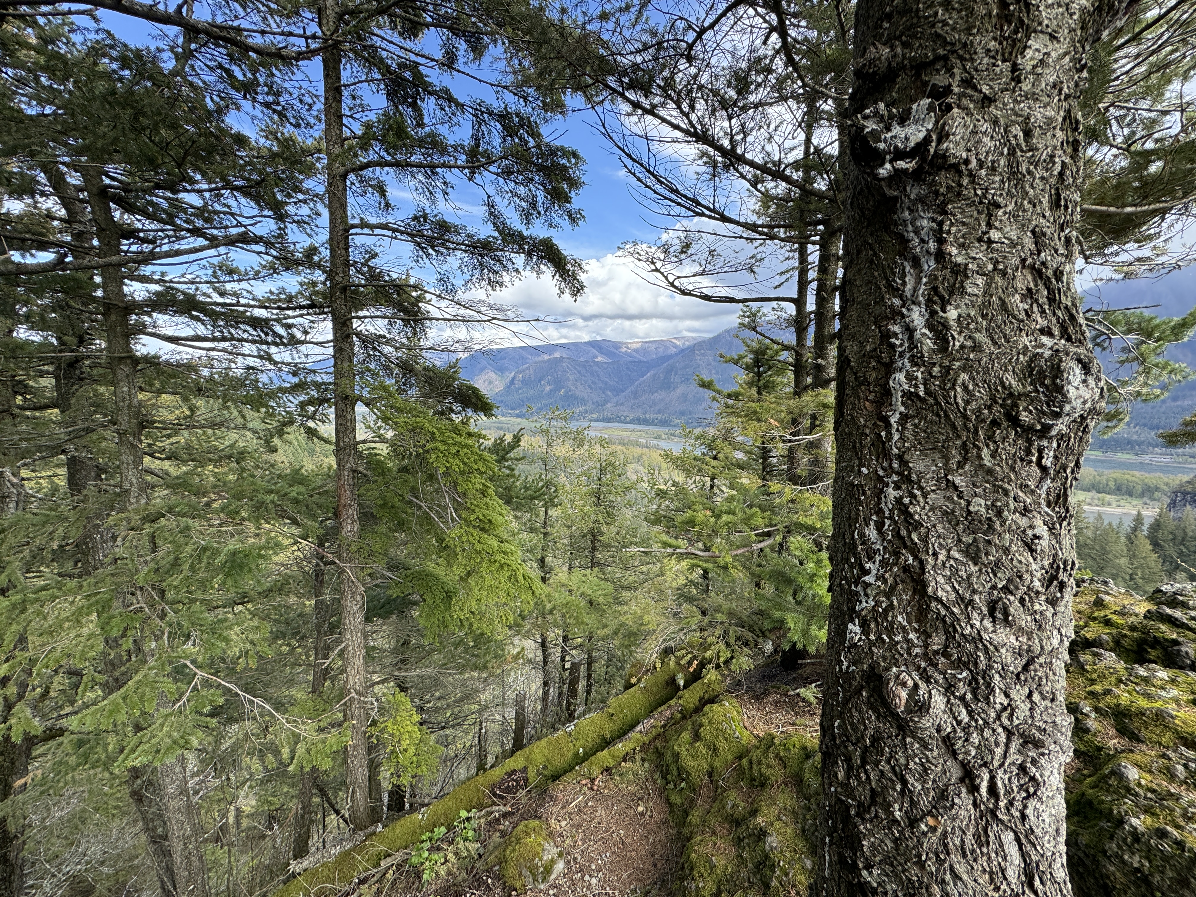
Looking through the trees from Little Beacon
|
 |
Trillium flower
|