Showing posts with label Packwood. Show all posts

Monday, August 10, 2026

Hike: Packwood Lake, Packwood, WA


Getting There

From I-5, take Hwy US-12 eastbound for about 65 miles through Morton & Randle to Packwood. Drive through town until you reach the intersection for Skate Creek Road + Snyder Road. Take Snyder Road (east) for about 1.5 miles until it becomes NF-1260. Continue for about 4.5 miles to the Packwood Lake Trailhead.

The trail is for hikers and pack animals. It's a huge parking lot with a pit toilet, and ample room for horse trailers.

I responded to a post by a (semi-retired) geologist Pat to the MSHI group asking for a hiking buddy to scout an upcoming research site at the lake: dating submerged trees to find out the age of an ancient landslide that caused the formation of the lake about 900 years ago. Pat was one of our guest speakers at the MSHI-WTA Jamboree recently. I've also heard him talk about the 1980 eruption during one of the Volcano Naturalist lessons.

We met at Mountain Goat Coffee and caravaned up the Packwood Lake Trailhead. Two years ago I helped out with a Glacier Overlook Hike and stayed in Packwood to hike to the lake. As it turned out, I'd also done the GOH trip and stayed in Randle to join Pat.

The Hike

Distance: 8.24 miles
Elevation Gain: 1,280 feet


We got geared up and set out on the trail. We adopted a leisurely pace, stopping occasionally to rest or look at a cool plant or rock or marvel at the mature, old growth Western Red Cedar or Douglas Fir. The trail barely seems to ascend, more like a roller coaster of small inclines and declines. Pat pointed out the remnants of a pumice-ash from a couple of MSH eruptions in the 1400s.

After a couple of hours, the trail comes to an area of lots more sunlight and some giant boulders, evidence of the old landslide. 

Eventually, we caught of glimpse of a wall of trees and turquoise water. Before we reach the shoreline, the trail turns abruptly north. We're close to the water but it's down a-ways a steep hillside. Bushwhacking.

We continue downwards and see the ranger's residence. At least, we've reach the lake. When Pat comes back for the project, he and his crew will drive up on the forest road to the hydro-electric plant. We inspect the steep driveway and Pat considers his truck ability to make it up and eye-balls some a place to park at the bottom of the hill.

We stop for lunch and chat with a couple and their two Huskies. We encounter a handful of others. Pat says he wants to hike along the western shore to find some old-growth trees. I know there isn't a trail but don't say anything. It would be a lot of bushwhacking to make any progress. I'm glad we don't make the attempt.

We decide to start heading back down to the car, having done what was needed at the launch site. We're going to take a core sample from an older tree. We skip past a few for one reason or another: evidence of rot, weird cracks in the bark.

Finally, we find one that's suitable. I get the opportunity to do the whole things (well, mostly). It a thin hollow tube with threaded point on the end. With every half turn, the trees squeaks, a good sign that the wood is healthy and not rotted inside. A few times it's muffled or makes no sound at all but I continue.

With help, I insert another aluminum piece that has barbs on one end. This slides under the woody core and allows us to pull the core out of the hollow, coring tube directly into a thing to store it for the journey back to the car and then the lab. It's just three plastic straws from Starbucks.

After some effort, I extract the boring tube and pack it back up for transport.

We continue on our descent to the car. It's a bit of a slog but we break up the hike down with rest stops and to chat with some folks heading to the lake (overnighters).

At last, we round a corner and can see cars in the parking lot. A father and daughter have stuff strewn around their car on the ground: packing their backpacks for a couple nights at the lake. They are one a road trip and did another overnight on the Olympics. 

Pat and I change into 'driving' clothes and say goodbye. I'm grateful to be able to join Pat. He offers to cover my lodging the night before with money from his grant. He says he doesn't hike alone anymore and I'm glad to have spent the day. 


1910 Ranger Station

Outflow for hydro-electric dam


Agnes Island


Sunday, August 25, 2024

Hike: Packwood Lake, Packwood, WA


Getting There

From I-5, take Hwy US-12 eastbound for about 65 miles through Morton & Randle to Packwood. Drive through town until you reach the intersection for Skate Creek Road + Snyder Road. Take Snyder Road (east) for about 1.5 miles until it becomes NF-1260. Continue for about 4.5 miles to the Packwood Lake Trailhead.

The trail is for hikers and pack animals. It's a huge parking lot with a pit toilet, and ample room for horse trailers.

The Hike

Length: 9.25 mi
Elev. gain: 1,578 ft
Moving time: 3:08:59
Avg pace: 20:26
Calories: 1,912
Total time: 3:34:55


I kind of wanted to head up to Paradise or to Reflection Lakes and hike up to Pinnacle + Plummer Peaks but there weren't any timed entries available. I thought about heading down to Cispus and driving up to the Burley Mountain Lookout but I wanted to get out on the trail.

Packwood Lake Trail looked like a good option, albeit not as challenging as I might have wanted. I half expected the parking lot to be empty. I had no idea. Packwood Lake is a popular entry point for the Goat Rocks Wilderness. I passed a scout troop and another group of backpackers.

Before I got started, a couple with minimal gear set out and another person that didn't have a pack. I never saw them on the trail but did when I reached the lake. I learned from the forest ranger that it's quite popular spot. Maybe the mid-Aug rain had scared many away. I wondered if the Rainier permit situation drove people to try alternate hikes in the area.

The lake was beautiful and huge. The water was that emerald green glacial water. The island in the middle was from an ancient landslide. I noticed a hydro-electric dam near the ranger stations but learned the lake is about 1000 year old.

 
The 1910 Ranger Station is currently being restored in a partnership between the USDA Forest Service and volunteers. 


There are a couple dozen epic campsites that have been grandfathered in by the USFS. The PCT is not far from the lake via the Upper Lake Creek & Coyote Trails, approximately 5 miles.

I was happy to reach the trailhead parking lot but I still wanted to hike more and some elevation gain. Next stop: High Rock Lookout.

Sunday, July 18, 2021

Road Trip: Mount Saint Helens, Mount Rainier, Snoqualmie Pass, WA


Google Map:

https://www.google.com/maps/d/u/0/edit?mid=13lY7QLGLPGvweV7K2vjD9N3R3A9GMbbN&usp=sharing


Roadtrippers:

https://maps.roadtrippers.com/?lng=-122.83943523240896&lat=46.6916834137775&z=7.18495178484434&a2=t!34112337


Itinerary

Day 1 - Sunday, July 18, 2021

Late start, around 11am, drive I-5 N to Hwy 12 E. 

Stopped in Morton for some groceries

Arrived at Iron Creek campground around 3pm

Set up tent and rearranged gear, edible stuff

Walked around the camp loop for a while, ended up going to the day camp. I just walked back to the campground on the road (NF-25).

Day 2 - Monday, July 19, 2021

Woke up earlier but finally got out of the tent around 7am. Spent the next hour or so breaking down the tent and packing everything but the coffee making stuff. 

When I reached the road I really didn't know what I was going to do. I considered my options around Packwood and Mt Rainier. I reviewed my plans for the following day and the trails around Reflection Lake and the Paradise Lodge. I also thought about doing a run up to High Rock Lookout. In the end, I'd planned my trip so I could be close to the north side of MSH. I wanted to complete the loop I'd started last weekend, and continue scouting the Ape Canyon-Smith Creek-Lava Canyon Loop.

I'm really happy with my choice to stick with the plan. I turned left on NF-25 and headed south. I remember driving this road after a long trek from Concrete. It was my goal the entire trip to avoid the interstate*. (*besides the part between home and Woodland).

As expected there was almost no traffic being that it was Monday morning. Once I turned onto NF-99 to Windy Ridge, I remember seeing a couple taking photos when the first big panoramas came into view from the road. I really want to explore the Mount Margaret Backcountry! Craggy peaks, surreal landscape of blast zone, a slowly returning ecosystem.

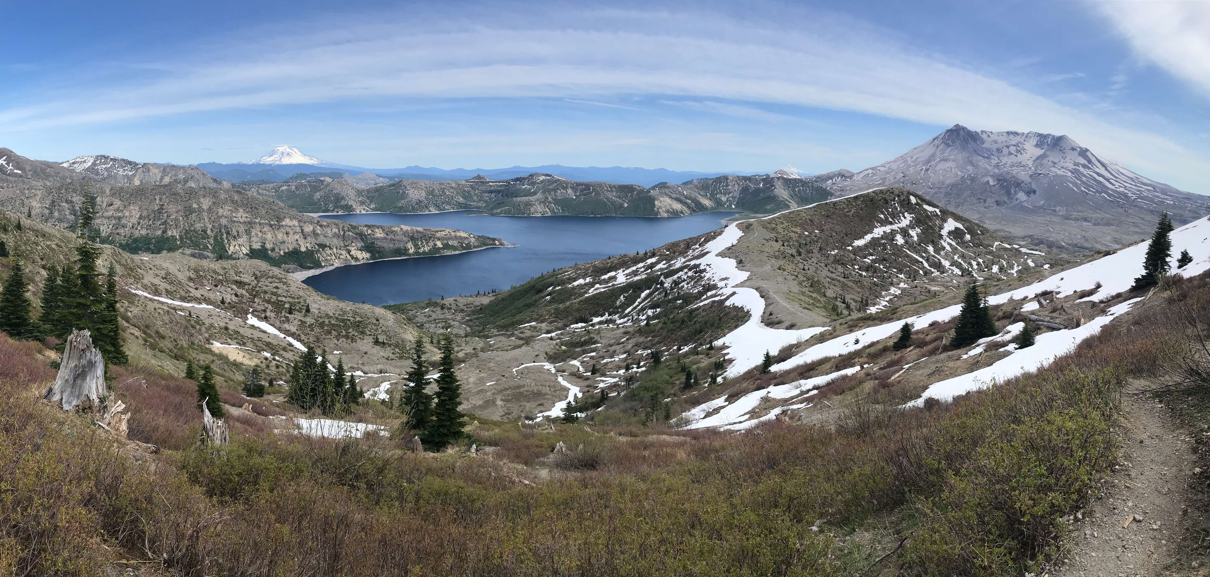
The views just got better and better. I remember visiting Windy Ridge last year or maybe it was in 2019, I don't remember. Just incredible to see across Spirit Lake toward Johnston Ridge, Harry's Ridge & Coldwater Peak where I was just hiking 11 days before. I want to see it all, even if it's, by necessity, in stages.

I parked near the trailhead and that couple I saw early pulled up to; it sounded like they were going for a picnic.

I geared up and set out on the Spirit Lake-Iron Creek Road (Truman Trail).

See ____ for the hike details.

I was stoked on a great hike and cheerfully changed out of my hiking boots. I was glad to have started my first full day of this trip with this particular hike. I could continue north to my next stop without reservation.

Since Norway Pass was my second option, I wanted to at least see the trailhead and get a peak at the terrain. I hesitated and passed the turn but went back around and made the turn. Why take the same road back to Randle that I came out there on. (I'd done this road a few years ago so I knew it linked back to the main road.)

This area that NF-26 takes you through is amazing in it's own right. Deep valleys, lush forest, and steep craggy peaks and ridges, outside of the blast zone. This road is the same distance as the main one, 26mi, but there are a lot of potholes and such, so it slow going. No matter, I'm there for the scenery. I would highly recommend this route if you have the time. In fact, I didn't realize where I was on the route but a guy stopped me and asked it it went to Windy Ridge. I said "yeah, more or less, it's definitely the more 'scenic' route to other road."

I emerged from the forest road and to the openness near Randle. I hopped on Hwy 12 and head to Packwood. The Mountain View Lodge just outside of town. I stayed there last summer but for just one night. (I'm recreating part of that trip but taking more time in each. Plus, there are fires and road closures up in the Methow area/North Cascades Scenic Byway.)

Side note: I didn't plan to go into town but I had sudden hankering for pizza. The place I went last time was open for another hour. On the way back into town, a huge herd of Elk or deer were grazing across from the gas station. (The pizza joint was a bust, 30-40 min wait for orders). On the way back, 1/2 the herd had crossed the road, so I carefully passed through.

Day 3 - Tuesday, July 20, 2021

???

Day 4 - Wednesday, July 21, 2021
Day 5 - Thursday, July 22, 2021
Day 6 - Friday, July 23, 2021