Showing posts with label White River Canyon. Show all posts

Wednesday, December 31, 2025

Snowshoe: White River Canyon, Government Camp, OR

Getting There

It was the last day of the year. Being behind on my hiking goals, I wanted to squeeze in one more outing. I saw the weather was looking favorable in the Gorge and around Mt Hood. 

A couple people posted amazing pictures from Silver Star. One person on AllTrails reported the road (L-1200) was in terrible shape while another said the road was fine. As I was driving on Hwy 30/N Killingsworth toward the I-205 turn, I considered hiking Silver Star but my decision was made when I turned right onto the southbound lanes towards Troutdale. I was going to Mt Hood like I said I was, stick to the plan). 

White River Sno-Park, an old favorite, was my destination. I passed the Mirror Lake parking lot: full, as expected. I still go a late start but figured I'd still have plenty of time for my usual route to the end of the trail. I stopped at Government Camp for a pitstop. 

The road were pretty clear to the Hwy 35 turn and to White River. The parking lot was less than half full. I wondered how much snow there actually was on the ground up in the canyon. No matter, I wasn't going anywhere else. (Trillium Lake didn't look promising, too crowded, flat loop.)

The Hike

Length: 5.53 mi
Elev. gain: 1,640 ft
Moving time: 2:38:41
Avg pace: 28:43
Calories: 1,398
Total time: 3:14:42 


I got suited up with my snow boots and snowshoes, and powder baskets on my poles. The snow on the ground was well packed and there weren't any post holes. Despite the clear skies, the sno-park wasn't very busy compared to other times I've been here. 

Once I got passed that last sledding hill, I veered off into the middle of the canyon, to the right (north) of the trees. I crossed the creek before putting on my snow shoes. 


The clouds were amazing when I started the hike. I only encountered one other snow shoer on the trail. He had a light pack, no poles and looked like a cotton sweatshirt. ಠ_ಠ


The end of the trail was in sight but also looked far away. I was feeling good and had plenty of time (i.e. daylight). I made a mental note that I wanted to start heading back down by 2:30p. I had one hour to reach the end of the road.

I heard some voices far away. I could see the Palmer chairlift moving on the ridge but probably too far. I thought there might be some people looking from the rim near Timberline Lodge. Nope, it was at least one person (probably two having a conversation). on the a steep hillside to my left (southwest). They were probably climbing up to have some fresh turns on skis or snowboard. Short but sweet section. 

The clouds had moved out by the time I reached this point, 2pm. In fact, the air seemed "warm". I guessed it was around low 40s. The snow was getting pretty mushy in spots. I don't know what my packed weighed but played a factor. I saw some snow shoe tracks that were on the top of the snow, probably made when it was a lot cooler.

I also noted that the snow coverage was pretty minimal compared to previous visits, lots of rocks showing. 


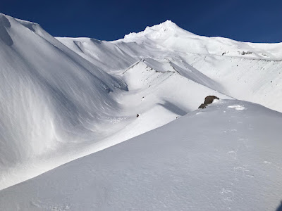
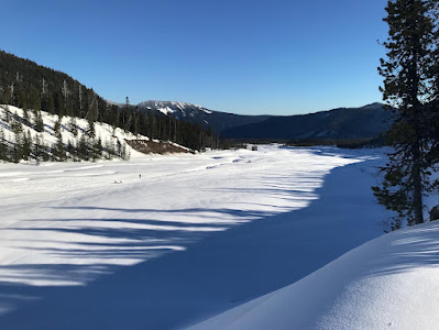
I made it to my destination. The end of the road. This looks like an ancient glacial valley.

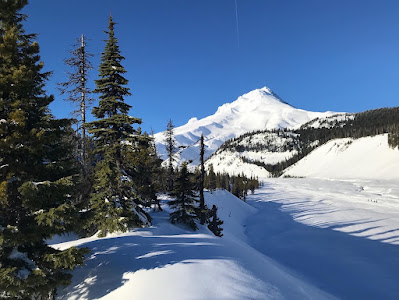
Here is my last picture of Mt Hood as I was winding my way back to the car. 3pm. 

I couldn't find a suitable route to climb into the trees for my descent so I returned the way I'd come. I'd seen a few sets of human-made tracks lower down coming from the trees. My biggest concern was creeks next to the small cliff. 

I saw a short section that looked promising. I was able to climb my way up and over the berm. The snow in the trees was softer than I'd expected. I thought the shade would have slowed the thaw. I found a couple of ski tracks. I followed some other snow-shoe tracks for awhile but ended up leaving the trees before that last sledding hill. I took my snow-shoes off where I'd put them on earlier, just before a creek crossing.

The direct sun was gone, just the blue light over everything. There were still lots of sledders having fun.

A little kid on a saucer zoomed by and skidded to a stop. They looked up and stared for a few beats before I waved and said "howdy". I'm sure I was a bit of a sight: sunglasses, trucker hat, big backpack with Garmin InReach & red MSHI patch. S&R? Mountain man? Astronaut? LOL.

Sunday, March 17, 2024

Snowshoe: White River Canyon, Government Camp, OR


Getting There

I was already at the Mt Hood Meadows Nordic Center, so the White River West Sno-Park is just about 4 miles southwest on Hwy 35. The sno-park is 7 miles from Government Camp.

Surprisingly, the parking lot was pretty empty, especially for a bright, warm sunny Sunday. Back at the Nordic Center, the parking lots were about 80% full. I pulled up to a wide spot on the perimeter near the pit toilet and start of the trail.

The Hike

Length: 5.64 mi
Elev. gain: 1,627 ft
Moving time: 2:59:45
Avg pace: 31:54
Calories: 1,604
Total time: 3:52:15


The guided snowshoe at the Nordic park was just a warmup. I set my sights on the end of the trail in the White River Canyon, nearly 6,000 ft in elevation.

I delayed putting on my snowshoes as it seemed like plenty of other folks were faring okay without them to do their sledding and exploring. I quickly found that the warm weather was softening the snow-pack. I knew I could find my rhythm again with them on, rather than sink to my calves unexpectedly.

When I reached the first steep hill where the trail goes up into the trees or parallels the river, I had a decision to make. Some other people surveyed the river/meadow trail and opted to go up into the trees. The river crossing at that point didn't look possible but I saw footprints leading up close to the ridge on the left. I hoped that if I took this route, I wouldn't have to backtrack, possibly a long way.

I took the chance and followed those footprints. Fortunately, I was able to safely cross the river a ways up. 

The snow was pretty soft and even with snowshoes, I would occasionally sink in a couple of inches. It made progress slow at times. I had to stop every 100 yards or so to rest. The sun was so bright and I was completely exposed.

In hindsight, I was getting cooked. While most of my bare skin was covered, my face and hands were not. I got pretty burned on the cheeks and fingers and top part of my hands. Ooops.

I was hoping to encounter some other hikers/snowshoers but not many folks were up there. I eventually rounded the corner and I could no longer see Hwy 35 and the parking lot. In the distance, I could see a group of about 8 people near the foot of the ridge where I was headed. As I approached, they began their descent and detoured into the trees. I took note of how they went so I could do the same when I started back down.

The sun and warmth was great but I was getting pretty tired. My destination was far away and seemed like a long shot. I employed a technique that works for any tough task: breaking it down into incremental steps. Bear Grylls used a count of "20" when he crossed a ravine on the rope (Men vs Wild With Jake Gyllenhaal; S7E1). Climber Joe Simpson referred to this technique in his voiceover on Touching the Void when he was dragging himself across the glacier and moraine. Alan Watts says "You can’t eat the whole chicken at once. You have to bite it, you have to reduce it to bits".

Rather than just push for the top-end of the trail, I picked a feature in the near distance and reset my sights to the next point. Mine situation was not life-or-death but it still worked. Somehow, achieving those small "wins" helps the spirit and attitude. 


Reaching the end of the trail felt so good. I challenged myself and made it! While the distance and elevation gain was moderate compared to other hikes I've done, the sun, snow, and footwear added some difficulty, plus I had about 15 lbs in my backpack.

I enjoyed the view and silence for a little while. I still had about 2.8 miles to get back to the parking lot. After a half-mile, my feet started to hurt. I probably should have tightened my laces because it seemed like my toes were hitting the end of the boot. I also didn't use my Superfeet inserts (Trailblazer/Hike Support). That mistake and no using sunscreen, two "lemons".

I tried to ignore the discomfort and focus on externals: the views, the warmth, the silence beside the snow crunching under my feet.

To my relief, I finally made it the treeline. I marveled about how long it took to descend from the end of the trail and how I had conquered that section. (pats self on back).

It was nice to get some shade and meandering trail. I tried to shade my face with my balaclava but it was a bit tight and not comfortable. I passed some snowshoers on their way up to the edge of the treeline. I recalled the first time I snowshoed up here and snapped some photos with a disposable camera or inexpensive digital camera.


Such amazing views of Mt Hood covered in snow. Maybe I will be able to climb this mountain. I'm looking forward to another trip to the MSH summit and maybe I can reach the Mt Adams summit. Hmm.


Sunday, January 9, 2022

Snowshoe: White River Snow Park, Government Camp, OR


AllTrails map

Getting There

All it took was the post by Mt Hood Meadows that it was blue bird day at the mountain. After a lame trip up toward Mt St Helens but not actually making it to anywhere good, I wanted to get some exercise.

The conditions on Hwy 26 were good, mostly dry until the straightaway passed Ski Bowl. At 10:30a, there were a lot of cars n trucks. up there. The Ski Bowl parking lot was overflowing and there was a horrendous line going up to the Timberline. I considered stopping at Trillium Lake but that parking lot was super park and overflowing too. 

Next up: White River Sno-Park, an old favorite. The overflow parking lot was not plowed and the middle of the main parking lot was not plowed either. I managed to eek out a spot in the lot north of the bridge (Barlow Road).  

The Hike (Snowshoe)

Length: 6.02 mi
Elevation gain: 1,686 ft
Moving time: 2:42:21
Total time: 3:05:41
Avg. pace: 26:58
Calories: 1,264

First hike of 2022!

I hadn't used my gear since last winter but the boots felt nice with my Darn Tough socks. I grabbed my poles but neglected to switch out the baskets. I headed down the road toward main parking and hopped onto the snow. I realized I'd left my phone so no photos and no trail tracking. I considered forging on but also realized my eye wear wasn't right, I need goggles.

I crossed under the bridge because I'd seen some snowshoers. Maybe I could get back to the car this way. The creek was flowing too quickly, I was cut off. I crossed under the bridge again and went back to the car to get the phone and goggles.

I started the trip tracking on AllTrails and started hiking.

I took the trail up as far as possible. I sat on the rock in the photo below, the highest point on this ridge. It's not a marked trail but is the starting point for skiers. Actually there were lots of fresh tracks on the adjacent ridges, true die hards.

On the return trip, I descended through the trees. There was a well-packed trail that made it easy to keep a steady, comfortable pass. I really like these snow shoes because they rarely feel like they're in the way. I don't do anything special with my stride.


Sunday, November 29, 2020

Snowshoe: White River Snow Park, Government Camp, OR

Length: 3.4 miles
Elevation Gain: 688 feet
Type: Out & Back

Getting There

The trail starts at the White River Snow Park. There are lots of families enjoying the first 1/2 mile or so to about the ridge on the left (west). There is a large main parking lot and an annex parking lot a few hundred feet away. You have bushwhack a trail through the forest to the main parking lot, then pass through the gate.

The Hike

The road is where most people are recreating on sleds, etc but the valley opens up on the right, though there was a creek running down the middle. About a 1/2 mile up the road gets really steep to access the ridge. Only snow shoers from this point onward. A lot of snow shoers continue below up the middle of the valley. 

On the first recent hike, I stayed on the ridge the whole time. I did take a look at a possible crossing but decided against it. On the second hike, I started in the valley up the top but on the way down I found a suitable crossing onto the ridge.

This is the view of Mt Hood from the ridge


 This is about where I turned around.

Near the top of the trail

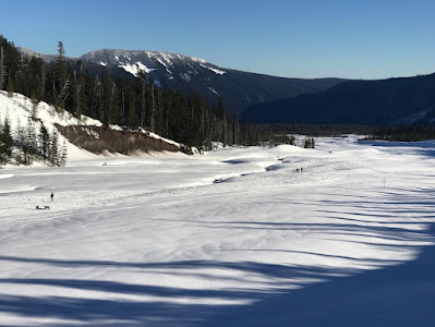
The valley about a 1mile from parking lot