Wednesday, July 28, 2021

Hike: Forest Park (Firelane 15, Wildwood, BPA) III, Portland, OR

AllTrails map

Getting There

Take NW Skyline Blvd north from NW Germantown Road. The Skyline Blvd Trailhead is 1.6 mi and a parking are available on right (east) side of the road.

I parked, put my window shade up, geared up and set out.


The Hike

Length: 7.74 miles
Elevation Gain: 1,726 feet
Type: Loop (except section to trailhead)
Moving Time: 2:21:37
Avg Pace: 18:17
Calories: 1,248
Total Time: 2:26:21

This is the first time I've done this exact route but it only slightly varies from my 'usual' route because I skipped the Firelane 12 section. 

It's a good route to get some elevation gain and distance without having to travel very far. I think I had my best time on the BPA Road section from Hwy 30/Linnton to the top/ridge: 22 min. (Just over a month away from my MSH summit attempt!).

The one notable observation during this hike was that it was strangely quiet on the trail. No birds chirping or rustling in the leaves. No bugs either. It could have been due to the heat but seems like if there are no insects, then birds have fewer food options. It was bizarre.

Monday, July 26, 2021

Hikes: Summary of my week of hikes on my Washington road trip


Summary of my week of hikes, July 2021

Wow, what an adventure! I left Portland on Sunday afternoon. One night near MSH, two nights near Mt Rainier, two nights in Snoqualmie Pass, and one more night near Mt Rainier.

Ever since I started hiking in earnest, I’ve been keeping stats.

This trip included 7 different hikes:
- Total distance: 52.17 miles
- Total elevation gain: 11,770 feet
- Highest elevation: 7,441 feet (Mt Rainer)
- Most elevation gained in a hike: 2,943 feet (Kendall Katwalk)
- Longest distance: 13.1 miles (Kendall Katwalk)
- Avg. distance: 7.45 miles
- Avg. elevation gain: 1,681 feet

F.U. arthritis! Ha!

Saturday, July 24, 2021

Hike: Panorama Point, Pebble Creek Trail, Paradise Glacier, Skyline Trail, Mt Rainier, WA


AllTrails maps


Getting There

This was Day 7 of my Road Trip. I stayed on NF-52 along the Nisqually River the night before because I hadn't made accommodations after leaving Snoqualmie Pass.

I was up early and since I didn't have any gear to pack, I just hopped in the front and drove to the Park.

There was already a long queue of cars waiting to get in but something to be expected for a summer Saturday morning.

Once I got in, the cars were well spaced so it was soon cruising mostly alone. Cars peeled off at various viewpoints and trailheads. I was heading straight for Paradise. By around 8-8:30am the main parking lot was already full but I found a spot in the first overflow lot.

I took my time gearing up, then headed out.

The Hike

Distance: 9.73 mi
Elevation Gain: 2,654 ft
Moving Time: 4:18:36
Avg Pace: 26:34
Calories: 2,279
Total Time: 5:13:51

The Ascent

Since I was on the left side of the trail system, I hoped on Skyline Trail, then Dead Horse Creek Trail. At 6135', I hopped on the Skyline Trail briefly, then onto the Glacier Vista Trail. Then, back to Skyline to Panorama Point, so many trails crisscrossing. 


I really hadn't planned my hike but the weather was perfect and I wanted to gain as much elevation as I could. The spots I'd hiked the previous Tues were swarming with people so I was also seeking fewer casual hikers. I headed up the Pebble Creek Trail which eventually is used by mountaineers heading to the Muir Camp and the summit. I climbed to the snowfield and stopped. I had crampons in the car (dammit!). Most people had microspikes but a few continued without. I figured going down without spikes was going to be the challenge.


Another hiker who appeared to be contemplating the same thing: go on without spikes? I said "Let's go for it". I just went up the first 'hill'. I saw the dirt trail on the left so made my way over the rocks. I crawled up the ridge. I went as far as I could: 7444'.

Distance: 3.2mi - Elevation Gain: 2080'.

I descended from the ice field safely and found a spot to stare at the quiet giant looming above. There was a perfect rock to lie down on.

The view (though stretched)


The Traverse

I followed my route from Tuesday, continuing on the Skyline trail, below McClure Rock and winding downhill. Instead of taking the Golden Gate Trail back to the lodge, I kept going on the Skyline Trail.

The benefit of getting an early start is having time to explore side trails. The Paradise Glacier Trail is a 2.0mi up-and-back trail. The upper part cross a huge patch of snow. I followed the footsteps of previous hikers.

When I got toward the end, a couple was resting at a small cairn. The actual end of the AllTrails trail is buried in the snow but I think I got with 800' of the end.


End of the Paradise Glacier Trail 800' ahead

The Descent

On the way back, instead of crossing the snowfield again, I followed a rocky ridge for a bit, while keeping the trail in sight. (I'd planned to knock down pile of rocks someone had left. Only trail makers are okay). I saw another one a few ridges over. I was really off-trail at this point. I was going to cross a patch of snow and looked down. Mountain Lion tracks in the snow. Not big, maybe a adolescent or female. They looked somewhat fresh, i.e. given the sun/heat, I'd expect older tracks to melt & lose shape. IDK.

I stopped, took the photo, and turned around. In hindsight I should have backed up first and scan the area. Anyway I walked briskly toward the ridge and eventually to the trail. Once I had some distance I turned around and scanned the horizon. Once I was on trail again, I felt safer for no good reason. Why should the snow make me more vulnerable than dirt? False sense of security. (Maybe like finding a forest or logging road when you're lost and feeling like you've made it but in reality you still might be in a pickle.)

Mountain Lion tracks


I made it back to the Skyline Trail. The hike was sort of over for me. So many people. The views were gorgeous but I just was ready to get back to the car. I'd taken about 100 oz of water and had finished all of it. I wasn't sure about drinking stream water, esp. at the lower elevations.

When I got to Myrtle Falls the place was so packed, it was uncomfortable. I donned my mask and weaved through the oblivious throngs.

Post Hike

When I got back to the parking lot, dozens of cars were prowling by looking for a parking space, and when they saw me, it was like sharks circling prey. I'd barely put down my pack and hiking poles and people were asking when I was leaving.

I was tired and this annoyed me. I flatly responded "not for awhile". In hindsight, I could have deflected by saying I was waiting for someone else instead of coming off as "I'll go when I'm good and ready". I looked across the lot and saw a guy snoozing in a camp chair. He knows.

One of the pleasure of hiking (or skiing, snowshoeing) is taking off your boots. When I had accomplished this, my mood improved. I changed into a dry shirt and was feeling much better. Another car came by and asked when I was going. Even though I was close I gave my "not for 10-15mins". The driver said "cool, I'll pull over." I liked that. I immediately chose them to take "my" spot. I quickly finished stowing my gear and told them I'd leave right then. I hoped in, backed out, and waved to them.

Leaving the park, I passed by such a long line of cars waiting to get in. It must have been 2 miles of cars. Ugh. It was time to go home (or at least get out of here.) I was stoked about the day of hikes and thought about it as I drove west.

Friday, July 23, 2021

Hike: Gold Creek Trail, Snoqualmie Pass, WA


AllTrails maps

Getting There

After hiking Kendall Katwalk on Wednesday, I decided to take a break on Thursday to go check out Cle Elum and Kachess Lakes in the Jeep. I had a great day and on the way back I noticed a long valley with peaks at the end (Alta Mountain, 6152'). I pulled off here and scouted the Gold Creek Pond parking lot. I reasoned that Snow + Gem Lake hike would be crowded so maybe this place would a good alternative. The parking lot was sparsely populated but it was late afternoon so it looked promising.

I got an early start in the morning, checking out of my room at the Summit Inn. There were a couple cars at the trailhead parking lot, including one with a couple of guys going for a hike.

I got geared up and set out.


The Hike

Distance: 8.74 mi
Elevation Gain: 810 ft
Moving Time: 3:06:35
Avg Pace: 21:21
Calories: 1,644
Total Time: 3:25:04

The trail starts in some low brush and I quickly got to a Y for the Pond Loop trail and the Creek trail. I quickly found myself on the forest road (which was closed at the trailhead parking lot). This road winds through a bunch of winter cabins. I didn't not see a single one that was occupied but could hear someone with a chainsaw somewhere not far away. One place looked completely empty, as in no furniture, possibly being refurnished or remodeled. I image it's a winter wonderland when everything is covered in snow.


After 1.4mi, I finally reached the actually trail and forest hiking. The route never strays too far from Gold Creek which is flowing pretty well. This part was easy hiking and saw some nice man-made trail features like foot bridges and stone work/water routing.

At around 3.5mi the overgrowth started to be a challenge. I went through parts where I could hardly see the ground, then it would open up nicely.

At 4.1mi the trail crosses Gold Creek but there isn't a bridge. The water was only about shin-deep. I was already feeling apprehensive about the hike. 

I'd hoped to find a well-traveled trail like so many others in the area but found a neglected trail.

If I'd been on a backpacking trip, or with a buddy, I would have happily crossed the creek. I might have brought river sandals or resigned myself to hike with wet boots. Given my incident the previous day, I was feeling pretty cautious about water crossings.

At this point I decided to turn back. I was a bit bummed because I could have done Snow Lake or somewhere like Kendall Katwalk. I had to remind myself to appreciate the beauty that this valley had to offer. I was glad be there. 

Maybe someday I'll go back and reach the Alpine Lakes (Alaska & Joe) and PCT at end of the valley. Probably not, only because there are 1000s of trails on my to-do list. Learn and move on. :)


Kendall Peak, 5441'


Gold Creek

Lemah Mountain?? from Gold Creek

Unnamed ridge on east side

More of Kendall Peak, 5441'

The "trail"

More of the "trail"


History of Gold Creek Pond

Gold Creek Pond is an old gravel pit used in the 70s and 80s to build I-90. It is picturesque but according to what I found online, the man made pond is actually causing “extreme harm to the Gold Creek Watershed.” Bummer :(

Restoration of Gold Creek Advocates: https://www.restoregoldcreek.com/the-issue

former gravel pit

Gold Creek Pond


Thursday, July 22, 2021

Hike: Mineral Creek Trail to Kachess Lake, Cle Enum, WA


AllTrails maps


Getting There 

This was supposed to be a scouting day in the car and a rest day from hiking; I'd hiked three days in a row for a total of 30.6 miles/7732' of elevation gain. (Dang!)

I'd intended to go to Tucquala Lake because I'd come class a couple of years ago when I visited Leavenworth and stayed at the Salish Lodge on that road trip in 2019. Instead of staying on Salmon Le Sac Road, I turned on NF-46, crossing the river. I just keep cruising until the road ended at the Mineral Creek Trailhead. I really wasn't prepared. I was out of drinking water and just had a couple of bottled drinks (iced tea and a Red Bull). I looked at the trail map but I was out of service. It looked like a short one. I figured I'd just see what was what.

The Hike

Distance: 2.98 mi
Elevation Gain: 574 ft
Moving Time: 1:14:43
Avg Pace: 25:03
Calories: 658
Total Time: 1:25:56

I threw what I had in my pack and locked up the car. I filled out the trail registration card and set out. There were a few tents set up next to Kachess River. I thought I was on the trail but quicky realized it was blazing my own trail.

I pulled up the AllTrails map and realized I was supposed to cross the river before the tents.

Up the trail, a couple of forest rangers came by, one had backpack-mounted sprayer. I remember their truck at the trailhead.

It was a gradual descent to the 'top' of Kachess Lake. Along the way are a couple creek crossings that were pretty straightforward. I finally reached a point where I could see across the lake. I found a place to take in the view and snap a couple of shots. 

Kachess Lake

I'd seen another viewpoint on the map about 1/2 mile down the trail, so I continued.

I was stopped in my tracks because of a landslide across the trail. It wasn't new because I could see some boot prints. It was only 20 ft or so but there was nothing to hold on to and it was a 45 deg slide to water. The ROI was low. It was just an arbitrary point on the trail to take a photo. Definitely a lemon.

Landslide across the trail

Kachess Lake again

I returned to the first viewpoint and found a trail that went down to the shoreline. I took the selfie above.

***

On the way back I came to the creek crossings again. I was overconfident and didn't take my time.

I stepped on a wet tree root and my foot just slipped out from under me. In an instant I was knee deep in water and my glasses were gone. I don't know how I didn't hit my face on rocks or roots. My left thigh was screaming in pain. I paused for a couple of beats before it registered what had happened and assessed my body for injuries masked by shock.

Nope, nothing broken, no blood. Embarrassed and feeling really foolish for my carelessness. I made sure not to move my feet and reached into the water to fish around for my glasses. At first I didn't feel them but looked behind me and figured that hadn't been taken further. I thrust my arm back into the water and this time I felt them. Miraculously the glasses AND the sunglass clips were intact and not damaged. Woohoo. I counted my blessings. I crawled out of the water and regained my composure.

I gingerly crossed the creek and slowly continued on the trail back to the car. I kept think how much worse it could have been. I was lucky. So damn lucky.

My leg was definitely hurting and I was bummed that I might not be able to hike for the remainder of my road trip. Fuck.

I was still a bit wobbly when I got to the bridge by tents which was just a log and rope. I almost fell there too because there was too much slack on the guide rope. I just wanted to get back to my car and put this major oopsie in the rear view mirror.


Post Hike

When I got back to the car, I put on dry clothes and did my best to get my boots dry. (Actually only one was fully immersed. Ya! for my waterproof Keen Targhee IIIs). My pants were still soaked and I was nervous to see what gnarly bruise was forming. I peeled them and to my amazement, I really didn't see any discoloration. (Well, it might take some time.).

Cut to: Hotel room the next morning.

There was no bruise, nothing. I basically just slid on the tree root like a foam roll. Whew.

Wednesday, July 21, 2021

Hike: Kendall Katwalk Trail, Snoqualmie Pass, WA

AllTrails maps


Getting There 

I woke up early in Packwood, WA after some awesome hikes around Mt Rainier. I planned on this being a travel day so I took my time driving north to Snoqualmie Pass. I made good time up Hwy 123 and joined 410 at the pass. The visibility was terrible up there. I kind of hoped to have some photo opportunities of Mt Rainier from the northeast.

By around 10am I had already reached Hwy 18 which was closed a couple of weeks before due to a wildfire. It was open and I looked like a typical, foggy PNW morning. I was hungry so I made a requisite stop at Twede's Cafe for breakfast and coffee. I was only about 30min from Snoqualmie Pass.

I finished by breakfast and headed out on I-90. I had no idea what my plan was going to be once I got there. I knew I was hours from being able to check in at the Summit Inn & Pancake House.

I thought about Twin Peaks and the scene where Laura Palmer & Donna Haywood are picnicking. I knew it's not Mt Si but I pulled over and checked AllTrails. There was a hike to the summit. It was totally cloud-covered so I mentally put it on a To-Do list of hikes.

When I took the Snoqualmie Pass exit, I immediately turned left and drove to the Kendall Katwalk trailhead. I pulled into an empty space and looked at my watch.

I guess I'll go for a hike. I had the energy. I had the time.

I geared up and set out.


The Hike

Distance: 13.05 mi
Elevation Gain: 2,943 ft
Moving Time: 5:07:02
Avg Pace: 23:31
Calories: 2,705
Total Time: 5:31:35

I stopped at the pit toilet to relieve myself and then filled out registration card at the rules & regs sign. There was another hiker starting a hike as well. I hurried along and immediately took a wrong turn, the trail to the auxiliary parking lot.

I waved at this other hiker and laughed. Oops.

On the way up I ran across some other friendly hikers, including a dad and his two younger boys who had good trail manners.

At times I had glimpses of recollection from my hike last year. Phaedrus had been there.

The weather really never cleared up. The photos were kind of moody, flat lighting, quite a contrast from the day before when the weather good at Pinnacle/Plummer Peaks. 

I happily reached Kendall Katwalk and said hello to a group (family) that was resting and snacking. I crossed the Katwalk and kept going toward Ridge Lake. I checked the time and decided to turn back. Not today. (If I'd left at 8am instead of after 12noon, I would have had the time.)

Just before crossing the Katwalk again, I stopped to drink some water, and change into a dry shirt for the descent.

The trip down was mostly uneventful. I noticed that the lower I got the more I noticed the freeway traffic noise and the ski slopes below. It takes you "out of nature". I realize now after looking at the map, I'd missed a short but likely steep climb to Kendall Peak. (I'm not sure I'll go back to Kendall given the wealth of trail options nearby but if I do, I want to get up there.).

The cellular signal is strong, even way up there so I did short Instagram Live video. LOL.

When I got back to the car, I marveled that my body was in a lot better shape that last year when I was barely able to hobble across the parking lot. The long descent was especially difficult on the knees and IT band. On this day, I was not suffering any unusual aches & pains. Woohoo!

Tuesday, July 20, 2021

Hike: Panorama Point Loop, Paradise, Mount Rainier, WA


AllTrails maps


Getting There

I made the short drive to the Day Lodge parking lot from Reflections Lakes. I found a spot near the edge of the lot. I recalled stopping here in 2020 to just take a look around. I marveled at the views of the Mt Rainier as well as the peaks I'd just hiked, Pinnacle, Plummer, etc. It's how I image the Alps. I remember coming up here in 2019 when there was snow everywhere and I'd stopped at Carter Falls, my first time inside the park.

Memories. Connections. ... anyway, I geared back up and headed out.


The Hike

Distance: 4.95 mi
Elevation Gain: 1,640 ft
Moving Time: 2:22:41
Avg Pace: 28:48
Calories: 1,257
Total Time: 2:31:01

There are so many trail starting from the parking lot. I quickly ended up on the Skyline Trail. I had no expectations about what elevation I was going to reached. I'd looked at the Panorama Point trail on the map but it's so different when you're out there IRL. The trail was full of people so I had no concerns about being the only one, far from it. 

I could see tiny dots far above me. Hikers. It gave me the drive I needed to keep pushing up.

The weather wasn't great. The clouds around the mountain were low. That band I'd seen earlier had grown. I knew this giant was looming over us all, we just couldn't see it.

When I reached Panorama Point, the views of the surrounding peaks was amazing. The trails are so amazing up there. A pair of hikers were coming down from the Upper Skyline Trail. I asked about the views and was encouraged to keep going.

I reached the Pebble Creek junction and more views of the glaciers and peaks. A group of about 10 hikers emerged from the fog. (I learned later in the Paradise Inn gift shop that they'd stayed at Camp Muir.)

From there I had the option to go back the the same way or continue on the loop. It was about the same distance so why not see new terrain.

The trail snakes down the slopes of the mountain. You can see people as little dots below, well above the tree line. It's a really nice trail so it's easy to make quick progress. The drank in the views.

I reached the Golden Gate Trail junction and happily cruised to the Inn. What a day I'd had. It was getting darkish. I'd put in some great hiking on this day.

When I reached Myrtle Falls there were lots of people that were just sightseeing, not hiking. A group was attending to a woman in a beautiful dress and photographer in the middle of a session. I continued back to the parking lot.

After the hike

Before heading to the car, I popped inside the lobby of the inn. I wanted a mocha which I got and a salad. I set me food and drink down and stepped into the store. Most people were wearing masks but it was sorta crowded. Turns out several were the hikers I'd seen at the Pebble Creek Trail who'd stayed at Camp Muir.  It had to do some research.

I drove back to Packwood.


Hike: Plummer Peak via Pinnacle Peak Trail, Reflections Lakes, Mt Rainier, WA


AllTrails maps

Getting There

Day Three of my July 2021 road trip. The weather on Monday was warm & clear skies. On this Tuesday, I wanted to get an early start so woke up and got ready.

When I got outside the skies were overcast. Oh well, the forecast said clear & sunny so I thought I'd just need to kill some time for it to burn off. I drove up the White Pass. I feel like I bring up the factoid that Phil & Steve Mahre skied here before their Olympic successes.

https://www.wenatcheeworld.com/news/local/olympians-coming-to-mission-ridge/article_feebb382-083d-5d73-ac36-276e3f55b897.html

There wasn't much going on this morning. I noticed a group of mountaineers gathering at the lodge. I remember driving through there in Aug 2018 when there were 100s of firefighters camped out here.

On my way back toward Mt Rainier, the skies were already starting to clear. I caught some glimpses of Mt Rainier and some other alpine ridges.

I cruised through the Stevens Entrance and drove passed the very first viewpoint, parking lot. It was overflowing with cars. Ugh. why? It's almost as if every 4th car sees the crowds and figures they have to stop cuz it must be awesome.

I whizzed by and was soon carving up the mountains alone (or the closest car was 100s of yds behind). Whew. The farther I went, the fewer cars I noticed on the road.

Given my connection to Reflections, this was my first stop. Coming up Stevens Canyon, my hiking curiosity was piqued. I had to get "up there". I didn't know where that was but now I do: Unicorn Peak.

I found a space to park across from the Lakes. I geared up and set out on the Pinnacle Peak Saddle Trail.


The Hike

Distance: 4.18 mi
Elevation Gain: 1,739 ft
Moving Time: 2:34:11
Avg Pace: 36:53
Calories: 1,359
Total Time: 3:28:04

The trail is well-maintained. I passed a lot of hikers but it didn't feel crowded per se. I made good time up and out of the trees. The trail changes from dirt and pine to rocks and scree fields. The upper section has a wall that is beautifully built.

The payoff of passing through the Saddle to backside is well worth the effort. It opens up to Mt Adams and the surrounding peaks: Plummer, Denman, Lane, Pinnacle, The Castle, Foss, Unicorn, Boundary.

There's a sign that says the trails are unmaintained from Saddle. I looked left and right. I saw some people exploring around but when I heard a 'woohoo' from a tall peak nearby I knew I had to get there.

It was Plummer Peak. It wasn't a difficult climb but there were a couple tricky spots. The pair of hiker I'd heard (likely) left a selfie stick which is mine now. Ha.

The views were just incredible. I could have stayed up there all afternoon but I wanted to see more! I saw the trail on the other side of the Saddle. It looked doable.

I hiked down to the Saddle and took the other trail. It's was pretty steep. When I got between Pinnacle & The Castle, I climbed up to see the views of Mt Rainier. In-fucking-credible!

I took some amazing photos and superwide panos. (According to AllTrails, I could have continued all the way to Unicorn as well as complete a loop back to the trailhead. Next time!

I found a spot just below Pinnacle Peak to sit for a minute. I was grinning ear to ear.

The day was young and I had more energy to hike. I made the descent back to the car. 

After changing out of my hiking boots and putting on a dry shirt, I grabbed my Nikon and headed to the Lakes. There was a band of clouds hiding Mt Rainier. I thought about Mr Haines and imagined him standing on the shore somewhere nearby taking a similar photo.

I snapped a couple mediocre shots and headed back to the car. I headed up the Paradise Lodge!

Monday, July 19, 2021

Hike: Windy Ridge to Windy Pass Loop (via Truman, Loowit, Abraham trails), Randle, WA

AllTrails map

Getting There

This was the first hike of my July 2021 road trip.

I left Portland on Sunday afternoon, July 18 and drove to Randle, WA. I camped at Iron Creek Campground about 15 min south of US-12/Randle. My plan all along was to do a hike at MSH before heading north to Mt Rainier but when I got to the road on Monday morning, I debated for a few minutes.

After a couple of beats, I turned left towards MSH.

Windy Ridge Viewpoint and the trailhead is 1h 7m via NFD-25 and NF-99. There are so many hikes along NF-99 include Meta Lake, Independence Pass, Smith Creek Trail, and more. I was headed to Windy Ridge and the Loowit Trail.

When I got the TH, there were only a few cars. I couple I'd seen earlier taking photos along the road also arrived and parked.

I geared up and set out.


The Hike

Length: 7.49 miles
Elevation Gain: 1,253 feet
Moving Time: 2:30:27
Avg Pace: 20:06
Calories: 1,326
Total Time: 2:40:33
Type: Loop (except section from TH to Loowit/Truman Trails junction)

The Truman Trail #207 follows the Spirit Lake-Iron Creek Road for the first mile before you reach the non-vehicular part of the trail and you set out on the plains, where the mountain collapsed onto/into Spirit Lake, on top of hundreds of feet of ash & mud. Somewhere buried out there is the former St. Helens Lodge at Spirit Lake and the remains of Harry R. Truman (RIP).

It's just 0.3mi until you get to the junction to Windy Trail #216E. (The Truman Trail continues west across the plain to Johnston Ridge.)

The Windy Trail changes into the Loowit Trail #216 about 0.8mi passed the Truman Trail junction and starts heading south toward Windy Pass.

The pass is 0.8mi from the junction. This is about as far as I reached when I hiked from Ape Canyon recently.

On the south side of the pass is the Plains of Abraham. The glacier fed creek was still running but I couldn't find a spot deep enough to fill my bottle easily. I ended up with less water than I started with. I didn't really need it. (Also, not using any water purification.)

---

In an episode of Survivorman, Les Stroud talks about the risks of drinking untreated water in some cases.

"But learn this mantra: you will die of dehydration a lot faster than you will from the effects of drinking untreated water. In fact, in all but the rarest circumstances, drinking untreated water won’t kill you at all. Even if you do contract parasites, most of them won’t hit you for at least a week, if not longer. Should you make it out alive, you can easily treat most of them, albeit with powerful drugs. (https://www.bcoutdoorsmagazine.com/finding-water-in-the-wilderness/)

---

After the pass I crossed paths with a guy on a mountain bike. I turned back to check his progress periodically. It was narrowly and slippery on foot, so I'd bet it was challenging carrying a mountain bike.

It's about 0.9mi from the pass and the Abraham Trail #216D junction. This trail takes you back to the Truman Trail and Windy Ridge TH.

A couple of mountain bikers were headed in the same direction but I didn't them again. The trail skirts a ridge just on the edge of the Restricted Zone and zigzags through these small drainage ravines. There are views for days the whole time. You cross through lots of bushes. It was a bit wary of mountain lions but figured the area was not optimal for bears or wolves. I wonder about the food chain here, and if there are enough food sources to sustain larger animals. Best to let the mountain bikers go first. Ha!

I finally reached the Truman Trail & road back to the TH. I met a small group that were taking in the views. I waved and said hello and booked it to back to Windy Ridge. The weather was great, sunny but not too hot, but the lighting for photography was a bit harsh. No ND filter on the iPhone.

Once back at the car, I took my time changing to road-trip shoes and a dry shirt. It felt good to have completed this section of the Truman & Loowit trails. Soon I was eager to continue on my road trip and set off north.


Sunday, July 18, 2021

Road Trip: Mount Saint Helens, Mount Rainier, Snoqualmie Pass, WA


Google Map:

https://www.google.com/maps/d/u/0/edit?mid=13lY7QLGLPGvweV7K2vjD9N3R3A9GMbbN&usp=sharing


Roadtrippers:

https://maps.roadtrippers.com/?lng=-122.83943523240896&lat=46.6916834137775&z=7.18495178484434&a2=t!34112337


Itinerary

Day 1 - Sunday, July 18, 2021

Late start, around 11am, drive I-5 N to Hwy 12 E. 

Stopped in Morton for some groceries

Arrived at Iron Creek campground around 3pm

Set up tent and rearranged gear, edible stuff

Walked around the camp loop for a while, ended up going to the day camp. I just walked back to the campground on the road (NF-25).

Day 2 - Monday, July 19, 2021

Woke up earlier but finally got out of the tent around 7am. Spent the next hour or so breaking down the tent and packing everything but the coffee making stuff. 

When I reached the road I really didn't know what I was going to do. I considered my options around Packwood and Mt Rainier. I reviewed my plans for the following day and the trails around Reflection Lake and the Paradise Lodge. I also thought about doing a run up to High Rock Lookout. In the end, I'd planned my trip so I could be close to the north side of MSH. I wanted to complete the loop I'd started last weekend, and continue scouting the Ape Canyon-Smith Creek-Lava Canyon Loop.

I'm really happy with my choice to stick with the plan. I turned left on NF-25 and headed south. I remember driving this road after a long trek from Concrete. It was my goal the entire trip to avoid the interstate*. (*besides the part between home and Woodland).

As expected there was almost no traffic being that it was Monday morning. Once I turned onto NF-99 to Windy Ridge, I remember seeing a couple taking photos when the first big panoramas came into view from the road. I really want to explore the Mount Margaret Backcountry! Craggy peaks, surreal landscape of blast zone, a slowly returning ecosystem.

The views just got better and better. I remember visiting Windy Ridge last year or maybe it was in 2019, I don't remember. Just incredible to see across Spirit Lake toward Johnston Ridge, Harry's Ridge & Coldwater Peak where I was just hiking 11 days before. I want to see it all, even if it's, by necessity, in stages.

I parked near the trailhead and that couple I saw early pulled up to; it sounded like they were going for a picnic.

I geared up and set out on the Spirit Lake-Iron Creek Road (Truman Trail).

See ____ for the hike details.

I was stoked on a great hike and cheerfully changed out of my hiking boots. I was glad to have started my first full day of this trip with this particular hike. I could continue north to my next stop without reservation.

Since Norway Pass was my second option, I wanted to at least see the trailhead and get a peak at the terrain. I hesitated and passed the turn but went back around and made the turn. Why take the same road back to Randle that I came out there on. (I'd done this road a few years ago so I knew it linked back to the main road.)

This area that NF-26 takes you through is amazing in it's own right. Deep valleys, lush forest, and steep craggy peaks and ridges, outside of the blast zone. This road is the same distance as the main one, 26mi, but there are a lot of potholes and such, so it slow going. No matter, I'm there for the scenery. I would highly recommend this route if you have the time. In fact, I didn't realize where I was on the route but a guy stopped me and asked it it went to Windy Ridge. I said "yeah, more or less, it's definitely the more 'scenic' route to other road."

I emerged from the forest road and to the openness near Randle. I hopped on Hwy 12 and head to Packwood. The Mountain View Lodge just outside of town. I stayed there last summer but for just one night. (I'm recreating part of that trip but taking more time in each. Plus, there are fires and road closures up in the Methow area/North Cascades Scenic Byway.)

Side note: I didn't plan to go into town but I had sudden hankering for pizza. The place I went last time was open for another hour. On the way back into town, a huge herd of Elk or deer were grazing across from the gas station. (The pizza joint was a bust, 30-40 min wait for orders). On the way back, 1/2 the herd had crossed the road, so I carefully passed through.

Day 3 - Tuesday, July 20, 2021

???

Day 4 - Wednesday, July 21, 2021
Day 5 - Thursday, July 22, 2021
Day 6 - Friday, July 23, 2021

Saturday, July 17, 2021

Hikes: Summary as of July 17, 2021


I've been keep track of the mileage and elevation gains for all my hikes since 2018.

I hiked in California to Agnew Lake near June Lake during my May-June 2018 Road Trip.
This was the second time, the first being with Julea & Cynthia when we camped near Mammoth.

2019 was a strange year. I don't recall any hikes. In fact, I took a road trip across the northwest: Oregon, Washington, Idaho, Montana. I did A LOT of driving and no hiking. I walked around Wallowa Mtns viewpoint, also from my motel to the waterfront park in Coeur d'Alene, ID and Spokane, WA, and the restaurant area in Whitefish, MT. I spent so much time driving to the Going to the Sun Road and the Logan Pass Visitor Center. It was too late to hike to Hidden Lake.

Right before the pandemic hit, I took a trip to MSH and hiked the Hummocks Trail loop. It wasn't until July when I ventured up to hike the Vista Ridge Trail that something was ignited. Just two weeks later I was exploring central Washington and hiked 12 miles to Kendall Katwalk. Then, Crater Lakes, WA near Lake Chelan a couple of days later.

2021 was really when things go rolling! My last hike in 2020 was actually a snow shoe adventure at White River. But, early Feb was my first venture up Hamilton Mtn; I only made it to Little Hamilton.

I'm up to 36 hikes this year and have climbed almost 47K feet.

Last Oct, I was out road tripping and randomly stopped at Climber's Bivouac. I just meant to hike on the Ptarmigan Trail until I got tired or hit like 15K steps. I didn't even have a permit to go above the treeline (4000 ft). It seemed doable. I planned to go back on Nov 1st when no permits were required. I left Portland at 6am and made it to the area by 7:30ish. There were so many cars, I was going to be far from the trailhead. Too many people too. I ended up hiking the Ape Canyon Trail for the first time. I even explored Lava Canyon as well. In hindsight I was not ready to summit MSH.

All my recent activity is partly motivated by wanted to be fit & ready to reach the top (4.1 miles, 4000 ft climb). There's a new permitting process this year so I won't be able to try to get a permit until Aug 1st for September climbs.

Wednesday, July 14, 2021

Hike: Forest Park (Firelane 12, 15, Wildwood, Newton, BPA) II, Portland, OR


AllTrails Maps

Getting There

Take NW Skyline Blvd north from NW Germantown Road. The Skyline Blvd Trailhead is 1.6 mi and a parking are available on right (east) side of the road.

I parked, put my window shade up, geared up and set out.


The Hike

Length: 7.59 miles
Elevation Gain: 1,752 feet
Type: Loop (except section to trailhead)


This is the second time I've done this exact route. My "moving time" was nearly the same.

Firelane 15 has some elevation changes right away and at the bottom of a small hill is the junction to take Wildwood or Firelane 12 (1 mile in). On this trip, I went right (south) on the Wildwood Trail. It intersects the BPA Road (at 1.8 miles).

Now I was on a route I've recorded & documented before: Wildwood to Newton Road.

It's 1.0 mile from BPA to Newton Rd on the Wildwood Trail.

It's 1.2 miles from there to the lowest point on the trip at Hwy 30 (BPA/Newton Road junction).

It's 0.9 miles from bottom to top. I've been improving my times getting up this section, from 35min to 25min.

Instead of returning to the Wildwood Trail, I took Firelane 12 back towards the TH. You drop down into a beautiful ravine with the junction for Firelane 15 at the bottom. The creek is dry right now but it's probably nice in the wet season.

The uphill side is a leg burner but only about 300 ft climb over 0.4 miles.

On the way back to the TH on Firelane 15, I took the detour to Kielhorn Meadow. There's really nothing beyond the clearing. It abruptly ends at a locked gate. Through the gap you can see a No Trespassing sign.


AllTrails links

https://www.alltrails.com/explore/recording/afternoon-hike-4206e38--165

Saturday, July 10, 2021

Hike: Ape Canyon to Windy Pass, MSH, Cougar, WA

AllTrails: Overhead view

AllTrails: 3D view (looking north)

AllTrails: 3D view (looking south)

Getting There

Take I-5 from Portland to Woodland. It's 23mi from Kenton to the exit 21.

There are a few gas stations to fill up here. 

It's 46.2 miles to the Ape Canyon trailhead and it takes about 1.1 hrs (if you're going the speed limit ;). From WA-503 (out of Woodland) take this passed Merwin, Yale Lakes to the turn off for the following: Ape Caves, June Lake, Climber's Bivouac, Ape & Lava Canyons.

It's 11.2mi (25min) to the trailhead. The clear cut areas was really sad to see. :(

The small parking lot was full and there were many cars parked along the road. I drove the first place I could pull off the road but it passed a spot so I did a u-turn. Just as I got back to the trailhead a truck was pulling out. I grabbed that spot. I put my window shade up, geared up and set out.


The Hike

Length: 15.37 miles
Elevation Gain: 3,104 feet
Type: Out and Back

Last time I did this hike was Nov 1st, 2020. I'd tried to go to the Climber's Bivouac and do the Ptarmigan Trail to the MSH Rim. It was the first day that no permit was required. Anyway, I barely made it to Pumice Butte and had troubles with my knees (IT band was tight).

The trail stays in the old forest for the first 4.5 miles. I passed though sections where I was getting eaten alive by flies, mosquitos, etc. I stopped to put on bug spray and ended up getting some in my mouth (yuck). It helped a bit but the best option was to keep moving, quickly!

I had a couple mountain bikers pass me and a handful of hikers on their descent.

When I got to Pumice Butte was felt really good. It was nice to emerge from the darkness of the canopy, see some rugged terrain, and get back to the spot where I turned around last Nov.

Several people were camping at the Butte. I temporarily lost the trail and walked into someone camp. She looked at me but didn't say anything. I just blurted "sorry, wrong turn". Because of the Trail Run, there were little colored ribbons marking the route.

There was guy hiking ahead of me. Somewhere on the Plains of Abraham he stopped to take a photo or drink some water and I passed him.

From there, I was in unknown territory. I was flat and easy. I'd seen a sign for the Loowit Trail so I figured I go there, then decide. 

A runner came by and asked if I had any extra water. I had been sipping my supply so I had plenty: 32oz and another full 16oz bottle. I gave him about 2/3rd of that (until his little bottle was full). I thought well, that determines the rest of my day (or so I thought).

When I got to the Loowit Trail junction, I set a new goal: Hike to the foot of the mountain. (The trail sign said 4 miles to Windy Ridge and that was a bit further than I wanted to go.)

About 2/3rd of the way I crossed a fast moving creek/stream. Woohoo!! fresh water. I could see some snow about 100 yds away. I pulled out my empty bottles and filled up. I knew was good water, safe to drink w/o purifying). It tasted so good.

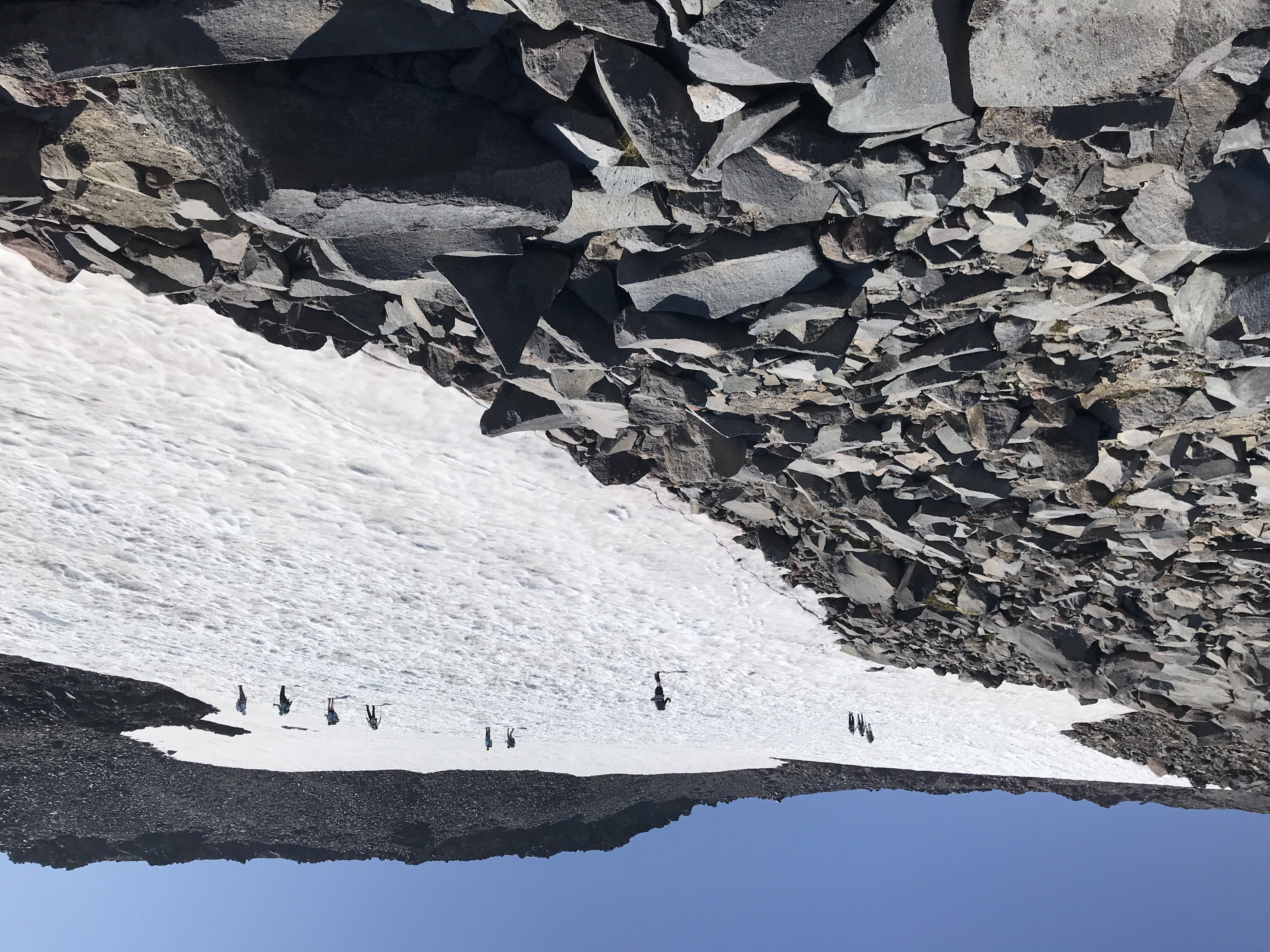
When I got to the base of the mountain, I saw some hikers climbing down a steep path. Holy cow! Until I saw them, I was expecting to head back from here. I thought "I wonder what the top of this pass looks like??").

The 2nd group was a family of four, two parents and two younger girls (7-8 y.o.). Well, if they could do it, so could I.

The view from Windy Pass was amazing. I could see Harry's Ridge, Mt Margaret, Coldwater Peak, and even the north tip of Spirit Lake.

After consulting the map, I saw there was a shorter loop that would link back to the place where I detoured onto the Loowit Trail without going all the way to Windy Ridge.

I couple passed me on the trail while I was enjoying the view and trying to decide what to do. I said "fuck it" and started the trek down.

They'd stopped for lunch and I kept going. In less than 10min I got cold feet. I wasn't up for this extra loop. I turned around while I was still close to Windy Pass and familiar terrain.

The ascent back up the steep trail wasn't bad at all, thanks to my recent training and exercise.

I made it through the pass and back on to the Plains. I filled my bottles up again at the creek. What a great thing. Access to water has been a consideration when I've been researching the Ape Canyon - Smith Creek - Lava Canyon loop. 

When the finally snow melts, that amazing creek will dry up so maybe that loop is best done in early summer.

I walked back to Pumice Butte and had two more runners pass by.

Just before my descent through the old forest, I stopped in the shade and enjoyed the view for 15-20mins.

The bugs weren't as bad on the way down but the 4.5 trip felt long. I was glad to get to the part of the trail that had the views of Ape Canyon.

When I got to the trailhead, most of the cars were gone from there and along the road.

It's always such a relief to take off my hiking boots at the end of a vigorous hike.

This is my longest hike to date. However, I only had 20 mins of peak time (Fitbit). On the Coldwater Peak trek, I had around 240 mins of peak time. Much more exercise, calorie burn.

View of MSH from the old forest (right)

Old tree stump

Ape Canyon (gash in the forest below)

Approaching Pumice Butte

Looking east from Pumice Butte

the beautiful Mount Saint Helens

Mt Adams

Selfie from the Plains of Abraham (Windy Pass in bg)

Panorama from Plains of Abraham

Plains of Abraham from Windy Pass

Coldwater Peak, Harry's Ridge, Mt Margaret Backcountry

Another view of Windy Pass and MSH

Another view of Spirit Lake, Coldwater Peak, Mt Margaret

Wildflowers on Plains of Abraham (Sky Pilots)

Plains of Abraham and Pumice Butte in bg

Another angle of wildflowers (sky pilot) near Windy Pass

Lupines

Looking up the trail

MSH <3