

Getting There
From Bend, OR, take Hwy US-97 south for about 10.9 miles to the Newberry Nat'l Volcanic Monument. Take the exit for the Lava Lands Visitor Center (NF-9702).
The Hike

Elevation Gain: 132 feet
Highest Elevation: 4,620 feet
This was my first stop at Newberry Nat'l Volcanic Monument. It didn't occur to me until later in the week that this wasn't the place that I'd seen from the pictures when I was researching my trip.
Nevertheless, the lava field was an incredible sight to see. The lava field and Lava Butte (cinder cone) are visible from the road. I quickly found that the visitor center was closed until Friday. I was looking forward to introducing myself and an unofficial ambassador from the Mt St Helens Institute.
I quickly found the Trail of the Molten Lands, a paved trail, partially wheelchair accessible. The signage was really helpful to get oriented and I marveled at the unique landscape.
The viewpoint was incredible and gave a bird's eye view of the lava field and the adjacent treeline.
It was a short trail so I was done in less than an hour.


It was a short trail so I was done in less than an hour.
---

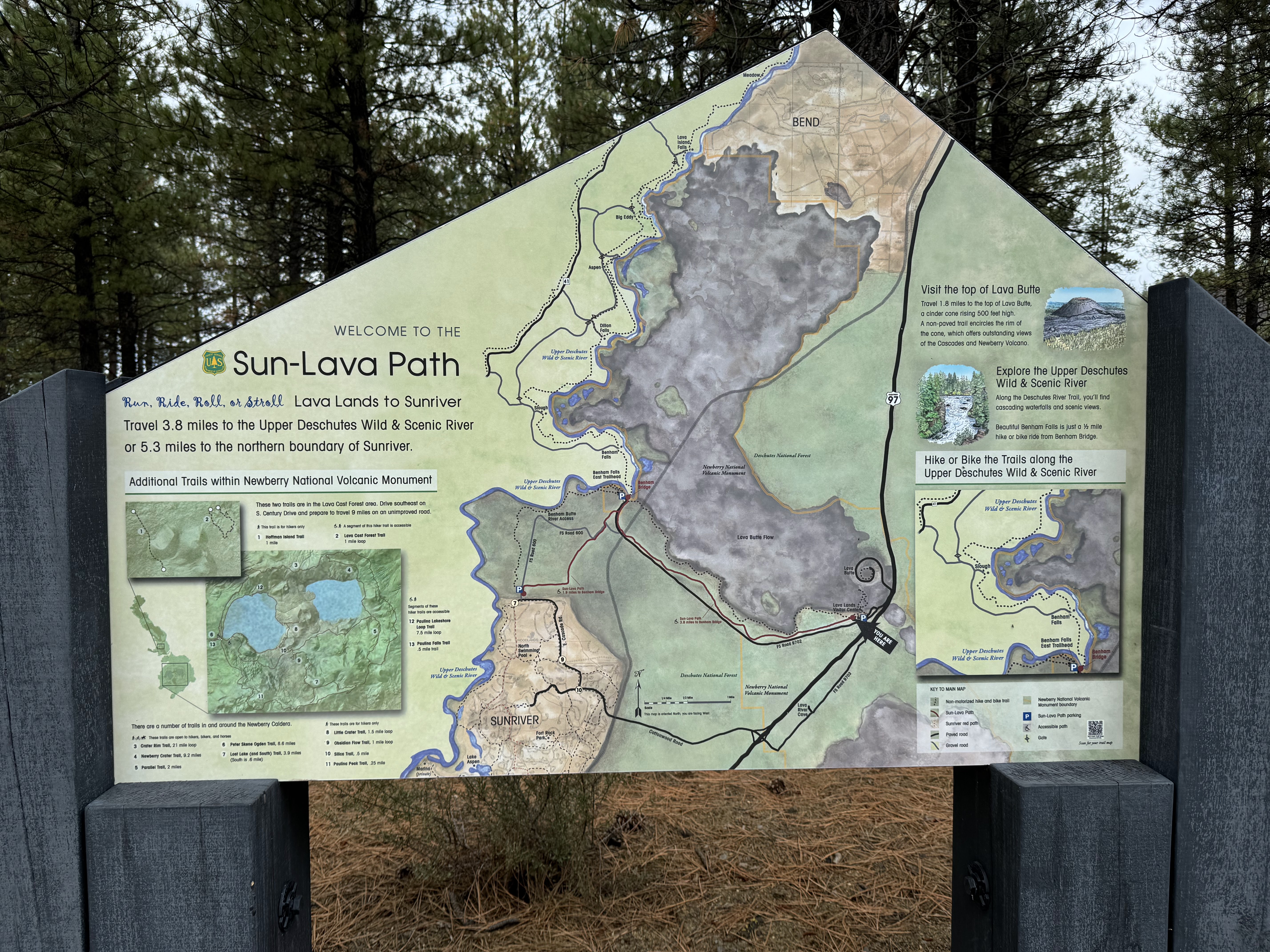
I was stoked to explore this part of the monument. On my way back to the car, I noticed an area map and bike trail: The Sun-Lava Path. I would have loved to bike this path but luckily Crawford Road (NF-9702) lead to a trailhead.
To be continued... (in the next post).