Featured Post

2024: My Year in Review

Another trip around the sun! I kept my same hiking goals from previous years: 52 hikes , 365 miles , 84,000 feet . However, I came up short ...

Tuesday, May 11, 2004

Hike: South Coldwater Trail to Lakes Trail Loop

Distance: 11.6 miles
Type: Loop

Elevation Gain: 2011 feet

High Point: 3948 feet

Duration: N/A


The Hike 

We parked at the boat launch and headed out on the west side of the lake. It hugs the shoreline pretty closely until the far end of the lake. From there it climbs up some switchbacks.

There was still snow covering the trail in spots as it was just mid to late spring.

We'd assumed the trail was same on the east side of the lake, i.e. hugging the shoreline. When it didn't, we should have turned back but instead forged ahead.

At some point we lost the trail and we traversed the hillside, sometimes through knee-deep snow.

We were woefully unprepared for this outing: not familiar with the trail, a late start to the hike, under-dressed for the weather, little water if any.

We hiked SW on the ridge as best we could but eventually it got dark.

There was a glow on the horizon but nothing to illuminate where we were. I remember steeping through a bush and down a little embankment. I imagined 100 ft drops that I'd seen on previous visits to the area. Scary.

We finally made it to a point on the ridge where we could see the lake and amber lights at the parking lot, hundreds of feet below. I think we futilely yelled for "help" a few times.

It started to sprinkle a little so we tried for find anything to shelter against. There are no standing trees for many miles, esp. in the blast zone. It would have been epic if we'd been there on purpose.

By luck or fate, we found some logging equipment, it's wheels deflated & half buried in the dirt. 

Not much of a shelter by at least something to lean against. There were a few logs nearby that we were able to pull some tinder to start a little fire. S. had some notebook paper and I had a lighter so we got a fire going.

It was so quiet out there. Just wind and far off howls of wolves or coyotes, seemingly miles away.

Neither of us got much sleep. Every so often the fire needed more wood. I remember N. didn't even have long pants. Like I said, we were so not prepared.

Just before dawn I was so parched. I blinked repeatedly trying to will my eyes to see through the darkness. I could see the difference in color between the dirt and a little embankment of snow.

It was more or less solid. I scraped a little bit off the top with my fingernails and put it in my mouth. Finally some moisture, hydration, even just a thimble's amount.

With each minute, the sky brightened. We were anxious to get moving and let the fire die out.

The trail was discernible at this point. We continued downhill through the curves. It was easy to see there was no way we could have done this without a flashlight.

We were so glad to finally reach the road. My mind was already thinking about what I wanted to eat & drink as we walked back to the parking lot.

All I had in the truck was a bit of water from the ice I'd had in my fountain drink the day before. 

Soon we were driving out of the park. A park ranger passed us just before the gate he'd just opened. I'm sure it was confusing to see us coming out at 6 am. We camped there but not on purpose. LOL.

Say what you will about Burger King, but that breakfast sandwich we had in Castle Rock tasted so &^% good.

https://www.alltrails.com/explore/trail/us/washington/south-coldwater-trail-to-lakes-trail


Sunday, July 21, 2002

Hike: Vicente Flat Trail, Big Sur, CA

Distance: ~8 miles (total to campground 10.9 miles)
Type: Out & Back
Elevation Gain:
1,687 feet
High Point: 1,851 feet

Duration: ~5 hrs


Getting There

I drove up from San Diego, likely a Friday. I camped at the Kirk Creek Campground at the south end of the Big Sur since it was close to the Vicente Flat Trail. I had a chill evening after arriving.

The following day I went for the hike.

The Hike

The trail runs more or less parallel to the coast and Hwy 1 for a while, then head into the trees, hills. I remember being in awe of these humongous Redwoods. I drank from a creek. I'm not sure if I did the exact distance as this trail but it was a way passed Espinosa Campground1.

"Average mature trees are from 200 to 240 feet high with diameters of 10 to 15 feet at 4 feet 8 inches above the ground." 2

I videotaped a confessional on the trail. This was the turning point for my move to Oregon.

Vicente Flat Trail

Fun facts

Crows ate my food during the hike so I drove up to the Nepenthe for a fancy dinner.

The 40-minute drive each way was worth it. The irony was not lost on me that I was camping but having a sit down meal at an iconic restaurant, visited by notable guests including Jack Kerouac and "Henry Miller, Anais Nin, Man Ray, Ernest Hemingway, Joan Baez, Kim Novak, Steve McQueen, Richard Burton and Elizabeth Taylor."3


Sources:

1 https://www.alltrails.com/explore/trail/us/california/kirk-creek-campground-to-vicente-flat-trail
2 https://www.bigsurcalifornia.org/redwoods.html
3 https://montereyfarmgirl.com/2018/07/06/nepenthes-phoenix-bohemian-bliss-big-sur/

Thursday, August 9, 2001

Hike: Gem Lake via Rush Creek Trail, Mono County, CA

https://www.alltrails.com/explore/trail/us/california/gem-lake-via-rush-creek-trail


Distance: 6.6 miles
Route Type: Out & Back
Elevation Gain: 1,943 feet
High Point: 9,187 feet
Duration: 2 hrs


Getting There:

The Rush Creek Trail starts at the Silver Lake parking lot on the June Lake Loop, just passed the June Mountain Ski Area. I was camping at the Sherwin Creek Campground in Mammoth Lakes with two friends from San Diego. We got to the parking lot in mid morning of the hike.

I think we drove back to San Diego afterwards.

The Hike:

The first two miles has a grade of 17% and climbs steadily above Silver Lake, no switchbacks. At the top of this section is a railway track that looks like stairs from a distance is not. It's pretty technical and you'll want to take it slow and carefully.

A little further along you reach Agnew Lake and the dam. 

The trail hugs the north side of the lake to another dam for Gem Lake.

From what I remember, we hike pretty far up the East side of Gem Lake and had lunch. The map at the top of this post is bit shorter of a hike.

Thursday, June 21, 2001

Road Trip: San Francisco via Hwy 1 & 101, CA

The Day Before the Trip

This road trip was intended to be part sightseeing on the coastline, part traveling to a concert. It was Coldplay for their 2nd of a two night run at the Warfield. I also had a ticket to see The Meters at Shoreline at New Orleans by the Bay Festival.

I was summer and what better way to maximize this experience than take a convertible.

I hopped on the Car Rental website (Budget, Enterprise, Alamo, etc) and reserved a convertible Mustang 5.0. Where do you get a usually get a rental car? The airport. I had my buddy from work give me a ride to the San Diego terminal. From there I grabbed the Rental Car shuttle to their offsite location over by The Casbah on Kettner.

When we pulled into the parking lot, I scanned the parking lot for my ride. I didn't see it but just thought it was getting cleaned from a previous rental. I waited in the lobby from my turn at the counter.

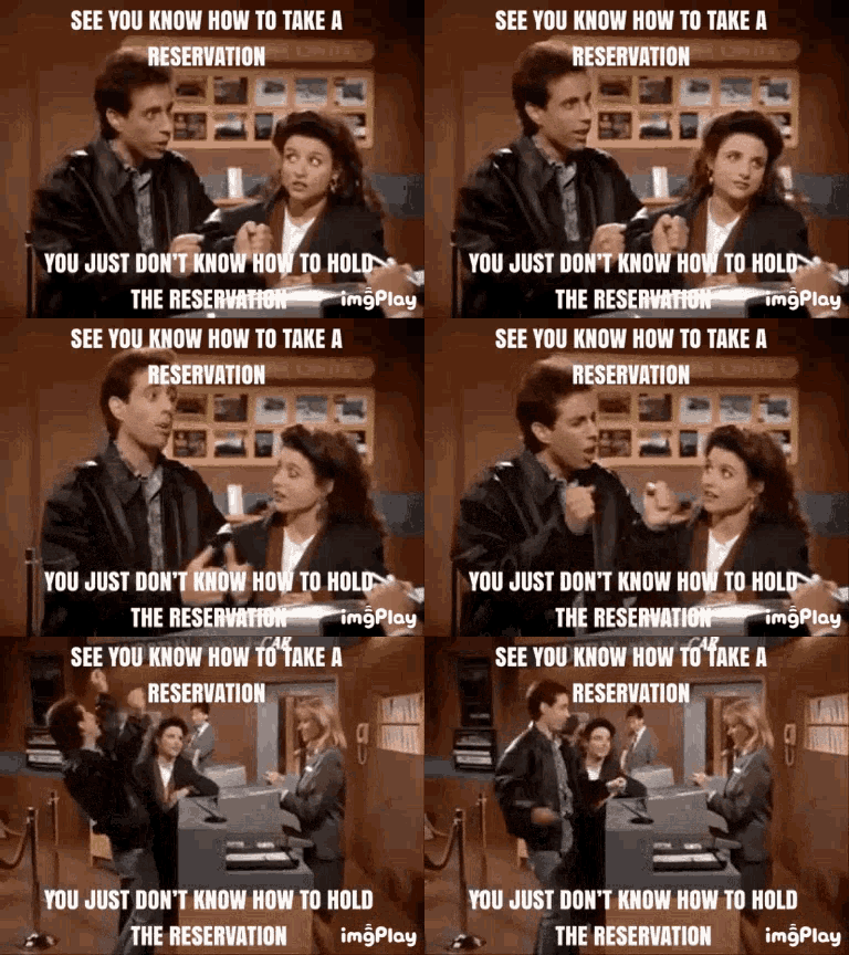
The customer service person pulled up my reservation and stared at the screen for a bit. They didn't have the convertible Mustang I'd reserved. All they had at the moment were midsize and compact cars. It was the Seinfeld episode about the difference between taking the reservation and keeping the reservation.

I told them I wasn't interested and walked out in a huff. This car was the basis of this road trip.

Now I'm stuck on foot on India Street wondering what to do. I found the Car Rental Cafe a few blocks away. They had a convertible Mustang 5.0 in the parking lot and it was available for rental. Woohoo!

While I filled out the paperwork, they pulled it up to the office and got it ready for me. This was an independent rental place so I had to leave a larger deposit and the cost was more than Big Chain Car Rental but it was an easy choice. Like I said, the car was the basis for the whole trip!

I drove back to my place in OB to get ready for an early morning departure the next day.

BTW, I found out a few days before that Coldplay had canceled second night of The Warfield.


Time Warp:

My recollection is out of sync with the calendar. I recall this was a weekend trip. I was going to Coldplay on Saturday at the Warfield and the Meters show was the Sunday. According to my internet search, Coldplay was scheduled at the Warfield for June 20+21, 20011 but only played the 20th2. The Funky Meters headlined the New Orleans by the Bay Festival on Saturday June 23, 2001 at Shoreline3. Maybe I stayed with my cousins on Friday 6/22. IDK.


The Drive

It's kind of nuts. I don't know when I left San Diego but it's almost 600 miles via Hwy 1/101 but I made it to San Francisco before it got dark. According to Google Maps, the Hwy 1/101 route is like 10+ hours so I would have had to get started by 7 or 8am in order to reach my SF hotel by 6pm.

I recall driving through LA traffic and seeing the Hollywood sign. I was jamming music & smiling while others were expressionless going to their job.

It's always so great to transition from the 7 lanes to bumper-to-bumper traffic to Ventura to 4 lanes to Santa Barbara to 2 lanes. By Hearst Castle and 1 lane each direction, there are few people or cars. So relaxing on the eyes to just absorb the views of the ocean and trees.

I hugged the coast all the way up to Mountain View, I think. I might have even driven by the Excite@Home HQ. 


Night on the Town

Since the Coldplay concert was already canceled a few days before, I went to find some alternate entertainment. I took a cab to Geary Street and Fillmore. I found a Japanese restaurant and got some sushi. I considered looking for strip club but saw people lining up at a music venue. I wandered over to take a look.

It was the Boom Boom Room. John Lee Hooker's bar. I remember seeing him in San Diego at Humphrey's by the Bay. As fate would have it, he'd passed away that very day, June 21, 2001 (RIP JLH)4. The Queen of Detroit Blues, the great Alberta Adams, was performing.

I remember standing in there, sensing the energy, quietly express my reverence. Mr. Hooker's booth next to the stage was empty. I don't recall any signs or anything. People just knew.

Ms. Adams acknowledged John Lee Hooker's passing and the gratitude to perform in his bar. I think I have her CD somewhere. (There's a little BB in the CD case.)


New Orleans by the Bay Festival

I have a missing day in my memory, June 22, 2001. I know I went to see the (Funky) Meters, which was on Saturday, June 23, 2001.

I remember sitting on the grass in the amphitheater to see show. I also got some New Orleans cuisine from the one of the many carts.

I knew I still had a long drive back to San Diego so I cut out. I'm not sure how I saw the Funky Meters headline AND still do an 8 hour drive afterwards. My memory.


Sources

1 https://www.billboard.com/articles/news/80229/coldplay-grandaddy-pair-for-north-american-trek
2 https://en.wikipedia.org/wiki/Parachutes_Tour
3 https://www.paloaltoonline.com/weekly/morgue/2001/2001_06_20.wedbox20.html
4 https://en.wikipedia.org/wiki/John_Lee_Hooker

Wednesday, August 3, 1988

Hike: North Boundary Trail, Alberta-British Columbia, Canada


Length: 86.6 miles
Type: Point to Point
Highest Elevation: 7,150 feet
Elevation Gain: 3,440 feet
Duration: 10 days


Getting There

I flew up from San Diego, California to Vancouver, BC and met my fellow hikers & our two guides. We stayed at a hostel somewhere and left the next morning for Jasper, Alberta on the Trans-Canadian Railway. 

https://commons.wikimedia.org/wiki/File:Pacific_Central_Station_Vancouver.jpg
Train Station in Vancouver, BC
 

Observation car

 "The stretch from Vancouver to Jasper is around 19 hours, and you gain an hour along the way as the clocks go forward when you cross into Alberta. The train normally leaves Vancouver's Pacific Central Station at 3pm and arrives into Jasper at 11am the next day, though the timetable can change depending on the season." 1

Train Station in Jasper, Alberta
 

Train route from Vancouver, BC to Jasper, AB via Banff


Trans-Canadian Railway

From the itinerary:

"August 1: Fly to Vancouver, arrive at 3:30 in the afternoon. Travel by taxi to the Jericho Park Youth Hostel where we'll spend the fist night eating burgers, getting acquainted, and sorting through piles of expeditionary equipment. Extra gear and clean clothes for the trip home can be left at the hostel.

August 2: Morning free in Vancouver. We might swim or head out to Granville Island for lunch. In the afternoon, we collect our packs and head over to the train station to catch the 4:30 train to Jasper. We'll spend that night on the train, in seats that lean way back for sleeping.

August 3: We awaken to great views of the Canadian Rockies outside the train window. After the train arrives, well head into Jasper for lunch, fuel, fishing licenses, and last minute supplies for the trip. In the late afternoon we'll catch a van-taxi to our trailhead near Rock Lake. The trip out to Rock Lake takes a couple of hours, so we'll camp at the trailhead that night."

Screenshot of map from @myownfrontier video

The Hike

"August 4: Hike through forest and open meadow to Willow Creek on the Snake Indian River. Camp near Willow Creek.

August 5: Follow the Middle Snake Indian westward to Blue Creek. This is pleasant open country with good views of the peaks, and forests of aspen and lodgepole pine. The valley narrows as we approach Blue Creek, and we'll pass some small mountain lakes.

August 6: Layover day to swim, fish, and explore the country around Blue Creek Valley.

August 7: Hiking up into the high country, we catch great views of the big glaciers on the north face of Upright Mountain.

August 8: Cross Snake Indian Pass (6700') after a long gentle uphill over alpine tundra. Descend to a campsite along upper Twintree Creek.

August 9: Descent past Twintree Lake and then drop steeply into the valley of the Smokey River. Continue on to a campsite at the mouth of Chown Creek at the edge of a broad valley near some glaciers and high peaks.

August 10: Layover at Chown Creek. Great place for a day hike up to the surrounding glaciers.

August 11: Hike up the Smokey River to campsite just below Robson Pass. Adolphus Lake is nearby, and if the weather is clear, we'll have good views of Mt. Robson.

August 12: Cross Robson Pass (5550') and descend past Berg Lake -- full of icebergs -- and pass through the "Valley of a Thousand Falls" to Kinny Lake where we'll make our last camp just a couple of miles from the trailhead. Here the forest is especially lush, because of the surplus rain that condenses around Robson's icy bulk."


Last Night

Our last night on the trail was at Kinney Lake in a cabin. It felt weird to be back to civilization and some modern conveniences. It seems that this area is often used as base camp for climbers.

Last Day

Kinney Lake: On our exit day, we made record time. It was a wide, well-maintained trail to the trailhead on Hwy 16. Someone said there was a walk-up cart in the in the parking lot (a food truck) that had burgers and fries, a welcome change to freeze-dried camp food we'd been eating all week.

From the itinerary:

"August 13: Descend to the Robson River Trailhead, and catch a bus or van-taxi back to Jasper. In Jasper we'll have time for lunch, showers, and a brief re-adjustment to the "civilized" world before catching the evening train back to Vancouver.

August 14: Arrive in Vancouver in the early afternoon. Spend the night at the Jericho Beach Youth Hostel.

August 15: Morning free in Vancouver. After a farewell lunch we'll head over to the airport for afternoon flight home, via San Jose."

--

I have a memory of having to hang our food from a tree at least 200 feet away downwind from our tents. I hadn't really thought of wildlife until then.

Illustration from momsgocamping.com
 

The food and cooking gear was distributed among the hikers but the guides did all the cooking. 

I do recall having a Eureka! moment with my backpack. It was an external frame backpack I borrowed from a neighbor back home. For at least the first day, my shoulders were bearing the full weight of the pack and I was only using the waist belt to keep it from moving around. 

By accident while sitting down on a log, I over-tightened the belt then stood up. Now the weight of the pack was carried on my hips and the shoulder straps were now just for stability.

"A properly fitting backpack should comfortably transfer approximately 80 percent of its weight to your hips and lower body, 20 percent to the front of your shoulders, and exactly zero to the top of your shoulders."

 
Start: Rock Lake (upper right); End: Kinney Lake (lower left)


...