Getting There
Take I-84 from Portland towards Cascade Locks. After the exit for Bonneville Dam, take the next exit (41): Eagle Creek Loop. There is a parking lot near the fish pools. I was surprised that there weren't any cars. I cautiously drove toward the trailhead. I stopped and parked near a bridge, still a bit of a road walk.
I noticed a car continue passed the bridge, so I took a chance and followed. As luck would have it, there was an open spot right next to the trailhead. Wow! This place is usually so packed when the weather is nice!
The Hike

Elev. gain: 1,542 ft
Moving time: 3:14:18
Avg pace: 22:47
Calories: 425
Total time: 3:19:42
This is the first time on this trail in many years. The last time was with a coworker that was visiting from San Francisco. We hiked up to Punchbowl Falls. I remember parking at the 1st lot near the exit and it was nearly full. This might have been around 2014-2015.
Before that, I was here with Brian, Holly, and Andy and we had Miles, Jodie's black lab. I also remember hiking by myself once up to the first bridge that crossed the creek.
This was my first hike of 2024. I wanted something close to home since I got a later start. I decided against Wahkeena/Devil's Rest for my first hike of the year. Something familiar but new. It's always crowded in the summer and when the weather is good. I remember driving by this past summer and see cars parked on the shoulder of the freeway exit. Geesh!
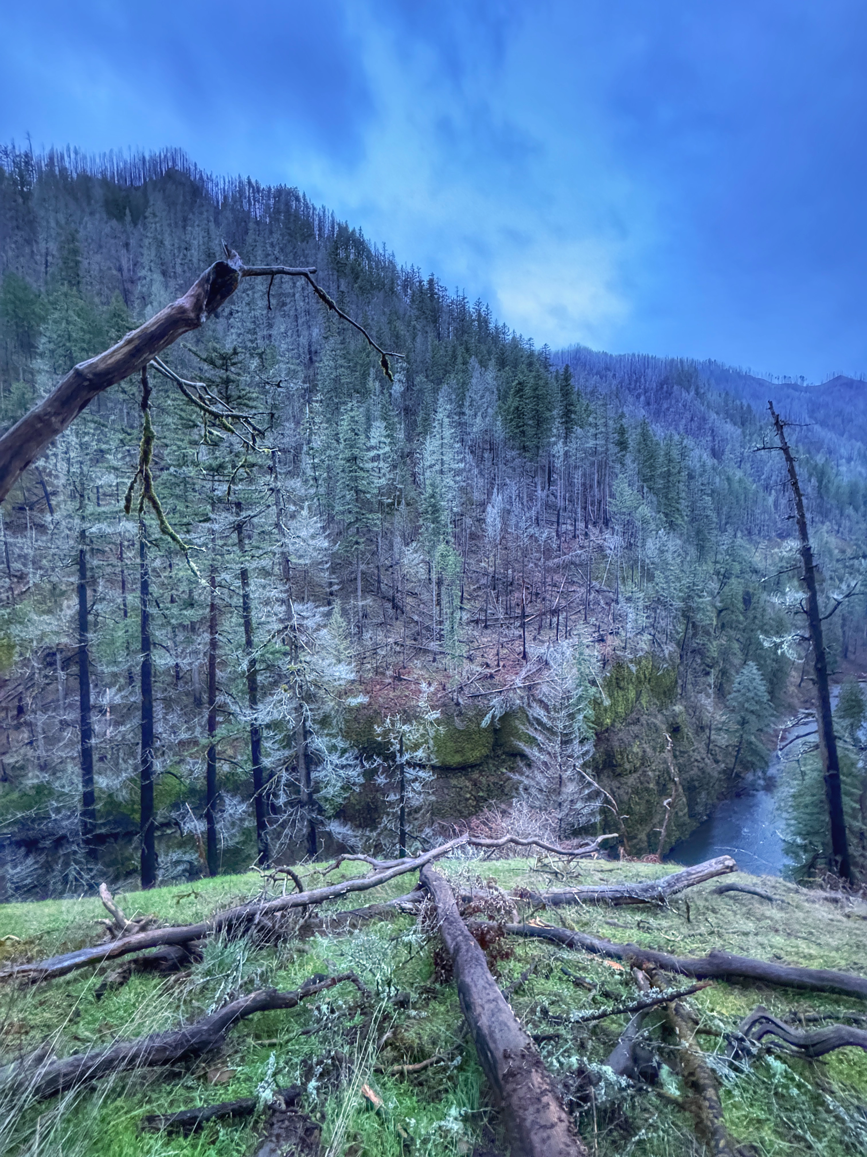
This trail is the site of the 2017 Eagle Creek fires that devastated the Gorge. There was so many dead trees. Like Triple Falls in Oneonta Gorge, the forest is sparsely populated with young trees. The views are spectacular with deep ravine and sheer cliffs. The place demands respect and I certainly held onto the cables on the narrow sections.
I gave myself until about 3:30p before I had to hike back down. That gave me about an hour of daylight and about an hour or so for walking. I made it to the car without needing to get out my headlamp but it was close, very dark blue light. I wondered about the people I'd passed, and how they were faring in the darkness.
While it's not necessarily a trail for people afraid of heights, it doesn't offer much of a challenge, elevation wise, though I still got about 1500 feet of EG. I do want to return when I have a lot more time, and hike all the way up to Tunnel Falls, about twice as far as I got this time, just passed Four Mile Falls at the bridge that crosses back over the creek before Tenas Falls.
This trail (a segment of the PCT) and goes all the way to Wahtum Lake and beyond. That would be an overnight trek and chance to check out Chinidere Mountain (again) and Tomlike Mountain before returning to the start point.