Saturday, August 31, 2024

Hike: Monte Cristo Mountain, Cook, WA


Getting There

For this WTA trail work party, we stayed at the Oklahoma Campground. From WA-14, just east of the Dog Mountain Trailhead, is the turn-off at Cook, WA. The campground is 14.2 miles north on Cook-Underwood Road.

This trail has an upper and lower start point. Our crew leader took off to meet volunteers arriving in the morning. The rest of the camp crew left not long afterward but we didn't know which trailhead we were meeting at. Two cars of us drove to the lower trailhead. It's on a potholed dirt road that gets more narrow and overgrown as we progressed. The trailhead was hidden in the foliage somewhere but we knew we'd gone to the wrong spot.

I managed to turn around (about a 5-point turn) and we headed back to the campground. I saw our crew leader's truck coming up the road to intercept us. I quipped a dad joke "guess we went to the wrong trailhead." (In hindsight, since the "wrong" road went right by our campsite and we didn't see the CL's car, we should have deduced it was the "other" road. Oh well.

We drove to the correct meeting spot, about 6.3 miles from the campground on NF-1840. We rendezvoused with the others and started out.

The Hike

Distance: 2.61 miles
Elevation Gain: 1,040 feet
Maximum Elevation: 4,176 feet


The forecast said the afternoon temperatures were going to be just under 100 degrees, at least in Trout Lake, WA. We lost an hour with the trailhead confusion but we had a good crew that worked fast and efficiently.

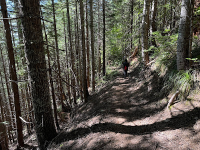
There was a small team of brushers with power equipment, a few folks had loppers, and we did a lot of treadwork including knocking off berms, rebenching, and creating a few drains.

As we made our way up the trail, I was feeling sluggish. Even though I had electrolytes, snacks, and water, I wondered if I was out of shape or it was the heat. Of course, I had some tools but not anything too heavy. I was somewhat glad to learn others were feeling the same. Maybe it was environmental.

We were scattered for lunch but I ate with Dave and Dax. Afterwards, the small teams continued to leapfrog. The trail seemed to get steeper, the higher up we climbed. I had to stop a bunch of times to rest and lower my heart rate. 

Eventually, I reached the bottom of the clearing. The brushing crew had dropped their gear and continued  to the top. I kept my bag but dropped my tools but kept my backpack. It was really hot out of the trees.

I rounded the last switchback and gained a little boost of energy. Whew! What a view from there. 180 deg panorama with Mt Hood to the south and the tip of Mt St Helens to the north. 

We lingered for a bit until everyone had made the hike to top of the ridge. We admired the views and took photos for a bit. Before we started the trek back down, the CL took a group photo. 

It was great to retrace our steps and admire the trail work on the way down. Back at the cars, I was happy to ditch my packs and cool down. We ate chips and drank sodas or Gatorade, and enjoyed some watermelon.

A good day and we completed all the things we set out to.


Thursday, August 29, 2024

Hike: Kalama Falls, Cougar, WA


Getting There

I was already at the Blue Lake Trailhead. I headed back down NF-8123 to NF-81. I parked at an unnamed forest road. It was about 6.2 miles.

This was a bonus hike. I had originally thought I could head to the 83 road to find some visitors to interact with but decided against it. I'd been wanting to hike this waterfall for awhile but it also seemed like it was busy with people. There was only one other car parked across the road.

The Hike

Length: 4.05 mi
Elev. gain: 312 ft
Moving time: 1:14:55
Avg pace: 18:31
Calories: 758
Total time: 1:16:58


I took my bear spray because I was feeling a bit vulnerable. At the Kalama HC, there was a sign on the bathroom that said "Don't leave food. Bear in the area."

About 1/4 mile from the car, I saw that other hiker. I knew I was now alone, unless someone had accessed the falls from a different starting point. I walked briskly and kept my eye on the trees on either side of the road. 

I passed the trail but decided to stay on the forest road for awhile longer. 

I finally reached the falls trailhead and dipped off the forest road. I started saying "Hey bear" over and over. I did see several large piles of poop. I doubted it was dogs or horses and suspected it was bear scat. Yikes. 

The falls are very picturesque but I felt rushed. I wanted to snap some pictures and start heading back to the car.


I would like to come back and bring some friends to check it out. Safety in numbers. The trek back seemed longer than the trip to the falls. I was happy to finally see the gate and FS-81.

Hike: Fossil Trail, Mt St Helens, Cougar, WA


Getting There

Coming from Chelatchie (MSHNVM/USFS HQ), take WA-504 to Lewis River Road. About a mile west of Cougar, take FS-81 toward Merrill Lake. The road becomes Merrill Lake Road. Continue for another 3.7 miles to Kalama Horse Camp.

I met two other MSHI/WTA volunteers. They hopped in my car and we continued to the Blue Lake Trailhead. Keep heading northeast on NF-81 for 2.7 miles and take NF-8123. The trailhead is another 1.5 miles.

The Hike

Length: 8.34 mi
Elev. gain: 968 ft
Moving time: 4:22:43
Avg pace: 31:31
Calories: 2,658
Total time: 5:06:25


The purpose of this hike was to scout the Fossil Trail for an upcoming trail work party. It was good to hike with fellow MSHI/WTA volunteers and explore a trail I've never been on. In early July, Rod and I had hike the Toutle + Cinnamon Trail out of the Kalama Horse Camp and had quite an adventure navigating through an obstacle course of blowdowns and an eroded trail.

We only encountered one hiker that was doing an out-n-back hike from the Kalama Horse Camp to the "Rusty Creek" bridge, and back. He mentioned learning about WTA from their website and being turned off by the call for "young & energetic" volunteers. He was surprised to learn that most of the folks are retired and older than 60.

He also reported that most of the remaining trail was in good shape except for an overgrown stretch. Overall, the trail was in good shape but there were definitely some sections that were in-need of brushing and treadwork.

It was an easy hike coming from Blue Lake, east to west. It looks like the elevation gain is double if you hike the other direction, west to east.


After we got back to Kalama HC, we scouted the forest road that volunteers would use to get to the work site in the middle of the 8+ mile trail, too far to hike with tools from either trailhead.

Unfortunately, the road becomes heavily rutted about 1/2 miles from the where the crew leader wanted to reach. Therefore, the Fossil Trail project was scrapped/postponed.

Sunday, August 25, 2024

Hike: High Rock Lookout, Towhead Gap, WA


Getting There

In the morning I had hiked up to Packwood Lake, so to get to High Rock Lookout trailhead, I dropped back down to Packwood and crossed US-12 onto Skate Creek Road. It's also labeled NF-52. Follow this westbound for about 18 miles. Keep an eye out for signs to High Rock Lookout. Turn left (south) onto NF-52, a dirt road with some potholes and dips.

Keep going for about 4.5 miles and look for a slight right onto NF-8440. The trailhead is another 2.6 miles. It tends to get busy up there since it's a popular hike and there are likely more folks that can't get into Mt Rainier due to the timed permit system.

I was fortunate to find an open parking spot right next to the trail but there were cars parked on the shoulder around the bend as well as some person's Toyota FJ Cruiser that was parked high up on a rock like some car manufacturer's promo. LOL.

The Hike

Length: 3.53 mi
Elev. gain: 1,339 ft
Moving time: 1:39:08
Avg pace: 28:07
Calories: 1,003
Total time: 1:53:19


This was only my second time hiking this trail. I'd tried to get up here way back in April but, of course, the roads were long from being opened. 

My feet were tired from the Packwood Lake hike but I was determined to get to the top. I'd just driven for an hour and I still had to drive back to Portland afterwards. I knew it was well traveled and no way to get lost since it's a ridge out-n-back trail.

I passed two couples on the way up which gave me some motivation to keep going even when I was winded. I had to pause a few times to let my heart rate drop back down.

I remember some of the places on the trail from my previous hike back in Sept 2020. Whoosh! That was a long time ago!

Near the top, there are a couple places where you can see the lookout from below. I noticed some people standing up there, looking over a railing. I didn't remember that you could stand on the roof, maybe that was new.

I rounded the last switchback and saw the last traverse. I paused to rest for a minute. A hiker on their way down gave me some encourage that I was almost there. Indeed. 

I finally reached the edge of the trees and the scramble up the slab of granite. The structure was indeed gone. The people I saw earlier weren't on the roof but rather, standing on the floor.

Several people were on the platform enjoying the views. Several more people were scattered below on the rocks getting some other vantage points. Mt Rainier was hidden somewhere in the clouds. You could barely make out its shape, or at least the lower flank.

I was happy to have made it up and gotten a bit of elevation since the Packwood Lake hike wasn't very challenging.

I changed my shirt at the top and put on my puffy jacket. It was both cool and humid. I was glad to be in a dry top. I started my descent and kept a steady pace to the bottom. My foot and toe pain came and went. Nothing major.

I passed a bunch of folks going up and wondered if they had flashlights and/or warm layers. The clouds were dark nearby and it seemed like rain was possible. Not my problem!


Looking south from the trail


Looking north

Cora Lake

Looking south

Hike: Packwood Lake, Packwood, WA


Getting There

From I-5, take Hwy US-12 eastbound for about 65 miles through Morton & Randle to Packwood. Drive through town until you reach the intersection for Skate Creek Road + Snyder Road. Take Snyder Road (east) for about 1.5 miles until it becomes NF-1260. Continue for about 4.5 miles to the Packwood Lake Trailhead.

The trail is for hikers and pack animals. It's a huge parking lot with a pit toilet, and ample room for horse trailers.

The Hike

Length: 9.25 mi
Elev. gain: 1,578 ft
Moving time: 3:08:59
Avg pace: 20:26
Calories: 1,912
Total time: 3:34:55


I kind of wanted to head up to Paradise or to Reflection Lakes and hike up to Pinnacle + Plummer Peaks but there weren't any timed entries available. I thought about heading down to Cispus and driving up to the Burley Mountain Lookout but I wanted to get out on the trail.

Packwood Lake Trail looked like a good option, albeit not as challenging as I might have wanted. I half expected the parking lot to be empty. I had no idea. Packwood Lake is a popular entry point for the Goat Rocks Wilderness. I passed a scout troop and another group of backpackers.

Before I got started, a couple with minimal gear set out and another person that didn't have a pack. I never saw them on the trail but did when I reached the lake. I learned from the forest ranger that it's quite popular spot. Maybe the mid-Aug rain had scared many away. I wondered if the Rainier permit situation drove people to try alternate hikes in the area.

The lake was beautiful and huge. The water was that emerald green glacial water. The island in the middle was from an ancient landslide. I noticed a hydro-electric dam near the ranger stations but learned the lake is about 1000 year old.

 
The 1910 Ranger Station is currently being restored in a partnership between the USDA Forest Service and volunteers. 


There are a couple dozen epic campsites that have been grandfathered in by the USFS. The PCT is not far from the lake via the Upper Lake Creek & Coyote Trails, approximately 5 miles.

I was happy to reach the trailhead parking lot but I still wanted to hike more and some elevation gain. Next stop: High Rock Lookout.

Saturday, August 24, 2024

Hike: Glacier Overlook @ Mt St Helens, WA


Getting There

I drove from Portland to Randle, then dropped down on NF-25 to Wakepish Picnic Area & Sno-Park, at the junction for NF-99. I was technically "camping" but I just slept in the back of my Jeep. It was good to have access to the pit toilet there. 

In the morning of the hike, I drove about 16 miles to the Windy Ridge parking lot to meet the guides, fellow volunteer, and guests. 

The clouds/fog filled the valleys to the east so I had to stop to snap a couple of pics.

After a short talk in the little amphitheater, we carpooled to the trailhead, about 2 miles. (Funny to pass hikers, mostly on the way out, who look surprised and wonder why we got to drive beyond the gate.)

The Hike

Distance: 6.77 miles
Elevation Gain: 1,760 feet
Max. Elevation: 5,277 feet

Note: This isn't the actual hike route. We are accessing an area that is off-limits to the general public through special permission from the USFS & the Cowlitz Tribe, I didn't want to make the actual route public. This is just the AllTrails map for Loowit Falls, which IS open to the public.

Additionally, we had access to the trail from the staging site for the Spirit Lake tunnel project road.


This was my third trip to the Glacier Overlook. I'd first been here in mid-July for the training hike with all the volunteers, guides, and some staff. I came back as a "paying" guest on at the beginning of August. This time I was supporting the guides as an MSHI volunteer. Plus, I'd hoped to get a third picture of the crater & domes for comparison.


While everyone was getting their gear ready for the hike, we spotted a herd of elk traversing the lower flank of the mountain, somewhere between Sugar Bowl dome, a nearly circular protrusion of hypersthene-hornblende dacite, and Windy Pass on the Loowit Trail.

Elk herd (middle right of the image)

Everyone was in good spirits and glad to be out on the Pumice Plain, despite the limited visibility of the mountain or Mt Margaret backcountry. We hiked to the closest point the the glacier for this hike. I turned around and snapped a pic of ravine were Loowit Falls is located. Incidentally, on the right is an old helicopter landing pad. What's left are some concrete posts to secure the aircraft in high winds.

Near where we had lunch, we spotted this pumice "bomb", a chunk of pyroclastic debris ejected from the volcano. It look a bit like Dutch crunch bread or tiger bread. I was cooling and cracking on the outside but still molten on the inside. We found other other rocks that were similar but completely shattered.

The next four pictures are various angles of the crater and zoom levels. It looked like the recent rains had washed some of the dirt and rocks from the leading edge of the glacier. It's about 60% ice, 40% rock. We caught a glimpse of the rim but it quickly disappeared behind the clouds/fog.


After lunch and a short talk by the guides, we headed back down to the Loowit Trail. The fog/clouds were hanging just above Spirit Lake. When we got down to the official trail, we took a poll to see if we had consensus to take a side trip to Loowit Falls. I'd never been that far west on the Loowit Trail and was happy for the bonus trek.

The falls is about 0.7 miles from where we were. You can see it once you make the 'turn' from the Loowit Trail.


One more look at Spirit Lake as we started heading back to the cars.