 |
| Wahkeena Creek |
Getting There
I was not planning to hike here when I left the house. I headed north from my house to WA-14 East. I was contemplating doing Hamilton or Hardy Ridge. When I got to Beacon Rock, the road to the trailhead was open but I kept going.
I was low on fuel but didn't take the time to top up at N Bonneville or Cascade Locks. After crossing the river, I decided to take another run at Devil's Rest.
Again, I liked being able to park between the eastbound and westbound lanes, instead of having to get on the Historic Hwy. Plus, real or imagined, I'm guessing this parking lot is "safer" due to high turnover and cameras.
The Hike
Length: 8.64 mi
Elev. gain: 2,513 ft
Moving time: 3:32:52
Total time: 3:48:33
Avg pace: 24:39
Calories: 2,140
 |
| AllTrails map |
First hike of 2023! Returned to the Wahkeena Trail (420) via Multnomah Falls. My intention was to reach Devil's Rest via the Angel's Rest Trail (415).
I geared up and headed straight for the Return Trail #442 to get to Wahkeena Falls trailhead.
At the top of the switchbacks, I took the Angel's Rest trail #415. I didn't expect to head north but it did. Finally I started the switchbacks up the ridge. I found a mix of mud, snow & ice.
I reached the Primrose Path junction and followed for a couple hundred feet but bailed soon after cuz it was steep and narrow. (It's about 700' climb over 0.4mi.) I've never been up here so opted for the main trail.
 |
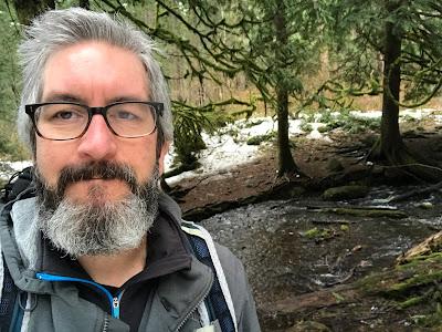
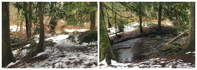
| Wahkeena Creek (near Angel's Rest trail junction) |
I returned to the junction and continued on Angel's Rest #415. When reached the next turn (Lily's Lane) I considered the time and it still seemed like I was a ways away from my goal. I only went a few hundred feet then aborted that one too. Too many unknowns: return routes, distance, downfall/obstacles, and it was already 2:30p. Darnit! Close but too far to reach Devi's Rest today.
I
started down the Angel's Rest to back Wahkeena Creek. Instead of starting my descent, I continued east to the Vista
Point Trail (419). The trail is narrow but easy to follow. From the viewpoint I could see my car way down there
🤣.
 |
| Columbia River from Vista Point viewpoint |
I descended back down and rejoined the Wahkeena Trail (420) then, back to the parking lot via the Return Trail
(442).
Hindsight: I think a clockwise loop via Devil's Rest Trail (420C)
would best in winter. I'll have to come back a third time to finally
reach Devil's Rest!
