Friday, September 15, 2023

Hike: Hamilton Mountain + Hardy Creek Loop, N Bonneville, WA

Selfie from Little Hamilton Mtn

Getting There

Just after Doetsch Ranch you'll see the Ranger Station on the north side of the road just before the Beacon Rock parking lot, then another road across from the bathrooms. The road winds up the hill for a bit.

It must be past the summer tourist season because there were a bunch of open spots on the parking lot.

Apparently, I didn't clean my water bottles out well enough and my 32 oz green one had spots of mold inside. Fuck. I'd brought my Sea-to-Summit 6L pouch that was about 1/2 full and ended up strapping it to my pack. Good thing I had it because it was a hot one in the Gorge.

The Hike

Length: 7.69 mi
Elev. gain: 2,270 ft
Moving time: 3:10:06
Avg pace: 24:43
Calories: 1,916
Total time: 3:45:40


After a doozy of a week, moving out of my house and enduring the long process including the closing, I needed a hike. This was the first hike since my MSH summit last Wednesday. My feet were still hurting a bit.

I hadn't had any food in the morning so I was wondering how I would do. I gulped a can of coconut water at the car and munched a handful of nuts 'n' dried fruit.

At Baby Hamilton, a trail runner past me and didn't have any gear, i.e. water. Wow!

I knew I was doing the Saddle-Hardy Creek Loop but I wanted to stop at Little Hamilton for the views. To my dismay, I saw that some asshat had chiseled out the USGS Survery Marker and stolen it. What a P.O.S! I took a photo of it back in May 2021, but I know it was still there when I was there in July.


Photo from May 29, 2021

I looked towards the switchbacks above and could see the trail runner disappear into the trees. I continued onward. I was a bit tired, energy-wise, but my legs felt good. I drank a lot of water+electrolytes. I was finishing my Nuun tablets. I took a lot short breaks to snack and drink fluids.

Just before the last turn and straightaway to the top, I finished my drinky drink. I gave me the fuel I needed to finish strong. I knew I had more water and electrolytes - Liquid I.V. At the top, I stopped for a few minutes, then continued to the Saddle.

A little way along, I stopped at a place where I could prop my back up and refill my bottle from the pouch.

At the MSHI happy hour last week, I'd talked with the trail work manager about gathering intel about the BRSP since I'd mentioned I hike there a lot. I was making mental notes about downed trees and other things that seemed noteworthy. The big item in my mind was the stolen USGS marker.

I carefully avoided touching any bushes lest they be poison oak or ivy. I was in shorts and short-sleeved shirt.


It was empty out there on the Saddle. So peaceful and rewarding to bask in the sun and enjoy the views.

As usual recently, I took Don's Cutoff Trail down to Upper Hardy Creek. About 2/3rd of the way down, I stopped and closed my eyes. It was so quiet. I thought about the noise from my former house from the trucks, train, PIR, crazy lady across the street. No more. But also, that I don't stop and listen enough when I'm hiking.

I didn't see anyone until I was back to Rodney Falls.

One person stopped me to ask about a pool of water. I said they could climb down to the water but that everything was really dry this time of year, just a trickle. I wonder what they were expecting.. maybe a pool they could swim in?? 

I skipped Little Beacon this time around. All in all, a good hike.

Thursday, September 7, 2023

Hike: Mt St Helens Summit, Cougar, WA


Getting There

From Portland: Take I-5 N for 28 miles to Woodland. Take Exit 21 for WA-503 E to Cougar. Follow Lewis River Road (WA-503) for 30 miles. Continue east for another 3.4 miles past Cougar on Road 90 and take NF-83 for Ape Cave/Climber's Bivouac. Take this road for 3 mile then turn left on FS-81 for 0.4 miles. Turn right onto Road 830 (dirt/gravel) and take that to Climber's Bivouac (2.2 miles).

I realized about half way between Woodland and Cougar that I'd left my hiking poles in my garage in Portland. It's weird how the mind works: I was listening to music and enjoying a leisure drive and it hit me. Fuck! I pulled over and did a search for the nearest store that would have some. I didn't want to drive all the way back to Portland. I thought it'd either be Woodland or Battle Ground. 

I found a Walmart in Woodland and double-backed. I wandered the section of the store where they were sure to be but I didn't see any trekking poles. I approached a store employee and asked. Yes. Aisle whatever. I panicked for a second, thinking they were out of stock but hooray!, a pair of aluminum poles. I grabbed 'em and a small cooler. (I'd also left my cooler at home and had guacamole and hummus from my stop at the Woodland Safeway a hour earlier). At this point I wanted to top up the gas tank and stopped at a AM/PM near the Walmart. I grabbed a small bag of ice and headed back out Lewis River Road. Whew!

When I got to Climber's Bivouac, I spent an hour or so organizing my stuff and putting snacks in plastic bags for the hike. There were people on the other side of the parking lot but I had my side to myself. It was pretty quiet since I didn't have my little Bluetooth speaker. Eventually, it got a bit cool and dark and I got in my cocoon in the back of my Jeep. Even with the yoga mat and blanket, I didn't have enough padding. Argh! Lying on top my sleeping bag helped.


I was awake every few hours as cars pulled into camp, their headlights illuminating the place briefly. Once I was in the sleeping bag, I really felt the lack of padding. 🤣. Luckily, there was just enough cell phone signal to stream some tunes from Spotify.

Around 4am I saw a few hikers with their headlamps walk by. I wasn't ready. Around 5:30a I put on my hiking clothes to warm them up in the sleeping bag. I waited until about 6am to get out of truck and take a wazz. I ate a banana and drank 1/2 can of maté: breakfast. I got on my boots and pack and walked to the sign-in board. There was just enough morning light to see my permit to enter the number into the register. I realized I might not have locked the car. I tried to see the taillights flash but couldn't. When I got back to the car, a big group was getting a pep talk. They were recruits or army reserves, about 10 guys. I pretended to get something out of the truck and consciously locked the car. Here we go!

The Hike

Distance: 8.18 miles
Elevation Gain: 4,570 ft
Highest Elevation: 8,258 ft
Total Time: 8h7m
Ascent: 6:15a - 10:45a (4h30m)
Time at Top: 10:45a - 11:35a (50m)
Descent: 11:35a - 2:22p (2h47m)


I started the hike through the forest. No other climbers were around. It was nice and quiet and I got adjusted to my pack.

At 6:56am, I was close to the Loowit Trail and sun was coming up.

At 7:09, I reached the treeline at about 4,800 ft. This is the end of the Ptarmigan Trail. I remember reaching this point back in 2020 when the idea of doing this climb was planted. I was just out exploring the lakes/reservoirs and drove up to Climber's Bivouac on a whim and did the hike. I had no idea what was involved.

I made my way up the Monitor trail and stopped to enjoy the views to the south and above me. A couple of pair of climbers past me and I passed a father and daughter that were doing this hike for the first time. I talked about my volunteer role on the trails below.


I didn't take any photos between 9:13a and 10:53a, after I'd reached the top. About 1/2 way up in the boulders, I synchronized with that group of military guys and chatted with a few of them. It felt good to have them as motivation and trail companionship, at least in my mind. I wondered how my fitness and age stacked up with the older guys and younger ones. The leader was a SAR guy and I overheard him talking about the gear he'd bring on these rescues.

There was one kid in the group that was struggling. Per the trailhead pep talk, the group took breaks every so often and wait for everyone to catch up. He was getting advice from the older guys. While I didn't revel in his discomfort, it reassured me that I was doing pretty damn good. All the worry about my recent arthritis symptoms and general anxiety about not reaching the top, thinking about my 2022 attempt was in my head.

I kept striving to reach the next lodge pole or rock or whatever: the counting method from Bear Grylls, thinking about Joe Simpson in Touching The Void. Breaking the big "thing" into smaller bits, like I have with Hamilton Mountain.

At the GPS station, I could see little dots of the people on the rim. The goal was within sight but it was still a 0.5 mile away. I was a bit nervous here. This is where I'd turned around last year. I continued hiking with the military guys and passed a couple of hikers. I just kept aiming for my next goal/milestone.

Eventually, the people at the rim looked a lot bigger. I was really going to make it! Fuck yea! I did my best to find other hikers' footprints and used them as steps. 

When the rim was close, I estimated I had 30 steps to go! I counted each one and it was actually just 32 steps. I made it!

I walked up to the high spot to the right of the end of the trail and took this photo! I turned and snapped the photo of that group of 10. They were hanging out on the other side. A pair of hikers I'd seen way below were sitting near them, eating sandwiches.


I walked towards the "true summit" but opted not to go. I was glad to be up there and regret not going a little but decided I'd head over there next year. I just enjoyed the views and the silence from up there. I'd purchased safety goggles because I'd anticipated wind and dust but it was perfect up there. It was so quiet you could here little rock falls in the crater but they were so small, I wasn't able to place them as there wasn't any dust.

True Summit from my spot on the rim

Shoestring Notch and Mt Adams

South view w/ Mt Hood, Mt Washington, Mt Jefferson

Crater view with Mt Rainier in far background

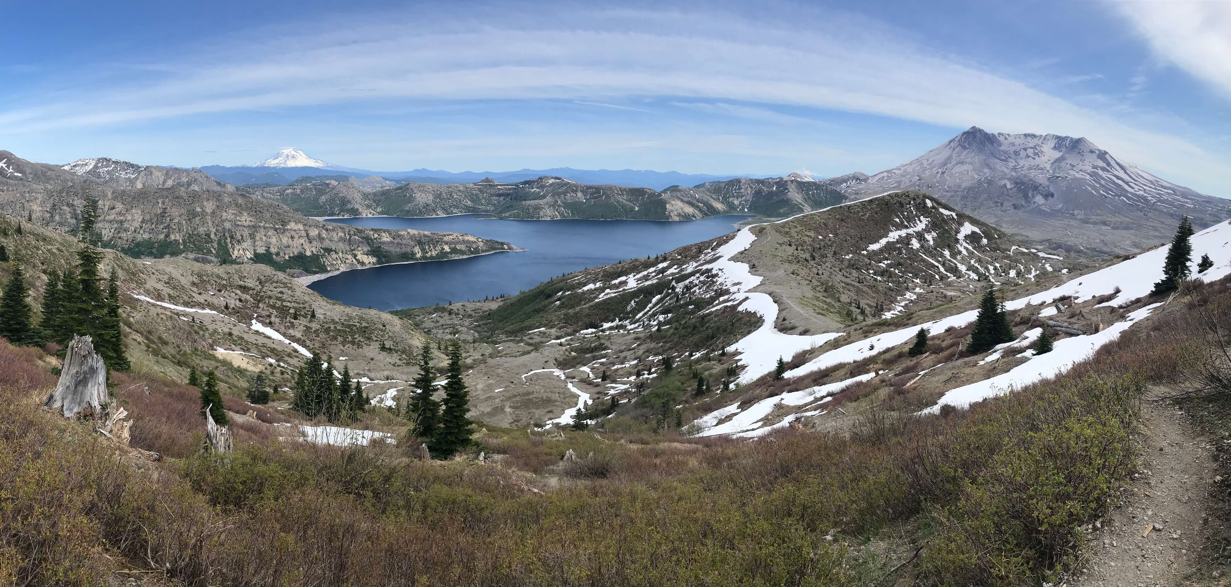
Panoramas


Friday, September 1, 2023

Hike: Lava Canyon & June Lake, MSH, Cougar, WA

June Lake, MSH

Getting there

It's 28 miles from Woodland to the Cougar. There are a couple of gas stations here. Continue east on SR-503 which becomes Rd 90 for 9.5 miles to Ape Cave. Looks for the sign to Ape Caves, June Lake, Climber's Bivouac, Ape Canyon & Lava Canyon which is Rd 83. It's 0.3 miles to Trail of Two Forests and 0.7 miles to Ape Cave. 

This was my 4th solo roving shift for the Mt St Helens Institute (MSHI) this summer. I also had two mentor sessions, one for the 83 Road sites and another for Ape Cave specifically.

It seems like more since I started the Ambassador training in late May at the Visitor Center in Castle Rock, followed by the Mountain Steward Training at the Science & Learning Center in early June. My first solo roving session wasn't until July 31st.

Anyway, I started the day at the Trail of Two Forests but no one showed up while I was there. I just used the time to pick up bits of trash in the parking lot and by the picnic tables. I also took a spin up to the viewpoint to see if the mountain was out. 

MSH from the viewpoint near Ape Cave

From there, I drove out to the end of NF-83, stopping at the Lahar Viewpoint. I figured I see if there were any cars and stay as long as it seemed to make sense.

There was one car there but the occupants had disappeared out of view on the trail. I picked up more trash while I waited for them to come back. To my dismay, I found two used diapers wedged against a rock next to the parking lot. Argh!!!! Fucking gross! I cursed the kind of people that would do that. I couldn't leave that stuff there, so I found a zip lock in my car and emptied out a grocery bag I was using for my spare clothes. I need to pack trash bags and several pairs of rubber gloves. I found another zip lock bag and used the 'picking up poop' technique to grab the baby-shit pouches and secure them inside the zip locks. Then I put them in paper grocery bag. I lathered on my hand sanitizer but still felt unclean.

I rinsed my hands with water but considered the bottle to be contaminated. What else could I do? 

I met the visitors and chatted with them for a minute. Another car with three people showed up. They had no plan and were happy to get some advice about where else to go. I directed all 5 to check out Lava Canyon as I talked about the lahar and Shoestring Glacier.

They left and I was alone again. I picked up some more trash (just candy wrappers and bottle tops).

I considered going to Lava Canyon myself but decided to head up Ape Canyon for a bit, not the full hike to Pumice Butte. I needed to save my feet & legs for the MSH summit next week. I bailed after a few hundred yards.

Muddy River Lahar from Ape Canyon Trail

I decided to walk to Lava Canyon rather than drive over. I chatted with a family of 3 briefly, then walked over.

When I got back to my car, there was some creature high in the tree tops dropping things. Dozens of objects hit the forest floor with a heavy thuds like rocks! I'm pretty certain they were Douglas squirrels way up in the tree tops throwing/dropping conifer seeds; they were landing with quite hard, dozens "rained down" within 3-4 minutes. I thought Sasquatch was hucking rocks LOL.

My next stop was going to June Lake. I figured it was an easy trail and not too long. I figured I had more opportunities to engage visitors by hanging out at the lake. Unfortunately, that was mostly a bust. Just 3 cars in the parking lot. A family of 3 were getting ready for an overnight. One was a little girl about 8 with her own pack. They seemed to know what was up. I saw them again near the lake. 

It was getting later in the afternoon but I wanted to stay until 5pm, so I returned to the Trail of Two Forests. The lot was empty but I figured I'd take a spin around the boardwalk and look for my photographs. The sun was getting low so the light was pretty nice.

When I got near the trailhead, I saw two guys starting the loop. They asked a lot of good questions, some I didn't have an answer. Another car of people arrived. I only chatted with the one person that had gone to read the signage. She asked if she'd have to crawl around to see the site. She was referring to the short tube and I assured it was optional and it was a 1/2 mile boardwalk loop.

Trail of Two Forests


The Hikes

Lava Canyon

Distance: 2.02 miles
Elevation gain: 381 ft
Maximum Elevation: 2,871 ft

Even though there was 5-6 cars in the parking lot, I didn't see anyone right away. I took the metal bridge across the river and headed down the far side of the canyon. There was a group of three: a man, a little boy, and an older woman. they accepted my offer to take a photo for them. The little boy had a big rock and was saying "this is my phone". They played along. I secretly hoped they weren't expecting to take this rock out of the monument. I hoped I wouldn't see anyone on the bridge: there weren't.

I met some people on the way back and took another photo for two guys on the bridge.

One man asked about my red shirt and if it was so they could report me when I was napping. Bizarre. He was upset that the bridge was closed and wondered why its repair wasn't a higher priority. I sympathized but didn't offer any reason.

I went down the other side of the canyon. Two people said the trail was sketchy but it was beyond the bridge, behind a sign that essentially said the trail was sketchy.

I crossed paths with more people on the way out.


June Lake

Distance: 2.66 miles 
Elevation Gain: 446 ft
Maximum Elevation: 3,163 ft

I made quick work of the 1.33 mile trail. I did see a bunch of plants I hadn't noted before. Pearlyeverlasting, Bunchberry dogwood, False Solomon's Seal, Devil's Club.

As I anticipated, there wasn't anyone there. I took a few photos. They family had said they were meeting another family to camp together but they weren't there. I even ventured to the dry creek bed to look at that huge log.

Pretty uneventful but it was peaceful.


Pearlyeverlasting

Dogwood

False Solomon Seal


I am Groot