Tuesday, February 9, 2021

Hike: Cape Horn Trail, Western Gorge, WA

Full 7.5 mile loop from Alltrails

Distance: 3.98 miles (point 1 to 2 and back)
Type: Out and Back

Elevation Gain: 700 feet

High Point: 1200 feet

Duration: 1hr 15min


Getting There: 

So many of my road trips / hikes involve quite a bit of driving. Think High Rock, WA, Mt St Helens, Mt Hood, the coast. Many of the Gorge hikes on the Oregon side can get crowded. So far, the hikes on the WA side seems to be less trafficked. I'd been to Beacon Rock / Hamilton Mountain a few days before. I've tried a few times to find a parking at Cape Horn but haven't had any luck. Since this was a Tuesday, I figured I'd have a good chance. I was right. Woohoo! I parked and geared up.


The Hike:

Near the parking lot, there's a wooden bridge and some downed trees. A guy was working by himself. When I said "hello", I got no response. Seems he was trying to prune and pull weeks to restore the area.

The trail was a bit muddy in spots but overall pretty good. Mud up on the ridge passed first lookout was frozen. Around there I found some hair ice. (from Exidiopsis effusa).

I made it to Pioneer Point then back to the parking lot. I didn't realized the bottom section was closed February 1st - July 16th annually to protect nesting peregrine falcons.

The whole loop is 7.5 miles. I'll have to tackle that after July 16th.

North view from ridge near Pioneer Point


Ascent to Pioneer Point

Hair Ice

“'Hair ice' is a beautiful winter wonder. While not rare, it can be difficult to find because it is formed under a variety of particular conditions. Hair ice is formed at a particular temperature between latitudes of 45 and 55 degrees, during a particular time of day and on a particular type of wood, which must be free of bark. It also requires the presence of a particular fungus — and, of course, you have to be there to see it before it melts!

Simply speaking, hair ice is formed when moisture fizzes from a bit of wood and instantly freezes, creating delicate, angel-hair-like strands in mid-air.

Big surprise: There’s more to it. A nuclear action within a freezing layer of water pushes liquid water through pores of the wood and into the freezing air. But beyond that, a particular fungus has a role in the formation of the hair ice structure.
”

Source: https://www.wta.org/news/signpost/hair-ice-even-cooler-than-you-thought


W View from Pioneer Point

East view from Pioneer Point

Selfie from Pioneer Point

Map at lower section of loop

Lower section of loop (closed Feb 1st - July 15th)

From of Pioneer Point from below


Friday, February 5, 2021

Hike: Little Hamilton Mountain & Rodney Falls, North Bonneville, WA


Distance: 4.94 miles
Type: Out and Back

Elevation Gain: 1100 feet

High Point: 1500 feet

Duration: 1hr 15min


Getting There: 

I was just out for a cruise. I was considering heading out to Stevenson to hop on Red Bluff Road. As I was passing Beacon Rock, I thought I scout the Horse Camp/Trailhead. About 100 yards away is the road to the campground. It's closed for the season but the trailhead is open. I wasn't really planning on a hike but I've been carrying my gear (shoes, hiking poles) in the truck for such an impromptu occasion. I have my Discovery Pass for WA Parks so good there too! 


The Hike:

The trail was pretty muddy in places. Other hikers before me had laid pine branches and such to get across the most saturated sections. However, in spots the trail surface was gorgeous: sandy, hard packed, no rocks. It's climbs pretty steadily so my calves got a good workout.

There are steep switchbacks, very technical when I got the base of the mountain, a hunk of granite.

In fact, because this was an impromptu hike I only went as far as Little Hamilton Mountain. The clouds were coming in and I had no gear (water, rain coat, etc). That's 1.7 miles up (1500 ft). The "top" is another mile along the trail and an additional 900 ft elevation gain.

https://www.alltrails.com/explore/trail/us/washington/hamilton-mountain-trail--2

Next time! This is an easy drive and good hike.


That's Little Hamilton; (Big) Hamilton is hidden by the clouds


Sunday, November 29, 2020

Snowshoe: White River Snow Park, Government Camp, OR

Length: 3.4 miles
Elevation Gain: 688 feet
Type: Out & Back

Getting There

The trail starts at the White River Snow Park. There are lots of families enjoying the first 1/2 mile or so to about the ridge on the left (west). There is a large main parking lot and an annex parking lot a few hundred feet away. You have bushwhack a trail through the forest to the main parking lot, then pass through the gate.

The Hike

The road is where most people are recreating on sleds, etc but the valley opens up on the right, though there was a creek running down the middle. About a 1/2 mile up the road gets really steep to access the ridge. Only snow shoers from this point onward. A lot of snow shoers continue below up the middle of the valley. 

On the first recent hike, I stayed on the ridge the whole time. I did take a look at a possible crossing but decided against it. On the second hike, I started in the valley up the top but on the way down I found a suitable crossing onto the ridge.

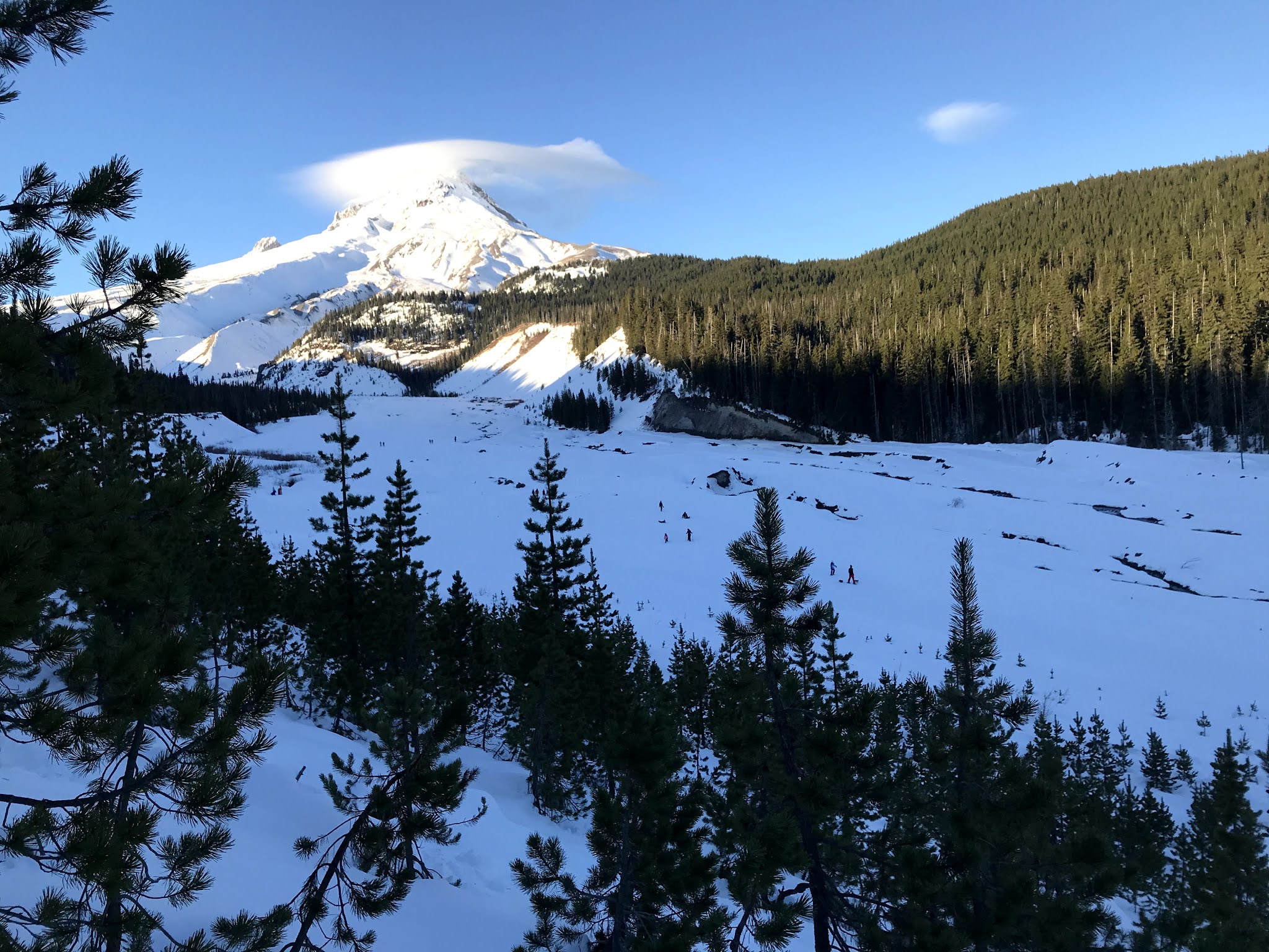
This is the view of Mt Hood from the ridge


 This is about where I turned around.

Near the top of the trail

The valley about a 1mile from parking lot

Sunday, November 1, 2020

Hike: Ape Canyon Trail, Mount St. Helens, Cougar, WA


Distance: 11.0 miles
Type: Out and Back

Elevation Gain: 2083 feet

High Point: 4359 feet

Duration: 5 hrs 15 mins


Getting There:

I'd originally planned to make an attempt at summiting Mt St Helens via the Ptarmigan Trail. I had a permit for Fri 10/30 but ended up booking a somewhat urgent dentist appointment. Nov 1st is the first day when there's no hiker limit, previously it was 100 per day. I knew the weather was going to be awesome, bluebird day. 

I set my alarm for 5am but tossed & turned. At 5am I hit the snooze but roused myself. I loaded my gear, hopped in the car, and headed toward Cougar.

Some cars were following me for awhile and I had a feeling we were all going to the same place. After the turnoff, I let the eager beavers go by. The 2mi gravel road was empty until I rounded a corner some distance from the parking lot. Way overflowing! If I'd beat those 4 cars I might have had a space on the shoulder. I drove down the hill to the next safe parking spot; 20 min walk to the trailhead. I considered that it was going to packed on the trail, covid-19, some people w/o masks. Fuck it!

I bailed and drove up the Ape Canyon/Lava Canyon. I was the only car at Lava Canyon. I'd wanted to check out the suspension bridge but alas it was closed due to damage. I went as far as I could but hardly got a workout.

Lava Canyon suspension bridge

Lava Canyon

I drove over to the Ape Canyon parking lot, 2mins away. It was about 8am and only a handful of cars. I parked and geared up. The sun was out in full glory.

The Hike:

"This is an incredible trail. Safe to say there is nothing quite like this anywhere in the states. You climb through a forest that somehow survived the blast of St. Helens with views getting better and better the farther you climb. Then, you pop out of the woods and begin traversing the Plains of Abraham."

Source: https://www.alltrails.com/explore/trail/us/washington/ape-canyon-trail

I'd hiked a small section of this trail in the past while out exploring. I recognized the spot where I'd taken some photos and turned around as I passed it.

The AllTrails description says it all. I didn't know much about the trail (length, elevation gain). I just kept climbing up through this beautiful terrain. I remember looking up in awe at the trees. I interrupted an owl trying to catch a squirrel.

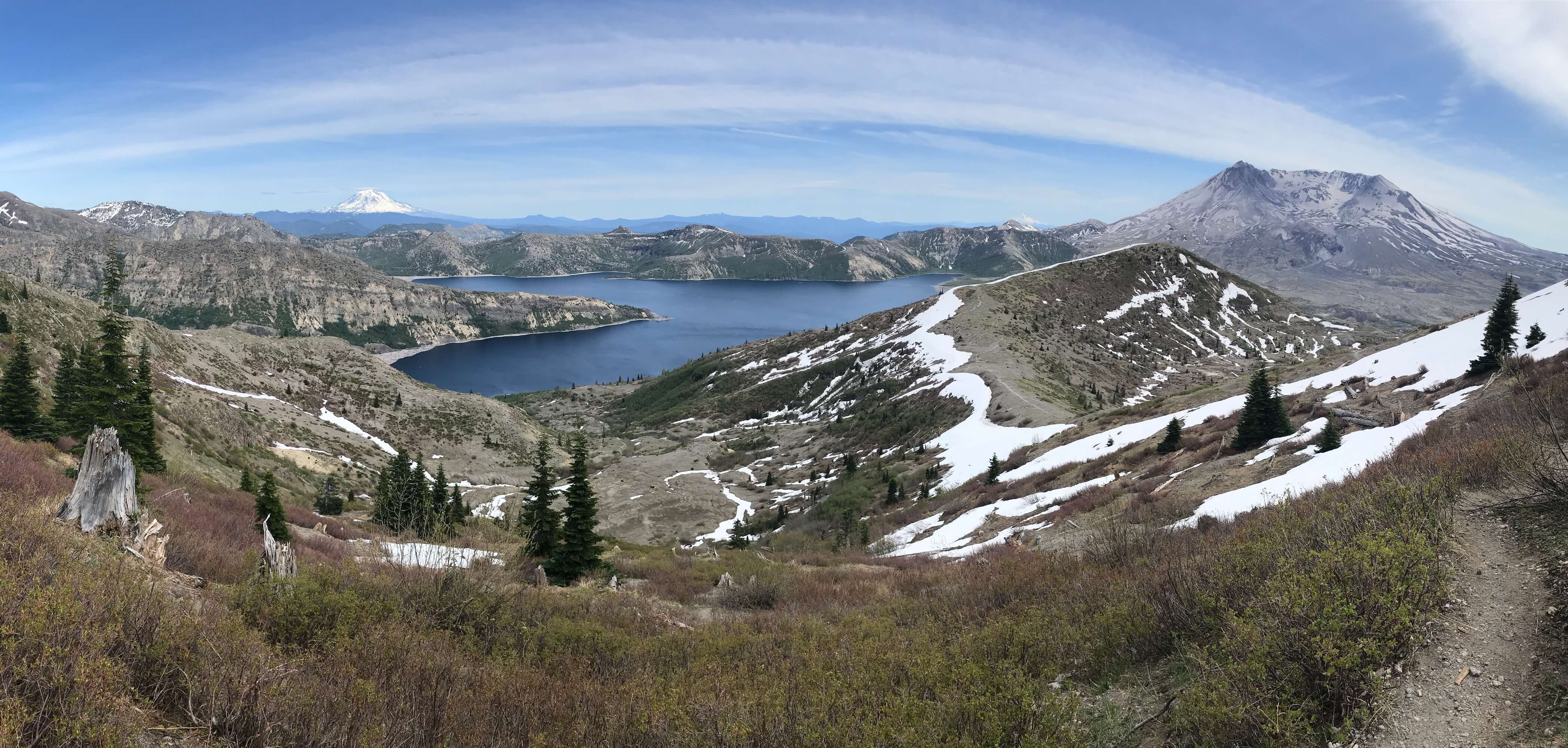
As the ridge narrows you can see Mt Rainier and Mt Adams and even Mt Hood eventually but Mt St Helens kinda looms in the background, a grey mass through the trees. The lahar flow below is otherworldly.

At the trail junction at the top, I continued on the Loowit Trail. There were 4 mountain goats sunning on the hillside a ways away. I'd seen tire tracks on the trails and thought ATVs used by rangers for trail maintenance but there were several mountain bikers.

I knew I had a grueling downhill hike ahead of me but was tempted to keep going forward toward Windy Ridge. In fact, this loop sounds amazing: Ape Canyon, Smith Creek, Lava Canyon Loop, 22.8 miles.


View of Mt St Helens from the Ape Canyon Trail


The white specks are mountain goats

The white specks are mountain goats

Trail junction at Pumice Butte

View of MSH from the trail junction


Sunday, October 25, 2020

Hike: Wildwood Trail ↔︎ Newton Road ↔︎ BPA Road Loop


Length: 5.46 miles
Elevation Gain: 1,109 feet
Type: Loop
Duration: 2.5 hours  

Getting There

The trailhead is off Skyline Road, north of Germantown Road. There's a short but narrow gravel road down to the trailhead parking lot with room for about 10 cars. I first found out about this place years ago when I did trail maintenance with the Forest Park Conservancy.

The Hike 

From the parking lot there is a spur trail to the Wildwood Trail. Head north and make a right at the junction onto Newton Road, then downhill for quite awhile (1.3 miles) to Hwy 30 and the BPA Road intersection.

Newton Road ↔︎ BPA Road intersection

Intersection of BPA Road and Newton Road

Hwy 30/Linnton

It's a steep grade up under the transmission lines, about a 800 ft gain in ~1 mile (15% grade) but the pay off is views of NW Portland, Kelley Point Park, and the Willamette.

View of NW Portland from 1/2 way up BPA Road

At the top, go left to stay on BPA Road (right goes to Fire Lane 13). It's 0.6 miles to the Wildwood Trail junction. It's 2.9 miles back to the parking lot. I opted to stay on the Wildwood until the Linnton Trail (spur trail).

Intersection of BPA Road and Wildwood Trail

All Trails:

https://www.alltrails.com/explore/map/mon-26-oct-2020-01-22-f02a8fd

Saturday, October 17, 2020

Hike: Ptarmigan Trail from Climber's Bivouac, Cougar, WA

View of the Green Knoll from the timberline

Distance: 4.0 miles (full trip on AllTrails is 8.2 miles)
Type: Out and Back

Elevation Gain: 1043 feet
(full trip 4,583 feet)
High Point: 4800 feet
(full trip 8287 feet)
Duration: 2.5 hrs (full trip ~8-9 hrs)


Getting There

I was just out for a day trip in the car and ended up at the Climbers Bivouac by chance. I'd take a drive on WA-14 to Carson. I sorta had in mind that I might head to Norway Pass or the Harmony Fall trail above Spirit Lake. I didn't exactly get an early start to I just keep driving the route between Carson and the Lakes/Reservoirs (Merwin, Yale, Swift).

When I got to Hwy 90/NFD-25 junction I realized I didn't have any water for a hike so I doubled back to Eagle Cliff Store & Campground, then back toward the junction. I paused briefly to consider heading to the Lower Smith Creek Trailhead but took a left instead.

I remembered going to Lava Canyon/Ape Canyon area so I thought that'd be a good spot for some photos and light afternoon hiking. At the last minute I veered left when I saw the Climbers Bivouac trailhead. I'd never been there so why not?

I was stoked to find the gravel road and surprised when I reached the top and found a nicely paved parking lot and campground. The fog was a bit heavy and it was cold. I hadn't planned to hike but parked and put on my gear to just scout the trail a bit. I read the sign that said the summit was 4 miles. I really wasn't up for an 8+ mile round trip, esp. when starting at 2:30 pm.

Permit Info:
https://www.recreation.gov/permits/4675309


The Hike

Whelp... I hiked as far as the 4800' ft mark where a permit is required to go further. It's the treeline and according to the trail description, it's a pretty grueling hike from there up and over the boulders and ash.

I passed a group of four women who sang "It's Only Just Begun", a siren's warning that I was in for a challenge.

Another guy was optimistic and said the rim was free of clouds. I thought "maybe the summit is reachable, the trail so far was certainly easier than the High Rock hike. I passed another group and asked when the situation was going up.

One guy said they'd left the trailhead at 7 am and it took 5 hrs to reach the summit. That lines up the estimates I've read: 4.5 hrs up, 3.5 hrs down.

I reached the 4800' ft / permit required marker about 10 min later. I venture in the scrub to take some photos. A couple was on their descent and looked at me quizzically. I waved and continued with the photos.


SW view from the trail

Intersection, Monitor Ridge, June Lake Tr, Loowit Trail junction

View of the Green Knoll from the timberline

View of ridge and boulder scramble, 4800' ft

SW view from the trail, sliver of Yale Lake in distance

Leaving the forest

Post-Hike Thoughts

Every single one of my hikes in recent memory going back to July has resulted in L knee pain on the descent. I believe it has something to do with my RA but it's also manageable (bearable) with stretching. But like clockwork, after an hour or three hours on the trail, it's the same. It's characteristic for the muscles used on descents vs ascents.

After reading this article, I'm going to start using the foam roller and see if I can reduce or eliminate this problem.

I remember Les Stroud talking about the Lemon scoring system (S7E7). (He also talks about the hazards of going uphill vs downhill, using big muscles quads & calves going up but small muscles in knee & ankle going down. Also, 1-10-1 rule: 1 min to calm down, 10 min decrease in limbs, 1 hr hypothermia)

For example:

  • A blister and old injury = 1/2 lemon
  • Hiking alone = 1/2 lemon
So today I might have scored the situation like this:
  • Time of day (later in afternoon) = 1/2 lemon
  • Not doing my homework on the trail = 1/4 lemon
  • No food = 1/4 lemon
  • Hurt knee = 1 lemon

Incidentally, I've found go backwards down steep sections like steps made from tree roots; it can be easier than using poles and baby steps.


The Map


https://www.alltrails.com/explore/trail/us/washington/mount-saint-helens-summit-via-ptarmigan-trail


I hiked to the #3 marker (0.2 mi past #2) on the map below, zoom in to see