Friday, April 14, 2023

Hike: Wind Mountain, Home Valley, WA

Selfie from Wind Mountain (bg: Dog Mtn, Columbia River Gorge)

Getting There

From WA Hwy 14 at Home Valley (just east of Carson), take Wind Mountain Road. Follow for 1.0 mile and take the right to stay on Wind Mountain Road. Go another 0.4 mile to Girl Scout Road (on right) and continue 0.3 mile to the trailhead. 

There's a clearing before the actual trail where the dirt road drops down. Technically, there's room for 1 or 2 cars across from the trail but best to park at the clearing.

The Hike

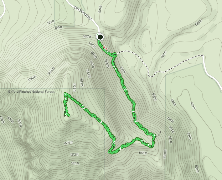
AllTrails map

Length: 2.55 mi
Elev. gain: 1,135 ft
Moving time: 1:11:22
Total time: 1:19:55
Avg pace: 28:02
Calories: 718

After hiking in the Wind River Valley (Bunker Hill, Whistle Punk Loop), I still had some daylight and energy. I wasn't ready to head back to Portland. Since I was close to Wind Mountain, it was an easy choice. I'd been wanting to hike it since scouting the trailhead a year ago after hiking at Dog Mountain.

I'd seen some trail pictures but really didn't know much else. I knew it wasn't as long as Dog Mountain but I only learned its history and spiritual significance until I reached and read the sign near the top.

It's not a long hike but it's got some decent elevation gain. It was good trek to pair with my earlier hike.

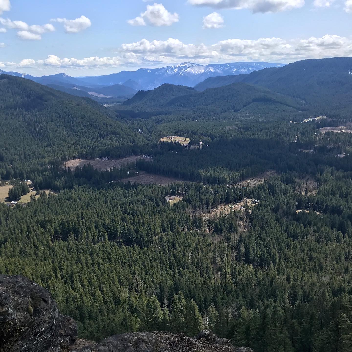
View of surrounding area (Augspurger Mountain)

Trail winds through downfall and rocks

The trail

Sign near the summit
 
"The Wind Mountain Spirit Quest Site was likely constructed between 200 and 1,000 years ago. Youth questing for their guardian spirits fasted and spent the night here away from their village or camp. Maintaining a constant vigil during the quest, they also completed strenuous physical tasks such as building rock piles. A vision or dream eventually came revealing the seeker's guardian spirit, a spirit that remained with a person for a lifetime.

This site is an exceptional example of the Columbia Plateau cultural pattern represented by construction of rock walls, pits and mounds in talus fields. Artifacts are seldom found in sites of this type.

Tribal people continue to visit this sacred area."  

It was an honor to visit the site and enjoy the views.

Columbia River, looking west

Home Valley

Dog Mountain, Columbia River

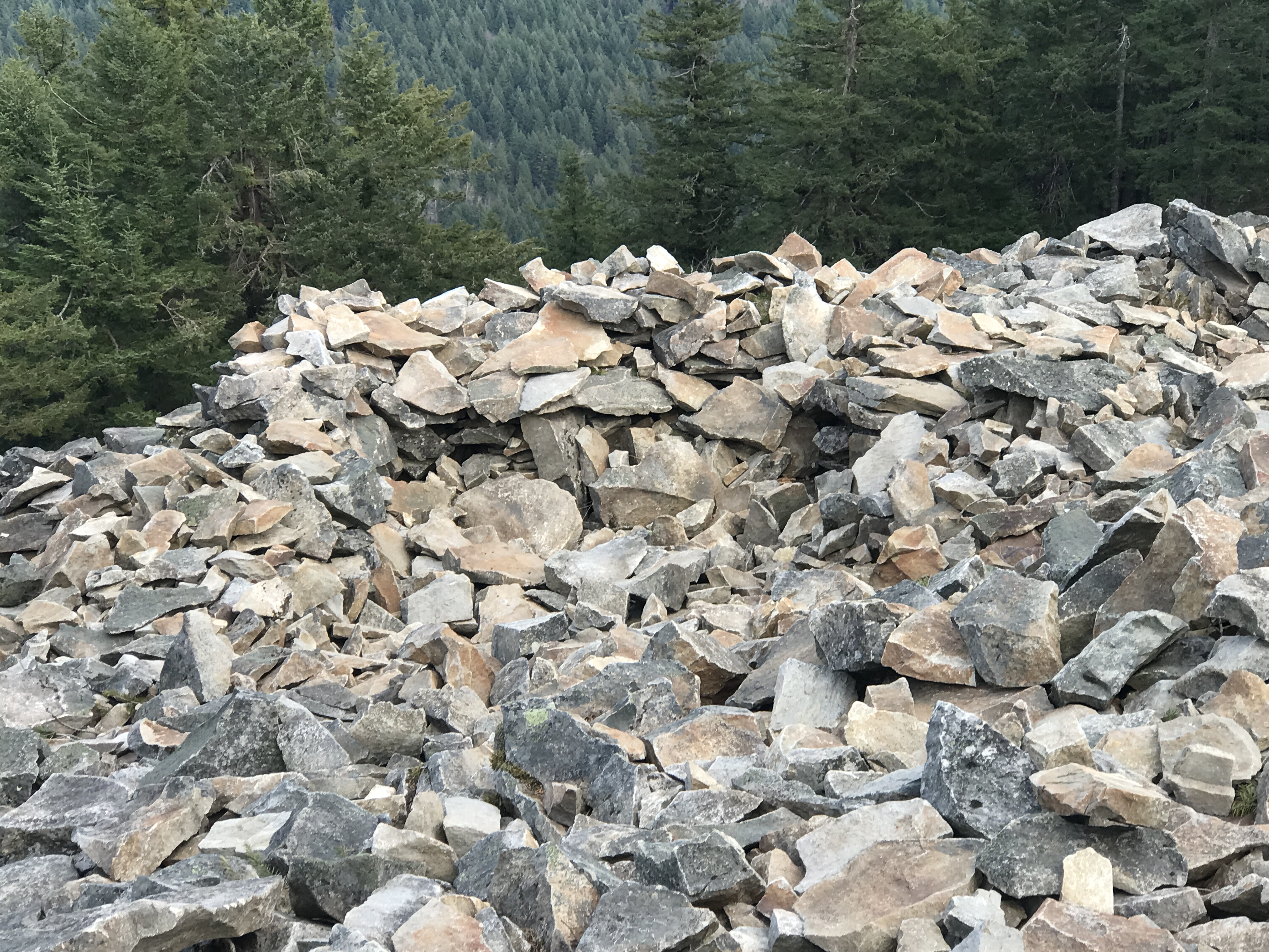
Rock walls, pits and mounds

Rock walls, pits and mounds

Glimpse of Oregon through the trees

The Summit

Pano of summit (Dog Mtn, Columbia River)


Hike: Bunker Hill + Whistle Punk Loop, Carson, WA


Top of Bunker Hill

Getting There

In Washington, take Hwy 14 to the Wind River Hwy through Carson. Take the highway north for 10.7 miles to Stabler. Take Hemlock Road west and go about 1.2 miles to the Wind River Work Center. The Google Maps directions are wrong and try to route you through private property! Go a little further past the Work Center to NF-417. Keep a lookout for the a right turn for Old Bunker Hill Road. It's just a little more to the Trailhead parking lot.

The Hike

AllTrails map

Length: 5.62 mi (Bunker Hill: 3.91; Whistle Punk: 1.71)
Elev. gain: 1,322 ft (BH: 1266; WP: 56)
Moving time: 2:11:39
Total time: 2:31:49
Avg pace: 23:26
Calories: 1,325 

Bunker Hill

Note: The Bunker Hill trail crosses a large field before you get to the tree line. The trailhead signage marks the Whistle Punk Loop trail.

The first part of the trail is a bit swampy but there are some logs to help you get through. Eventually, you reach a wider trail which is most of the route.

It's a beautiful hike with very little undergrowth. It climbs at a moderate rate via switchbacks. While it's airy in the trees you can't really see the surrounding hills in the valley. It's not until you reach the ridge that you can see daylight and hints at views.

The trail makes the final climb to the top on the backside of the actual ridge. The photos below start from the top. 

"A fire lookout once perched on the 2,383-foot-elevation summit, offering views of the Wind River Valley and the former Wind River Nursery. Bunker Hill is an igneous volcanic plug that was pushed up through layers of lava flows and volcanic debris 25 to 20 million years ago. The igneous plug is less resistant to erosion than the surrounding rock. Several places along the trail furnish superb views of the Wind River Valley, and the Ranger District/Nursery complex."
(https://www.fs.usda.gov/recarea/giffordpinchot/recarea/?recid=31724)

Footings from old fire lookout before the canopy grew up

A tribute to an old friend

View looking southeast of the Wind River Valley

Ridge trail

Another view of the Wind River Valley


Glimpse at the PCT

Swampy crossing

Pano of approach to trail (Bunker Hill is on the left)


Whistle Punk Loop

After my Bunker Hill hike, I took a spin around the Whistle Punk Loop. Just a few relics of the lumber industry is left, i.e. several rusted spark arresters.

"This trail is a barrier-free interpretive trail that tells the story of forest management from a historical perspective. Signs and a brochure guide visitors along the trail, which runs along an old railroad grade (dating back to 1913) and past features associated with railroad logging by the Wind River Logging Company."
(https://skamania.org/experience-skamania/whistle-punk-trail/)

"In logging's heyday, whistle punks were men tasked with operating the signal that let other loggers know a log had been hooked up and was ready to be moved. Using interpretive signage, this trail illustrates what was like to be on a logging show, from the crew, to the cook, to camp. There are even some relics from the past, including a "sled", which is now quite hard to see, as well as some other metal artifacts."
(https://www.wta.org/go-hiking/hikes/whistle-punk)

Wind River Research Natural Area

"This old-growth Douglas fir and hemlock forest is
designated for scientific and educational use. Research
is conducted on all aspects of this import forest type,
including plants, animals, soil and climate; this research
is used to improve our understanding and management of
similar forests.

If you enter this area, please leave plants, animals and
research installations undisturbed because continuing
ecological studies depend on unaltered natural conditions."


The Smoke Stack's Connected to the Spark Arrester

"The smoke from the fire makes hot sparks.
The hot sparks rise up the smokestack.
The smokestack is connected to the spark arrester.
The spark arrester is layered with wire mesh.
And the wire mesh stops the sparks."

As the Donkey Puncher pulls on the controls, smoke pours out of
the stack. He thinks about how steam generates power needed
for moving the cables that move logs. He hums.
"Dem Bones, dem bones, dem dry bones..."

"That steam, that steam, that powerful steam,
so hear the sound of the steam donkey..."

The water tank pipes to the boiler.
The wood tender throws in the wood chunks.
The fire box heats up the water.
And the steam goes into the steam box.

The steam box is connected to the pistons.
The pistons push the rods that turn the gears.
The gears are connected to the cabin drum.
And the donkey puncher feeds out the cable.

The cable goes out to the big woods.
The choker setter connects the cable to a big log.
The log is yarded to the landing.
And the steam donkey powers the cables.

That steam, that steam, that powerful steam,
so hear the sounds of the steam engine.

A continual menace to logging operations -- FIRE!
Despite protection from the spark arrester, firey sparks
flew from cables rubbing cables, cables rubbing logs, and
from screeching brakes on railroad cars."


"... and cables swing the 6,000-pound log overhead. As it
swings over the railroad car, he signals to the Donkey Engineer
to drop it quick. He scurries to remove the tongs, ignoring the
Head Loader's mouth over on the log pile.

He dreams of becoming a High Climber, He knows he has
enough nerve to climb and rig 200-foot spars with 2,000-pound
blocks. He'd be his own boss and earn $5 more a day - a big
jump from the $2-day wage he received when starting out as
as Whistle Punk."


A Portable Workshop of Ingenuity
 
"Ha! You call dis ah verkshop?" mocks the Swede. "It's just a railroad
car with sides and a roof. Da crew just rolled it off da railroad on
'dare way to pick up another trainful of logs. Ha! A verkshop! Ha!"

"by Tunder, Svede!" shouts back the Irishman. "If we didn't have
dis workshop, the logging show wouldn't operate. If it weren't for
our smarts, the railroad wouldn't run, the blocks wouldn't move smoothly,
and we wouldn't have handles on our saws."

"Oh yah, Red. Yah. So where's da Marlin spike to splice da cable?
Da boss vants me to work on dis one. Fast! It's holdin' up one side
of da show! Da main line cable broke, and dat boss!... Dat boss, he
don't want 'dose 50 men hangin' round in da woods."


Saturday, April 8, 2023

Hike: Archer Mountain, Washougal, WA


Getting There

Take WA Hwy 14 out from Washougal. Take a left (north) at Smith-Cripe Road, about half way between Prindle and Franz Lake. The High Valley trailhead parking lot is about 0.5mi up the road. There's room for 10-15 cars if everyone parks responsibly (i.e. perpendicular or angled).

This time there were 6 cars when I got there so I parked parallel. I geared up and set out.

Note: I thought the day was going to be a bust. My original plan was to hike Eagle Creek or Nesmith Point but I knew it was going to be bad when I saw 1/4 mile traffic jam at Multnomah Falls. I changed plans then to hike on the other side of the river. Indeed, cars lined every nook and cranny at Eagle Creek. Table Mountain Trailhead looked okay but Hamilton Mountain was packed. Archer was the clear choice. I hardly saw anyone on the trail. Peaceful. 


The Hike

Length: 5.83 mi
Elev. gain: 2,274 ft
Moving time: 3:27:57
Total time: 4:05:00
Avg pace: 35:39
Calories: 2,093


Cool hike around Archer Mountain. After quite a climb (1000':1 mi) to Scott Point, my first stop was Quiver Point. I didn't quite go to the end but close enough. The next stop was gonna be Arrow Point but when I got to the cutoff, the route looked muddy, steep, and sketchy. Oh well, I'll try again when it's dry. I continued up to the top of Archer Mountain. The foliage was flattened from the winter snow so you could see through the trees to BRSP.

When I got back to the meadow near the trailhead, I still had some energy and it was only ~3:30p. I headed up the other side of the canyon towards the basalt ridge. It was grueling but I made it past the scramble section. I felt a twinge in my L ankle and R knee. I knew the descent was going to be tough so I turned around.

Half way up the trail

View from Quiver Point

View of ridge from Scott Point

More from Scott Point

More from Scott Point

Archer Falls

Trillium

View from ridge

View from Scott Point


Saturday, April 1, 2023

Hike: Hamilton Mountain + Saddle + Hardy Creek, N Bonneville, WA

Sunshine on the Hardy Creek Trail

Getting There

Take WA-14 from Vancouver, WA east toward N Bonneville.

After passing Cape Horn and the trailhead parking lot, the skies were so dark past Stevenson. I decided it was a Hamilton day.

Just after Doetsch Ranch you'll see the Ranger Station on the north side of the road just before the Beacon Rock parking lot, then another road across from the bathrooms. The road winds up the hill for a bit.

The Hike

AllTrails map

Length: 7.82 mi
Elev. gain: 2,323 ft
Moving time: 3:16:08
Total time: 3:39:07
Avg pace
: 25:06
Calories: 1,974


Yet Another Hike At Hamilton (YAHAH). I really need to find another trail like Hamilton Mountain. Just kidding! I love this hike and it's a great workout. It's my 5th visit to the Park this year, last year I hiked here 11 times, and 15 times in 2021.

During the drive out there, the rain and fog was persistent. I knew the trees would give good protection. The lower part of the trail was pretty muddy. Hilariously, I saw 7-8 Huskies from about 4 different groups. There's a damaged foot bridge just above the parking lot.

The tree that has been down for awhile just past the turn for Hadley Grove has finally been cleared. Crews recently repaired the trail near Rodney & Hardy Falls so I'm guessing they knocked that one then.

The next few sections were on-par with previous visits. There's no snow until near the top, i.e. the last 1-2 switchbacks.

At the summit, a group was hanging out. The top was socked in so no views.

I put on microspikes and headed along the ridge to the Saddle. This is the first time I'd done the loop since Nov 6. The parking lot had around 10-12 cars but I really didn't pass anyone on the trail after the summit until reaching the parking lot but did see a couple hikers from a distance, one at the Saddle with a dog and another near Hardy Falls.

For some variety, I took Don's Cutoff Trail. The snow on the Upper Hardy Creek was pretty light. I finally took off the microspikes before I reached the Equestrian Trail.

On the Hardy Creek Trail, the sun came out.


When I got to Rodney Falls on the return trip, I took the old switchback trail near the stairs. I gave up after 4-5 switchbacks. Not exactly sure where it goes because it's not marked. Possibly an animal trail though it looked like humans had been there. I wondered if it was an unofficial route to the top of Pool of the Winds.