Wednesday, October 4, 2023

Hike: Green Lakes via Fall Creek Trail, Bend, OR

Broken Top, Green Lakes

Getting There

From Bend, take SW Century Drive to Mt Bachelor until it changes to and continue on Cascade Lakes National Scenic Byway: it's about 25 miles out of town. Pull into the Green Lakes/Soda Creek Trailhead parking lot.

The Hike

Distance: 9.84 miles
Elevation Gain: 1,221 feet
Highest Elevation: 6,576 feet


For this hike, a Central Cascades Wilderness Permit is required for both day use and overnight stays from this trailhead between June 15 and October 15. 

https://www.fs.usda.gov/detail/willamette/passes-permits/recreation/?cid=fseprd688355

---

After my relatively short hike with little elevation gain along the Deschutes River the day before, I was craving something a little more challenging. Plus, I was eager to get a closer look at South Sister and Broken Top since I saw them upon arriving to Bend and they are visible from all over.

Just after leaving the parking lot, you cross a primitive log bridge. The Fall Creek Trail follows the creek and climbs steadily, with many opportunities to see the many waterfalls. Only in hindsight did I realize I'd seen Fall Creek Falls.


Fall Creek Falls

You cross a couple more bridges before getting to the west edge of the moraine. The trail sort of level off and you see the foliage along the river changes to deciduous trees and bushes in full fall colors.


I decided to take the side trail to Broken Top and veers away from and above Fall Creek.

Suddenly, Broken Top and the small lake beneath it come into view. Spectacular!

Broken Top

South Sister

Broken Top

There are several options of trails to get to the large Green Lake. South Sister towers above the valley. It's awe-inspiring to be saddled between these two mountains.

I continued on toward a spit of land with trees to get a look at the large lake. Another wow moment! There were several people already there enjoying the views and result of their hike. The water was all around with South Sister revealing more of her eastern flank.

While it certainly wasn't crowded, when more people arrived, I decided to find somewhere else to have lunch and frankly, it was a bit chilly in the shade with a moderate breeze. As I left, I found another place to photograph Broken Top.

South Sister

Broken Top

I retraced some of my steps and made my way back to the smaller lake and a trail marked Broken Top. There were a few marked campsites (#7, #8). I found a place to have my sandwich and soak in the views.

I wasn't going to make a summit attempt but I thought I could go for a little bit. I hesitated since I didn't have my Keen hiking boots. There was a trail going down the water on the south side. I found a tiny plastic duck. I returned to the detour. (It's a good thing it didn't go any further because that wasn't the summit trail, it just passes the mountain and continues south of Ball Butte.

I wanted down the shoreline on a narrow trail and noticed more horse hoof prints than footprints. I found a tiny plastic duck. I had to take a picture of the little guy before putting it in my pocket. Leave no trace!


I had a great descent back to the trailhead on the Fall Creek Trail. The light had changed from earlier so I didn't bother with any photos.

Tuesday, October 3, 2023

Hike: Benham Falls & Lower Deschutes River Trail, Bend, OR

Getting There

I was already at the Lava Lands Visitor Center off US-97. Take NF-9702 northwest for 4.0 miles to the Benham Falls East Trailhead. There are enough parking spaces for about 10 cars. Pay $5 for a day pass or use your America The Beautiful or Northwest Forest Pass or other qualifying pass.

The Hike

Distance: 4.73 miles
Elevation Gain: 280 feet
Highest Elevation: 4,188 feet


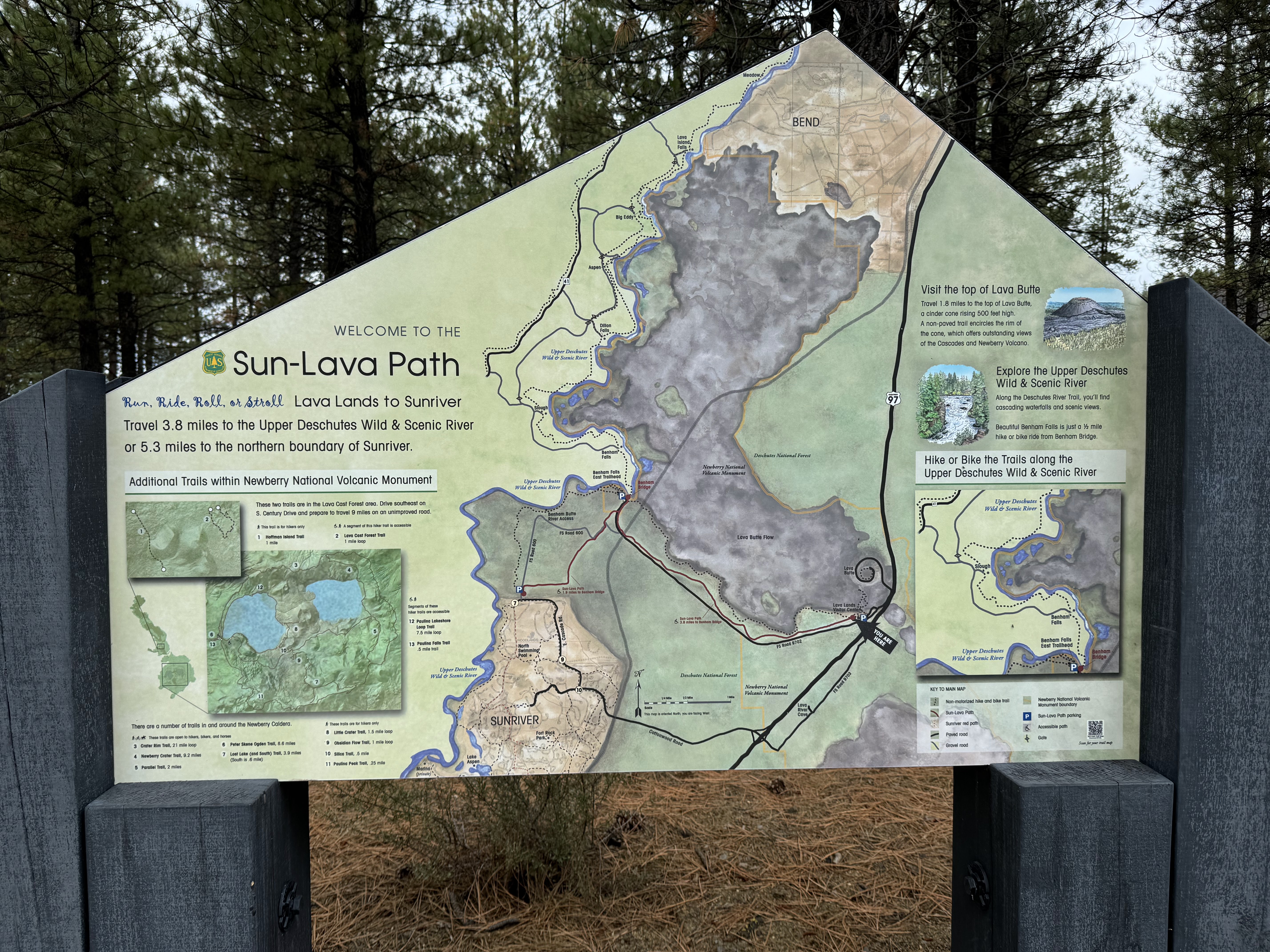
I had no idea what I was in for. I just enjoyed the beautiful landscape along the Deschutes River: trees on one side and rugged lava on the other. I studied the large area map-sign for a bit and looked at possible destinations. 

Across from the trailhead parking lot

From Benham Bridge, near the parking lot

Beyond Benham Falls, there were several spots along the route. I was prepared for a longer hike but also wasn't sure about elevation and time. It looked like I could reach Dillon Falls.

The trail between where I was parked and Benham Falls was pretty flat and straight but you could see through the trees at the rugged lava field across a slow-moving river. As I got closer the the falls, the noise of the rushing water got louder and louder.


As I got closer the the falls, the noise of the rushing water got louder and louder.

I found a side trail that lead down closer the water and suddenly the river took a turn and was rushing downhill through a narrow gully. The falls weren't so much a long drop as a series of cascading drops. To my surprise I came to the West Trailhead and a small parking lot accessed by a dirt road. I wondered where this road started from.

I found the lookout and snapped a few more pictures, then continue on the trail.

After a short distance and a few more turns, the water was much more calm and there wasn't any whitewater. It was still pine trees on one side and lava rock on the other.


I reached a section of deciduous trees and other foliage. I was a blast of fall colors: oranges, yellows, reds, browns and quite a contrast to the coniferous trees I'd been walking through.


I reached another parking lot with a pit toilet and picnic tables. The water was glassy. I thought it made a good spot to eat lunch.

Slough Day Use Area

From Slough Day Use Area

I met a couple that were also checking out the view and we chatted for a bit about Newberry and I shared comparisons to MSH. When they continued their hike, I picked a table and took off my pack.

It was peaceful besides a few people nearby yelling at their dog that it was time to go. LOL. The pupper didn't want to get out of the water.

As it turns out, I was at the Slough Day Use Area. I still didn't know where this dirt road originated but it didn't matter. I decided this was my turnaround spot. I wasn't planning to do a long hike. I still had time to visit the High Desert Museum before it closed at 5pm.


I put 1/2 my sandwich away and started back to the trailhead. If I understood the signage, the side of the monument was on closed at 5pm. I didn't want to get stuck behind the gate. I guessed the dirt road gave 24/7 access to the area.

Back at the car, I finished my sandwich and drove back to US-97.

Hike: Trail of the Molten Land, Bend, OR


Getting There

From Bend, OR, take Hwy US-97 south for about 10.9 miles to the Newberry Nat'l Volcanic Monument. Take the exit for the Lava Lands Visitor Center (NF-9702).

The Hike

Distance: 1.12 miles
Elevation Gain: 132 feet
Highest Elevation: 4,620 feet


This was my first stop at Newberry Nat'l Volcanic Monument. It didn't occur to me until later in the week that this wasn't the place that I'd seen from the pictures when I was researching my trip.

Nevertheless, the lava field was an incredible sight to see. The lava field and Lava Butte (cinder cone) are visible from the road. I quickly found that the visitor center was closed until Friday. I was looking forward to introducing myself and an unofficial ambassador from the Mt St Helens Institute.

I quickly found the Trail of the Molten Lands, a paved trail, partially wheelchair accessible. The signage was really helpful to get oriented and I marveled at the unique landscape.

The viewpoint was incredible and gave a bird's eye view of the lava field and the adjacent treeline.

It was a short trail so I was done in less than an hour.


The viewpoint was incredible and gave a bird's eye view of the lava field and the adjacent treeline.


It was a short trail so I was done in less than an hour.

---

In the 1960s, NASA sent astronauts to the area to test equipment for the upcoming moon landings. 

I was stoked to explore this part of the monument. On my way back to the car, I noticed an area map and bike trail: The Sun-Lava Path. I would have loved to bike this path but luckily Crawford Road (NF-9702) lead to a trailhead.

To be continued... (in the next post).

Saturday, September 30, 2023

Hike: Kings Mountain, Tillamook, OR


Getting There

Take Hwy 26 from Downtown Portland and drive about 20 miles west to Hwy 6 past Banks, OR. From there it's another 26.4 miles to the trailhead. It's about 3.2 miles east of the Tillamook Forest Center. There's room for about 8 cars to angle park and some room for another 3-4 cars to parallel park.

When I arrived, the lot was full but there were a few cars parked on the side of the road. Cars and trucks were whizzing by but at least there was room to pull off completely. I geared up and set out on the hike. Just as I reached the parking lot, a car was pulling out. I quickly ran back to my car and hoped that another hiker wouldn't arrive and snag it in the short time it took to U-turn and drive the 100 yds. I lucked out. In fact, the car next to me was also leaving as I got there so there was soon another empty spot. I was happy not to be on the side of the highway.

The Hike

Length: 5.67 mi
Elev. gain: 2,575 ft
Moving time: 2:55:03
Avg pace: 30:51
Calories: 1,765
Total time: 3:05:31


Today is the last day of the The Nature Conservancy September 2023 Fundraiser. The goal was to hike 40 miles. While I surpassed that in August during WTA's Hike-a-Thon, I came up short in September.

It's a tough hike at 2,575 ft of elevation gain in around 2.8 miles. The total mileage for the day was 5.67 miles. This brings me to 33.6 miles for September. Not a bad effort! Glad to support this organization.

This signage says this is a difficult hike and they aren't kidding. Fortunately, I'm in good shape for the elevation gain. My feet are still a bit sore from plantar fasciitis but it didn't stop me. Just before I'd started, I'd downed a 16 oz can of coconut water, a great source of electrolytes.

There were only a few people on their descent as I made my way up the trail, including a few dogs and their owners.

In a particularly steep section, I saw a couple with two dogs coming down so I stepped off the trail and behind two trees. My intention was to make room while still be visible. Unfortunately, it backfired a little because the woman saw me looking up the trail and was startled. Oops. I said hello and apologized for her causing her reaction. She laughed and her partner did also. He wished me a good hike.

As I was getting close to the top, a trail runner came up behind me quickly. Not his first "rodeo". He just had a small bottle of water and was shirtless. He quickly pulled away but said encouragingly, "almost to the top".

When I got to the clearing near the summit, I saw him again and wished him a good descent.

I had the top to myself. So peaceful and quiet. Just the right temperature.

I'd stopped at the viewpoint on the way up, so I decided to stop there again to eat half of my sandwich.

Some mushroom foragers arrived and we chatted for a bit before I left so they too could enjoy the viewpoint.

I made sure to be careful on my descent. It was a great hike. I'd love to go back and do the longer loop which includes Elk Mountain portion. It's a 10.6 miles loop with 3,697 ft of elevation gain: totally doable. The AllTrails route is counter-clockwise so you traverse to the Elk Mountain Trail and descend from Kings Mountain.


Saturday, September 23, 2023

Hike: Silver Falls Canyon Trail Loop, Sublimity, OR


Getting There

When travel south from Portland or anywhere north of Wilsonville, Google Maps recommends taking OR-551, just south of Charbonneau. I think it's a more enjoyable route that taking I-5 to Woodburn but I did take that route home. I preferred the freeway in the rain to a narrow two-lane highway.

I found gas (a 76 station) in Hubbard, OR. I think the per gallon cost was around $4.50.

Both routes go through Woodburn and you take a left on OR-214. This takes you through Mt Angel, where the big Oktoberfest is held. (Funny that the event is Sept 14-17, not even in October - WTF?) 

Point of Interest

There is a covered bridge called the Gallon House Bridge on the right (south) about 1/2 way between Mt Angel and Silverton. This one you drive over the Abiqua Creek and through the countryside. Take Downs Road NE, the left on Gallon House Road NE/Oak Lane. You can get back to OR-214 at Hobart Road NE.


 Continued

After about 13.5 miles from Silverton on OR-214, you'll come to the North Falls Trailhead parking lot and a hard right gooseneck turn. Continue another 2 miles to the South Falls Day Use Area. It's $5 a day for parking.

The Hike

Distance: 5.09 miles
Elevation Gain: 1,060 feet


I hadn't been out here in years. It's a bit touristy for my hiking tastes but I knew the waterfalls would make for some good pictures and I wanted to do something a little less strenuous. It was National Public Lands Day! The North Falls parking lot was nearly full and I knew the South Falls area had ample parking. It's where I'd started from on previous visits, including my last and that time I went with Brian and Andy and Jodie's dog, Miles, but had to leave him in the truck (sad face).

I found a trail ambassador with a big sign but while I was looking at where to go, a group came and rudely crowded me out. Dicks! I just started going on the first trail I saw, the Rim Trail which connects the South Falls Day area with Winter Falls and North Falls parking lots. I dropped into the canyon at Winter Falls and continued on the Canyon Trail.

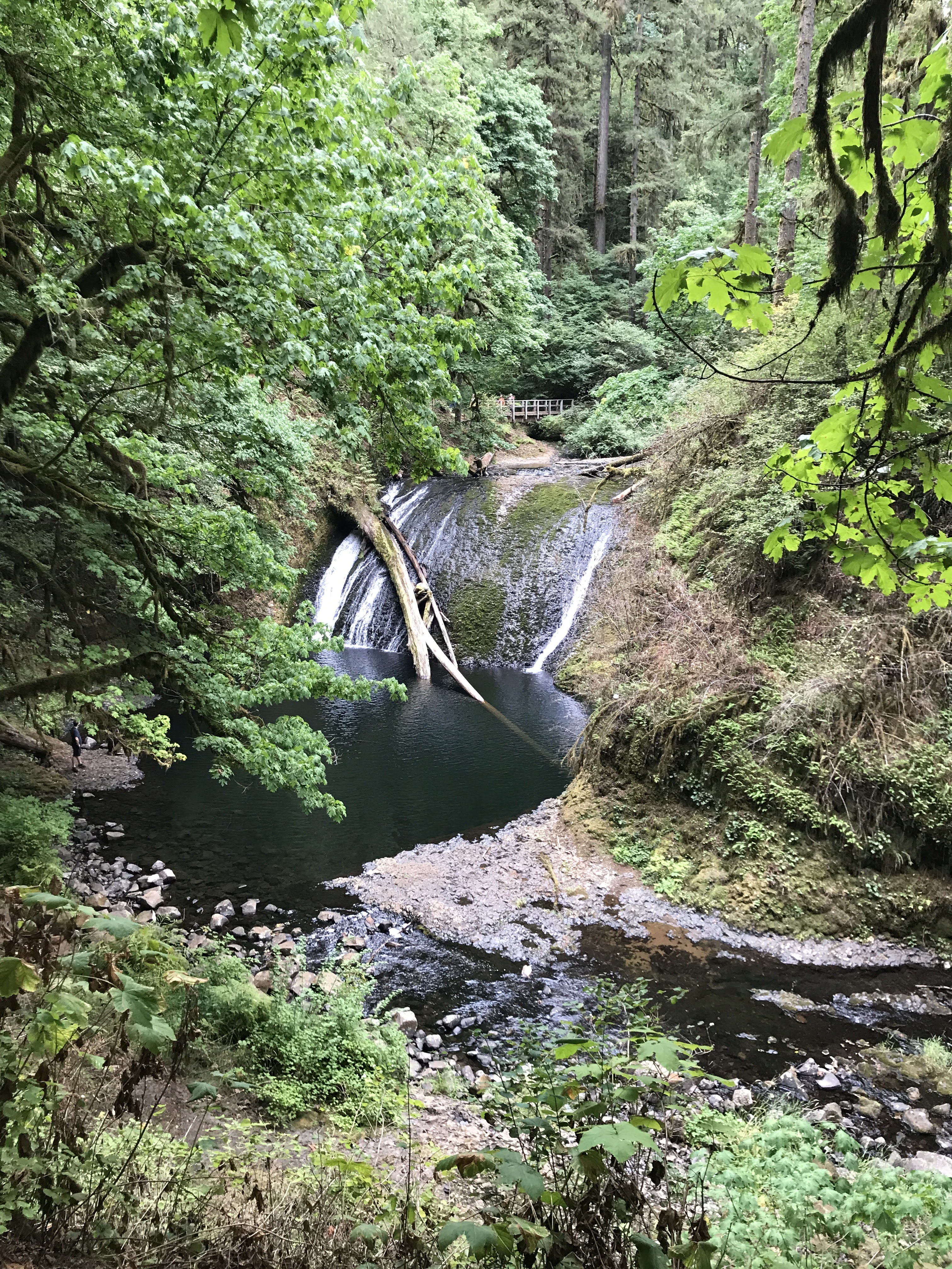
The water levels were really low and two of the 10 falls were dry. No matter, most were flowing enough and were spectacular just the same. Silver Falls is known for it's trails that are carved into the rocks and go behind the waterfalls.

I kept going and although it seemed liked I was going away from my car at South Falls, the trail slowly curves around and back.

Somewhere I remembered hiking there and vaguely remember going in the opposite direction. I specifically remember going down the switchbacks at Lower South Falls and looping back in the Maple Ridge Trail, clockwise. This time I was going counterclockwise and enjoying the views just the same. 

Close the South Falls, I saw a man that was sitting on the ground oddly. When some people ahead of me stopped to help him get up, I realized he wasn't just resting. This partner looked a bit concerned. When I got closer, I heard him say that he was experiencing a bit of vertigo. My volunteer/trail steward/first aid instincts kicked in. To my disappointment, he pointed at two guys behind me and asked for the "big strong guy" to help him negotiate a bumpy section of trail. I guess I didn't look sturdy enough. I followed and chatted with the man's partner. 

When he told the other guys he was fine to carry on without them, they took off. I offered my hiking poles and said the 3-points-of-contact would add stability. He took them and started down the trail confidently. I continued to walk a bit behind him with his partner. When we got to another rock/bumpy section, she asked me to help by offering my hand and/or shoulder to lean on. I sped up and offered to take one of the poles in exchange for my hand. He put both poles in his right and I grabbed his hand. We introduced ourselves and I tried to lighten the mood by talking about the beautiful surroundings and being a volunteer at MSH.

We go to the bridge below South Falls. They said they were good to continue from there. I wasn't sure but a man's got his pride and there were lots of other people. Some other hikers had sent for some park rangers so they were going to wait for them. I wished them well and took the waterfall loop.

As I made my way to the other side, I saw the couple again. They had climbed a steeper incline and were making good progress. I offered my poles again but the partner said he was doing well with the railing for support. Shortly thereafter, two park rangers appeared. I knew they would take it from there. I wished the partner well again as the rangers were asking the man how he felt, etc. As I walked by I waved and he told them, I'd given my poles to use. I was glad to help someone out that was in-need on the trail and get (most of the way) back to the parking lot.

It was good 5 miles hike and I'd come back when the waterfalls were flowing again in the Fall after we get some rain!


South Falls