Saturday, July 15, 2023

Hike: Sandy River Trail @ Mt Hood, Rhododendron, OR

Getting There

Take Hwy 26 to Zig Zag. Head north on Lolo Pass Road for 4.2 miles then take Muddy Fork Road. I parked in the shade by the bridge and NF-1825 which goes to McNeil & Riley Horse Campground and the Ramona Falls Trailhead.

Note: The road to Ramona Falls is in pretty bad shape. High clearance vehicle is best.

The Hike

Length: 5.22 mi
Elev. gain: 397 ft
Moving time: 2:05:18
Total time: 2:23:47
Avg pace: 23:60
Calories: 1,262


My original plan was to hike the Ramona Falls Trail but it seemed like it was going to packed and I wanted a quieter day so I turned back. There were a lot of cars along the way. I figured the trailhead parking lot was going to be full so I turned back and parked at the bridge in the shade.

Last time I was here was Dec 3rd, 2021. I'd also planned a similar hike but bailed on the road walk from the bridge to the trailhead and found the Sandy River Trail.

Today, I found my way to the Horseshoe Ridge Trail by mistake and followed it southwest for a bit. I realized I didn't have maps since I was out of cell coverage. I turned back and went the other direction which I was familiar. After passing the Riley Horse Campground, the trail becomes the Sandy River Trail. 

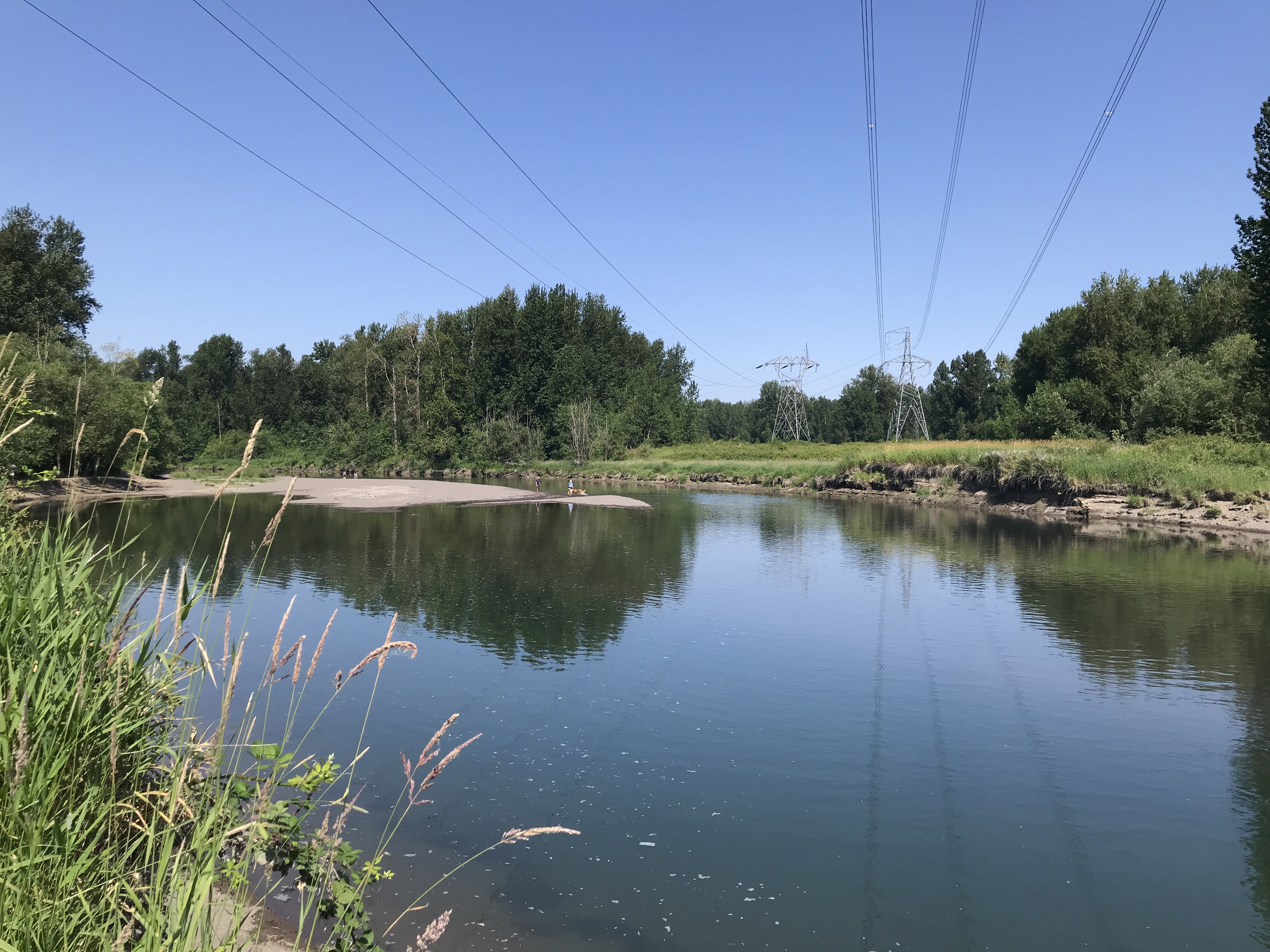
There are a bunch of access points to Lost Creek along the way. The trail crosses Forest Road 1825 and parallels the Sandy River. The views of Mt Hood were spectacular. 

After taking some photos of the river and Mt Hood, I realized there was a couple sitting in the water. I hadn't noticed them at all. I waved and started back to the car.

It was hot AF out there and I went through almost 100 oz of water in my short outing. 

Like my last visit in 2021, I drove up to French's Dome for another look. There were several rock climbers so I kept my stay short. I circled the dome then bailed.

Horseshoe Ridge Trail

Lost Creek

Lost Creek

Lost Creek

Sandy River & Mt Hood

Looking west toward Lolo Pass Road

Sandy River & Mt Hood, a little further up the trail

Sandy River Trail


Sunday, July 9, 2023

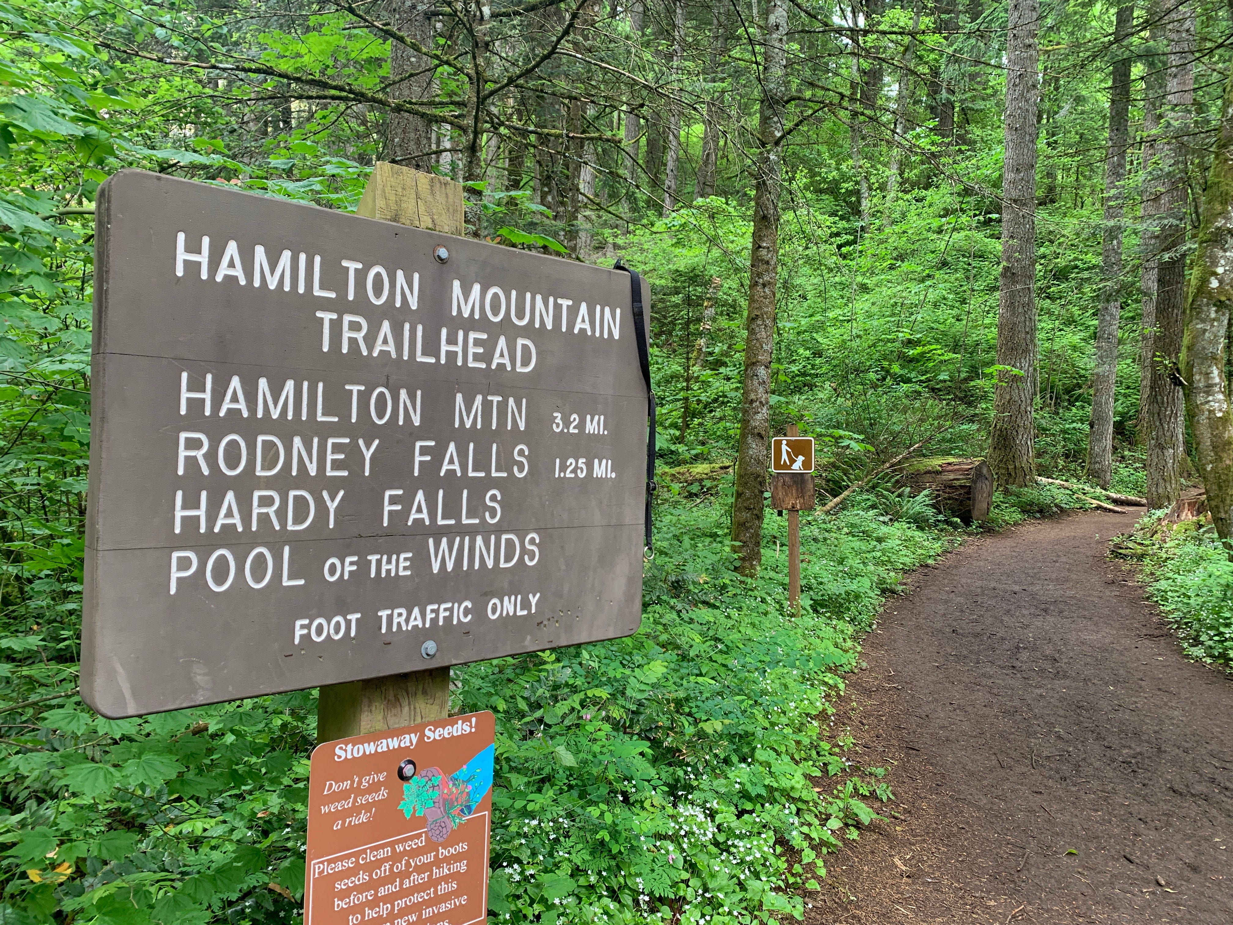
HIke: Hamilton Mountain, N Bonneville, WA

Beacon Rock and me from Little Beacon Rock

Getting There

Take WA-14 from Vancouver, WA east toward N Bonneville.

Just after Doetsch Ranch you'll see the Ranger Station on the north side of the road just before the Beacon Rock parking lot, then another road across from the bathrooms. The road winds up the hill for a bit.

There was an unattended sign that the main parking lot was full but a few cars had left. The upper parking lot was also open just before the entrance to the parking lot.

The Hike

Length: 6.82 mi
Elev. gain: 2,221 ft
Moving time: 3:32:51
Avg pace: 31:13
Calories: 2,144
Total time: 4:16:03


Recovered a little bit of my spirit at Hamilton Mountain. It's been a minute since I did a hike with some elevation gain. I got there at around 10:30a. Lots of folks enjoying a sunny Sunday, only ~80 deg F. I got bit by skeeters about a 1/2 mile in so I stopped and put on bug spray and a long sleeve shirt; no issues the rest of the hike.

At the top, you could see a few mountains: Adams, Dog, Wind, Table, Hood.

On the way down I hiked through Hadley Grove and up to Little Beacon for a little alone time to think and appreciate the view.


Thursday, July 6, 2023

Hike: Sandy River Delta, Troutdale, OR


Getting There

The parking lot is accessible from Hwy 84 just east of Troutdale. From I-84 eastbound, take Exit 18 and follow the Crown Point Highway north under the freeway. It changes to Thousand Acres Road. Follow that into the parking just past the off-on ramps.

You can use a Northwest Forest Pass or buy a day pass at the vending machine.

The Hike

Length: 4.58 mi
Elev. gain: 62 ft
Moving time: 1:24:18
Avg pace: 18:25
Calories: 849
Total time: 1:26:08


I was planning to pick up some items from Costco near the airport but got there too early, before they opened. I took the opportunity to go for a quick hike around SRD.

I knew it would be warm but since it was still before 10am, it wasn't too bad. I had my favorite straw hat but I didn't anticipate the mosquitoes. 20 ft from my car, I paused to start the hike tracking on AllTrails and got bit several times. Ack! 

Not a welcome start to the day but I continued on. I've been paranoid about ticks as well and decided to stay out in the open despite the direct sun.

I followed the Confluence Trail towards the Bird Blind. Then, took the Meadow Road to the end, Thousand Acre Road. I didn't want to venture into trees because of the lack of bug spray on-hand so I doubled back toward the Confluence Trail.

I wandered over to Channel and watched the dogs play in the water for a minute.

Old Channel Trail

The channel

I wasn't ready to go back to the car just yet so I took the Meadow Road to the end for a 2nd time. I knew the trail to the river was wide so I decided to go as far as I could. I passed a woman and her two dogs. I pulled out my phone to check the route and was immediately swarmed by a dozen mosquitoes. 

It wasn't my plan to double back to hastily but I had to get out of there. The woman must have been wary that I was following her but I didn't know what to do. If I could have said something about the bugs, I would have. 

At the first opportunity, I veered off down the Meadow Road and brushed my arms and legs to demonstrate (possibly) why I'd turned around so quickly. I never looked back but kept a brisk pace.

It was time to go back to the car. I took the Confluence Trail back to the parking. When I got to where I'd been bitten earlier, I paused and hoped to avoid more bites as I'd already racked up a dozen or more, including on my cheek and earlobe which was swollen.

I rushed through the trees to my car and hastily hopped in. Whew, I made it without any more bites.

I've been extremely stressed and depressed about selling my house. This little outing helped a tiny bit.


Saturday, July 1, 2023

Hike: Camassia Nature Preserve, West Linn, OR

Getting There 

From Downtown Oregon City, head northwest on 7th St/Hwy Bridge. Continue onto OR-43 N/Oregon City Arch Bridge, then follow OR-43 N. Turn left onto Willamette Falls Dr and take a light right onto Sunset Ave. 

Turn right onto Walnut St for this trailhead. There are some other start points but this is the one my mom and I started from a few years ago, the last time I was here.

It's neighborhood-street parking so be respectful of residents and their driveways. There is parking on Maple Ave and Chestnut Ave.

The Hike


Distance: 0.69 miles
Elevation Gain: 94 ft


Last minute walk around Camassia Nature Preserve. Only 0.7mi loop. I wasn't planning a hike and didn't even had hiking boots or other gear. I did have my signature straw hat!

Dry, hot, and a bit overgrown. Still happy to take a little spin. I didn't see anyone else on the loop. There were a lot squirrels scurrying about.

Raised platform

Mt Hood

Also, specimens of the oak savanna that "once covered about 400,000 acres of the Willamette Valley. Today, fewer than 20,000 acres of oak trees, representing just 5% of historical totals." I learned about the oak savanna was at Wapato Access Greenway State Park on Sauvie Island.


Monday, June 19, 2023

Hike: Ape Cave & June Lake, MSH, WA


Selfie from June Lake

Getting There

From I-5/Woodland, take the Lewis River Road (WA-503) eastbound to Cougar. Continue past on NF-90 to NF-83 (Ape Caves, Ape Canyon, Lava Canyon, etc).

I was out there for my mentor session with an experience MSHI volunteer and two other mentees. We met at a road pullout, then, because of the rain, we stopped at Ape Caves. While one mentee, Evan, was getting instructions on using the radio and other stuff we covered last weekend at SLC, Katie and I introduced ourselves to the Ape Caves staff. 

We went to the lava tube opening and chatted with a few visitors and got some orientation on the area. Katie and I ventured into the tube for a little bit but just to where the trail splits.


When the rain stopped, the four of us drove up to the Marble Mountain Trailhead in order to head up to June Lake.

The Hike

Distance: 4.83 miles
Elevation Gain: 545 ft


From Instagram:

Today I had my mentor session on the south side of Mt St Helens. I met a seasoned MSHI volunteer and two other mentees near Cougar, WA. It was raining this morning so we stopped at Ape Caves to interact with some visitors and take at peek at the lava tube.

When the rain stopped, we drove up NF-83 to the Marble Mountain Sno-Park, where road is still closed. We took the Pine Marten Trail for a while then out on the road. We stopped to chat with two people visiting from Chicago, then continued to the June Lake Trailhead and up to the lake for lunch. We talked with two more people that were from the East coast.

On our way back we met a guy who had a wealth of knowledge and a lifetime experience in the area. You never know who you'll encounter. We chatted for 15 minutes. We passed a couple with a dog and just said hello. Some interactions are brief while others develop into an interesting dialogue.

It was good practice engaging visitors and using the radio. I'm feeling ready to go out there on my own or co-rove with another volunteer.

From the Trailhead parking lot, we followed the Pine Marten trail, while parallels NF-83. We popped out onto the road when we saw a couple of visitors from Chicago. We chatted with them for a bit about their plans and where they could see MSH.

We continued along the road to the June Lake Trailhead. We meandered up the trail, chatting with each other, discussing flowers and the ancient lahar flow next to the trail.

We stopped at the lake to eat lunch but the rain came back. We hiked into the trees for shelter and examined the foliage. When the rain stopped again, we went back to the lake and met two more visitors. We chatted for a bit and they took a group photo for us. Before we left the lake, we popped over to the lahar flow to look at the boulders.

We walked back to Marble Mountain Sno-Park. A car and an RV past us on the road that was supposed to be closed. The car came back pretty soon because the road was blocked by snow.

When we got back to the gate, we called Columbia Dispatch to report the open gate. While waiting two more cars full of people looked like they wanted to go through. We closed the gate but didn't lock it. The RV came back through.

We drove back to where we met in the morning to check out on the radio. We caravaned back to Amboy to the MSHI HQ to return the radio.


Sunday, June 11, 2023

Hike: Hummocks Trail, Toutle, WA


Coldwater Lake from the MSH Science and Learning Center


Getting There

From Castle Rock, just off I-5, take WA-504 east for for 43.3 miles to the MSH Science and Learning Center. Then, take the cloverleaf turn and follow the road for 2.4 miles to the Hummocks Trailhead.

The Hike

Distance: 2.39 mi
Elevation Gain: 273 ft
Duration: 1hr 11min


Fun hike with fellow Hiking Steward volunteers with Mt St Helens Institute. We spent the morning together in the MSH Science and Learning Center learning about the role and responsibilities, practice using the radios when roving, how to respond to visitor inquiries in an engaging way, and learning more about the 1980 Eruption and the mountain's history.

We had lunch on the balcony overlooking Coldwater Lake and views of MSH.

In the afternoon, we split up into 4 groups of about 10 people each to hike the Hummock Trail. We carpooled down to the trailhead because the monument still closed to the public, related to the landslide near JRO.

It was a nice leisurely hike, we went in a counterclockwise direction. We'd stop at various places to point out features and practice out interpretive skills.


Sunday, June 4, 2023

Hike: Hamilton Mountain-Hardy Creek Loop, N Bonneville, WA

Zach Urness / Statesman Journal

Getting There

Take WA-14 from Vancouver, WA east toward N Bonneville.

Just after Doetsch Ranch you'll see the Ranger Station on the north side of the road just before the Beacon Rock parking lot, then another road across from the bathrooms. The road winds up the hill for a bit.

However, the summer hiking season is in full force with the warm weather and end of school term. The sign at the bottom of the hill said the parking lot is full. I probably could have found a spot but opted to park on Hwy 14 by the Beacon Rock Trailhead and walk the road to the trailhead.

Indeed, there were several cars leaving as I walked up and I could see a few empty spots. It looked like the upper parking lot was open as well but no clue on openings. The Discover Pass seems to help.

Anyway, it was a little extra distance and elevation so I didn't mind where I was parked.

The Hike

Length: 8.13 mi
Elev. gain: 2,346 ft
Moving time: 3:17:24
Avg pace: 24:16
Calories: 1,988
Total time: 3:25:50


I haven't really been hiking lately. Too many other things going on. Besides some low effort hikes at Sandy River and Cooper Mountain, my last rigorous hike was Forest Park when I had some hydration issues.

Before that, I hiked a mostly flat out-n-back at Coldwater and had lower back problem. My last visit to Beacon Rock SP was the big, 2-summit hike to Phlox Point and Hamilton Mountain figure-8 loop, a 14+ miler, 3600+ ft of climb.

This hike was fitness gauge, let's see how well I do and a first hike in my new Lone Peak ALL-WTHR Mid Hiking Boots.

I also practiced talking to people like I will have to do when I'm a Hiking Steward. Obviously, I didn't introduce myself as volunteer, I did realize that I am not as shy as I imagine. Maybe it would be as difficult at I think it will to do "customer service" on the mountain or in the Visitor Center.

The Boots

I used my REI points to get these for around $20! (My Keens Targhee IIIs went for $20 at their sidewalk sale last summer!).

Last summer, while the price was right, the fit of the Targhees felt wrong. The fit of boot on my right foot just didn't feel the same as my worn in boots. I tried different sole inserts, adjusted the lacing, and even bought a second pair from the store in case there was some kind of manufacturing defect I could see. I also saw a podiatrist but they didn't find anything wrong with my gait or otherwise.

It turns out the issue between old and new boots was uneven were on the tread. I returned the 2nd pair of Keens and the Lone Peaks and just powered through on the $20 Keens. I eventually broken them in enough where they felt right.

I picked up the Lone Peaks while trying some other boots but returned them after walking around the office for a 1/2 day. I noticed Kyle from Kyle Hates Hiking on YouTube wearing some low-top Lone Peaks. This spring, when I saw them on-sale and realized I could get them for almost nothing, I bought 'em. I bit of an impulse buy as there's nothing wrong with my Keens. I wanted to try a lighter-weight "summer" boot.

My Review

They're pretty comfortable. I didn't had any issues on the uneven terrain, even on the rockiest part of the trail where you can feel them through the soles. Even with the Size 11s, it felt like my toes were really close to the end of the boot.

I accidentally kicked a few rocks and didn't stub my toes. The Keens have a distinct advantage over the Lone Peaks, the rubber toe cap, which has saved by feet many, many times over. 

While the Lone Peaks are a great shoe, I prefer my Keens for all-year protection.


Fitness Check

Given my recent hikes, I always worry about my fitness, especially as I anticipate going out on the trail for MSHI. Reaching the Hamilton summit is morale booster and decent gauge on my readiness. I tend to have doubts on my hiking ability but have realized time and again, that it takes a lot more time before I lose my stamina and strength.

As with many previous posts, I've been more conscience about my hydration and electrolytes. I forgot to bring any LMNT packets but I had bit bottle of sugar-free Gatorade. That's pretty much all I drink but I had extra water, ~48 oz.

One Day Later

My legs feel good today, no major soreness. I think I can handle longer hikes around MSH.


Other Thoughts

The foliage was pretty thick, esp. between the summit and the Saddle. I don't recognize poison ivy or oak but I suspected I was walking through some of it. Indeed, because I could feel some itchy parts on my arms. I should have worn a long sleeved shirt.

I used rubbing alcohol when I got home and that seemed to help a little, I still have some spots there I really want to scratch but won't.

While I needed this hike for my mental health, I did have complication. I stopped briefly at far end of the Saddle to rest and sit for a minute. I noticed my Nest camera notification that a person was at my door.

I looked at the video and saw some guy hanging out on my porch. He didn't ring the doorbell but was mumbling like he was talking to himself or maybe he thought someone was watching and listening. He even tried to open the realtor lockbox that was there since I moved in. I removed the key not too long ago and reset the password. Still disturbing to see someone attempting to gain access to my place. 

My adrenaline shot up because I felt helpless. I was at the inflection point on my hike and still had over an hour to go plus a 45min drive back home. I could have called the cops or maybe triggered my alarm to scare him off. I was just glad I'd put the dumpster inside the garage so I didn't look like the place is vacant.