Tuesday, August 15, 2023

Hike: Ape Canyon to Pumice Butte, MSH, Cougar, WA

View from Pumice Butte near Ape Canyon/Loowit Trail junction

Getting There

It's 28 miles from Woodland to the Cougar. There are a couple of gas stations here. Continue east on SR-503 which becomes Rd 90 for 9.5 miles to Ape Cave. Looks for the sign to Ape Caves, June Lake, Climber's Bivouac, Ape Canyon & Lava Canyon which is Rd 83. It's 0.3 miles to Trail of Two Forests and 0.7 miles to Ape Cave. 

Ape Canyon and Lave Canyon are 10 miles north at the 83/90 junction. The trailhead is at the end of Rd 8300 on the southeast side of Mt St Helens.

---

This hike was one of my stops for my 2nd solo outing as Hiking Steward for Mt St Helens Institute. The forecast of triple digit temperatures had me nervous. I wasn't sure if I was even going to hike and planned on just visiting the trailheads and other points of interest to interact with visitors.

After a short stop at Trail of Two Forests at 9:30a, I noticed the thermometer was still in the 80s and the peak temps weren't supposed to hit until 2p. I figured I had time to rove the Ape Canyon Trail and be headed back down in time. Then, I could stop at Ape Cave and cool down underground.

When I arrived at the trailhead, there were only two cars in the lot. The forecast had kept people away.

As I was getting ready, 6 mtn bikers who'd parked at Lava Canyon rode by and up the trail. I packed plenty of water (over 6L) to give to visitors, plus two bottles of Gatorade and another two bottles of water I had from the cabin. This was in addition to my own water supply and electrolytes. It was heavy but I was glad to be prepared to intervene if need be. The last time I was out on this trail I encountered a few people that seemed to not have enough water.

I put on my pack and grabbed my radio and started up the trail.

The Hike

Distance: 8.67 miles
Elevation Gain: 1,868 ft


As soon as I left the asphalt parking lot and was in the trees, I could feel the temperature drop. There was a slight breeze. It took a bit got get used to the extra weight and made sure my hip belt was tight to minimize the strain on my shoulders.

About a mile up the trail, I passed the first pair of hikers that were finishing their outing. One person hardly made eye contact when I introduced myself so I shifted my attention to the other person. I asked if they wanted some extra water but they declined and hurried by.

A short while later, a second pair of hikers came down the trail. I introduced myself and we made comments about the heat. I asked if they wanted some water but they also declined.

That was it for the two cars in the parking lot. I marched onward and upward.

I kept drinking electrolyte powered water and felt really good and energized.

Eventually, I caught up with three of the 6 mtn bikers, all teenagers. They all seemed well equipped with Gatorade and one had an emergency transponder like the InReach. They was off their bikes walking slowly. They stopped to let me pass.

A bit further up two more bikers were stopped to wait for their buddies to catch up and beyond that, a guy, the adult in the group, was stopped. 

We leap-frogged up the trail several times. When Mt Adams and Mt Rainier were in view, I pointed them out to the two lead bikers.

At one point, I had a nice longer conversation with adult. They were visiting from Seattle and was appreciative of my volunteer presence on the trail and within the monument.

At one point, when they was stopped to wait for the boys in the rear of the group, I zoomed past at a good pace. When I'd started, I wasn't sure if I'd reach the top of the trail but I could see the monitoring equipment and it motivated me to complete the route.

I walked up the Loowit Trail junction and took off my pack. I found a large tree which provide ample shade. It was great to take off the weight I was carrying. I ate an apple and refilled my water bottle.

The six bikers finally arrived and celebrated their arrival with a cheer. I saw them from 100 yards away as they sought some shade off the Loowit Trail. I waved and started my descent.


It was good to be out of direct sun and back in the trees. It must have been in the high-80s or lower 90s. A nice breeze was refreshing.

I stopped to check out my new favorite plants: Ghost Pipe and Pinesap, both do not contain chlorophyll; they get their food through parasitism upon fungi rather than photosynthesis. The Ghost Pipe looks a bit creepy and looks like zombie fingers poking out of the ground.

I also saw a plant that had leaves reminding me of duck's feet called Sweet After Death!

Ghost Pipe (Monotropa uniflora L.)

Ghost Pipe (Monotropa uniflora L.)

Pinesap (Monotropa hypopitys L.)

Sweet After Death (Achlys triphylla DC.)

I finished my hike and found an empty parking lot besides my own car. Thankfully, it was in the shade. I was kind of surprised that the bikers had not passed me on the way down. I hoped they hadn't had a mishap but thought if there was some kind of emergency, the chaperone would have sent two scouts to find me for assistance.

I got out my camp chair and sat in the shade nonchalantly. Soon after all 6 bikers emerged from the trail.

We chatted some more about the cooler-than-expected temperatures and a successful outing.

The rest of my rove

I stopped at the Lahar Viewpoint and talked to several visitors. I still wanted to stop at Ape Cave to explore the lower passage. I'd read in the previous day's report that the gift shop had closed early so I hoped I could still make it.

The parking lot was about 1/2 full and the store was indeed closed. There weren't any USFS people either. I was the only "official" presence. I said hello to people but didn't do my usual interpretation. Most everyone was focused on the lava tube and not paying much attention to me despite my obvious red Volunteer shirt and red MSHI hat.

I descended into the cave and hike to the end of the lower passed. It was difficult to interact and identify myself but I didnt' chat with a few people. One person complained about other hikers yelling in the cave. I just said some folks just like the reverb.

Another person asked when the gate was closed but I assured them that they wouldn't close it if cars were still in the lot. Actually, I didn't know if the gate is even closed during the summer.

I gave my "out of service" call to radio dispatch and disassembled the radio (removed the battery and antenna).

Funny Story

As I was getting ready to drive back home, I realized I could find my phone. I remember noticing I'd cracked the screen on my hike and set it down somewhere. I couldn't imagine how I could have lost it between the trailhead and the Ape Cave parking lot.

I searched everywhere; under the seats, in the seat pockets, through all my gear in the back seat and cargo area. Nothing. I was dismayed and confused. "How????". Besides losing my phone, I'd lose all my photos from the last two days. <sad face>. I drove the 9 miles feeling like it was sour end to a spectacular two days.

My only option was to retrace my steps and hope for a miracle. Maybe I'd set it on the bumper at the trailhead and it had fallen off. It was highly unlikely anyone had driven in the parking lot after me so there was a glimmer of hope.

To cover my tracks, I first stopped at the Lahar Viewpoint but there were no cars and no phone on the ground.

I drove the rest of the way to the Ape Canyon parking lot. I hit a bump and heard a noise between the steering wheel and the gauges.

My phone!!!! 

Holy cow. I laughed quietly in relief. I didn't remember if falling there earlier but all was well. I had my phone and photos. Whew!!!!!

I put on some music and drank a mate drink. So thankful and happy. Good things do happen.

Saturday, August 12, 2023

Hike: Oneonta Gorge Trail, Cascade Locks, OR

Getting There

Take the Historic Columbia River Highway (Hwy 30), constructed between 1913 and 1922. The Oneonta Trailhead is 2.0 miles east of Multnomah Falls, and just 0.6 miles west of Horsetail Falls Trailhead.

You can access Hwy 30 via I-84 via Exit 28 (Bridal Veil/Angel's Rest) or Exit 35 (Ainsworth State Park) from either the west or eastbound lanes. 

In the morning to just after lunch, I was volunteering at Latourell Falls as a Trail Ambassador for Trailkeepers of Oregon (TKO), greeting visitors, orienting them about the trail, and suggesting other waterfall hikes.

Since I was in the area and already had my hiking boots on, I figured I could get in a hike and log some miles for WTA's 2023 Hike-a-Thon. Originally, I'd planned to hike up Wahkeena Falls since I hadn't been there since winter. I knew the trailheads were going to be busy but I was hoping for an open spot. Unfortunately, Wahkeena's main and auxiliary parking lots were full. I was running low on gas, so my closest places for fuel was Cascade Locks so I continued on Hwy 30 in that direction. 

When I reached Oneonta & Horsetails Falls Trailheads, there was ample parking. I pulled into a spot and headed out.

The Hike

Length: 4.55 mi
Elev. gain: 1,375 ft
Moving time: 2:03:36
Avg pace: 27:09
Calories: 270
Total time: 2:12:02


The first part of the trail is a long switchback in the trees and gradual climb. Once you reach the gorge, it starts to climb a bit. There's a permit box at the junction for Horsetail Falls Trail. It looks like a steep descent down but I was headed for Triple Falls and beyond.


The forest is gone. The trees were burnt in the 2017 fire which started at Eagle Creek. There is no shade except behind a few large tree trunks. The trail is stable but there are a few spots where careful footing is wise as the drops are pretty sheer. 

There are some viewpoints of the gorge.


I finally made it to a viewpoint for Triple Falls. I can imagine this surrounded by a lush forest but now it's a stark reminder of the fire 6 years ago. I continued up to the bridge. There was a group of hikers sitting next to the creek, cooling off in the shade. It was pretty hot and I was feeling it. Probably in the high 80s to low 90s.


I had another 1.5 liters of water but low on electrolytes. I wasn't sure what lie ahead on the trail but continued up. I found a spot to get down to the water. Not to fill up my bottles because I didn't bring a filter but to dunk my neck gaiter to help cool down.

There was a couple going in the same direction. They passed me but I passed them a bit later when they were stopped in the little shade there was. I was started to get chills; not good; it's a sign my body is having trouble regulating the temperature. I didn't have a clear destination and I didn't want to take any chances so I turned around and started the walk back to Triple Falls.

Even when going downhill, I continued to have the occasional wave of chills. I drank more water and took my time. When I reached the bridge I stopped to take a panorama and rest in the shade. I was starting to feel better and enjoyed the descent down the gorge.

Further down the trail, I came across a pair of hikers that looked a bit exhausted and were sitting on the trail. One of them asked me about Horsetail Falls Trail but I said I thought it was down below at the Mark O. Hatfield Wilderness permit box. They said they hoping to reach Triple Falls. I gave wrong info as I thought it meant the series of Oneonta Falls (Lower, Middle, and Upper) but in fact, the bridge WAS Triple Falls. Oops.

I stubbed my right big toe even though the Keens have a burly rubber toe cap. It slowed me down a bit as my toes were snug against the front of the boot on the downhill.

I made it back to the trailhead/parking lot and continued east to Cascade Locks to get some gas. I noticed quite a few thru hikers walking around town. Oregon now has self-serve fuel. Kinda of a trip. I remember when I first moved to the state 20 years ago, I'd absentmindedly got out of my truck and got reprimanded for starting to pump my own gas.

I thought about stopping for a late lunch at the Bridgeside but zoomed by and got back on the freeway.

I still had to drop off my TKO stuff at Rooster Rock. When I'd been there in the morning, the ranger station was closed but this time a person was checking & selling parking permits. I told them I was with TKO and there to drop off my stuff, and the ranger waved me through.

All in all, a good day in the Gorge.

Saturday, August 5, 2023

Hike: Ape Cave Upper Passage, MSH, Cougar, WA

Selfie at the skylight

Getting There

It's 28 miles from Woodland to the Cougar. There are a couple of gas stations here. Continue east on SR-503 which becomes Rd 90 for 9.5 miles to Ape Cave. Looks for the sign to Ape Caves, June Lake, Climber's Bivouac, Ape Canyon & Lava Canyon which is Rd 83. It's 0.3 miles to Trail of Two Forests and 0.7 miles to Ape Cave.

The Hike

Distance: 2.55 miles roundtrip
Elevation Gain: 364 ft


I'd been to Ape Cave on June 19 for my mentor session to be a Hiking Steward for MSHI, another volunteer/mentee had only gone in a few hundred feet to the bottom of the 2nd set of stairs. However, this was my first time actually inside the lava tube.

Like many locals and nearby resident from Vancouver and Portland, I'd lived in the PNW for over 20 years but had never ventured up there. I just assumed it was always super busy with people and I'd always gone out to the forest for some solitude and scenic views.

At the last minute and per my MSHI mentor's suggestion, I arranged for a mentor session at Ape Cave with a seasoned volunteer. I confirmed with the volunteer coordinator and confirmed with the person I'd be spending the day with on arrival time and other details. While I'd been trained for the NF-83 road and sites like June Lake, Ape Canyon, Lava Canyon, Ape Cave is unique

I expected to spend most of my day at the cave entrance greeting, educating, and orienting visitors who were there to explore the lava tube. I knew about the history of the area and some facts about what to expect but none of it was first-hand. To my delight, part of my orientation was to include my own venture underground.

I was tempted to do the Lower Passage with is shorter and easier to get my feet wet but when I descended the stairs inside, I decided to go for the challenge, the Upper Passage. And it was!

The day before when i'd confirmed I was coming, I stopped by a hardware store to get two new, powerful flashlights and a brick of AA batteries. On my previous visit, I'd used my camping headlamp which is fine for puttering around a campsite at night and digging through the snack box but was totally inadequate for cave exploration or spelunking. I was hardly do anything that adventurous since thousand of visitors do the same tube every week but it was still my first foray into this kind of environment.

I knew there was "27 rock piles" but that didn't quite describe what I actually found. To add to the challenge, I only had one free hand to negotiate the giant rocks that you had to climb over since I was holding the flashlight on the other hand.

As a volunteer and representative of the site, I greeting folks along the way and tried to answer questions. One that kept coming up is "how much further". I told them honestly that it was my first time in the lava tube as well. I encouraged the people that were a bit tepid about their abilities.

The rock piles were not difficult to get over but as you got further along, some of the passages were narrow. Fortunately, my pack did not prove to be an encumbrance. Actually, I think the only place were I felt the squeeze was when climbing the ladder at the end to get back to the surface.

One obstacle that presented an bigger challenge was a 6-7 foot rope ladder with no foot hold. I was behind two other groups that were helping each other out. Bravely, I didn't accept the help I should have take but I managed to clumsily get up the ladder, like a beached whale. LOL. I did put my knee down on a jagged rock but didn't suffer any lasting discomfort.

I thought about one visitor I'd talked to at one of the early rock piles that seemed particularly nervous about the adventure. They weren't gonna like this section. I stopped and waited for another large group I'd passed to see how they managed. The kids made it up with little effort and in fact, several adults who protested seemed to make it fine. I certainly wasn't there to provide climbing assistance or be a guide. As they waited for the whole group to get up and over this obstacle I took off.


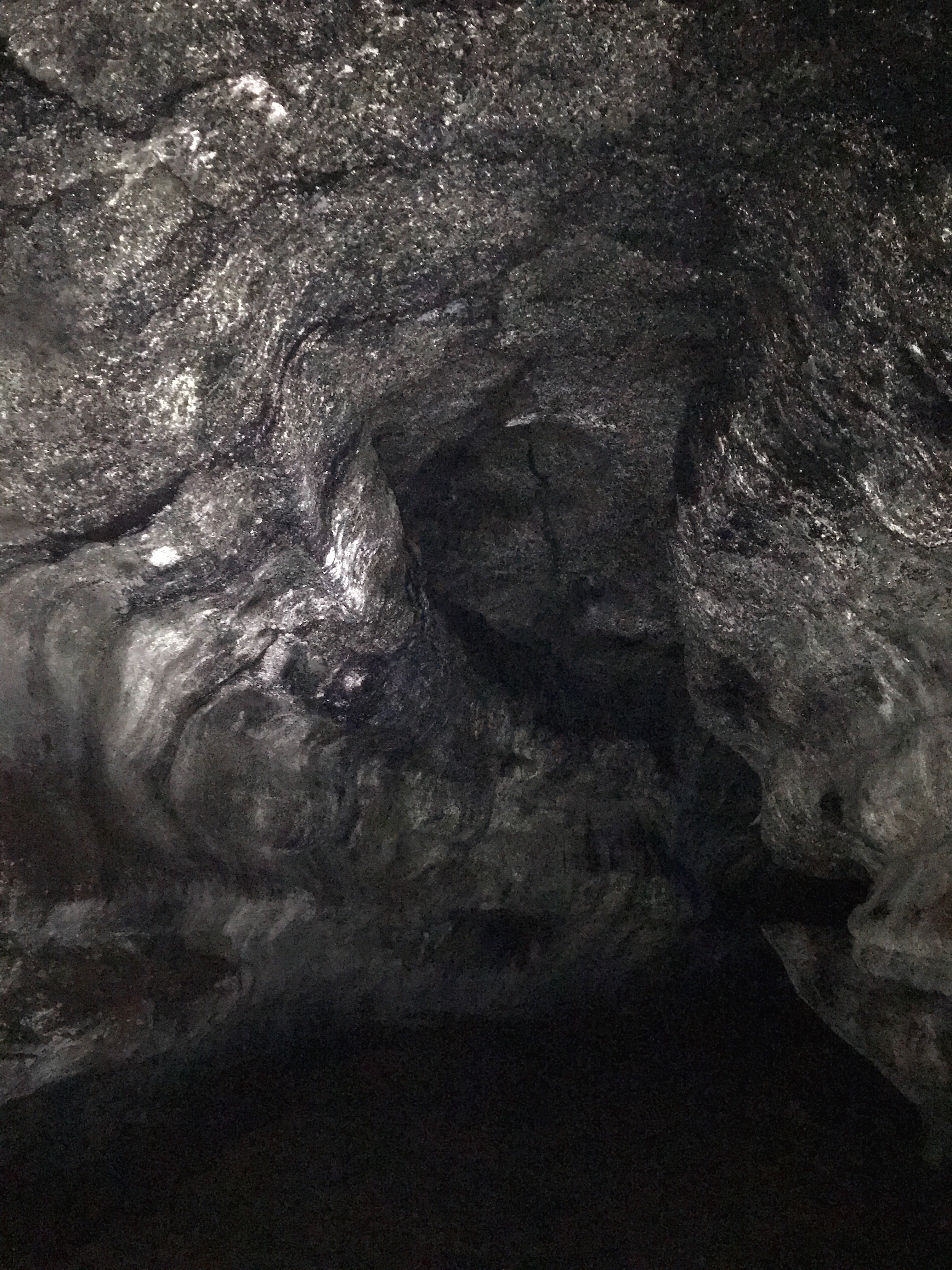
The cave

The cave

Near the skylight

Fascinating textures

What an experience. I continued to marvel at the high ceiling and contrast of course rock with smooth, glasslike patterns. Near the end, there is a skylight. I did my best to photograph the tunnel but my camera didn't have anything to focus on so many pictures were blurry. This skylight was perfect for some underground photography.

Near the exit

If there hadn't been so many people down there, I would probably have been nervous as there was no way to gauge distance or progress with technology. Eventually, I made it to the exit. There was a gathering of people there waiting their turn for the ladder. The climate got a bit humid and there was a bit of a fog as the outside, warm air mixed with the cave air.

Lots of folks were resting outside the cave, enjoying snack and the daylight. One teenager that was having a little difficulty was sitting quietly, relieved.

It had been raining earlier but that had stopped but it was still warm from the summer heat. I took off my jacket, took a bit swig of water, and ate half a sandwich. I picked up some bits of trash and milled about. I'd seen many of these people at entrance so there wasn't much need to engage. Most people just seemed a bit tired and glad to completed the "more difficult" section of Ape Cave. I said something about taking a well-earned rest and headed back to the trailhead through the forest.

The exit (hole in bottom left)
Just outside the exit

Trail back to the cave entrance

Trail back to the cave entrance

I finally reached the entrance and again and shared the highlights of my subterranean journey with my mentor. He was an older gentleman who admitted he wasn't fit to do the cave. I was glad to share my own experience.

Throughout the day, visitors arrived in waves due to the timed 2-hour passes: 9am, 11am, 1pm, 3pm, 5pm. Around 4pm another MSHI volunteer arrived. She was going to work this site but did some roving on the Loowit Trail near June Lake and ended up helping participants of 5K stay on track.

At 4:15p, we took down the signs we'd put up, mostly pictures of the 1980 eruption and other educational aid, even though this side of the mountain was mostly unaffected. It's still the reason the monument exists.

Walking through Ape Cave is high on the list of exceptional things I've done, right there with Preikestolen in Norway. I said goodbye to my mentor and the other volunteer. A great day!

Friday, August 4, 2023

Hike: Latourell Falls, Columbia River Gorge, Corbett, OR


Getting There

Take I-84 E to Exit 28 (Bridal Veil), then turn right at the Angel's Rest parking onto Historic Hwy 30 for about 3 miles to the Latourell Falls parking lot.

The Hike

Length: 2.41 mi
Elev. gain: 679 ft
Moving time: 58:54
Avg pace: 24:24
Calories: 594
Total time: 1:15:31


To continue with my exploration of volunteering opportunities outdoors, I'd signed up with the Trailkeepers of Oregon for a shift at Latourell Falls. I'd visited many of the waterfalls in the Gorge and hiked several of them but not this one. While not required, I figured I'd be a better steward and representative of TKO if I'd actually hiked the trail!

I was more than pleasantly surprised. I took the counterclockwise loop to the upper falls. It turns out this is the best way to see the waterfall from the parking lot. This late in the summer, it's still flowing quite nicely.


After the preview of the falls, the trail winds north under Hwy 30 to a park.


From the park, the trail climbs rather quickly with only short switchbacks. There are a couple of junctions that aren't marked well and I whipped out my phone to confirm which direction to take. Note: On the ascent, take the right turns. I suspect if you take left turns you'll discover they dead-end.

I funally reached at viewpoint and stopped for a few minutes. Given my recent roving experience and confidence engaging the public, I chatted with a couple of out-of-town hikers for over 10 mins. They were happy to learn about what I knew about the location and Gorge in general but admitted it was my first time on this trail. We talked about the flora and some other hiking options they could make in the later afternoon. We said our goodbyes and I continued on to the Upper Falls.

Upper Falls


As I completed the loop, there is one more viewpoint to get a good look at Latourell Falls.

Bonus

On my way home, instead of going back to the freeway on-ramp at Bridal View/Angel's Rest Trailhead, I wanted to stop at Portland Women's Forum State Scenic Viewpoint. About 0.5 miles from Latourell Falls (before Figure 8 Loops on Hwy 8), I saw two black bears, a mama and her cub about 30 feet in front of me. They had descended an incredibly steep trail and sprinted across the road, disappearing into the trees again. It was the first time I'd ever seen bears IRL. What a treat!

Thursday, August 3, 2023

Hike: Loowit Trail via June Lake, MSH, Cougar, WA


Getting There

Take Exit 21 from I-5 N (Exit 22 from I-5 S) for WA-503 S/Lewis River Road. It's 28.4. miles to Cougar. WA-503 becomes Road 90. Take NF-83 and drive 6.9 miles (north) to the June Lake Trailhead.

Funny Story:

My original plan was to hike Silver Star Mountain. My usual route has been from the south on L-1200 out of Washougal but since my last visit out there resulted in a flat tire on the road to Noble Ridge Tree Deck, I was pretty gun-shy (pun intended) so I thought I could assuage my somewhat irrational fear of another flat by approaching the trailhead from the north. I'd driven L-1200 from pavement to pavement so I thought it was straightforward.

I drove through Battleground and took the turn for Moulton Falls and weaved my way through the back-country to the forest road. I was watching the navigation app and approximate time to arrival. I had to relieve myself and the 15 min ETA was acceptable. I past the junction for L-1201 and Google's suggestion to take it. A couple miles later, the time estimate jumped to 1 hr 30 mins!

WTAF! I was on L-1200. Ducking Google!!! I began to panic. Where did I go wrong? Maybe I was supposed to take L-1201. Further along, Google routed me to a road that was closed. Grrrr! I'd actually only done the full road from the south. I stopped and turned around and drove back down to the junction. As I approached it, the ETA reset back to about 15 min. Very strange. I made it to L-1201 and found a closed gate about 100 yards from the junction.

Oh FFS. I gave up. Today was just not a day for Silver Star. My nerves from the prevous flat tire were still fresh and I couldn't stomach taking a chance. I passed a couple of trucks heading up and should have asked if it was on the right road and the Maps app had gone mad but I didn't.

I knew I was close to MSH and I didn't want to waste a hiking day since I'd already made it this far. I'd just been up here 3 days before for my MSHI rove. I plugged in June Lake as my new destination which routed me past the MSH Ranger Station where you pick up the radio for MSHI shifts. I didn't need the map anymore. I made a "pit shop" at the Yale Bridge port-a-potty.

As I made my way north on NF-83, I felt calm and assured. I arrived at the trailhead parking lot and found a spot in the shade. While I wasn't there as a MSHI volunteer, I was participating in WTA's Hike-a-Thon!

The Hike

pic hike on the Loowit Trail via June Lake, MSHNVM. This was my second time in this area of the monument and my first hike for WTA's 20th annual Hike-a-Thon. I only went about half way to Pumice Butte. It's kind of gnarly and rugged when you leave the forest and start traversing the base of Mt St Helens.

Despite the number of car in the parking lot below I only encountered a family of four leaving June Lake and one other hiker heading south on the Loowit in the forest section. When I stopped to change out of my wet Hike-a-Thon shirt and put on the long-sleeved/UV shirt, I received a message that my house inspection was done and there were only very minor things to fix. This improved my spirits.

The Loowit trail above the trees is amazing and a bit gnarly. I took each step very carefully in the places where I crossed over rocks, which is often. While I had plenty of time (daylight) I only went as far as I needed to get an unencumbered view of MSH, about 1/2 way to Pumice Butte. I knew there was a section that goes through a stand of trees and then there's the actual lahar, where I stopped last time I was here.

I found a spot under a tree to take off my pack and dry my shirts. I ate half of my sandwich and swatted a pesky insect. My anxiety of the day was in the background but it was still there. It wasn't due to my fitness, hiking experience, or anything with the hike but it was part of the reason I turned around where I did. That's alright. I got some great photos and felt empowered by tackling a tricky part of the monument. It was good experience for future roves. 

I refilled my main water bottle, put on my partially dried shirt and head back towards June Lake.

When I reached the June Lake/Loowit junction, I imagined the hike from there to the Ptarmigan Trail.

On the switchbacks, I encountered a guy in flipflops. That guy seemed hardcore, definitely not his "first rodeo".

At the lake, a group of about 7 were there. One guy had been in the water. Some teenagers were sitting on a log and three more folks were chitchatting. I thought about mentioning Hike-a-Thon but the opportunity just didn't present itself. Before I'd got there I was sorta looking forward to talking to some people but since I wasn't there as a MSHI volunteer, I didn't have that "authority" or perceived expertise. Whatever.

I took a short detour to the dry river bed then back to the lake. I found another place to stand along the edge and ate the other half of my sandwich. There was several bits of trash on the ground and beer can. I bagged it up and stowed the rubbish in my pack.

I headed back to the trailhead and noted that this hike seemed longer by myself than it did when I was on my mentor hike with the other 3 volunteers.

All in all, it was a good day. Most of my anxiety had finally evaporated.