Tuesday, December 14, 2021

Hike: Dog Mountain, Carson, WA

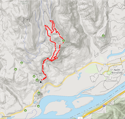
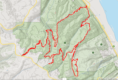
AllTrails map (mobile)

Getting There

Tuesday, Dec 14 was my birthday and I knew I wanted to hike somewhere. I got a bit later start than I wanted but then again, what’s the rush? (More on that later).

I had my snow shoes so I thought I’d hit Trillium Lake, White River, or even Mirror Lake. I knew when I passed Exit 16 that I wasn’t going via Hwy 26. I thought I’d take the long way through Hood River.

On my way, I reconsidered and thought “the weather is good down here, how about staying in the Gorge?”. I took the Ainsworth exit and followed the frontage road to the trailhead. Welp, all but one trail was closed due to fire damage, erosion control.

The pulled back on the highway and kept on trucking’. It was cool to see Cape Horn, Archer, Hardy Ridge, Hamilton, Table from across the river. 

I drove passed Cascade Locks and pulled into another trailhead. The ____ just follows the freeway unfortunately, too much noise!. I snapped a couple photos and bailed.

As a got close to Hood River, Wind And Dog Mountains caught my eye. I drove to HR and crossed over to WA. I made my way back west to the Dog Mountain trailhead parking lot. Only a few cars were there so I parked and geared up. (I’d only ever seen the place packed with cars and signs about needing a ticket during peak summer months.)


The Hike

Length: 5.57 mi
Elevation gain: 2,438 ft
Moving time: 2:21:16
Total time: 2:30:26
Avg. pace: 25:22
Calories: 1,245

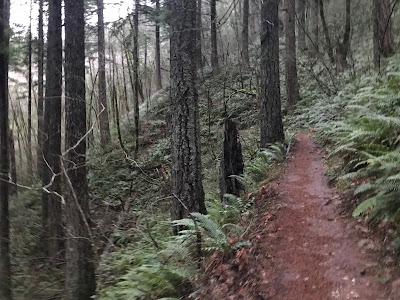
The trail was great, a lot like Hamilton, wide and well groomed. It’s definitely a leg burner (2500’ in 3mi) but there are some nice breaks in the upper forest.

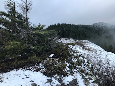
The first viewpoint was worth it. I took a couple selfies and sent them to my mom and two aunts.

When I got to the trail split (more difficult vs difficult), I chose the easier of the two.

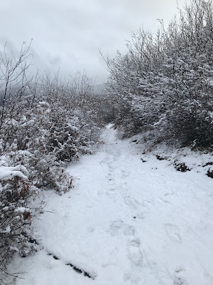
At 2000’ where the two trails rejoin the trail was steeper and icy. I thought about the difficulty coming back down without micro spikes. I continued despite.

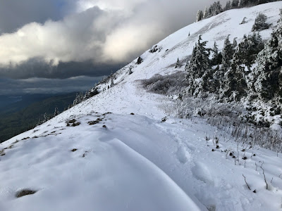
Eventually the ice was replaced by nice hard pack snow. This ended at Puppy Dog Viewpoint. Obviously most folks were turning around here.

Beyond were ankle deep foot holes. I didn’t have gaiters or micro spikes. And since I’d gotten a later start it was 3p, the time I’d decided to head down lest I run out of daylight.

Going to the top would likely have added 45min-1hr.

I vowed to return soon, with the proper gear. Soon!!!!!

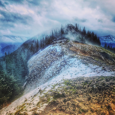
Looking at the last 1/2 mile (but turned around)

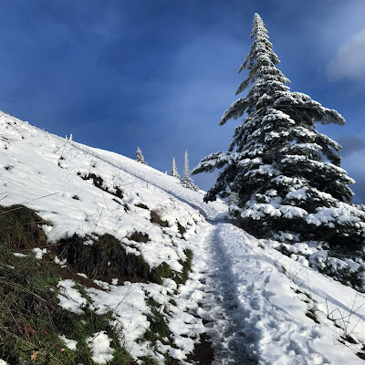
The final straight-away to Puppy Dog Viewpoint

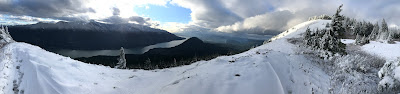
Pano from above Puppy Dog Viewpoint

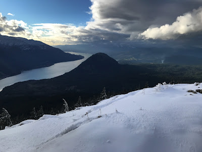
Looking west at Columbia River Gorge + Wind Mountain


Sunday, December 12, 2021

Hike: Hamilton Mountain/Hardy Creek Loop, N Bonneville, WA


AllTrails map

Getting There

I started my day heading to a completely different destination: Mt St Helens/Johnston Ridge.

My detour to the store cost me a precious 1hr and missing the on-ramp to 205N didn't help.

The skies were overcast and I knew from the forecast & weather updates that it was snowing around Cougar and Toutle.

There was a high probability that:

  1. The mountain was obscured by clouds so not a great day for photography
  2. The road to Johnston Ridge was closed at the Hummocks/Cold Water. (I was prepared to hike the Ridge Trail, Hummocks Trail, or Coldwater Lake anyway.)
  3. The road beyond the Coldwater Visitor Center was closed. 

I really wanted a hike, not a road trip so this was not a great choice.

The drive up wasn't bad, weather-wise, until just passed Kalama. The rain really started coming down and continued all the way Castle Rock.

I pulled into the gas station/McD's and used the facilities. Once back in my car, I stared at the weather report again and considered alternate hikes around the area. Still not convinced, I headed toward MSH anyway. After I mile or so, I pulled over. Nope.

I was burning daylight but I could still salvage the day if I head back south.

I drove back to the freeway and returned to Vancouver.

I took 205S to WA-14. I still didn't know where I was going. I considered Cape Horn but decided Hamilton Mtn was "the one". I was pleasantly surprised to find so many cars in the lot. It was dark and foggy but I was ready.

A hiker stopped by as I was gearing up and said it was amazing at the top. "Huge snow flakes." She said she'd been up there many times but never it seen it so beautiful.

The Hike

I saw an older couple just below Rodney Falls but the trail was mine until the switchbacks. (Actually I passed lower down a guy that didn't reply when I said hello. I find that so bizarre.)

On the Little Hamilton section there was a group of 5: two teens, a younger kid that was fussing with a root in the middle of trail (his older brothers scolded him for not getting out of the way), and a couple (college age?). They were uncomfortably closed to the edge of the cliff. When they saw me, they tried to make room by inching even closer to the edge. JFC! I stopped and beckoned them to move to a safer spot. I didn't need that much space to get by. Yikes!

It wasn't clear if they were continuing up or on there way down.

I had the rest of the ascent to myself and made quick work of it. There were some great views from here:


I could tell from the surrounding mountains that the top was likely be dusted with snow.

I had no idea what I would find.. Snow!!!!:


The Hamilton Summit

Columbia Gorge & Columbia River

The last section of trail was snow covered. I didn't get any falling snow like the hiker mentioned but it was spectacular. After having hiking this trail so many times in the last year, it was great to see it like this. I stood in spot where I'd cooled off with my straw hat, only this time I was bundled in damp but warm clothes.

I wanted the extra distance that the loop provides but I'd lost a couple of hours of daylight driving up to Castle Rock. I said "if I reach the top by 3pm, I'll do the loop". In fact, I made it by 2:55p. I paused for a min or two then continued along the ridge toward the Saddle.


Trail selfie

When I emerged to the clearing, there was a couple and a dog having lunch. I walked to the edge and snapped a couple of photos. They asked about the trail to summit. I wished them well and continued on my descent.

View of Table Mountain in the clouds

Hamilton Saddle

Hamilton Saddle panorama

Stylized pic that I posted to IG

The descent is a great time to mediate. After the climb and knowing it's all downhill, I find my mind wanders sometimes, but more often I'm just in-tune with the sounds around me. My hearing was muffled behind a headband, wool hat, and hood of my jacket. I heard a few rustles in the bushes that were definitely not birds. More like falling branches but it could have been a deer or other larger animal. I'm not sure if there are cougars or bears in the park.

Since I've been on the trail so many times, it's become a bit routine and I don't pause enough to enjoy where I am. Well, today I did stop to look back at the trail. There was some night light filtering through the clouds, and canopy. It's incredible that this route is carved into the forest. What a gift. And to experience it through all the seasons this year.

Hardy Creek Trail


Friday, December 10, 2021

Hike: North End of Forest Park XIII, Portland, OR


AllTrails map

Getting There

Take NW Skyline Blvd north from NW Germantown Road. The Skyline Blvd Trailhead is 1.6 mi and a parking are available on right (east) side of the road.

The Hike

Distance: 7.46 mi
Elevation Gain: 1,739 ft
Moving Time: 2:31:00
Avg Pace: 20:15
Calories: 1,330
Total Time: 2:33:57

View of NoPo and the Willamette River from BPA Road


This is the thirteenth time I've hiked this loop. This time I took the clockwise route to change things up. It's amazing that simply changing directions makes a familiar trail seem new.

To my surprise, the Descent took 22 minutes matching my best Ascent time and just 5 mins faster than my average.

This marks Hike #72 for 2021. I'm getting close to meeting my hiking goals and it feels good as I approach my 50th birthday.

It's great to see so many birds on the trail and hearing & seeing the creeks swollen with water. The trails are pretty muddy though but whatever.... waterproof boots FTW!

Sunday, December 5, 2021

Hike: PCT via Bonneville Trailhead, Cascade Locks, WA


AllTrails map
 

Getting There 

Trailhead is off WA Hwy 14, across from the east side of the dam.

There are only about 5-6 spots for cars and a bunch of pull-through/XL spots for horse trailers.


The Hike

Distance: 10.39 mi
Elevation Gain: 1,572 ft
Moving Time: 3:25:04
Total Time: 3:33:39
Avg Pace: 19:45
Calories: 1,807

This was my first time on this trail so I wasn't sure what to expect. I knew from the trail map that there is much elevation change for the first few miles. The PCT junction is at 0.7 miles. The trail is in rough shape and there were a lot of mud puddles that a crew of two were clearing in a few spots. When you get into the forest, it gets better, less mud and more pine needs and firm ground.

It's pretty rocky when you get out of the forest. You come across a massive road to the quarry and one of small lakes with turquoise colored water, Gillette Lake. Surprisingly it's "a natural body of water filling a depression in the the landslide"(1). I honestly thought it was similar to Gold Creek which was a gravel pit from the construction of I-90 in Washington (Snoqualmie).

Gillette Lake, WA

From the aerial photos of the building of the dam shows the area was huge construction site on the both sides of the Columbia River (WA, OR).

Once you get through that area, you cross a couple more roads but the rest of hike is similar to Cape Horn and Hamilton.

I took Two Chiefs Trail at the junction of the PCT and trail to Table Mountain. (Note: I didn't see any signage about "private" trails so presumably it's permitted to enter.) I wanted some elevation gain so I hiked up to a gooseneck in the trail but unfortunately, it's thick in the trees so no views. It would be a nice long loop back to Gillette, though you'd be hiking through the quarry, destruction of nature. Table Mountain, Aldrich Butte, and Sacagawea and Papoose Rocks are just another 3-4 miles (extra 6-8 miles r/t) but that makes a long hike from the Bonneville Trailhead.

Definitely would need to get a much earlier start. Distance and elevation gain is huge.. about 4,500 ft and about 15 miles. It's potentially hikeable through winter but who knows -- it's >1000 ft higher than Hamilton.

--

(1) https://www.oregonhikers.org/field_guide/Gillette_Lake_Hike

Friday, December 3, 2021

Hike: Sandy River Trail to Ramona Falls Trailhead + French's Dome, Rhododendron, OR

Forest Road 8123 - Sandy River Trail
 
French's Dome Trail

Getting There

Take Hwy 26 to Zig Zag, then take E Lolo Pass Road northbound.

At about 6 miles, take Muddy Fork Road. At this time of the year, Forest Road 1825 at the Sandy River. There is room to parallel park on the river side of the road.


The Hike - Sandy River Trail

The sky was mostly sunny with some billowy clouds. I was planning to hike to Ramona Falls but knew from trail reports that since the Parks dept had removed a bridge near the trailhead and hikers had to cross. They suggested calling ahead; I didn't. 

I didn't realize how far the trailhead was from where I had to park. There weren't any folks out there that I could see besides the two that mentioned the "big cat scat". I followed the road cautiously down the center. I knew I really didn't have the time to do the whole hike anyway because of how far up the valley the falls are. I knew this was a scouting trip and that the idea of wading across the Sandy River at this time of year was not enticing.

It was kind of a bummer to see debris around all the campsite entrances off the road. I gave up even trying to reach the trailhead and turned back. I started picking up garbage along the way. At one site, someone had either tossed they to-go wrappers or animals dragged it out of the fire pit. The paper bag was soaked but I was able to squeeze it and stuff more bits of trash into it. Gross.

About 1/2 way back to the car, I saw a couple cross the road and I noticed the Sandy River Trail. I was less cautious about seeing a "big cat". I stopped a couple of times to take some photos so I'd set down the bag of trash. At one spot, I got a few hundred yards away and had to circle back around.

I saw these two guys ahead of me that were going to pass by the trash I'd set down. Part of me was trying to catch up so I could explain that I'd just set it down temporarily. However, to my dismay, I saw them both look at the garbage and walk right on by. JFC! Really!!?? It's way we can't have nice things because individuals can't be bother to chip in a little. I'm not sure they are on the same level as the shitty people that "camp" there and leave garbage behind but still kind of pissed me off.

Of course there are ZERO receptacles anywhere since it's off season, so I carried this garbage all the way back to Portland and put it in my with my trash.

French’s Dome

While I didn't have the time to hike, I still had time to cruise up Lolo Pass Road for a bit; the afternoon sunlight was amazing. I really took a close look at where Ramona Falls is located on the side of Mt Hood and could see better how close Vista Ridge, Lolo Pass, and McNeil Point.

I was getting some great views of Mt Hood but always with power lines in the frame. I pulled into a small parking lot that I'd passed many times before. I was hoping to find a viewpoint to get a "clean" shot. I started to descend this little switchback and was immediately greeted by a huge monolith. French's Dome is hidden in the trees. 

Immediately, I noticed climbing anchors in the rock face. I read the sign and looked around. I'd never seen climbing platforms all around the rock. Probably for both erosion prevention and also to provide level ground for cushions.

The sign:

French’s Dome - A Climber’s Challenge

“French’s Dome is an eroded remnant of a “volcanic neck”. The neck was a conduit that fed lava to a surface that was once located more than 700 feet higher than the present climbing rock.

Erosion from glaciers and rivers has stripped away the surrounding 700 feet of material to expose the knob. The 150 foot dome of rock is olivine basalt and is estimated to be several million years old, older than Mt Hood.

French’s Dome is a popular destination for climbers. ___ combined Northwest Forest Pass (NWFP) funds and a grant from The Access Fund, to construct climbing platforms. These replaced the eroding structures pictured here. NWFP funds will be used for future site maintenance.”


Thursday, December 2, 2021

Hike: Forest Park (Firelane 12, 15, Wildwood, Newton Road, BPA) XII, Portland, OR


AllTrails map

Getting There

Take NW Skyline Blvd north from NW Germantown Road. The Skyline Blvd Trailhead is 1.6 mi and a parking are available on right (east) side of the road.

I parked, geared up and set out.


The Hike

Length: 10.04 miles
Elevation Gain: 2,086 feet
Type: Loop (except section to trailhead)

This is the 12th time I've done this general route and 5th time I've added a leg to Newton Rd Trailhead which adds about 1.6 miles but not much elevation change. I also hiked up to the high point near the BPA Trailhead.

My ascent time from Hwy 30 to the top: 0.8mi was 22min. My Best Time so far.

I'm just trying to get a few more reps (hikes) before the end of the year but also to stay fit for other adventures (snow shoeing, skiing, more hikes).

Wednesday, December 1, 2021

Hike: Scouting the Blue Lake Trail / Toutle Trail, MSH, Cougar, WA

All Trails maps

Getting There

This was my first time to this trailhead but I've driven by the turnoff several times en-route to Red Rock Pass Trailhead or Climber's Bivouac. 

Most Direct Route from Portland:

Take I-5 N to Woodland. Then take Lewis River Road east toward Cougar (WA-503). Just after the Yale Lake Boat Launch, take the Merrill Lake turnoff (north) on Merrill Lake Road (NF-81). After crossing over the Kalama River, keep an eye out for a 90-deg turn (and small sign) to stay on NF-81. (*If you find yourself on Forest Road 030, turn around). You'll see the Kalama Horse Camp on the right. After Goat Mountain you'll get to the junction for Toutle Road (Forest Road 8123) to the Blue Lake Trailhead.

The road is a bit rough with potholes and newly formed trenches from rain but no problem for pickup or Jeep.

When the road gets really rough, you'll see the trailhead sign. There's plenty of room for several cars to parallel park. You'd need a motorcycle or 4x4 spotter to get passed the creeks that have pummeled this area but the Forest Road 8123 continues.

The Hike

Distance: 2.32 mi
Elevation Gain: 240 ft
Moving Time: 56:29
Total Time: 1:09:10
Avg Pace: 24:23
Calories: 498

I didn't leave Portland until about noon and wasn't on the trail until about 1:30p. I didn't have time for a long hike in unknown area like this. I figured I could do some scouting though. The clouds made from some excellent lighting at times. Diffused shadows and some slivers of blue sky. The weather was amazing, around 60F.

Time will tell if I can do a longer hike before winter really sets in. Crazy temperatures for Dec 1st. Even if there is some snowfall, it likely to be easily negotiable with micro-spikes and hiking poles. It sounds like the issue for other hike destinations like Ramona Falls is that the creeks, streams, rivers can be swollen and impassible. Certainly a trends that will continue if we get early snow, then warm weather. It would certainly make hiking on snow pack much more dangerous due to hidden cracks & crevices.

I started hiking on Forest Road 8123 but after looking at the map, this was not going to emerge from the trees for miles. I wanted to take advantage of the light and views of MSH. I turned around and headed back towards the Blue Lake Trail. 

I eventually found my way using the GPS/maps back to the Toutle Trail and spur trail to Blue Lake. I chatted with a couple who were looking for a way to cross Coldspring Creek. (This is a way to reach the Sheep Canyon Trail which then links to the Loowit Trail for nice 14mi loop passed Butte Dome.)


The Drive Home

Instead of taking the Lewis River Road back to Woodland and I-5, I took WA-503 south through Amboy and Battle Ground. I've crossed the Yale Bridge before but I was floored when I got there and saw the blanket of fog. It was magical. I took a chance and stopped on the bridge to take a few photos. Fortunately, no cars were coming because I saw them crossing later at high speeds. Oops. The lighting was gorgeous.

I crossed the bridge and parked. There was a steel staircase down to the water's edge; even some life vests for anyone to use. So glad I took a different road home.